Quiet Weather Across The US Today As Another Tropical Threat Emerges
Hello everyone!
There’s very little to talk about in the way of US weather today.
A weak cold front will bring the threat for showers and thunderstorms to parts of the Eastern Great Lakes as well as Northern New England. While little in the way of severe weather is expected, dangerous lightning and heavy rain will be threats with any storm.
An upper level low over Nevada will continue to bring snow showers to parts of the Rockies, though with limited moisture, little in the way of accumulation is expected.
Elsewhere, radar imagery shows some shower activity across Kansas but no severe weather is expected. Some flooding is possible if the heavier showers sit over the same location for a prolonged period of time, however no widespread major impacts are expected.
Despite the quiet weather in the US, trouble is brewing once again in the tropics.
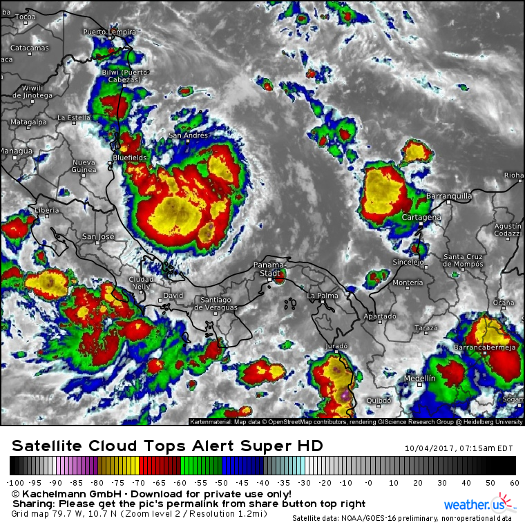
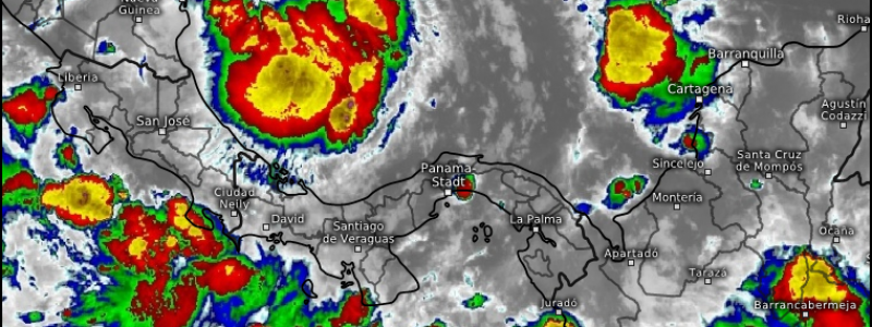
This cluster of thunderstorms, designated as Invest 90L by the National Hurricane Center, is forecast to develop into tropical storm Nate in the next day or two. What does this map show?
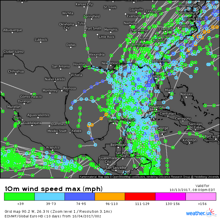
The system is expected to track northward towards the Nicaraguan coast before moving into the western part of the Caribbean Sea. This area is notoriously favorable for tropical cyclone development this time of year. What does this map show?
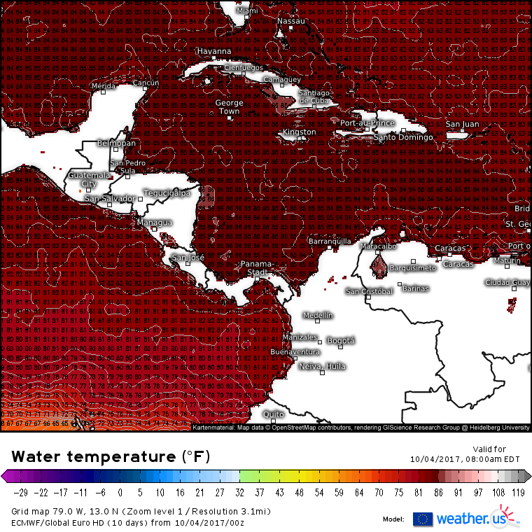
ECMWF model data show very warm waters across the entire Western Caribbean. This part of the Atlantic is one of the very few so far untouched by a major hurricane this season, meaning that there’s plenty of unused fuel for 90L to develop.
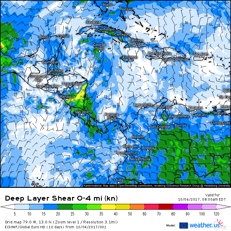
Looking at some of the other factors that could slow down a developing tropical system, neither dry air (map above) nor wind shear (map below) appears to be much of an issue for 90L in the coming days. I certainly would not be surprised if we had yet another hurricane by Saturday.
Impacts to the US remain shrouded in a bit of mystery, which is typical for a storm that hasn’t even formed yet. However, there are strong signals that 90L will likely make landfall somewhere on the Gulf Coast either in the latter part of the weekend or early next week. The exact landfall location and intensity remain uncertain. It’s never a bad idea to think about your hurricane plan in those areas, you may need to implement it this weekend!
I’ll have more updates on this system as it continues to develop in the coming days.
For more information on your local forecast: https://weather.us/
For more information on the local forecast for ME/NH: https://forecasterjack.com/2017/10/04/gradual-warming-trend-continues/
-Jack
