PTC 9 Likely To Slowly Develop As It Approaches Florida This Weekend
Hello everyone!
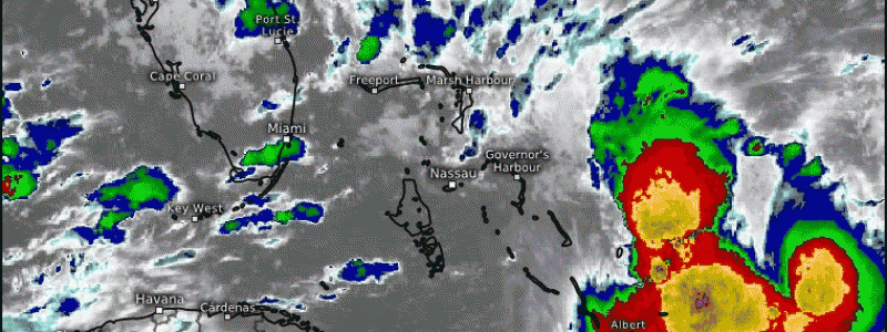
Potential Tropical Cyclone 9 is located in the southern Bahamas this morning, and is likely to develop into a tropical depression or storm over the next couple days as it moves NW towards Florida. The system still doesn’t have a well-defined center of circulation (hence its PTC designation), but it does have some shower and thunderstorm activity concentrating over the NE part of its trough axis. Southwesterly shear is likely hampering the system’s development at the moment, but that shear should relax over the next few days, so we’re expecting to see a tropical depression or storm form sometime either today or this weekend.
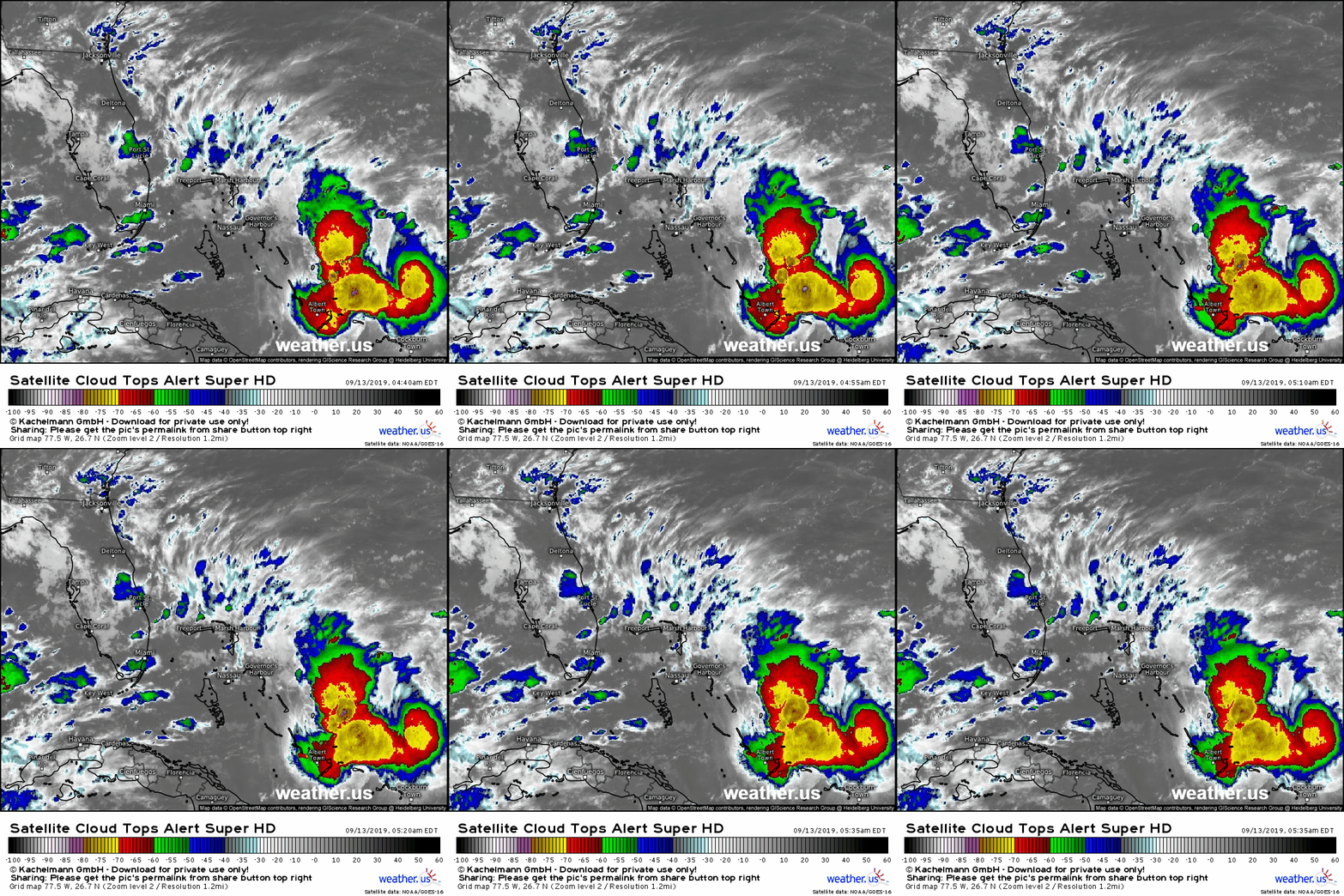
Satellite imagery this morning highlights the area of persistent deep convection just NE of the Southern Bahamian Islands as well as the southwesterly upper level winds over Cuba and the Florida Straits that are hampering development. Those southwesterly winds are associated with an upper level low over the Gulf of Mexico which will be moving off to the west over the next several days. This will result in a weakening of those upper level winds, and likely a subsequent increase in the system’s organization.
The storm is moving off to the NW this morning, and should continue roughly along that heading over the next couple days. By Sunday, the storm will be either over the NE part of Florida near Jacksonville/Daytona Beach or over the Gulf Stream just offshore.
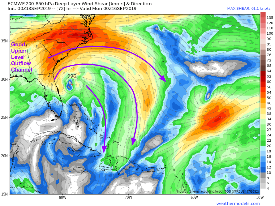
By this point, if the storm is over water, its environment will be relatively favorable for intensification. Upper level winds will be venting the storm instead of trying to pull it apart, as shown by the shear map above. The waters in this region are still quite warm, despite being churned up by Dorian last week. The final potential environmental impediment to development is dry air, which slows down a storm by weighing on its updrafts. There isn’t expected to be too much dry air over the next couple days, but as the storm moves farther north, it will encounter a dry airmass moving down from Canada. To what extent this will inhibit the system’s development remains uncertain, but it’s something to watch out for as we move through the weekend and into the early part of next week. Map via weathermodels.com.
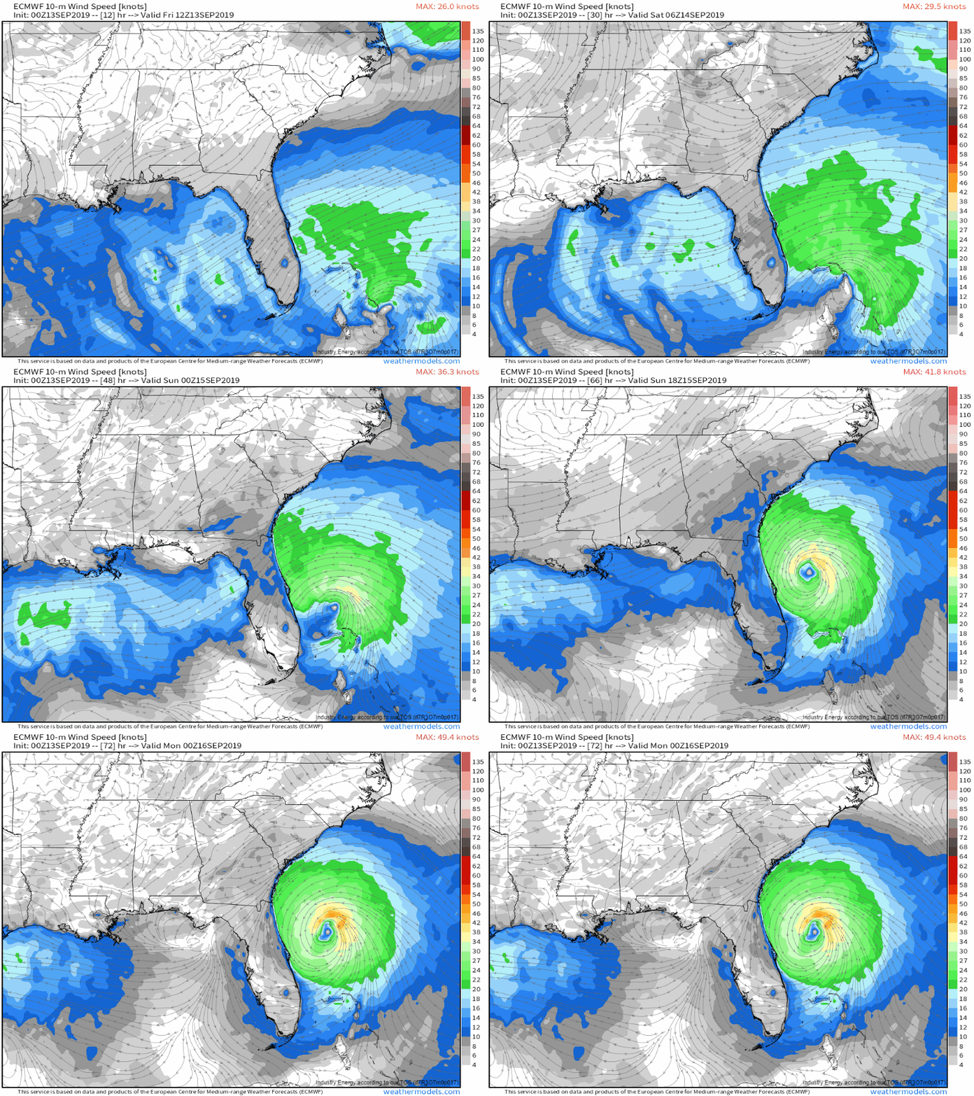
As far as impacts go, for Florida this doesn’t appear to be a significantly impactful storm. As the center of circulation slowly develops to the east of the state, winds will increase out of the N/NE, and could reach TS force along parts of the coast. As far as winds go, the ECMWF is actually one of the more bullish models as it develops PTC 9 into TS Humberto fairly quickly. Other models suggest the center of the system moves farther west and remains weaker while tracking over the Florida Peninsula. GIF via weathermodels.com.
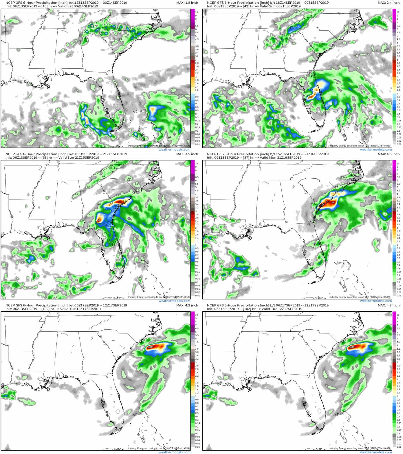
The GFS model currently favors the westerly track, which would mean that there’s more rain but less wind for Florida. Several inches of rain could fall in a relatively short time if the storm’s center actually makes it onshore, at which point we’d need to worry about flash flooding. The storm will turn north and then northeast early next week, which means that parts of SE GA, SE SC, and potentially SE NC might also get into the system’s wind and rain. Because the storm is still forming and is relatively weak, storm surge is not expected to be a major threat at least in Florida. GIF via weathermodels.com.
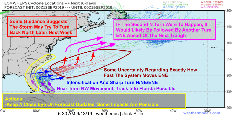
Here’s a look at the latest “spaghetti” guidance from the EPS. While there’s still plenty of uncertainty, especially later in the forecast period, the general idea that 95L slowly organizes while moving NW this weekend before strengthening as it turns N->NE->ENE early next week is reasonably set. During the middle of next week, the storm will be moving ENE over the open Western Atlantic. At this point, some EPS members show a turn back to the north in response to high pressure developing over New England. While this would bring the system a little closer to the East Coast, the next approaching trough should turn it back out to sea later next week. Map via weathermodels.com.
Aside from some lower-end rain/wind in FL/GA/SC, I don’t think there will be significant impacts from this system along the East Coast. That being said, if the New England ridge ends up arriving much stronger/faster than currently shown, the storm may be able to move close enough to the coast to bring more impactful weather. It’s a possibility you should be aware of, but shouldn’t be too worried about at this point.
I’ll have more updates as the forecast becomes clearer in the coming days.
-Jack
