Potential Tropical Cyclone Two Will Threaten Louisiana With Major Flooding This Weekend
Hello everyone!
All eyes are on the Gulf of Mexico this morning where a cluster of showers and thunderstorms known as Potential Tropical Cyclone Two is trying to become more organized. This system is expected to develop into Tropical Storm Barry sometime today or tonight as it moves slowly west. By tomorrow, the system will likely be strengthening as it turns north towards the Louisiana coast. Landfall is likely sometime on Saturday, by which point the system is expected to be a strong tropical storm or category one hurricane. In this post, I’ll explain some of the dynamics going on under the hood of the system as well as what residents of Louisiana can expect in the coming days. It’s also important to note that any important preparation/evacuation decisions should be made in consultation with the National Hurricane Center and your local officials.
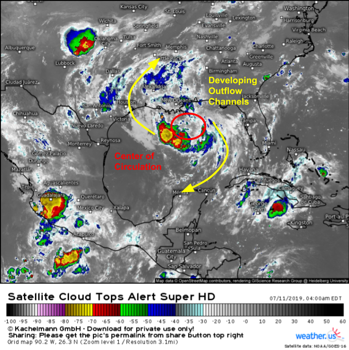
Satellite imagery early this morning shows that PTC 2 is currently disorganized, but is in an environment conducive to steady strengthening over the next few days. To the extent that a center of circulation exists (the latest hurricane hunter reconnaissance mission did not find one, hence the system’s continued “potential tropical cyclone” status), it is located to the north/northeast of the system’s most persistent thunderstorm activity. Until persistent and intense thunderstorm activity develops atop the storm’s center, very little in the way of strengthening will occur. On the flip side, waters in the area are quite warm which will give PTC 2 plenty of fuel to work with. Additionally, cirrus clouds showing up on satellite imagery above are fanning out away from the storm’s center, indicating that good outflow channels are ready to help ventilate the storm once it develops deep convection. The environment is favorable for intensification if the system can get organized enough to take advantage. For more discussion of the system’s environment, refer back to Tuesday’s post which discussed the larger scale shear/dry air setup in more detail. This post will be more focused on the storm’s forecast track and impacts, the biggest of which will undoubtedly be flooding.
Here’s a look at the general steering environment for PTC 2. A large ridge has built over the Rockies, and a shortwave trough is moving through the Ohio Valley into the Northeast. Each feature is tugging PTC 2 in a different direction. Clockwise flow around the ridge wants to push the system SW, keeping it in the Gulf of Mexico for a longer time. Counterclockwise flow through the trough wants to pull the system northeast, bringing it ashore in Louisiana. Exactly how strong each of those influences ends up being will determine exactly where the storm moves ashore. For the next day and a half to two days, the ridge appears to be the stronger influence (while the trough is back up over the Great Lakes. Thus the storm will move slowly west or even west-southwest. By tomorrow evening, the trough will be approaching and it will likely result in a turn towards the north. Exactly when that turn happens will be critical in determining where the system makes landfall, and how much time it has to strengthen before moving onshore. Map via weathermodels.com.
While there is some uncertainty regarding PTC 2’s eventual landfall location and the intensity of its winds at that time, there is little doubt about the storm’s primary threat to Louisiana and surrounding areas: flooding. Tropical cyclones produce flooding both by pushing ocean waters up and inland (storm surge) and by dropping tremendous amounts of fresh water in the form of rain. PTC 2’s surge threat will be determined by the strength of its winds. Stronger winds unsurprisingly are better at pushing water from where it should be to where it shouldn’t be. The rainfall threat though will not depend on the storm’s maximum intensity. A storm with strong winds and a storm with weak winds can both produce the same amount of rain given other favorable conditions. For example, before Harvey, Houston’s worst tropical cyclone related flooding event was from tropical storm Allison in 2001. That system produced almost three feet of rain, but never had winds over 60 mph. While a repeat of Allison or Harvey is not forecast in the next few days, I bring the example up to highlight how even “weak” tropical cyclones can produce extremely dangerous flooding. With that in mind, let’s take a look at PTC 2’s potential to create flooding issues.
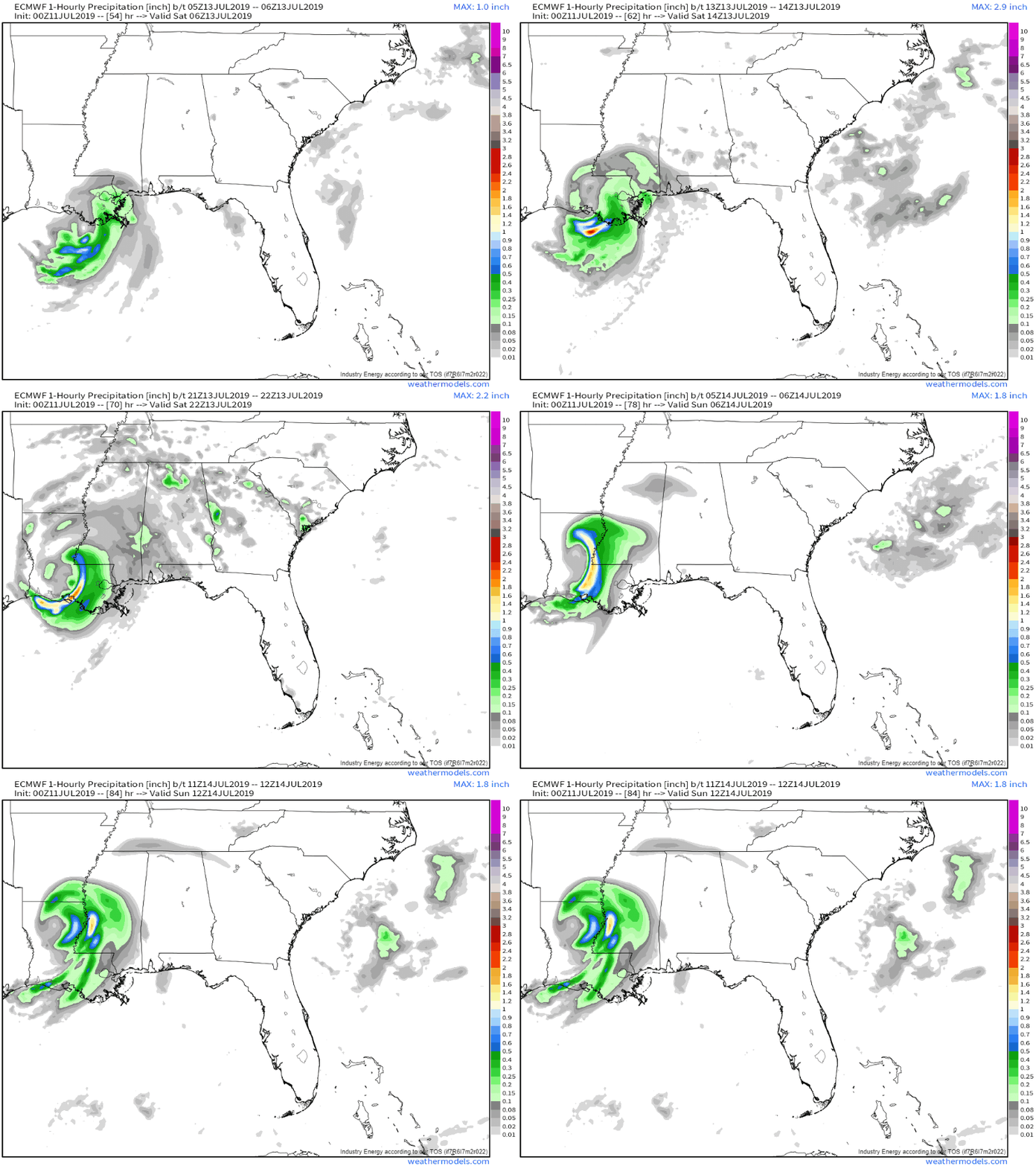
Here’s a look at the ECMWF’s hourly rainfall forecasts for PTC 2’s landfall and the following 24 hours. Note that hourly rainfall totals routinely exceed 2″ on the eastern side of the storm. While some of the higher numbers are likely due to the model struggling to figure out exactly how strong the storm’s thunderstorms will be, given the deep moisture and the strong dynamics of a tropical cyclone’s core we can be quite confident in some very high rainfall totals. Eastern Louisiana and adjacent parts of Mississippi should be prepared for 10-20″ of rain from PTC two as it slowly moves north-northwestward during and after landfall. This is more than enough to cause flooding along smaller rivers and streams as well as in the usual poorly drained areas. GIF via weathermodels.com.
What about larger scale flooding along the bigger rivers, especially the Mississippi? Because the Mississippi River remains high after an extremely wet spring across the Plains, it won’t take as much water to raise the river level as it would in a drier year. The rain won’t likely be enough to push the Mississippi into major flood stage, but unfortunately heavy rain isn’t the only factor working to push water levels upwards in Southeastern Louisiana.
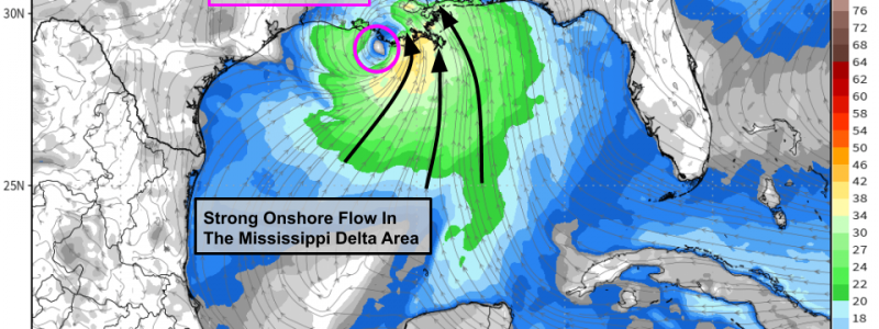
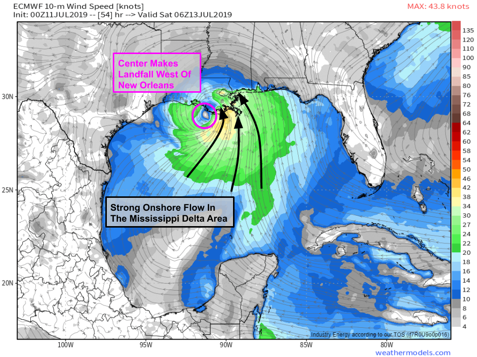
As the storm moves ashore west of the Mississippi Delta (where the river meets the ocean), winds in that area will be steady and fairly strong out of the southeast. Of course, exactly how strong the winds are will be determined by how strong the storm becomes, which we don’t quite know yet. The southeasterly winds will be trying to push water up the river towards the northwest. While the storm may not be strong enough to generate a massive storm surge that reverses the flow of the river, by pushing a bit in the opposite direction, the surge will slow the rate at which water can dump out of the river and into the Gulf. This effect, combined with the torrential rains, will likely push the river into major flood stage on Saturday. If your area typically floods in big Mississippi River flooding events, you should be taking proper precautions to protect your life and property. Please follow the instructions of local officials who will know whether you might need to evacuate, and should that order come, please listen. There is no such thing as a “weak” hurricane, and even tropical storms can be quite dangerous. Map via weathermodels.com.
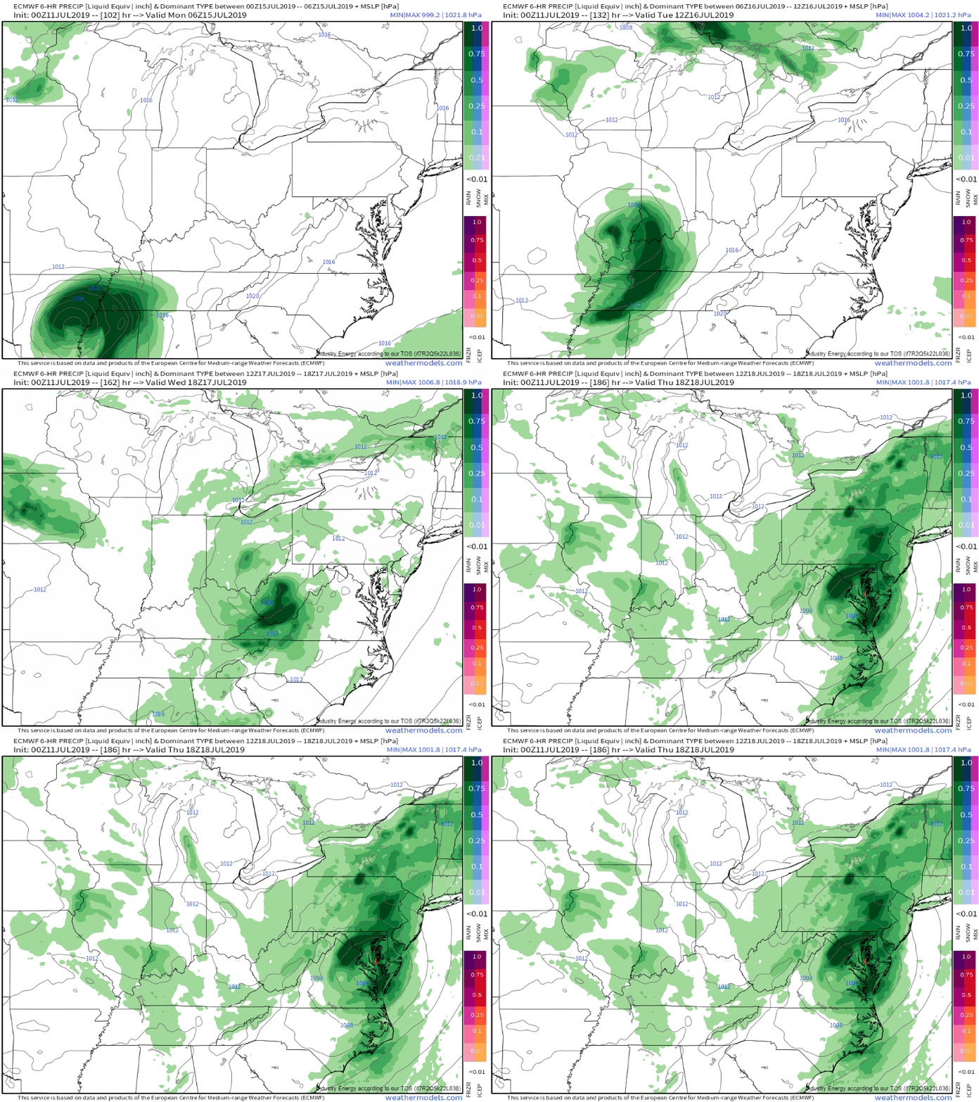
The system will rapidly weaken as it moves north on Sunday and Monday, though it will remain a flood threat all the way up into the Ohio Valley early next week and eventually the Mid Atlantic/Northeast by the middle/later part of the week. GIF via weathermodels.com.
How can you keep track of PTC 2 over the next few days? We have lots of tools at weather.us to supplement the official info you can get from the National Hurricane Center.
Follow along with what the storm is doing now by looking at GOES-East satellite imagery (tutorial video), HD radar imagery, and current observations including wind speed and rainfall.
Understand the range of possible outcomes for the storm’s future by looking at the EPS storm tracks map (tutorial video), and our Forecast Ensemble output (tutorial video) for your specific location.
Get my latest updates and analysis on twitter @WeatherdotUS and @JackSillin.
-Jack



Ever consider having a live thread after your posts?
generates some good discussion – usually have some regulators that will line up to be moderators.
There are a lot of weather-heads out there , good and bad but there is typically some good idea and thought generation that comes forward…..
will you have more active posts as systems kick up like Barry currently threatening the gulf?
Hi Greg, thanks for the comment and suggestion! While the live thread idea is a good one, based on the number of spam comments we get, I have a feeling it might get overrun with bots if there’s not someone around to moderate and curate stuff. While you’re absolutely right that after a while, you’ll get some good regulars to fill that role, I’d probably have to do it at the outset and there’s just not enough time in my day to do something like that the way it should be done. Perhaps at some point in the future that might become viable. As for more posts, yes I typically do one a day during high impact weather events that cause problems over a significant area. Today’s update on Barry is ‘under construction’ now.
All the best,
Jack