Persistent Heavy Rain Expected In The Southeast
Hello everyone!
A very wet pattern will establish itself over the Southeast this week as waves of low pressure move from Texas through the Ohio Valley. These systems will be tapping deep tropical moisture, and will have plenty of lift to squeeze that moisture out as heavy rain. The result will be some impressive rain totals, on the order of 6-10″ for a large swath from SE AR through N AL, N MS, most of TN, and KY. This blog will outline some of the factors behind the very heavy rain, and how you can follow along with the system at weather.us and weathermodels.com.
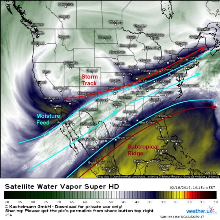
The large scale pattern shows up nicely even today on GOES-East WV imagery. A large trough has been carved out over the West Coast, with a subtropical ridge downstream over the Caribbean. Strong SW flow is present between these two features, and that flow is tapping tropical moisture from the Eastern Pacific. Storm systems will ride along the boundary between the warm ridge and the cool trough, right where that moisture is located. The result will be days of heavy rain for a wide corridor from the Lower Mississippi Valley through the Southern Ohio Valley into the Mid Atlantic.
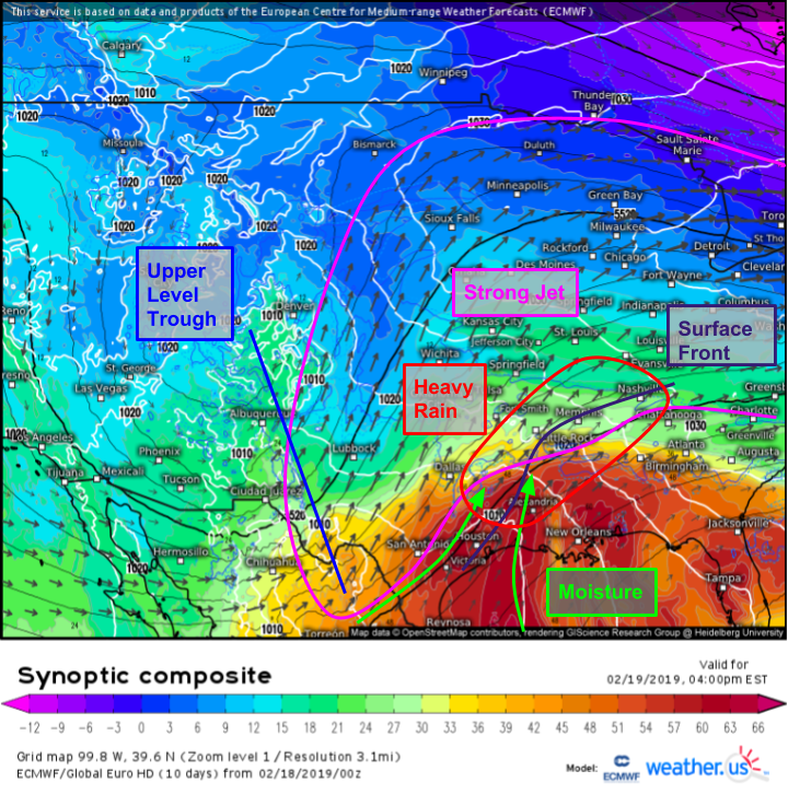
Here’s the large scale setup for tomorrow afternoon, during one of the waves of heavier rain. Deep moisture can be seen flowing north from the Gulf of Mexico and the Eastern Pacific as SW flow becomes a little more southerly ahead of an approaching upper level trough. Farther aloft, a strong jet will curve east through the Plains into the Great Lakes. The right entrance region of this jet is where the best dynamics are for heavy precipitation, and that region will be located across the Lower MS Valley tomorrow. At the surface, a frontal boundary will extend from near Houston Texas up through LA/AR towards Memphis TN before hanging a right towards Nashville. This boundary will focus shower and thunderstorm activity given the favorable synoptic environment meaning that we have all the ingredients needed for heavy rain.
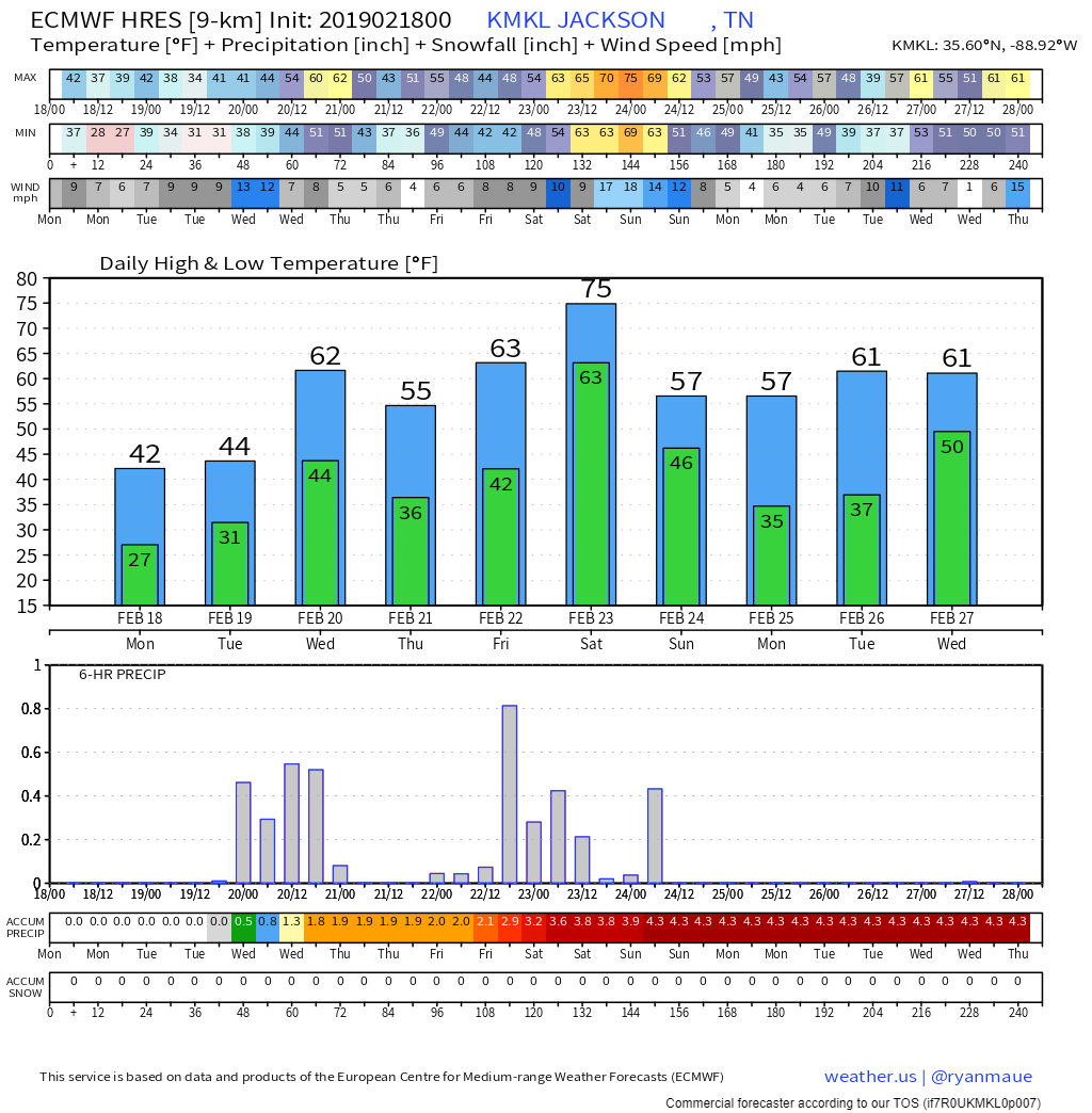
One of the cities closest to the axis of heavy rain will be Jackson Tennessee, located a little northeast of Memphis. Here’s how the ECMWF expects the week to look in that area. Rain will be falling more or less continuously between tomorrow evening and Sunday, with a short break possible Thursday morning. The heaviest rains will be tomorrow night and Friday afternoon/evening as those are when the strongest disturbances will be moving through the pipeline. Of course, exact precipitation timing and intensity will be determined more by small scale convective processes, so take the model’s rainfall total predictions with a bit of a grain of salt. The ECMWF’s resolution isn’t quite high enough to “see” individual thunderstorms, so thunderstorms that do form will add to the totals from larger scale dynamics shown here. Chart via weathermodels.com.
Including the thunderstorms, how much rain will fall? The WPC’s precipitation guidance has human forecaster input, and human forecasters are able to tell where thunderstorms might form (approximately). Thus that product is a better guide than just looking at the models verbatim. Of course an even better tool are your local NWS forecasts (which we have nicely visualized at weathermodels.com under the “NDFD” heading. These take into account not only the models and human input on the national level, but also local human input from the local forecasters at each local forecast office. These forecasters know the intricacies of your local weather the best, and thus produce the most accurate forecast.
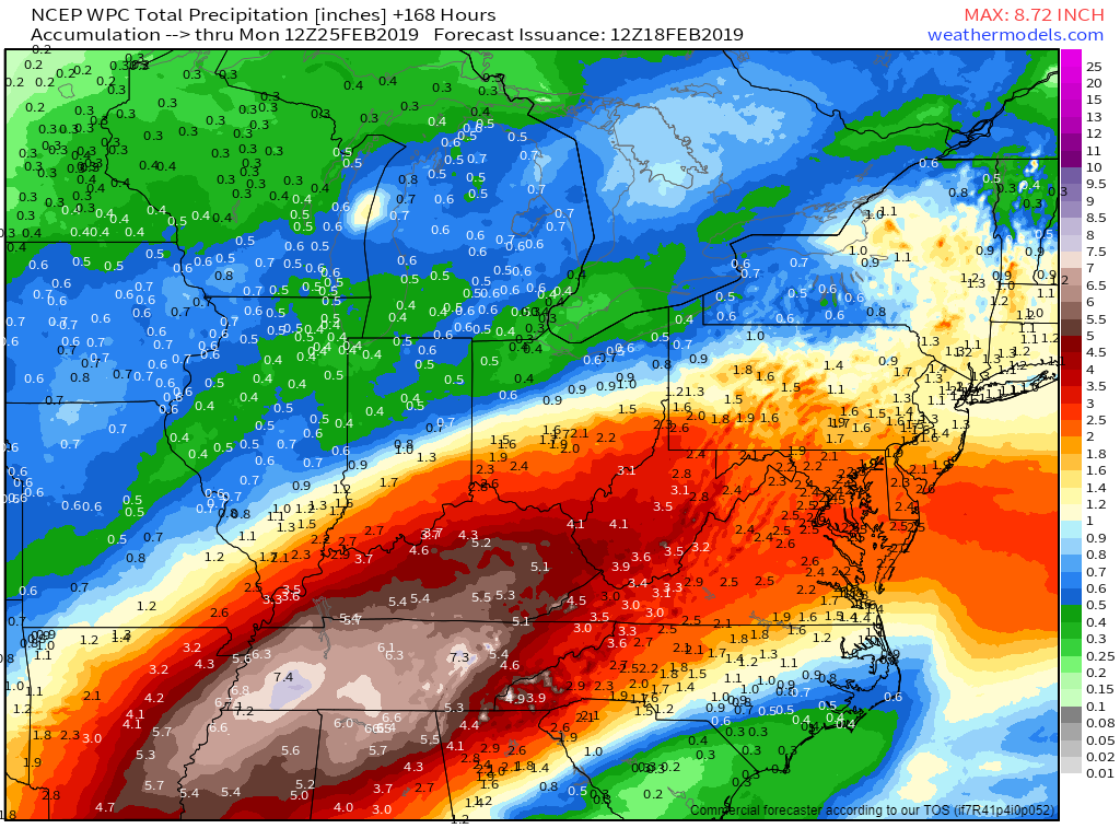
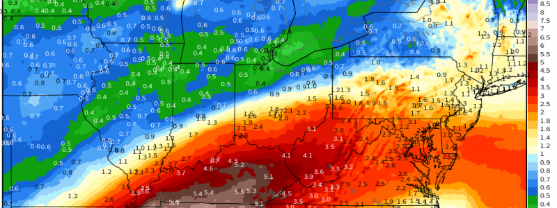
This map is the national guidance from the WPC, which shows amounts in the Lower MS Valley/Southern OH valley a bit above what the ECMWF was thinking, because the WPC forecasters have figured out that thunderstorms are likely to form in that area which will add to rainfall totals beyond what the ECMWF sees on the large scale. A widespread 4-8″ rainfall is forecast over this area, and while some locales will see a little more/a little less due to small scale convective processes, on the large scale this will be more than enough rain to cause flooding concerns not just on the urban/small stream level, but also for the main stem rivers. Map via weathermodels.com.
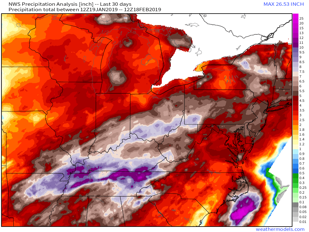
Precipitation analysis data shows well over a foot and a half of rain having fallen across these areas already in the past 30 days. This means that soils are saturated, and rivers already fuller than usual. Flood control operations are underway in this area ahead of the upcoming storm, but there’s only so much that we can do to manipulate the rivers. If you live in a flood prone area anywhere between Houston TX and Pittsburgh PA, you should be ready for the possibility of inundation. As always, remember not to drive through flooded roads and heed any advice local officials have for you. Map via weathermodels.com.
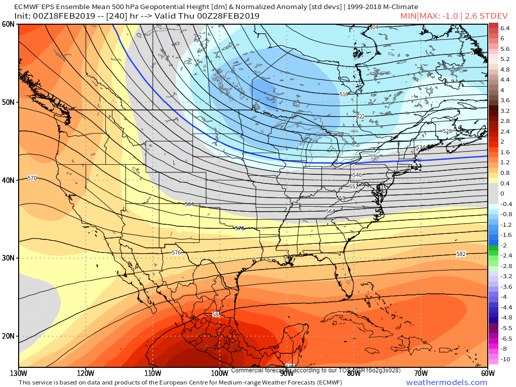
Looking into the longer range, there are some indications the pattern might shift towards more of a northwesterly flow pattern across the Central US to close out February. This would put an end to the heavy rains in about a week to 10 days if it ends up verifying. Until then, watch the radar and be mindful of high water hazards. Map via weathermodels.com.
-Jack
