Pacific Storm To Bring Snow To Rockies And Upper Midwest Today
Hello everyone!
After hurricane force winds knocked out power here in Yarmouth Maine, I’m back online and updates will now continue flowing normally. Today’s weather focus will be on the North-Central part of the country where a plume of Pacific moisture will intercept a cold Canadian airmass, resulting in snow.
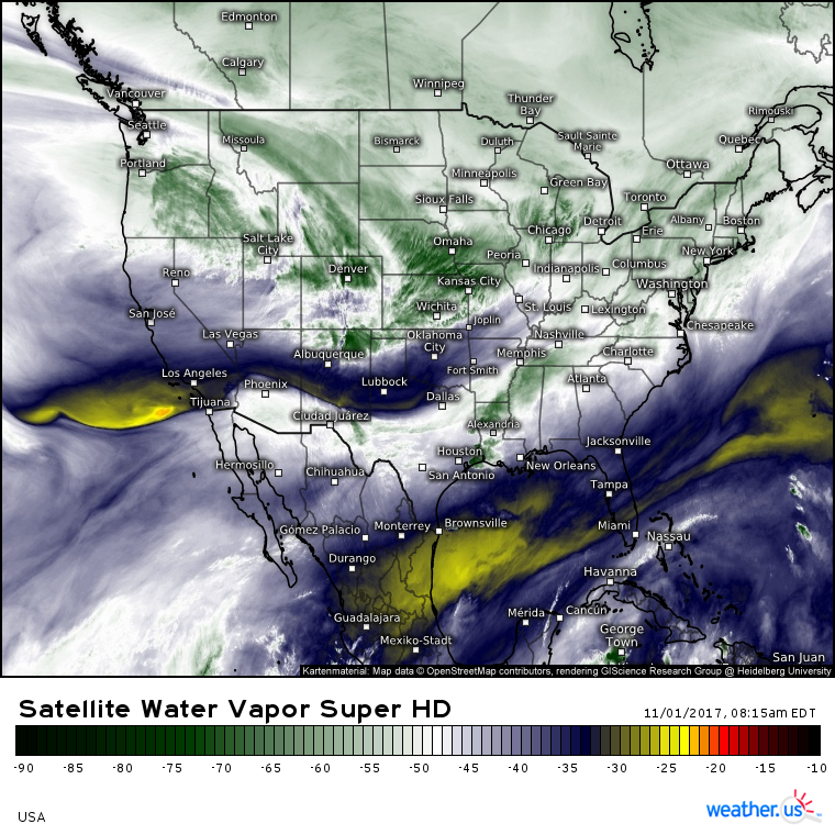
GOES-16 Water Vapor imagery (what’s that?) shows the pipeline of Pacific moisture and energy extending from Seattle to Kansas City. A disturbance embedded within this flow will help to focus precipitation this afternoon and evening across parts of the Upper Midwest. Much of this precipitation will fall as snow!
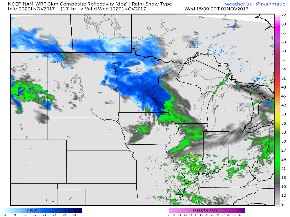
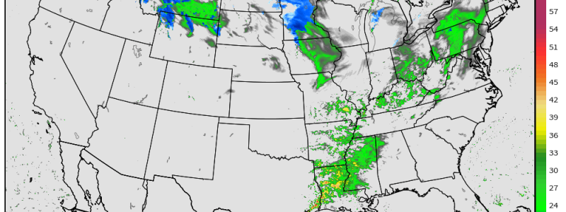
Simulated radar imagery shows a band of moderate to heavy snowfall forecast to be oriented from NW to SE this afternoon across Minnesota. While temperatures will be cold enough for snow, it won’t be by much, and the warm temps are likely to somewhat limit accumulation potential.
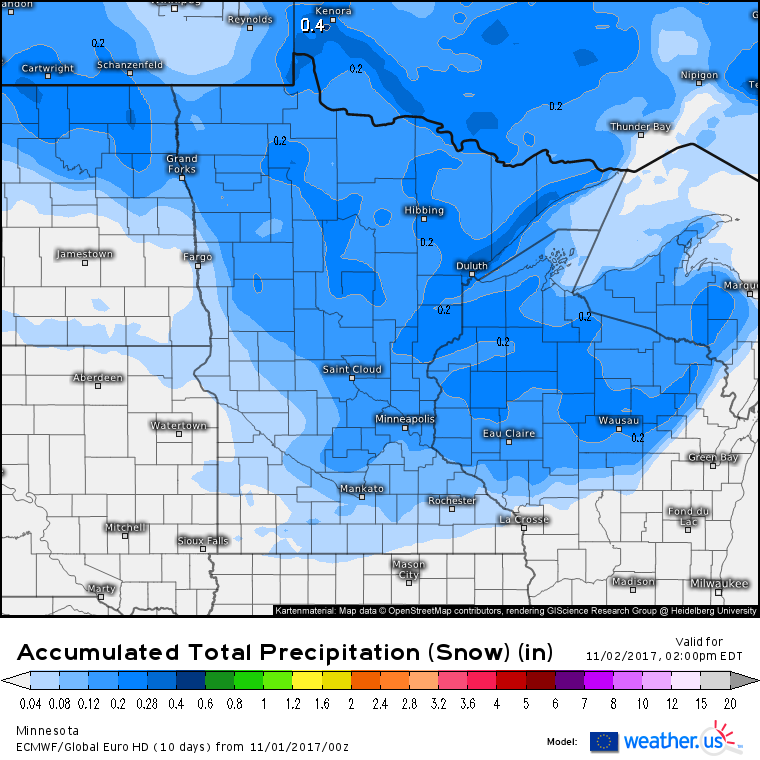
This is the ECMWF’s forecast for how much liquid equivalent precipitation is expected to fall as snow today across the Upper Midwest. To get the forecast for how much snow will pile up on your lawn, multiply these numbers by a snow to liquid ratio (more on this process). Given the borderline temps, and early season/daytime timing, snow is likely to have a hard time accumulating, especially in the Minneapolis area. However, there are some fairly strong dynamics in place aloft, meaning that snow will likely fall heavily for a time, which will allow for enough accumulation to make the roads slick for the afternoon commute. Based on snow to liquid ratios a little under 10:1, around an inch is expected in the Minneapolis area, with 2-4″ expected to the north and east from Duluth down into NW Wisconsin. Where snowfall is enhanced along the shores of Lake Superior north of Duluth, a few 3-6″ amounts are possible.
Snow will depart to the east tonight, with fog potentially presenting new issues in Southern Minnesota as temperatures cool and moisture sticks around.
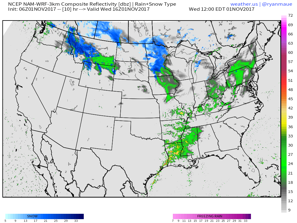
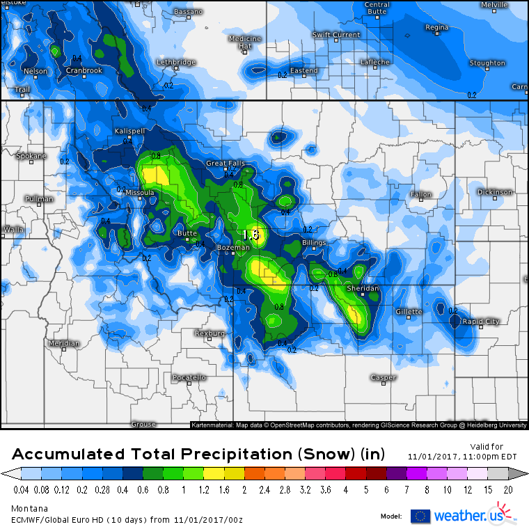
Elsewhere across the US today, heavy snow is expected in the mountains of Montana as a different disturbance embedded within that Pacific pipeline moves through. A weak disturbance will slide up the East Coast today bringing light rain and mountain snow to the interior Northeast. Showers and thunderstorms will be associated with the tail end of that system in Louisiana and far eastern Texas, though no major issues are expected.
The Montana snowstorm will drop some impressive amounts at elevation today, with 1-2 feet expected for the summits. 6-12″ is a good bet for some of the passes, but valley locations likely won’t see much snow at all. If you’re headed up and over some of the passes today, be prepared for winter driving conditions, but otherwise this is as low-impact a 1-2′ storm can be.
I’ll have another update this afternoon looking ahead at what weather is forecast for the rest of this week and heading into this weekend.
-Jack
