Multi-Day Severe Weather Event To Begin In TX/OK Tonight
Hello everyone!
After our last storm tracking from the Southern Plains through the Southeast brought several tornadoes to Southern Alabama and Georgia, we have another system to watch this weekend. This next storm will track farther to the north, meaning that the severe weather threat will be a bit more widespread. On the bright side, the environment may not be quite as favorable for intense storms, especially intense tornadic storms. This post will outline what to expect for tonight’s threat, including some of the meteorological processes behind the storms.
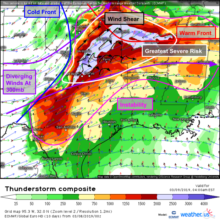
Here’s a look at the overall setup visualized by the ECMWF’s thunderstorm composite map. The storm itself will be moving through the Central Plains, with the severe weather focused on its southeastern side. Winds aloft will be diverging, which will help provide large scale support for upward motion. At the surface, a cold front will provide the impetus for convection as it moves from the TX/OK Panhandle region this afternoon towards the eastern parts of those states later tonight. Shear profiles are highlighted in black, and are generally favorable for severe weather with winds strengthening and veering (becoming more westerly) with height. Note that this map is valid at 4 AM. How do we get such unstable air early in the morning, typically when the atmosphere is most stable?
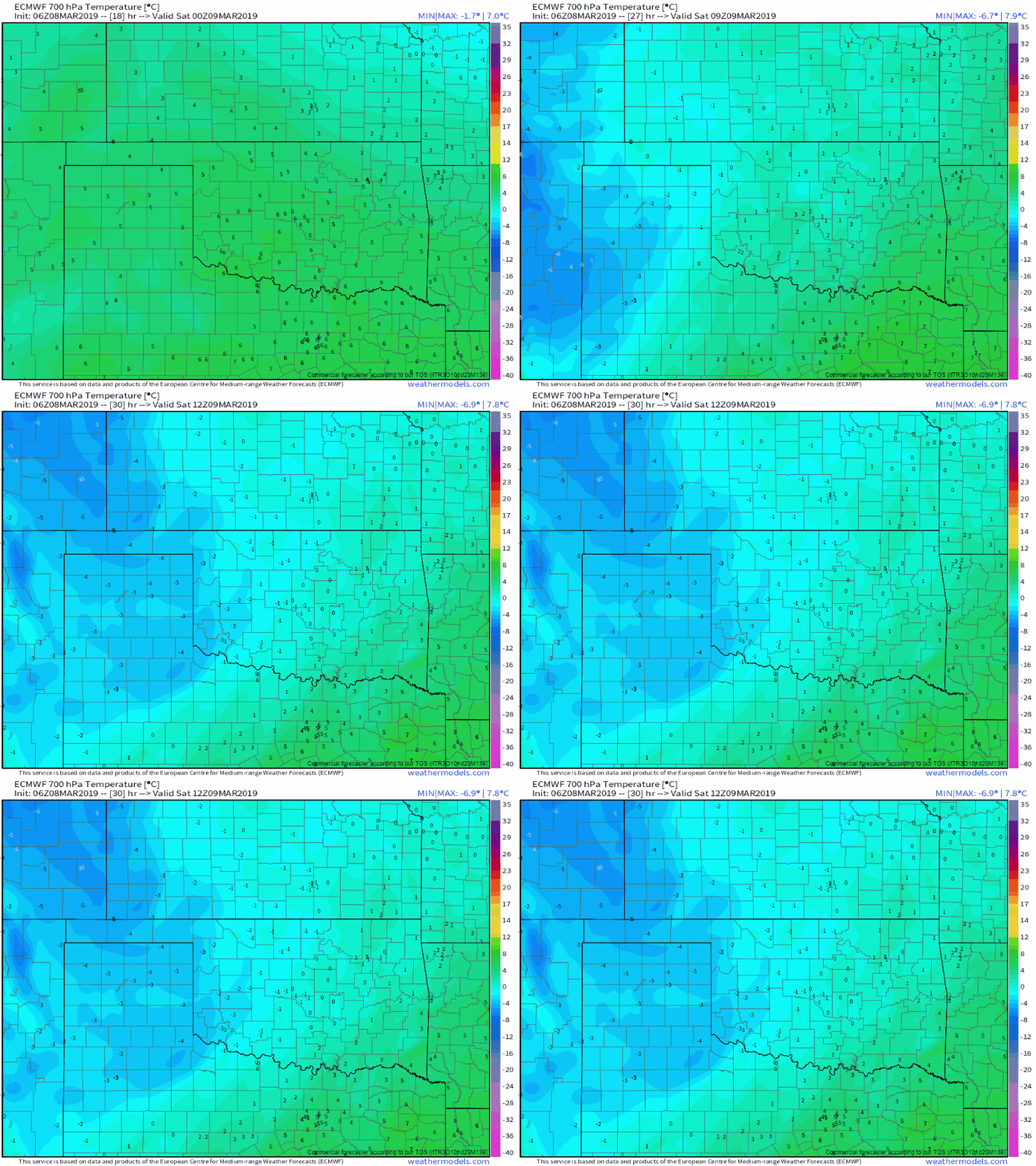
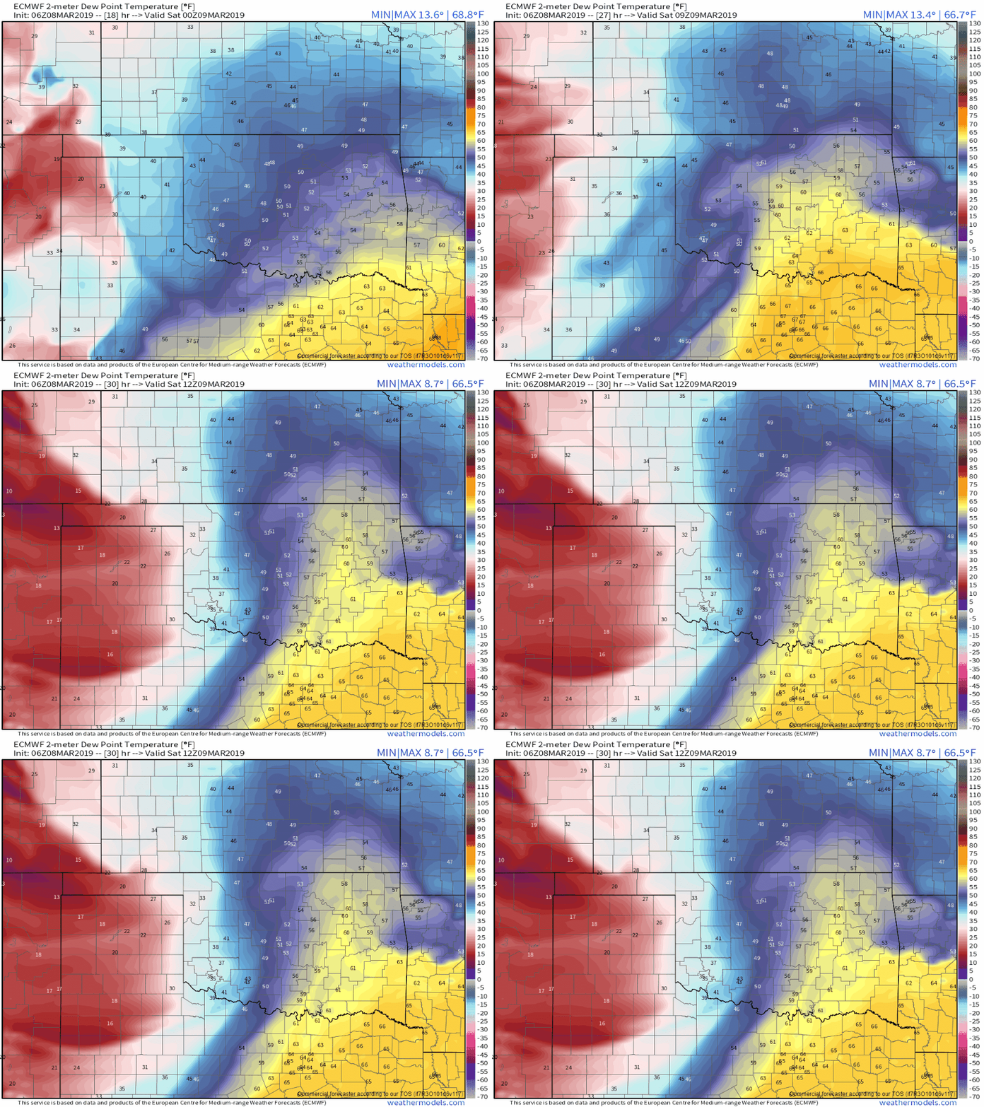
The two animations below are both from the ECMWF model, and both span from 6 CST tonight to 6 CST tomorrow AM. The animation on the left is the temperature at ~10,000 ft while the animation on the right shows surface dew points.
How do these plots relate to instability and why do they explain why the air over Oklahoma will become more unstable tonight even as we lose daytime heating? Instability isn’t just a function of surface temperature. Yes, warm air is less dense and thus more unstable than cold air in general. But there are other considerations that can factor into instability just as much if not more than how warm or cool it is at the surface. Because instability depends on a near-surface air parcel’s density relative to the environment aloft, it’s important to see what’s going on in the mid levels. If your mid levels are cold enough, even a fairly cool surface parcel can be unstable because the air above it is so much colder. This is where the mid level temperature plot comes in. Notice how the mid levels become significantly cooler (by 10-12F) during the night tonight. That means the same surface air parcel would be significantly more buoyant if it were lifted into the mid levels.
The animation on the right highlights significant moistening of the low level airmass, which also explains the rising instability. Moist air is less dense than dry air. Why? The answer lies back in your high school Chemistry class and the Periodic Table of the elements. Consider an air parcel that is made up of primarily of Oxygen and Nitrogen (a dry airmass). Each atom of Oxygen has a mass of 16 (atomic mass units), while each Nitrogen atom has a mass of 14 AMU. Both elements are diatomic, meaning you need two of them to form a stable configuration in the atmosphere. So each O2 molecule has a mass of 32, while each N2 has a mass of 28. Now imagine you start adding more water vapor, replacing some of those O2 and N2 molecules with H20 molecules, which have a weight of 18 (2 for each H and 16 for the O). Each O2 or N2 you replace with an H2O represents a significant decrease in mass. Thus a moist parcel of the a given temperature is less dense than a dry parcel of that same temperature, and thus more buoyant if lifted.
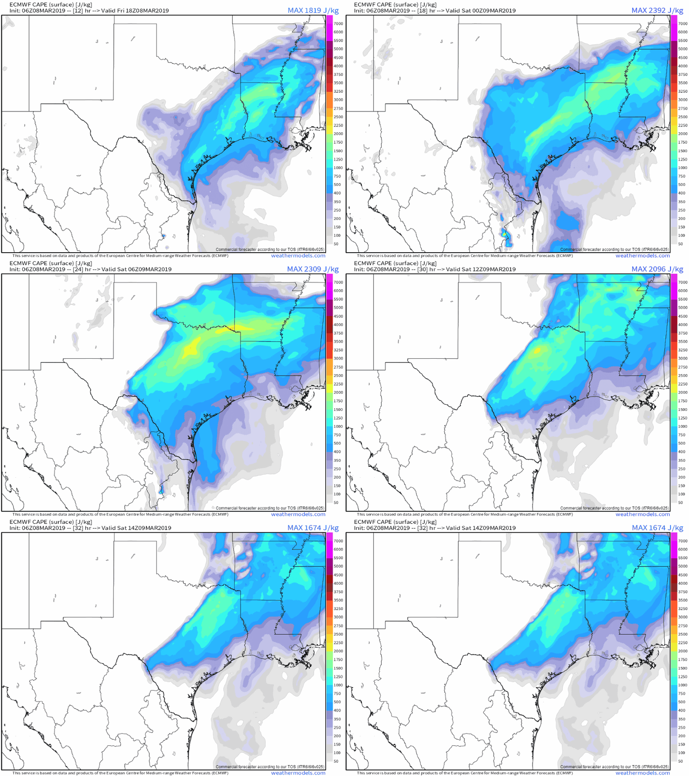
Put those two factors together and you can explain the animation above, which shows instability increasing over the course of the night tonight in NE TX and SE OK. That increasing instability will provide fuel for storms, as the unstable surface air parcels get lifted by the approaching cold front. Expect storms to develop late this evening over Central OK/TX before moving quickly to the east-northeast.
All animated graphics are from weathermodels.com.
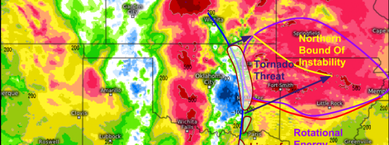
A look at the environment early tomorrow morning shows two distinct aspects to the threat. A line of storms is likely to exist in the more strongly forced environment closer to the low itself, where the cold front has the most momentum. Farther south, cells will be a bit more sporadic. The shading on the map above represents rotational energy in the lower atmosphere, which is an important ingredient for tornado formation. Rotational energy is maximized along and north of the warm front in E OK and N AR, and this is where the tornado threat will be greatest. Tornadoes will be most likely on the leading edge of the line of storms, and will be especially dangerous because of their short lifecycles as well as the early morning timeframe. If you live in the path of these storms, be sure that you have a way to get warning info even if you’re asleep!
Storms will move into the Ohio Valley tomorrow morning, setting the stage for the next part of the severe weather event. More details on that part of the system to come.
-Jack
