Moderate Snow To Impact Much Of The East Coast Today
Hello everyone!
Today’s most active weather will be found across the East Coast as a coastal storm intensifies just offshore. This storm’s main aspect will be a band of moderate to occasionally heavy snow that will impact areas from Washington DC to New York City and up into New England.
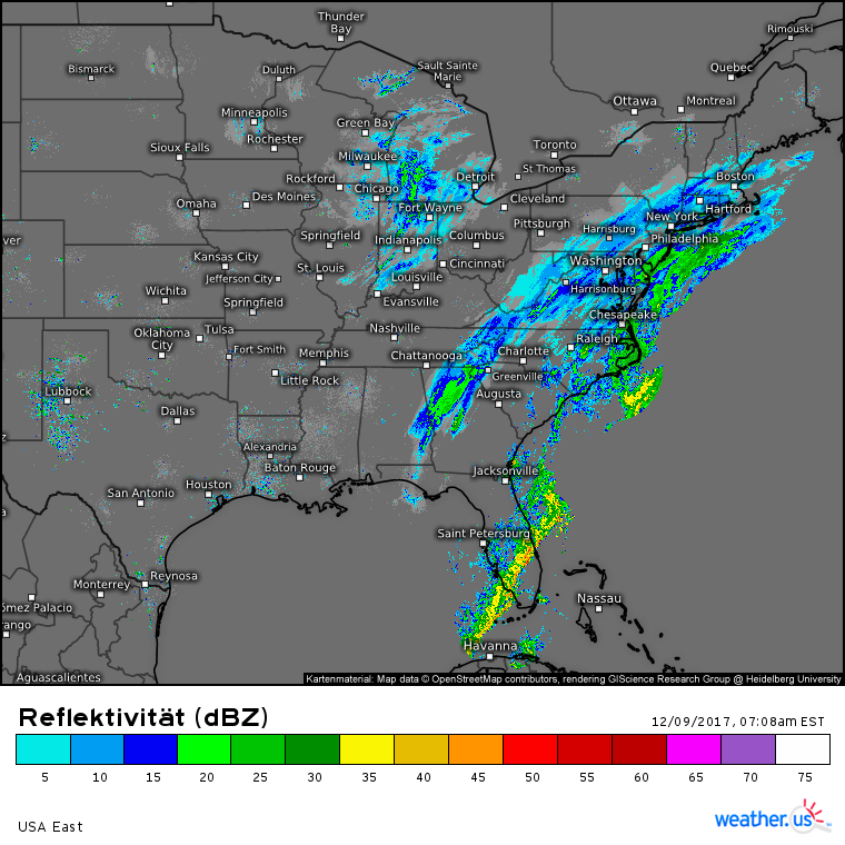
Regional radar composites show this band of snow already filling in. It stretches from the Florida panhandle, where snow has been falling this morning, to New England where snow is just starting. Also note the line of strong thunderstorms in Southern Florida. We discussed those storms yesterday morning, and they are evolving more or less as expected. Severe weather remains possible in the Miami area through late morning, at which point the storms will move offshore and cool northwest winds will take hold.
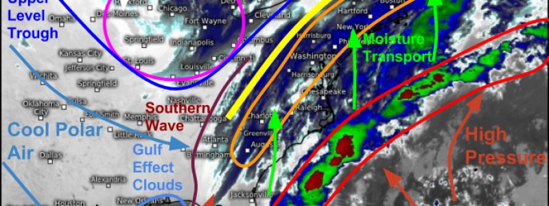
Satellite imagery this morning shows all the features we’ve been discussing using the model maps in the past few days. We have our upper level disturbances, both the southern wave and the Arctic disturbance. These upper level disturbances are running into the strong temperature gradient set up along the coast, and the baroclinic potential energy stored up in that gradient is being released in the form of strong thunderstorms near the center of low pressure which is off the Carolina coast. Another important feature we’ve been discussing is the very strong jet streak located over the Appalachians. Looking at satellite loops, you can see high clouds in this area moving extremely fast, an indication that the jet streak is every bit as intense as forecast. Air rises in the right entrance region of jets like this, and the resulting circulation allows for a lower level jet to develop and transport moisture northwestward, where it can rise, cool, and condense into snow.
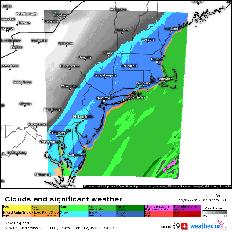
Swiss Super HD model forecasts give a good overview of what to expect as the storm evolves this afternoon. By 4 PM, steady snow will be ongoing from Philadelphia to NYC to Boston and Portland. DC’s snow will be tapering to flurries, while eastern parts of Long Island and Cape Cod see a cold rain. Snow will be lighter the farther northwest you go, and parts of central New York/Pennsylvania will likely see a mix of sun and clouds for much of the day today.
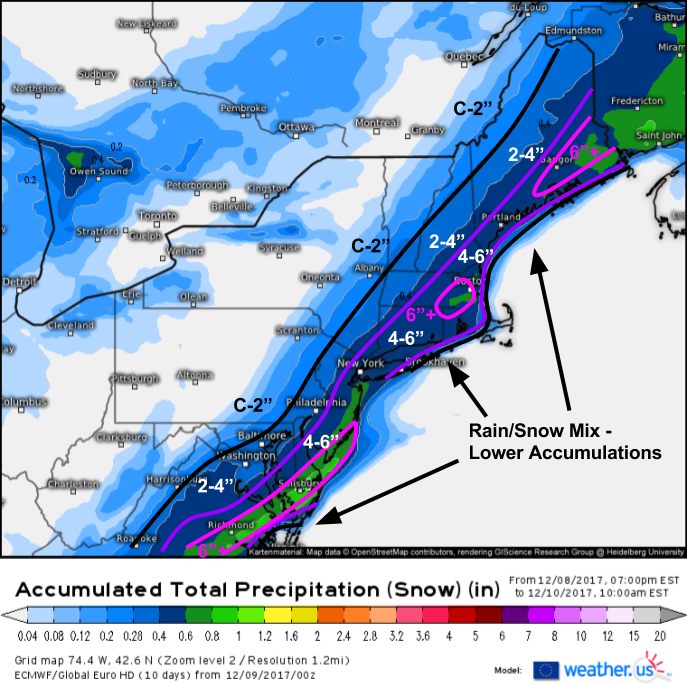
Here’s what I’m thinking for snowfall amounts from this system. Most places will see between 2 and 6″ of snow. Lighter amounts will be found on the far NW fringe of the system as well as in coastal parts of Virginia, eastern Long Island, Cape Cod, and the islands of Downeast Maine where rain will mix in with the snow today. A band of snow last night has already dropped nearly 6″ of snow in parts of the Delmarva, so today’s additional snow will push storm totals over 6″ in that area. The other contenders for totals over 6″ include the Boston area and interior Downeast Maine.
Snow will linger into tomorrow morning across parts of New England, but by tomorrow afternoon this system will be well east with cool and dry northwesterly winds developing and ushering colder air.
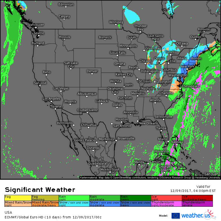
Elsewhere across the country today, snow showers and squalls associated with the Arctic disturbance discussed above will impact parts of the Great Lakes. The system will reinvigorate lake effect snow, especially downwind of Lake Michigan as northerly winds will flow over the whole length of the lake, maximizing lake effect potential. Outside of that system, very quiet weather is expected with high pressure remaining in control of the West Coast.
Unfortunately, that high pressure isn’t doing Southern California any favors. Dangerous fire weather will continue as cool air remains pooled in the Great Basin, seeking to escape downhill into the Los Angeles area. Conditions won’t be as extreme as some recent days, but with several large blazes already in progress, this remains a dangerous situation.
For more information about your local forecast: https://weather.us/
For more information about the local forecast for ME/NH: https://forecasterjack.com/2017/12/09/moderate-snow-today/
-Jack
