Midwest Snow Fades Tonight, Next System Will Bring More Significant Snow And Ice Wednesday In The Northeast
Hello everyone!
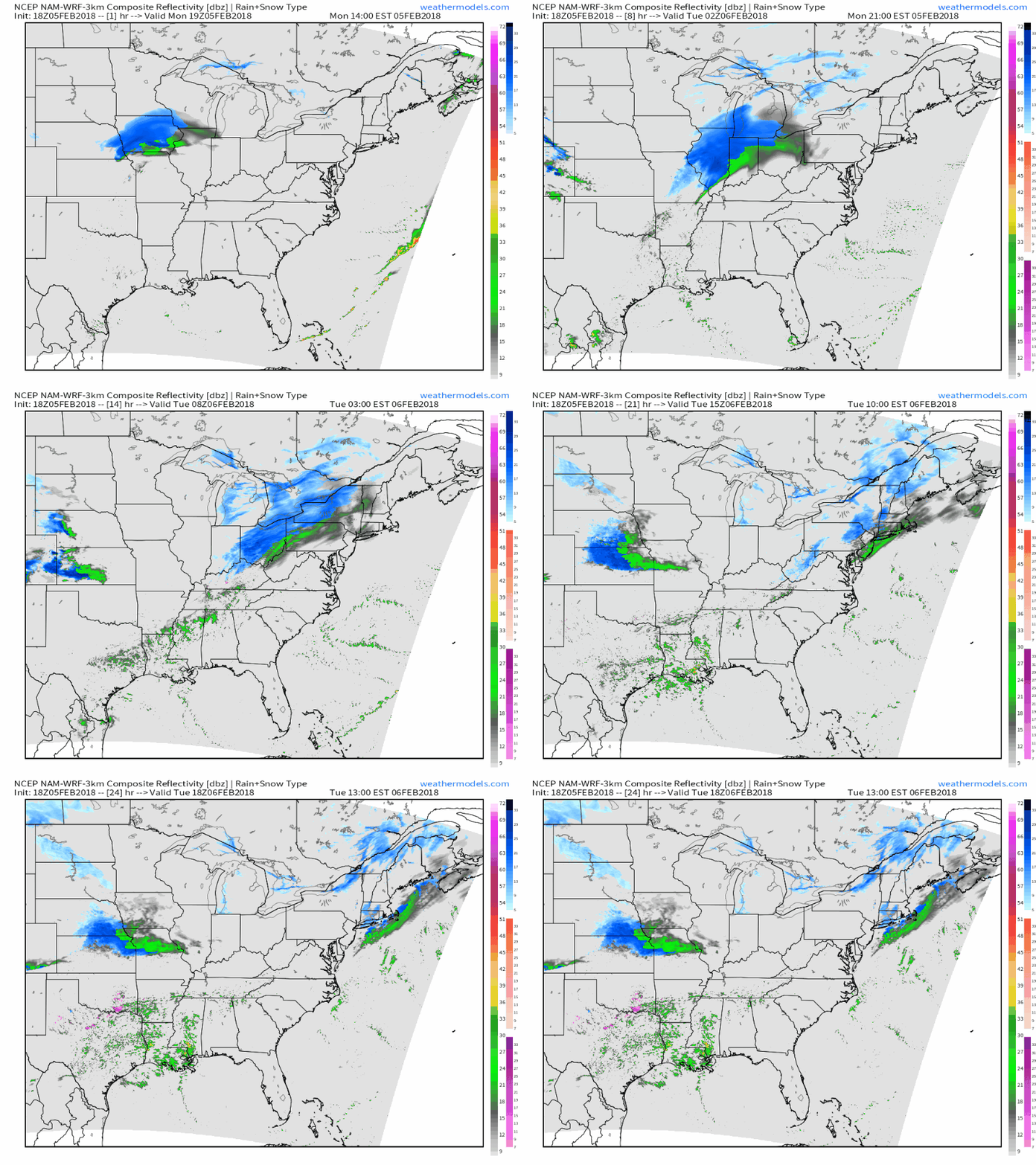
With high pressure retaining control of the western part of the country, our focus for active weather remains on areas along and East of the Mississippi River. A weak system is bringing a narrow stripe of moderate/heavy snow to parts of the Midwest tonight, but by the time it reaches the Northeast tomorrow, it will be little more than a loosely organized collection of snow showers. A much more impactful system is in the forecast for Wednesday with heavy snow and ice forecast across a wide swath of the Ohio Valley and Northeast.
Here’s a simulated radar GIF from weathermodels.com showing that system with moderate-heavy snow weakening and drying up as it approaches and crosses the Appalachain mountains late tonight and early tomorrow morning. For Northern Illinois, North-Central Indiana, and Central Ohio, a few inches of accumulation are expected through tonight, which will result in slick travel. For areas farther north and south, lighter snow and lesser impacts are expected. Just dustings are expected in the Northeast. Track this system and its progress via our HD radar products. Click the composite map to zoom into state level for HD imagery, and click again for even more detail at county level.
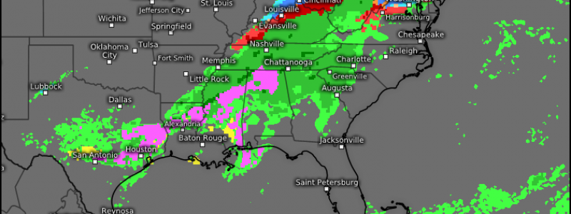
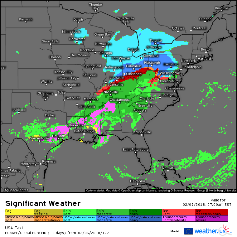
The much more impactful system this week will begin as an area of snow in the Southern Plains tomorrow, and will evolve into a multifaceted winter storm by Wednesday morning.
This storm, much like the last one, will bring three types of impactful weather to three different parts of the East. At the southern end of the storm, strong to severe thunderstorms will impact parts of the Deep South and Gulf Coast with gusty winds and hail being the main threats. At the northern end of the storm, the upper Ohio Valley, the interior Northeast, and Northern New England will see heavy snow, with accumulations in some areas likely exceeding a foot. Between the storms and the snow, mixed precipitation will bring icy conditions to parts of the Ohio Valley and Mid Atlantic.
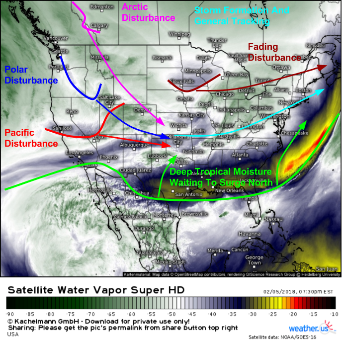
I’ll have a more detailed analysis of this storm, some of the meteorology behind it, and its impacts tomorrow evening. In the meantime, you can watch the various disturbances begin to line up over the Rockies tonight on Water Vapor satellite imagery from the new GOES-East satellite (what’s that?).
Here’s an annotated WV satellite map to help show you which features to keep an eye on over the next day or so. Just like our radar imagery, you can zoom into our satellite imagery by clicking the map to get to state or even county level. You can also use the menus to the left of the image to select your desired area, or to active custom zoom mode which lets you pick your own domains.
-Jack


