Michael Only Continuing To Intensify As It Bears Down On Florida
Hello everyone!
Michael is not slowing down as it prepares to slam into the Florida Panhandle. The storm underwent rapid intensification last night, with its maximum sustained winds now at 130 mph. The storm remains on track for landfall this afternoon just Southeast of Panama City Florida. The storm will then race NE through Georgia and the Carolinas, bringing a plethora of hazards to areas still reeling from Florence’s impacts. This post will focus more on the Carolina leg of Michael’s journey, the Florida leg having been covered in detail a couple days ago.
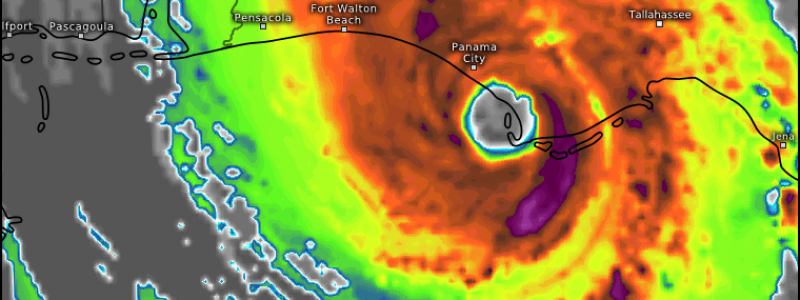
Here’s looped satellite imagery this morning from GOES-East’s 1 minute mesoscale sector. Notice the very clearly visible eye, surrounded by a ring of very intense thunderstorms. Dry air has been trying to filter into the inner core, as seen by thsoe warmer cloud tops NE of the eyewall, but so far the storm has fended off that intrusion remarkably well, with the eye clearing and warming in recent frames (a sign of strengthening).
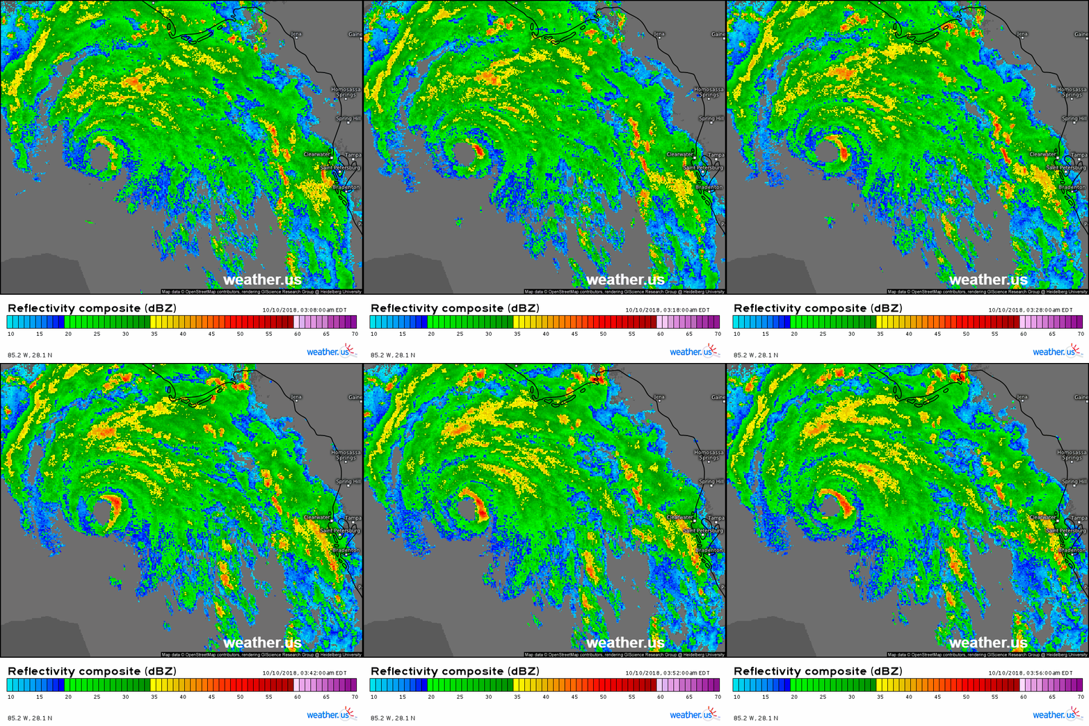
Composite radar imagery is now picking up Michael’s eye and eyewall as the storm moves closer. The outer bands of the system have already moved onshore in Florida, with the inner bands not far behind. Note the individual cells not necessarily part of any organized bands in the storm’s northeast quadrant. These are the cells to watch for tornadic activity over the next few hours as they exist in an environment characterized by incredibly strong rotating winds (this is a hurricane after all!).
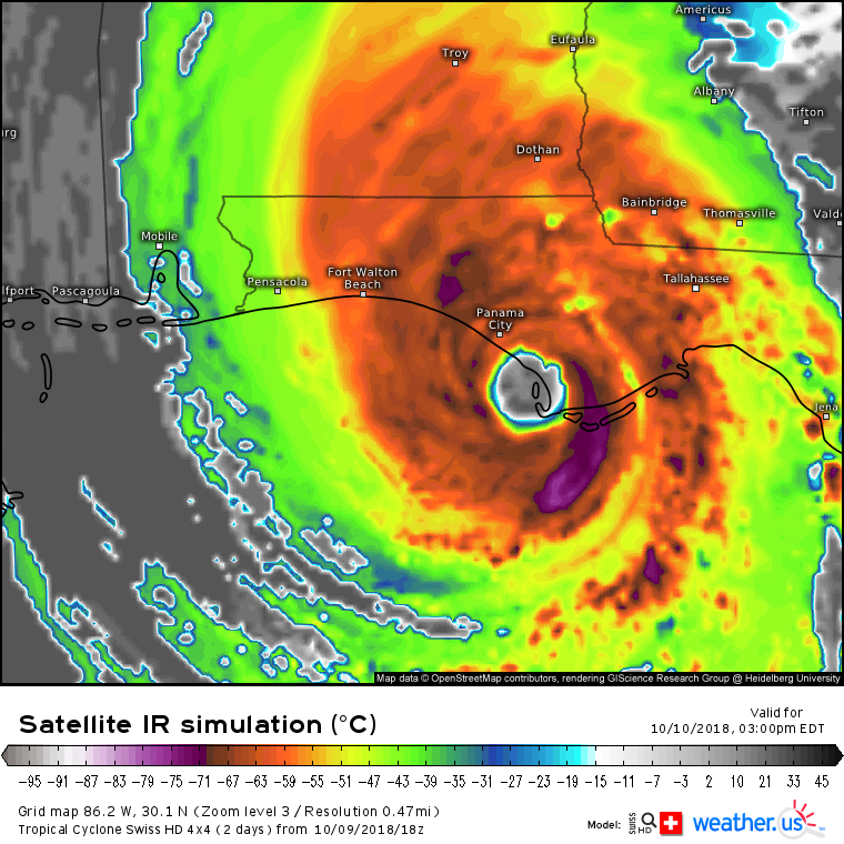
There will be extreme wind where the inner core comes onshore. Sustained above 120 mph, gusts above 140 mph. There will be very heavy rain, though thankfully nothing like what we saw with Florence due to the storm’s fast motion. Still, 3-6″ with local amounts of 8-12″ will cause some flooding problems, especially in areas already super-saturated from Florence. In addition to the wind and rain, there will also be extreme storm surge in excess of 10 feet above normal tidal levels for parts of the Florida shoreline near/east of Panama City. This is not a storm to take lightly! I covered most of the point of landfall impacts on Saturday, and other than the bumping up of the wind/surge numbers to account for the storm’s rapid strengthening, the overall idea hasn’t changed. Our Swiss Super HD model is being run specially for this storm, and is producing some pretty neat output such as the map above.
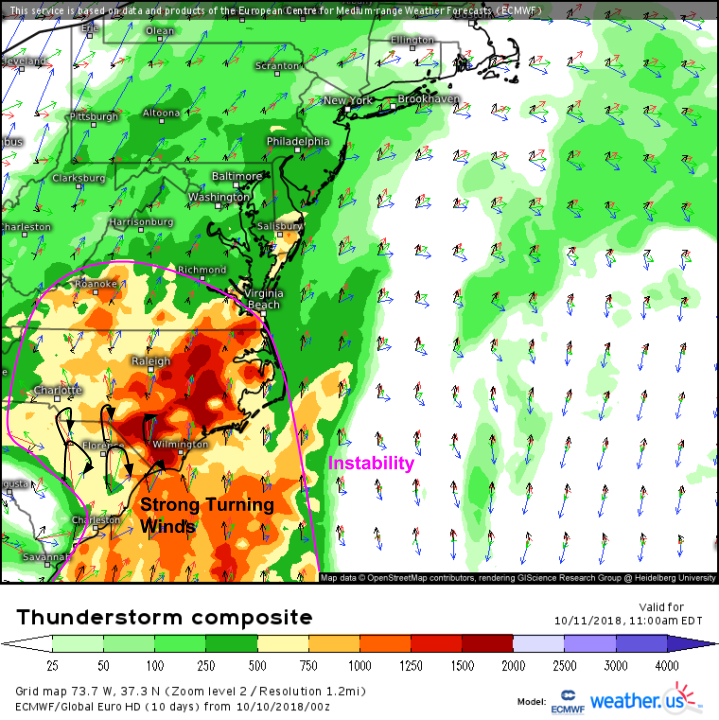
One of the big threats tomorrow in the Carolinas will be tornadoes. The ECMWF’s thunderstorm composite map highlights this setup with a plume of fairly robust instability will be present out ahead of Michael’s circulation, which will provide some very strong winds turning with height. This massive amount of rotational energy will be harnessed by updrafts of thunderstorms in the outer bands. Numerous tornadoes are likely in eastern SC/NC as a result of this setup tomorrow, so be watching closely in case any storms head in your direction!
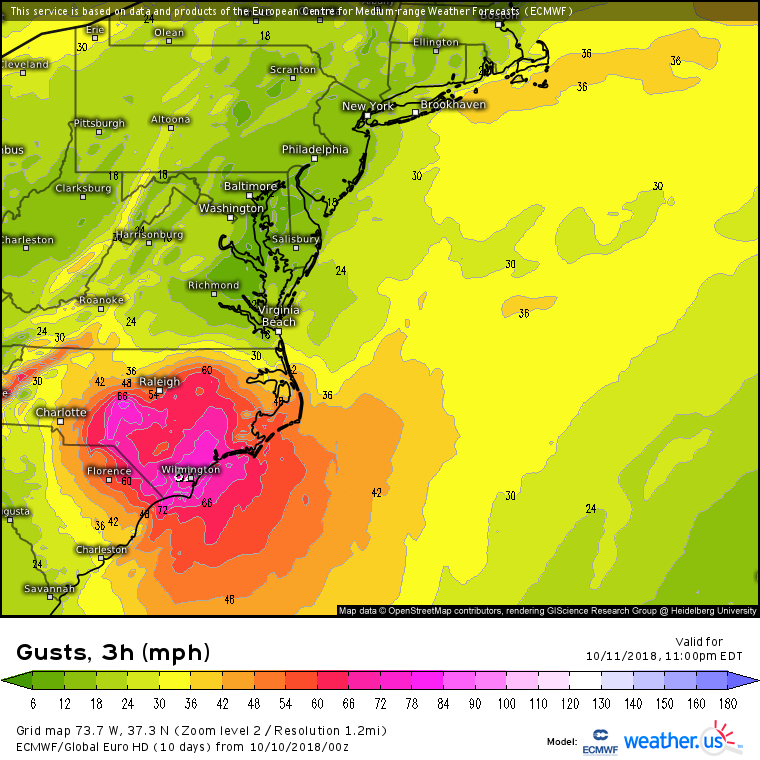
Strong winds associated with the hurricane’s circulation will also continue northeastward into the Carolinas. TS force gusts capable of causing tree/power line damage will impact all of eastern NC/SC, with gusts near hurricane force possible along the NC/SC coastlines. Typically, these winds would be dangerous but not damaging, however for parts of the NC coast near Wilmington still reeling from Florence, typically minor/moderate impacts will be much more serious. This goes for coastal flooding/beach erosion as well, with strong onshore winds expected to drum up some serious surf. Normally, this wouldn’t be much of a story, but with dunes/other protective infrastructure weakened by Florence, impacts may very well be more noticeable than usual.
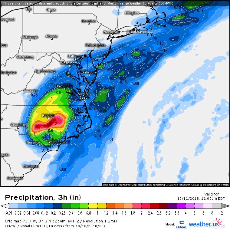
The remnant core of the storm will also bring with it some very heavy rain. Here, the ECMWF model shows >2″ falling in just three hours over parts of NC that saw feet of rain just a month ago. Flooding will be a threat, even though the storm is fast moving!
Michael will race offshore on Friday, brushing Cape Cod with some heavy rain bands on its way out into the Atlantic.
More updates through the day today on twitter @WeatherdotUS @RyanMaue and @JackSillin.
-Jack

