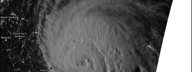
Maria Moving North Of The Bahamas This Evening
Hello everyone!
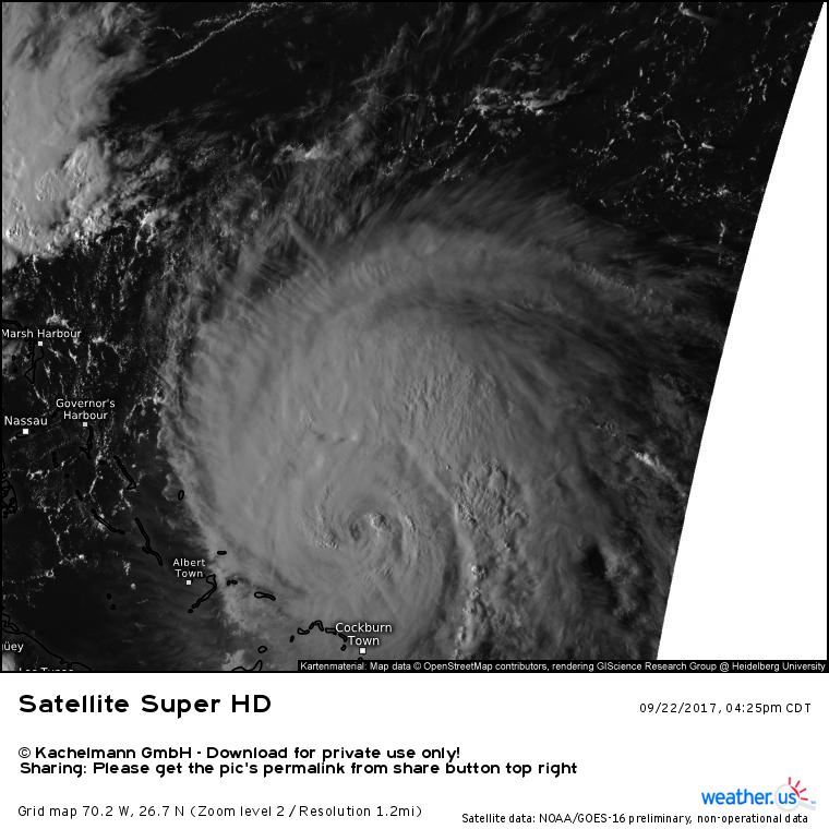
Major Hurricane Maria continues to move north of the Bahamas this evening as it continues on its NW trek.
Maria’s satellite appearance isn’t nearly as good as a few days ago, but it does remain a large, powerful, and dangerous hurricane. While not nearly as well defined as yesterday, an eye is visible north of the Turks and Caicos islands, and strong thunderstorm activity is noted surrounding the center and to the northeast. Southwesterly wind shear is resulting in a more lopsided structure to the system, and is keeping Maria’s intensity in check. Wind shear is only expected to increase as the storm moves north, and no further strengthening is forecast as a gradual weakening trend takes hold in the coming days.
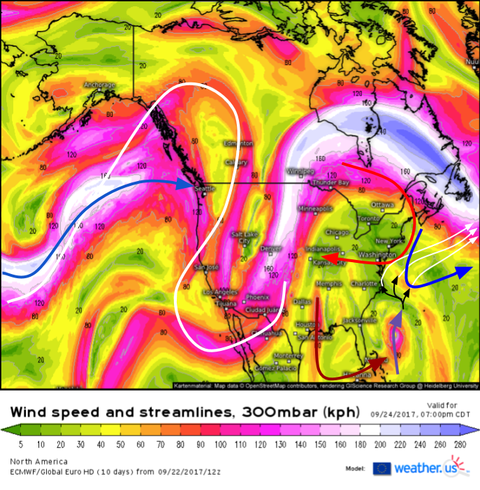
Here’s a look at some of the players in the upper levels according to the ECMWF model’s forecast for Sunday evening. Maria will be well east of Florida, where the only impacts expected are rough seas. An upper level low over Florida will continue to keep shear in the mix, resulting in slow weakening for Maria. The remnants of Jose will be somewhere SE of New England, where a weakness in a ridge of high pressure will be present. Maria will feel this weakness and turn N/NNE in the coming few days. It’s possible this gradual recurve continues and the storm heads right out to sea (right-most thin black/white arrow combo). It’s also possible, and in fact likely according to what I’m seeing, that the blocking high pressure over New England works in tandem with the upper level low over the Gulf of Mexico to draw the storm a bit closer to the coast. Just how close to the coast Maria is able to make it will determine the extent of impacts in the Mid Atlantic. There’s still some uncertainty as to how much of a NW drift there will be, and thus there’s some uncertainty as to the severity of impacts here in the US.
You’ll notice in the map above that changes are afoot in the Pacific and along the West Coast as Typhoon Talim’s Rossby Wave Train (scroll down to near the bottom of the link to see an explanation) breaks down.
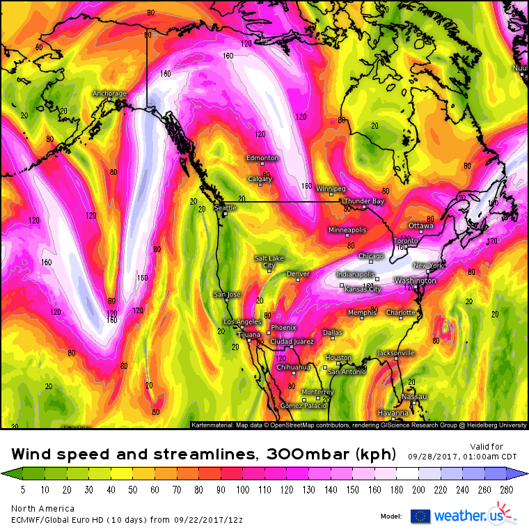
By the middle of next week, the large trough over the West Coast will be replaced by a ridge as we begin another pattern change. As a result, the blocking high that was over New England will be replaced by a strong jet stream and a trough over Hudson Bay. These strong westerly winds in the upper levels will force Maria out to sea after a brush with the Carolinas. There’s very little uncertainty regarding this part of the forecast. At the moment, New England looks clear from any impacts outside of large swells, with the possible exception of Cape Cod where some breezy conditions are possible along with rain showers if the storm tracks close enough.
The ECMWF ensemble tracks from this afternoon paint this picture well. Notice the high confidence in a N track to between Bermuda and North Carolina, followed by a possible drift NW, the extent of which is uncertain. All ensemble members then rush the storm ENE with all but a couple keeping the storm away from land during this time.
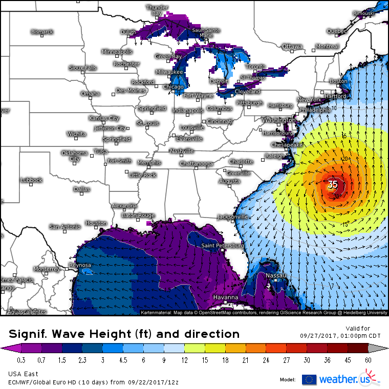
It’s always good to remember that a track offshore doesn’t guarantee a no-impact event. Large swells will continue to batter beaches already damaged by Jose. While no major surge, wind, or rain issues are likely with an offshore track, minor to moderate beach erosion/coastal flooding impacts are expected regardless of track.
I’ll have more updates on Maria tomorrow and in the coming days as we nail down the extent of impacts in the Carolinas.
-Jack
