Major Pacific Storm To Deliver Heavy Rain And Mountain Snow To Much Of The West Coast Over The Next Few Days
Hello everyone!
Just a few days after the last storm moved down the West Coast, another is lined up for tonight and tomorrow, and this one will be even stronger than the last. Look for widespread very heavy rain and mountain snow that will be measured in feet across the Sierra Nevada. Snow will also extend inland, with heavy accumulations also expected across parts of Idaho and Nevada. One unusual thing about this storm is the low snow levels in the Northern California area. The coastal mountains north of San Francisco will see heavy accumulations over a foot from this storm that are usually limited to the high peaks of the Sierras. I’ll discuss why that is below. Meanwhile in the East, a developing storm will bring flash flooding and severe storms to parts of the Lower MS Valley today before the storm explodes into a powerful Nor’easter off the Mid Atlantic coast. For more on today’s impacts from that storm, check out this morning’s other blog post. I will detail the late week coastal impacts this evening.
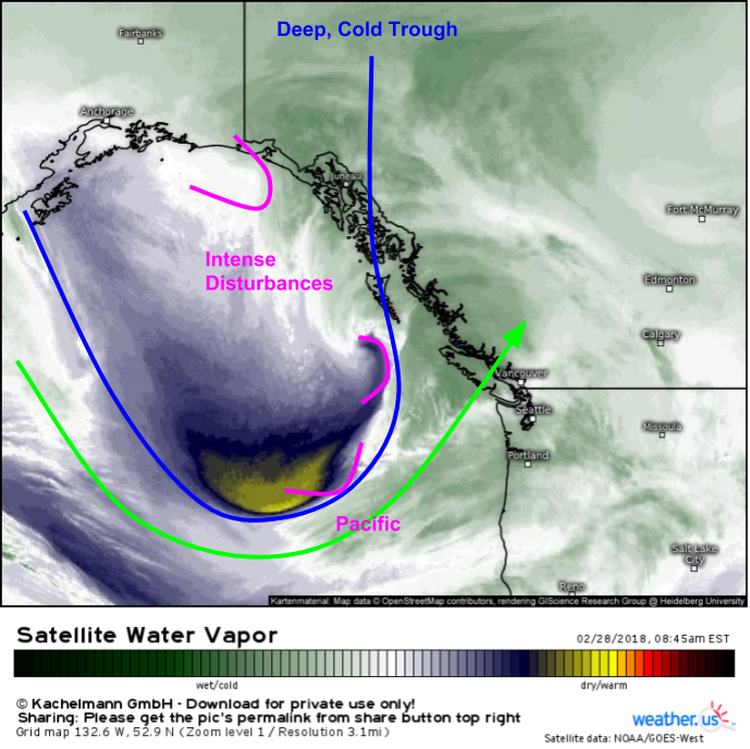
Here’s a look at WV satellite imagery showing the storm system gathering steam over the Gulf of Alaska. A large cold trough is visible as a dip in the jet stream, with intense disturbances rotating around the trough’s periphery. Pacific moisture is seen streaming onshore to the southeast of the trough, and that moisture is already producing precipitation in coastal parts of the Pacific Northwest as seen by our HD radar products. It’s the juxtaposition of the very cold trough with the deep moisture that will make this such an impressive storm especially for lower elevation areas that will get much more snow than they would from a typical tropically sourced system.
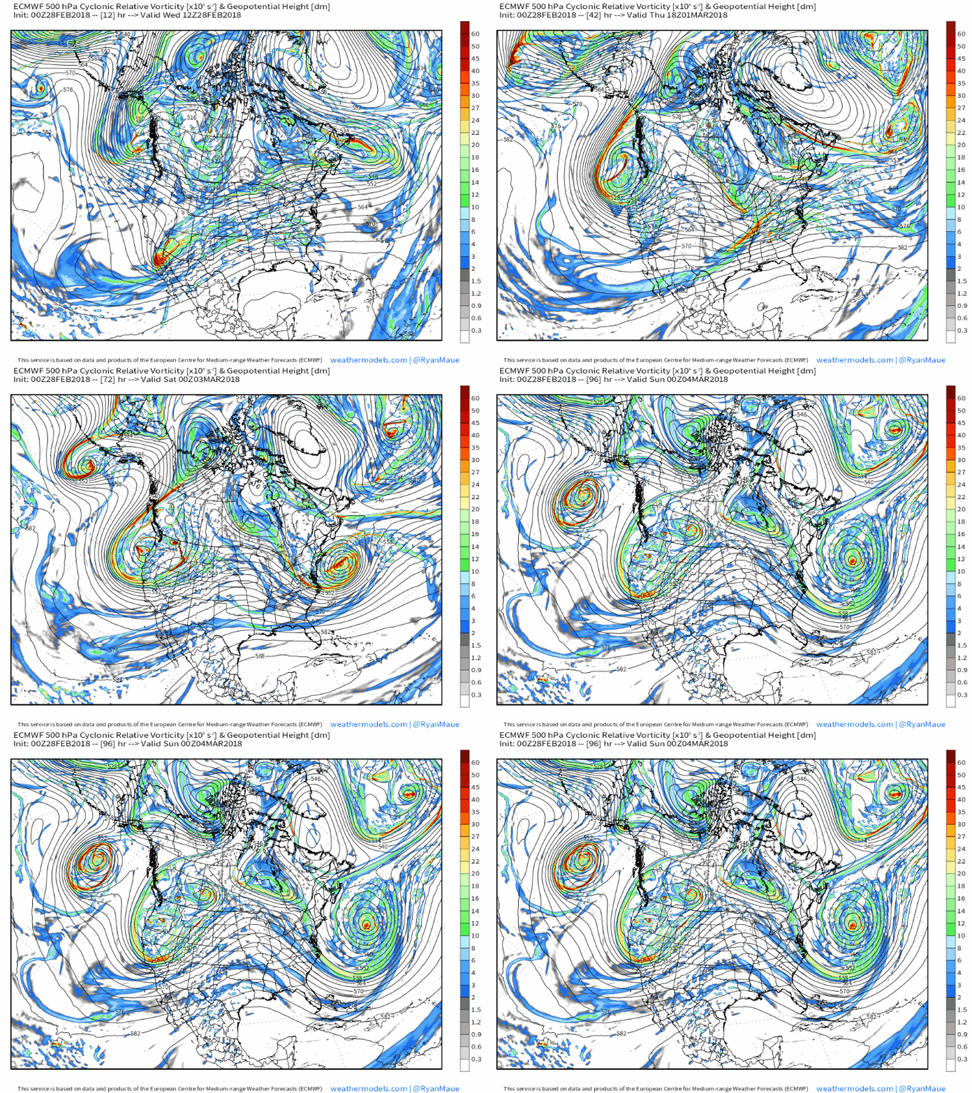
Here’s an animation from weathermodels.com showing the ECMWF’s mid/upper level (500mb) energy (vorticity) forecast from this morning through Saturday evening. Notice the energy currently south of Alaska wobbles around a bit today before consolidating and dropping south towards Oregon tomorrow. Because the moisture will be located on the southern side of the system, that means Northern California will be the place to be for heavy rain and snow.
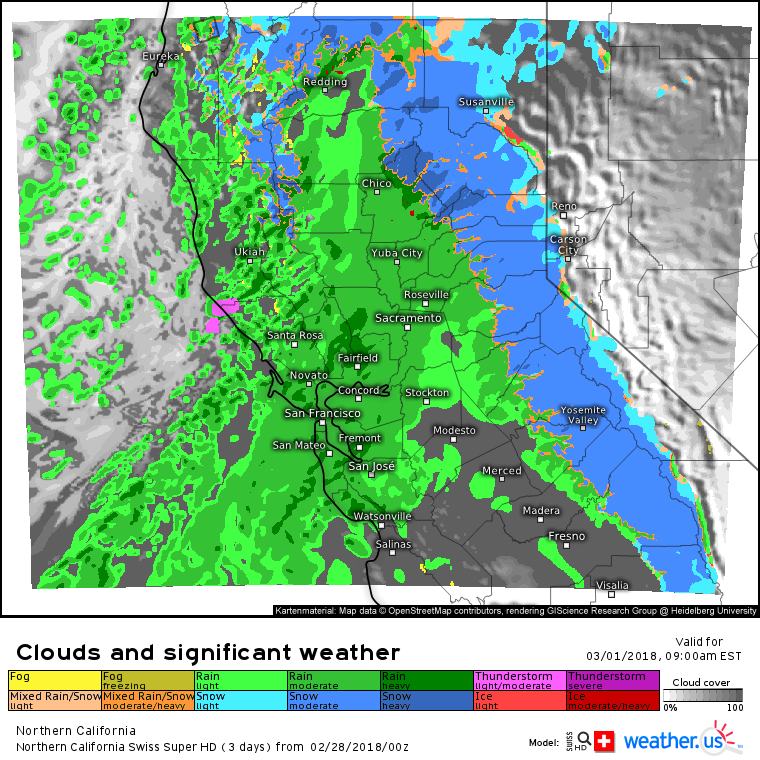
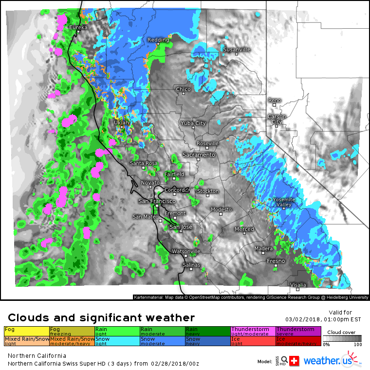
Swiss Super HD forecasts for Northern California show exactly the results we would expect from this setup. Bands of heavy rain are forecast for the lower elevations tomorrow morning as heavy snow falls in the higher elevations. Thunderstorms are even possible as the cold air aloft associated with the upper low moves south, strengthening the vertical temperature gradient over areas near the coast that are kept warm by the Pacific Ocean.
As Friday morning approaches, the cold air associated with the upper low will have fully moved into Northern California, and snow levels will drop in the hills north of San Francisco. You can click the maps on weather.us to zoom into any of these maps for county level detail to see exactly where the rain/snow lines are forecast to set up. It is important to note though that these forecasts are not perfect, and the actual rain/snow line is unlikely to perfectly match up with even the best model’s forecast. That being said, because the Swiss Super HD model is run at such a high resolution, it is better equipped to pick up on localized terrain influences and elevation changes that will be critical in determining who sees snow and who doesn’t.
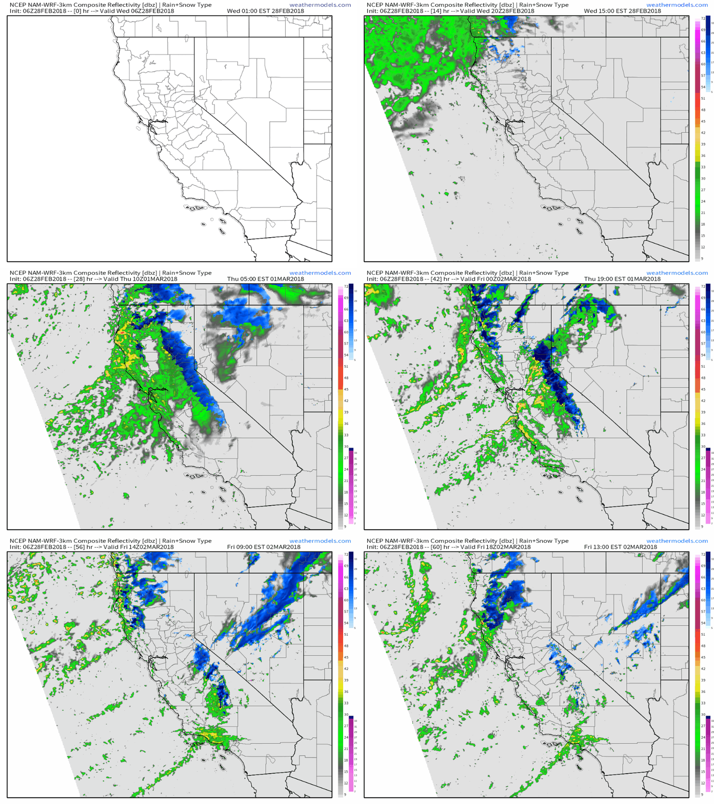
Here’s a California-wide simulated radar animation from the NAM model via weathermodels.com showing the general evolution of the storm over the next few days including the initial round of heavy rain/snow tomorrow followed by the dropping snow levels tomorrow night and into Friday morning. As we saw above with the ECMWF’s upper level pattern forecast, the system will hang around into Saturday, so this animation doesn’t even cover the whole storm.
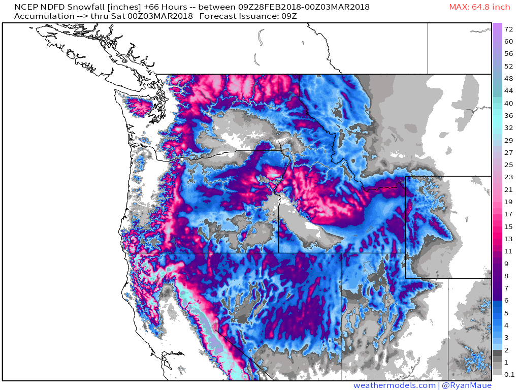
How much snow is expected from this storm? This map which shows the National Weather Service’s official snowfall forecast through Friday evening gives a pretty good sense of what to expect for most areas, though some parts of California will continue to see accumulating snow into Saturday that is not shown on this map. Notice the high totals in Northern California’s coastal mountains as well as the Sierra Nevada. The storm will be strong enough to spread snow east into the Intermountain regions as well, with significant accumulations also expected in Nevada and Idaho.
Map via weathermodels.com.
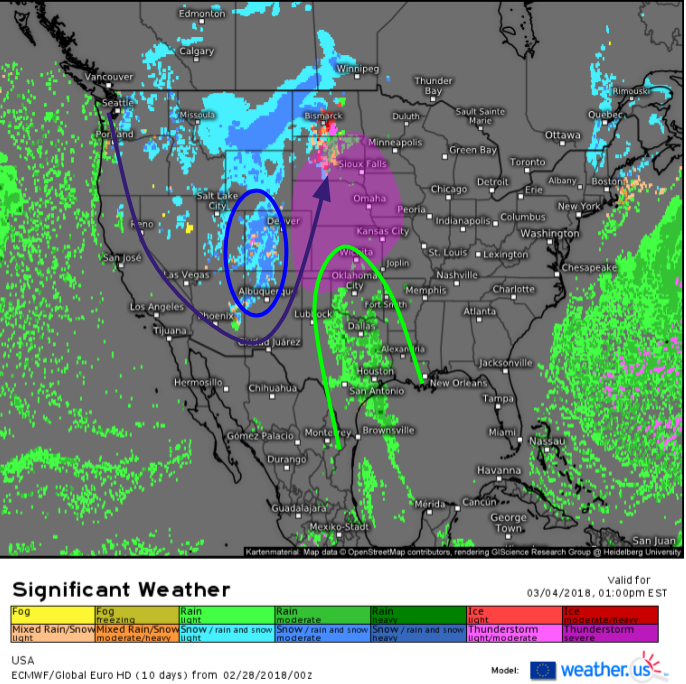
As we move into the second part of the weekend, the storm will move east with a much-needed round of heavy snow expected in the mountains of Colorado before upward motion ahead of the upper level trough combines with Gulf moisture to form yet another storm system across the Plains, though it looks like this one will track farther northwest than those in recent weeks, which could give the waterlogged Southern MS Valley a reprieve from the worst of the rains. More on that system to come.
I’ll have more information on the storm system forecast to intensify off the Northeast coast on Friday this evening.
-Jack
