Major Pacific Storm To Bring Heavy Rain And Mountain Snow To California Today And Tomorrow
Hello everyone!
Rain is already beginning to fall across California this morning as a storm system approaches from the West. This system will impact the area through tomorrow, with the main threat being mudslides as a result of torrential rains falling on the burn scars from earlier wildfires. The Thomas Fire burn scar is of especially high concern as 6 to as much as 10″ of rain is possible there.
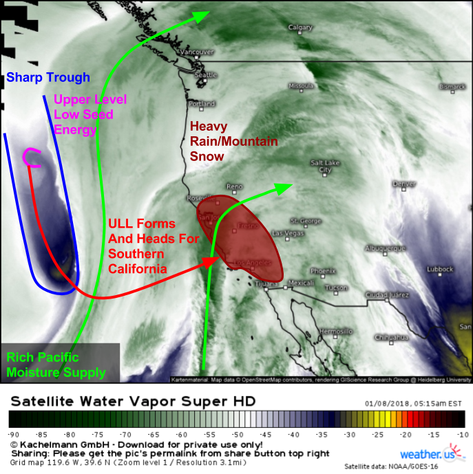
Water Vapor satellite imagery (what’s that?) shows a setup favorable for heavy precipitation today. Deep plumes of Pacific moisture are noted both directly in front of a strong upper level trough, and a little farther to the east. A disturbance diving SE through the core of that upper level trough will help it “cut off” into a low pressure system of its own, which will slow its forward progress as it approaches the coastline.
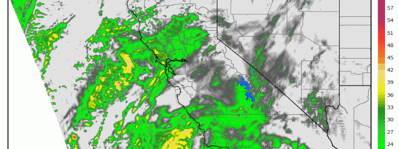
Here’s an animation from the NAM model (maps/GIF from weathermodels.com) that shows rain and mountain snow associated with this system evolving from this morning through tomorrow night. Notice the heaviest precipitation falls along the coastal mountain range that runs from just north of LA to just north of Santa Barbara. This is right where the Thomas Fire burned with such ferocity just a few weeks ago.
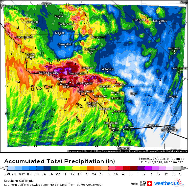
Here’s the Swiss Super HD model’s forecast for total precipitation through the end of the event on Wednesday. Notice the mountains north of Santa Barbara where the Thomas Fire burned are expecting over 6″ of rain, falling in a relatively short period of time. Prolonged downpours and steep slopes that lack vegetation are a dangerous combination, and mudslides are becoming a near certainty in these areas. Elsewhere, watch for urban/small stream flooding in places like Los Angeles and Santa Barbara themselves where 2-4″ of rain are expected.
Rain will move out early Wednesday morning.
-Jack


