Major Hurricane Maria Poised To Devastate Puerto Rico
Hello everyone!
Maria continues to strengthen this evening as it moves towards Puerto Rico. I’ve already gone over the forecast for Maria, but some of the key points bear repeating as the storm is forecast to be a devastating event for Puerto Rico.
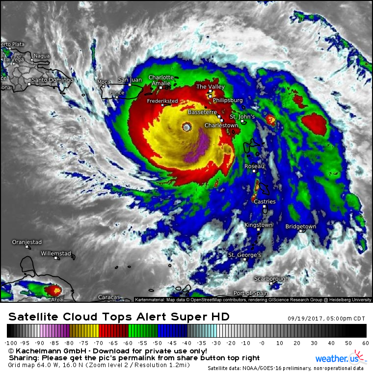
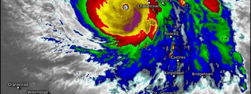
Satellite imagery of Maria shows a nearly perfect system. It’s hard to find a flaw anywhere in its structure. A very clearly defined eye is visible and is surrounded by a region of extremely powerful thunderstorms. Outflow continues unimpeded in all directions, and well-organized spiral bands extend out from the center. Maria’s satellite image belongs in the intense hurricane textbooks, and that’s not good news for Puerto Rico. If you’re interested in learning more about satellite imagery and how to find/read maps like this at weather.us, check out this video.
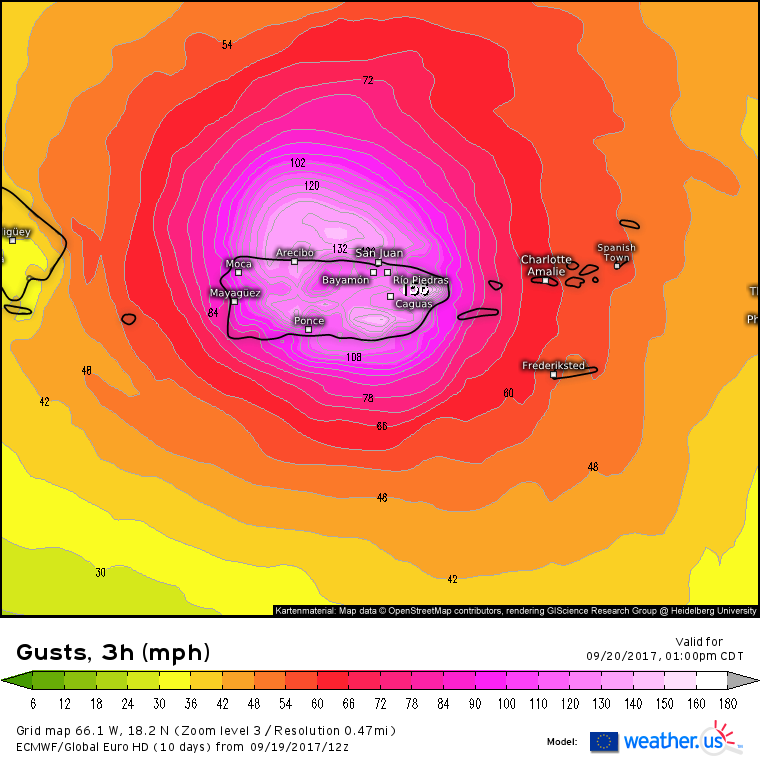
When a hurricane threatens the mainland US, escaping the storm is fairly straightforward for most people: get in a car, and drive out of harm’s way. As Maria approaches Puerto Rico, this will not be an option. Interaction with the mountains of Dominica have helped to expand the wind field. As a result, the entire island of Puerto Rico can expect hurricane force wind gusts, with many places seeing winds in excess of 100 mph. Areas near where the eye tracks will see much higher winds, well in excess of 150 mph. Puerto Rico’s mountains will bear the brunt of Maria’s winds, as winds in the storm increase with height. On the windward sides of the taller peaks, wind gusts over 200 mph are forecast. Anything that’s not a well built concrete structure will be severely damaged or destroyed by these winds.
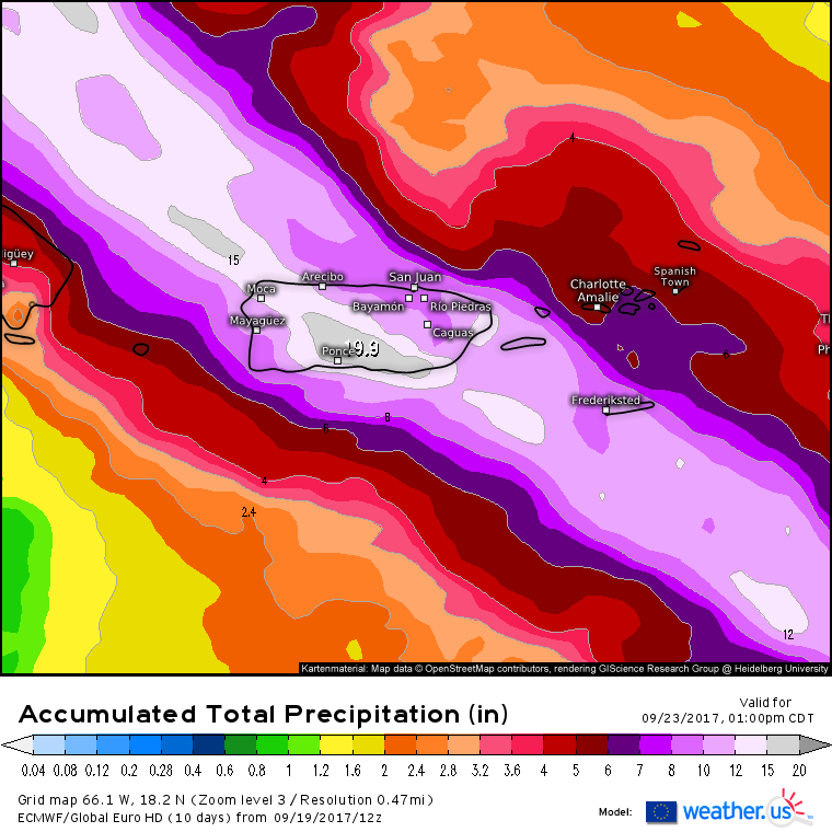
Of course, winds aren’t the only threat associated with landfalling hurricanes. Puerto Rico’s mountains will squeeze the tropical moisture out of Maria’s core, weakening the storm but also resulting in extremely heavy rains.
A general 8-12″ rainfall is expected across the entire island, and amounts approaching 2 feet are possible in the mountains. These very heavy rainfall totals will promote flash flood and mudslide threats through the rest of the week.
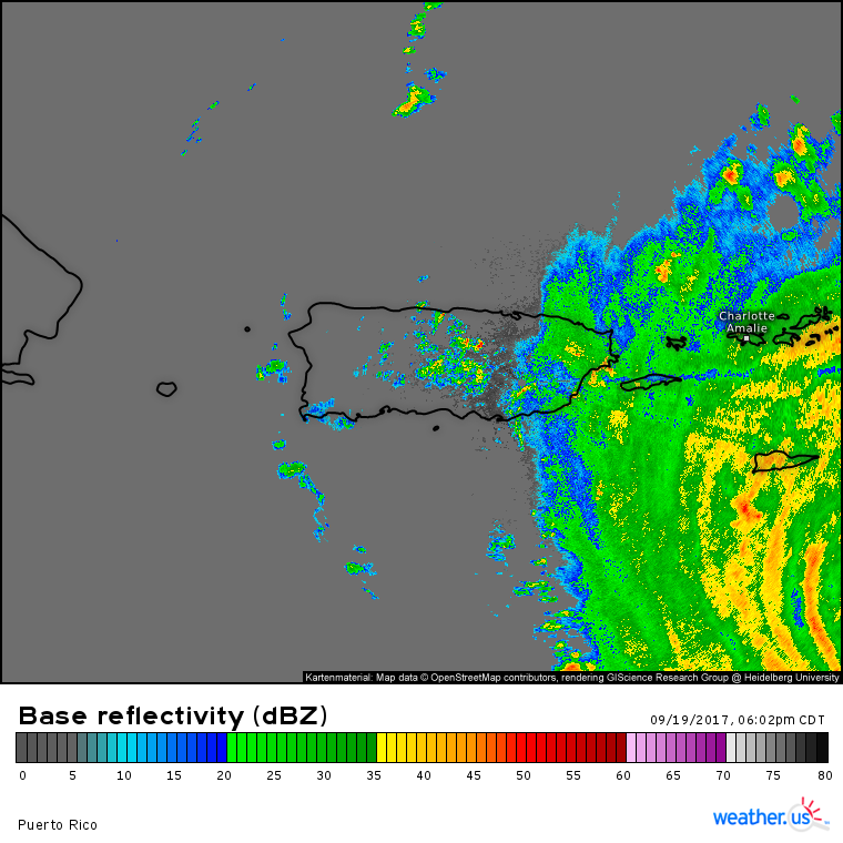
Maria’s outer bands are already bringing inclement weather to Puerto Rico. Watch the whole event unfold in extraordinary high definition with HD radar and 1 minute GOES-16 imagery at weather.us!
Maria will depart Puerto Rico on Thursday as it continues its trek WNW.
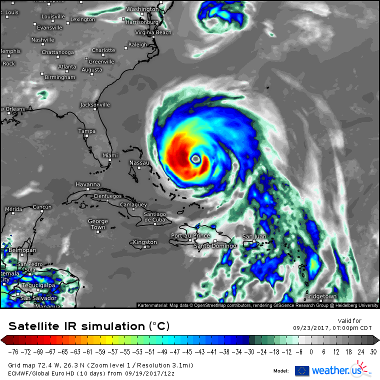
This simulated satellite image from the ECMWF model shows Maria moving NW as a still powerful hurricane on Saturday. The remnants of Jose are noted towards the top of the image. Jose’s remnants will play a big part in determining Maria’s track. Notice the large area of clear skies NE and NW of Maria. These cloudless areas indicate an upper level ridge. Normally, this would steer Maria west towards the US. However, Jose has busted a hole in that ridge. This will likely allow Maria to turn north and eventually northeast. How far west these turns occur will make all the difference for the US East Coast. While current forecasts keep the storm offshore, a landfall or very close brush remains a distinct possibility. We’ll know much more in the days ahead!
I’ll have another update tomorrow morning.
-Jack
