Major Hurricane Irma Set To Ravage Southern Florida Today
Hello everyone!
The main story will of course be Hurricane Irma as it roars ashore in Southwestern Florida today. Landfall in the Florida Keys is just a couple hours away with landfall farther up the coast expected this afternoon. I’ll once again break down each impact that Irma will bring to Florida as well as where you can find more information over on weather.us.
Click on any link for more information about a particular topic. For each link, you can click the map to zoom in, you can click near the edge of the map to pan, and you can use the (-) button to zoom out. You can also explore other parameters/satellite views and time steps via the menus to the left of each image.
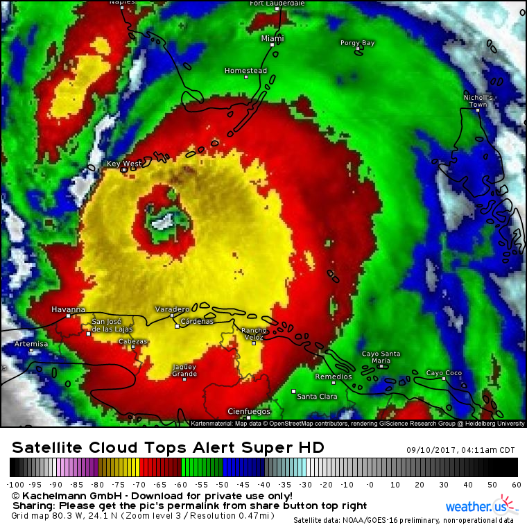
Satellite imagery of Irma continues to show a strengthening storm this morning.
GOES-16 imagery now updated every 1 minute shows an expansive area of cloud top temperatures below -70C with several of the strongest towers approaching -80C. This indicates extremely strong thunderstorm activity in the eyewall. Soon we’ll get 1 minute visible imagery as the sun comes up which will provide us with an even more detailed picture of the storm. Use the menus to the left of the image to select visible data once the sun comes up in a couple hours.
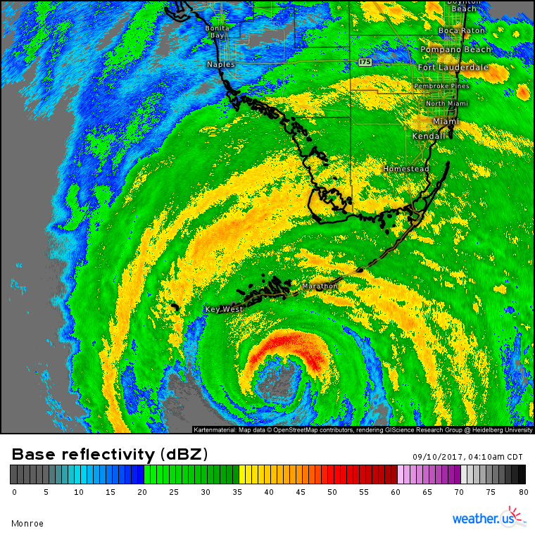
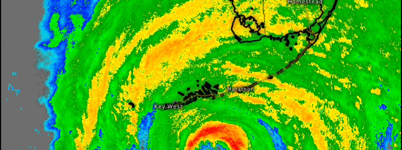
Radar data shows several important features associated with Irma in Southern Florida.
First of all, you can see the eyewall which is the innermost ring of very strong thunderstorms indicated by the bright red south of Key West and Marathon Key. This red band is where the 130+ mph winds will be located. The calm eye that has little or no wind at all is just to the south of the eyewall and is shown by the grey areas that indicate no precipitation. Farther to the south, the eyewall looks weaker, however I suspect that this is due to the radar beam being too interrupted by the northern eyewall to see the southern one very well. The next feature is the solid shield of rain now encompassing the Miami region as well as the Keys and the adjacent Gulf waters. This solid rain shield marks the change between intermittently severe conditions (in the outer bands where winds gust to 50 mph but quickly settle down) to constantly severe conditions. Hurricane force wind gusts are present in the outer part of this rain shield with sustained hurricane force winds closer to the eyewall.
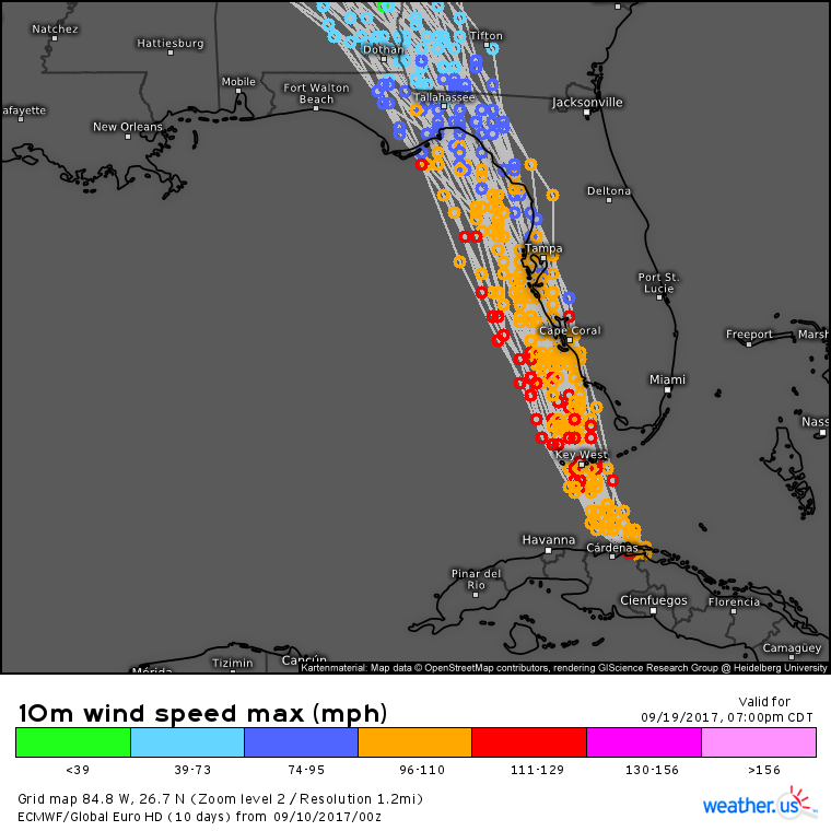
The forecast that we’ve been talking about for several days is now set in stone more or less.
All EPS ensemble members have Irma tracking NNW just off the west coast of Florida with a landfall either near Tampa or in the Big Bend region. Small wobbles of 5 or 10 miles east or west will make a large difference in landfall location due to the orientation of the coastline and the angle of approach of the storm. Ultimately, it will make little difference for areas where “escaping the worst” means wind gusts of “only” 100 mph. Storm surges of 10-15 feet will sweep inland across southwestern Florida and will be deadly for anyone in their path regardless of slight wobbles this way or that way.
Let’s break down the timing a little bit for some of the areas along Irma’s path.
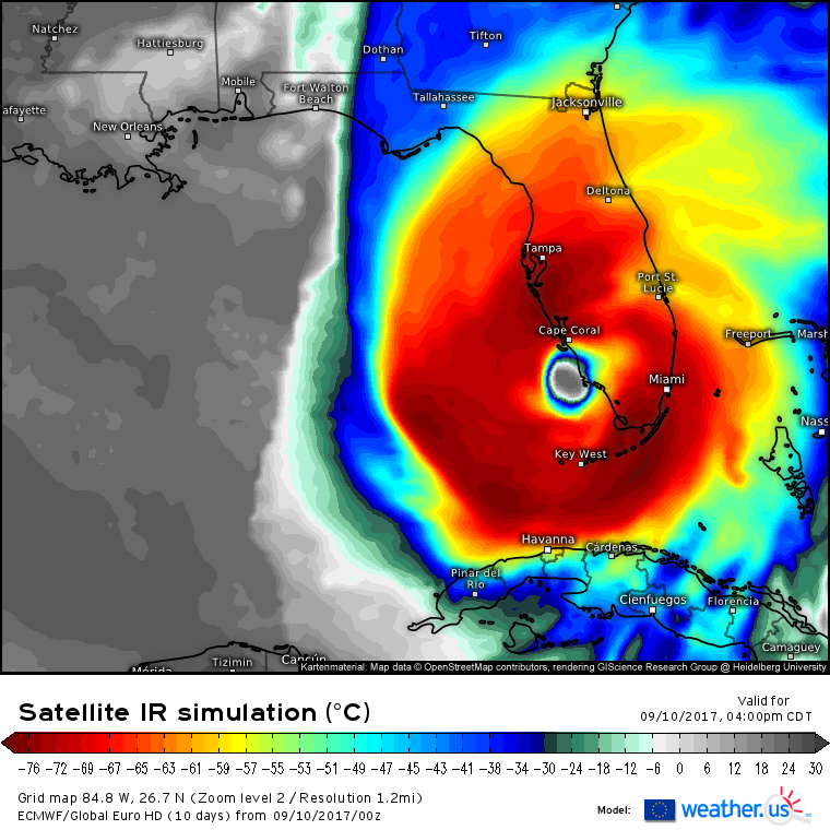
The eye will move over the Florida Keys in the next couple of hours. By 11 AM, it will be moving north of the Keys with very intense winds and rain spreading up the SW coast. This morning, winds to the north of the hurricane will be out of the east, pushing water levels down a little bit along the southwest coast of Florida. Don’t let your guard down though, the worst of the storm surge will be after the eye has passed. In Southeast Florida, winds won’t be quite as high, but the threat for tornadoes will loom large.
By 5 PM this evening, the eye will be approaching the SW FL coast. A wobble 10 or 15 miles west would result in a landfall closer to the Tampa area while a wobble 10 or 15 miles east would result in the eye coming ashore near Naples. Either way, both areas will see extreme winds, torrential rains, and storm surge. As we head through the evening, conditions on Key West and the rest of the Florida Keys will slowly improve. However, the threat for tornadoes will remain along the East Coast.
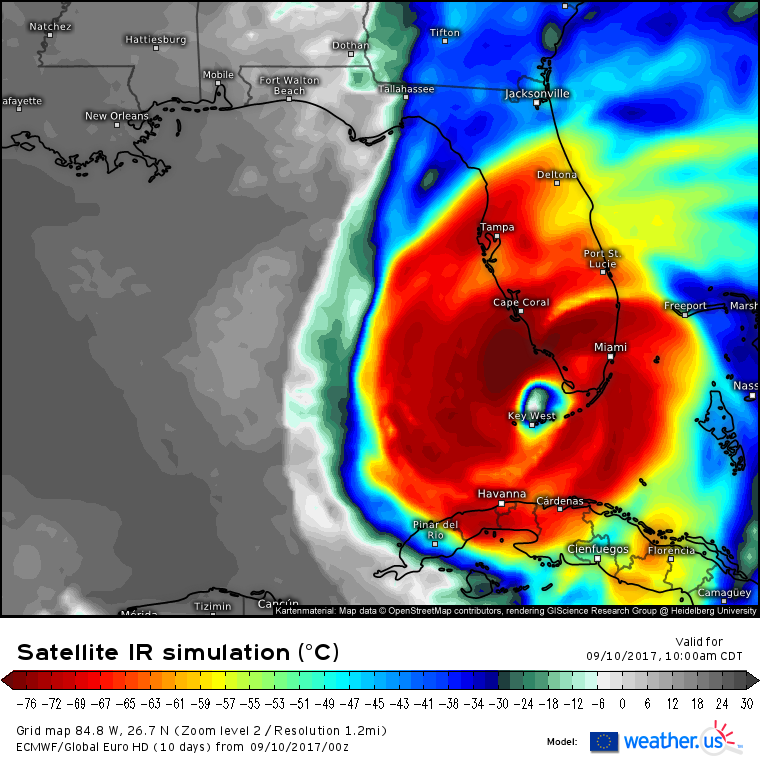
This is the most important map in my opinion, not due to the wind speeds (which are drastically underestimated by the model), but due to the wind direction. Notice ahead of the eye, there are offshore winds that will be blowing water away from the coastline. Behind the eye, however, those winds reverse direction. You’ll have 120 mph winds pushing water towards the coastline after the eye moves past. This is where storm surge will become a huge issue for places like Naples, Fort Meyers, Cape Coral, and eventually even Tampa. If you get the eye and think the storm is almost over, think again, the worst is yet to come.
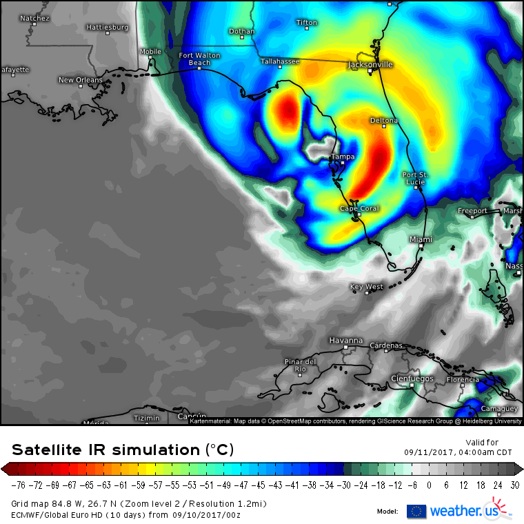
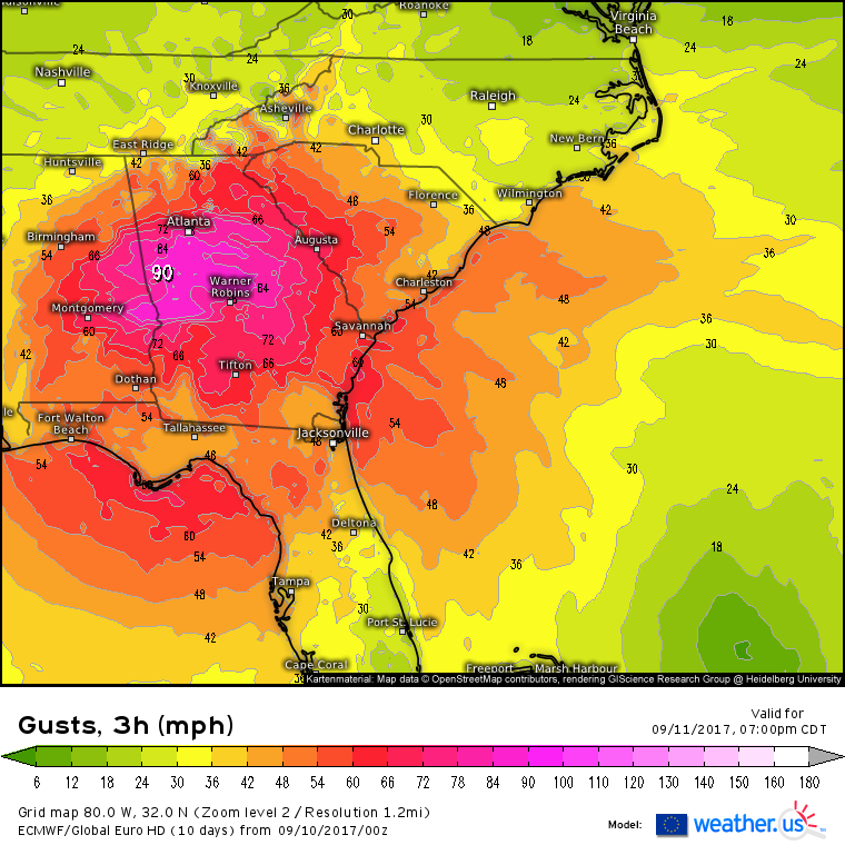
By tomorrow morning, the storm will be moving north near the Big Bend region of Florida which will also see extreme storm surge in excess of 10 feet. While the 130 mph winds from the Florida Keys won’t make it to Tallahassee or Jacksonville, you don’t need those extreme wind gusts to cause major problems. In fact, widespread power outages are expected with hurricane force winds all the way to Atlanta as we head through tomorrow.
In addition to the wind threat, heavy rains and severe weather will also accompany the storm into Georgia tomorrow.
Unlike Harvey, this storm will not last long over land, and by Tuesday evening, it will be nothing more than a harmless swirl of clouds accompanied by some light showers.
To track Irma yourself, we have a wide variety of tools available at weather.us. Here are links to some of the most useful resources for this storm.
GOES-16 1 minute satellite imagery: see updated satellite pictures of Irma every 60 seconds! For now, use IR, then switch to visible when the sun comes up. You can toggle between views using the menus to the left of the image.
HD radar: get HD radar scans from radars up and down the Florida peninsula. Watch the eye, the eyewall, and each outer band come ashore. You can use the menus to the left of the image to adjust the zoom and select other radar parameters such as velocity data to look at potential tornadoes.
Model guidance: look at updated model guidance to see how the storm is forecast to evolve over the coming hours and days. One of the most useful tools for seeing how the storm moves and changes is the Simulated Satellite product from the ECMWF.
Ensemble forecasts for your house: compare ensemble forecasts for your location in a variety of parameters including wind speed, temperature, and rainfall. Just type in your location and go. If the ensembles agree on a wind speed or a rainfall total, you can have high confidence in that forecast panning out. If not, don’t place too much weight in any given forecast. More information on ensembles.
I’ll have an update on FB Live at 10 AM EDT with all the latest on Irma.
Jack Sillin is a weather nerd and forecaster who regularly writes for weather.us and 33andrain.com.
