Major Hurricane Irma Pounds Florida With Extreme Conditions As Jose Drifts Offshore
Hello everyone!
Irma continues to be the main story in the tropics today, but Jose is not to be neglected completely- it too could pose a threat to the US in the coming days. I’ll start with Irma, its timing, and its impacts, before mentioning some of the uncertainties associated with Jose.
Click on any link for more information about a particular topic. For each link, you can click the map to zoom in, you can click near the edge of the map to pan, and you can use the (-) button to zoom out. You can also explore other parameters/satellite views and time steps via the menus to the left of each image.
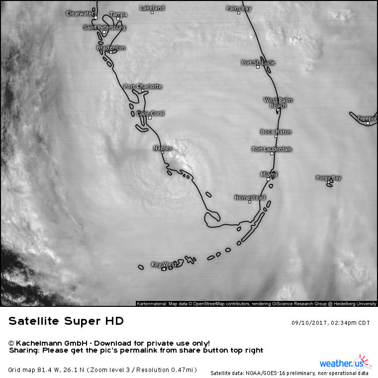
GOES-16 1 minute super-high-resolution imagery shows the eye of Irma moving into the Marco Island area.
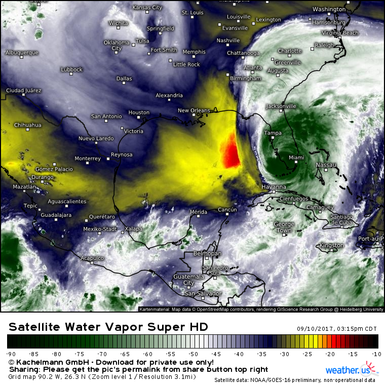
The storm continues to display subtle signs of weakening, but remains a powerful system. Deep thunderstorm activity is in progress to the east and northeast of the center as well as around the center itself.
However, drier air is beginning to work into the system from the west which is resulting in weakening. This dry air is visible in the above WV satellite image. The eye of Irma is covered with clouds and is no longer the spectacularly well defined structure we saw in the Leeward Islands a couple days ago. However, that’s of no comfort to the residents of the Southwest coast of Florida who are experiencing wind gusts well over 100mph.
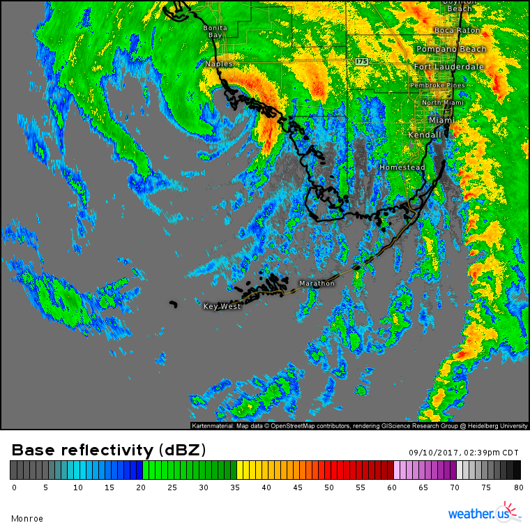
Those 100+ mph gusts are coming in the eyewall of Irma which is the innermost band of the storm, currently moving into Naples.
Behind the eyewall is the eye of Irma. This is the area of calm winds and light/no rain that signals the middle of the circulation. The eye has officially made landfall in Marco Island as of 3:35 PM EDT as a Category 3 hurricane with winds of 115 mph. Ahead of the eye, winds are out of the east. These offshore winds are pushing water offshore, resulting in large drops in the water level. You may have seen pictures on social media of normally submerged sandbars and harbors emerging from the water. Don’t let this fool you into thinking the surge isn’t coming! Behind the eye, winds will turn onshore and force all that water and then some to rush back in. The water level will go from 3-5 feet below sea level to 10-15 feet above sea level in a matter of minutes.
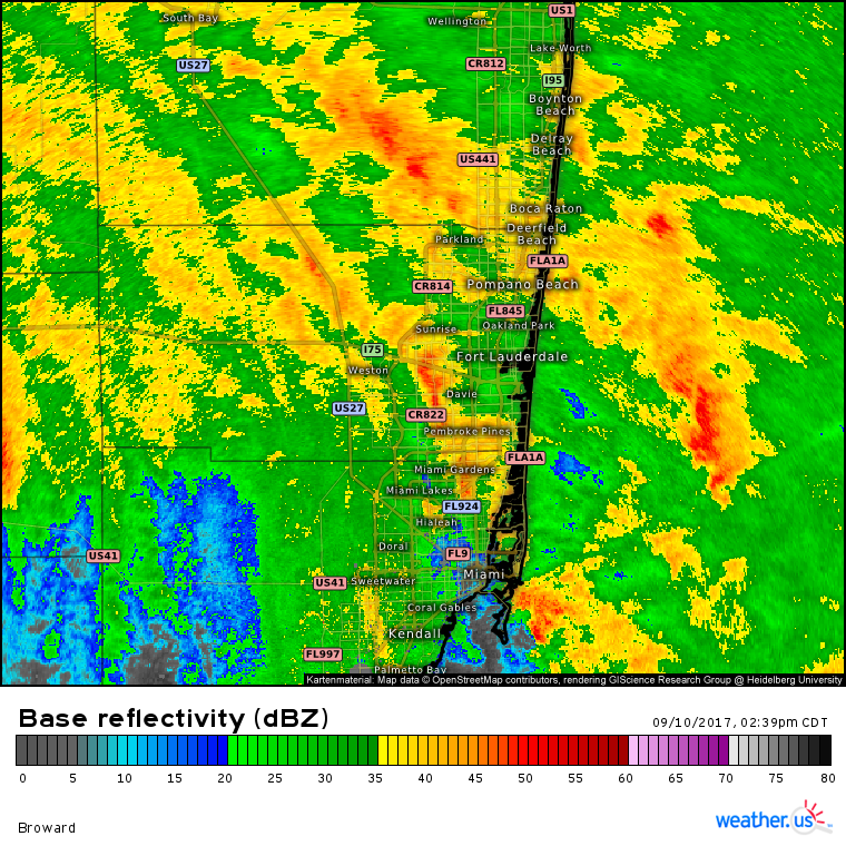
Farther to the east, sustained winds are lower, but the storm is no less dangerous. The threat in places like Fort Lauderdale isn’t wind or surge, it’s tornadoes.
This radar image shows two powerful feeder bands of Irma in the Fort Lauderdale area. Each band contains a stream of tornadic cells that are rapidly rotating as they race NE at 60-70 mph. These tornadoes will strike with little to no warning, so it’s best to remain in a safe place until all of these bands depart.
Speaking of storms departing, when will Irma finally leave Southern Florida alone?
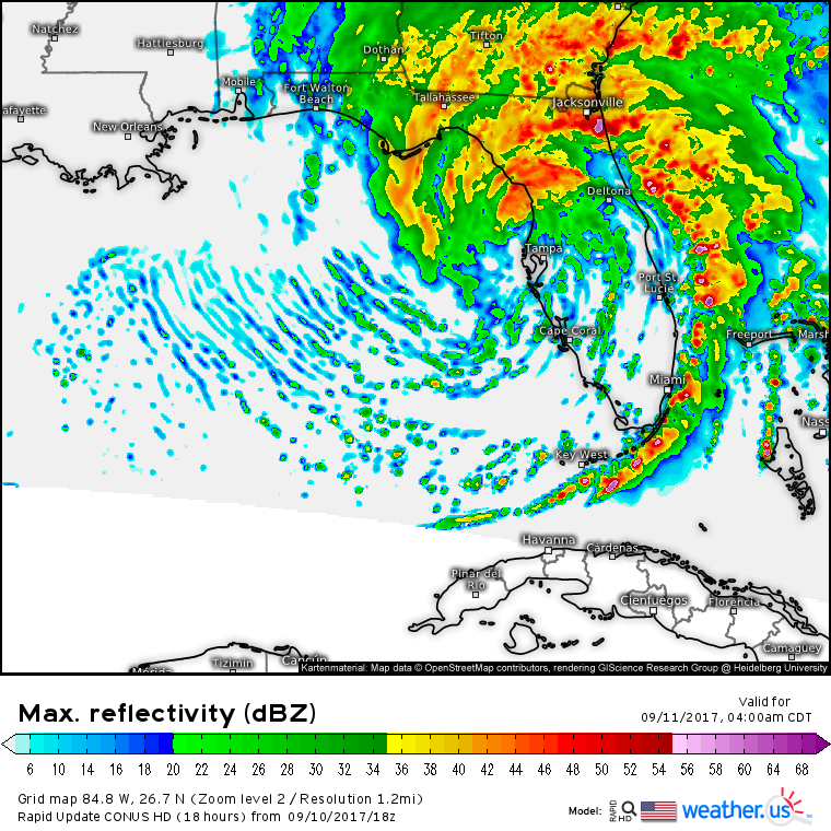
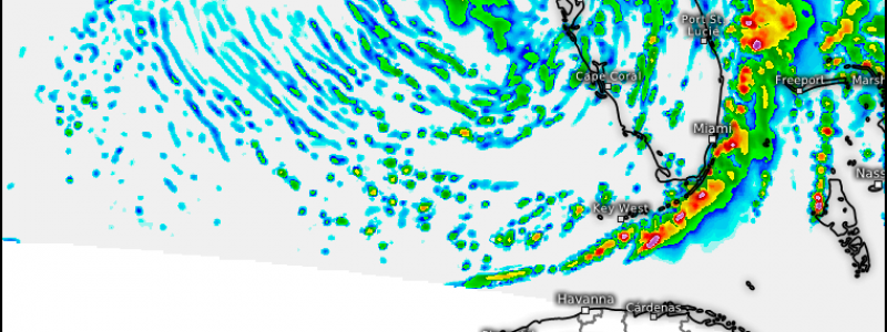
This model shows a pretty good approximation of what the radar will look like tomorrow morning. The worst of the weather will be moving towards Northern Florida as the core moves up the coast. Winds in the Florida Keys and in the Miami area will be settling down, though they’ll still be gusty as squalls rotate through. Those squalls will be similar to those that passed through yesterday. They’ll contain torrential rains and winds of 50-70 mph. Additionally, they’ll carry with them the threat for tornadoes. However, these squalls won’t last too long and they won’t bring the 100 mph+ wind gusts that are causing severe damage on the west coast of Florida. Also, there will be plenty of sunny skies developing as drier air works into the storm from the west.
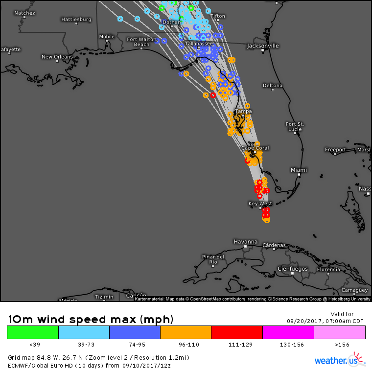
Irma’s track is no longer a mystery and we can see that higher confidence in the ensemble forecasts that I’ve shown for days now. Remember when these lines spread hundreds of miles apart and we had little to no idea where the storm was going? Those days are over. The lines are separated by little more than a few miles and Irma’s forecast is more or less set in stone.
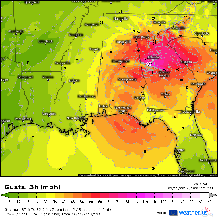
As we’ve mentioned many times before, high winds will continue to impact areas well away from the coast tomorrow as Irma moves north.
Atlanta is likely to see hurricane force wind gusts as is the rest of Georgia. Tropical storm force winds will spread into the Carolinas as well as Alabama and Tennessee. While these winds will be a far cry from the 100 mph+ conditions we’re seeing now in Florida, they’ll definitely be strong enough to cause issues with power outages and downed trees.
By Tuesday evening, Irma will be no more. Ferocious winds will taper to gentile breezes, and torrential tropical downpours will fade into light showers.
Once that happens and Irma is no longer a threat, we’ll turn our eyes to the next storm which you can see beginning to move into the picture in the SW Atlantic.
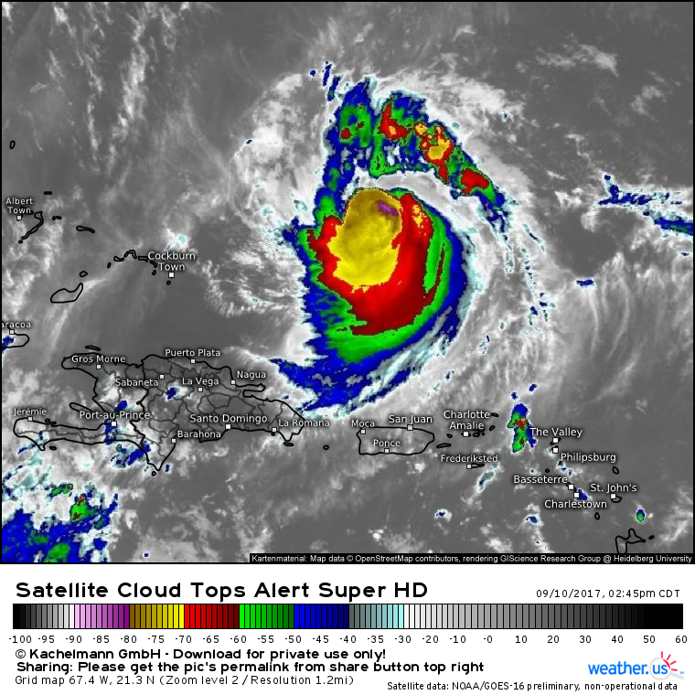
Satellite images are showing a ragged look to Jose as the storm feels northerly outflow from Hurricane Irma. This is disrupting the circulation a bit.
The storm has a deep area of thunderstorm activity near its center though the upper level winds from Irma are “shearing” that thunderstorm activity south of the center. This will likely result in Jose weakening from 130 mph winds this morning down closer to the 100 mph mark by tonight and tomorrow as the storm moves NW.
After tomorrow, things get a little funky for Jose.
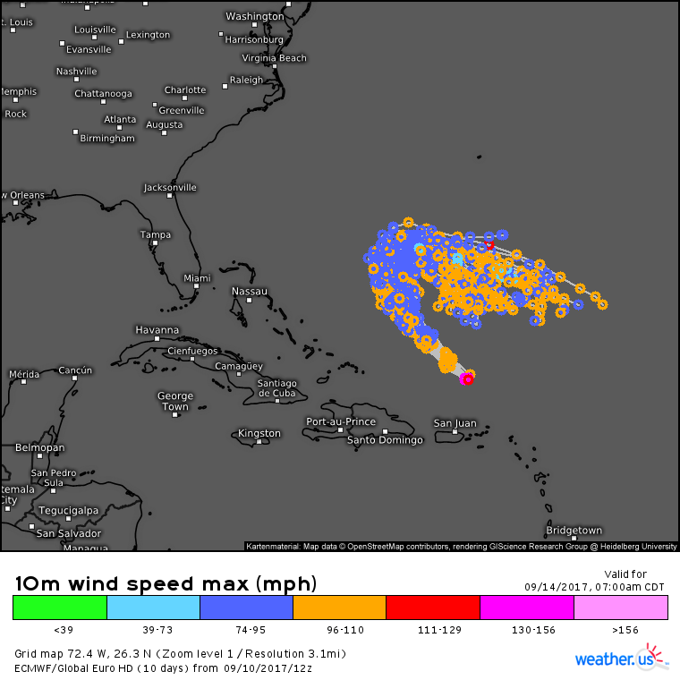
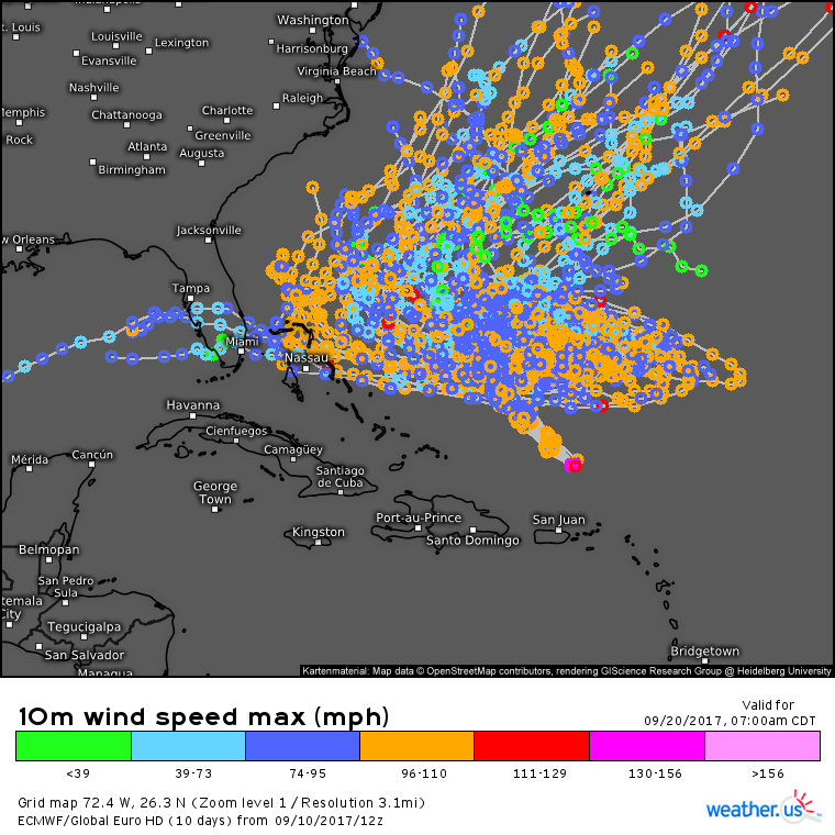
The hurricane is forecast to turn sharply to the right and reverse course in about 3 days time, moving to the southeast at day 4. The extent of this SE motion will be critical in determining Jose’s long term track. As you can see, there’s already considerable spread among model guidance with regards to how far SE Jose moves after the turn on Tuesday. This uncertainty of course compounds out through time, and by day 10 the forecast for Jose is a firm ¯\_(ツ)_/¯
I’ll talk much more about Jose, what’s creating all this uncertainty, and its potential US impacts after Irma dissipates on Tuesday.
In case you’re still not tired of tropical systems…
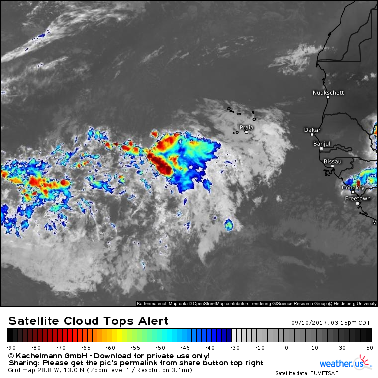
This tropical wave could develop into TS Lee in the coming days as it moves WNW across the Atlantic. Of course it’s far too early to speculate on the potential track of a storm that doesn’t even exist yet.
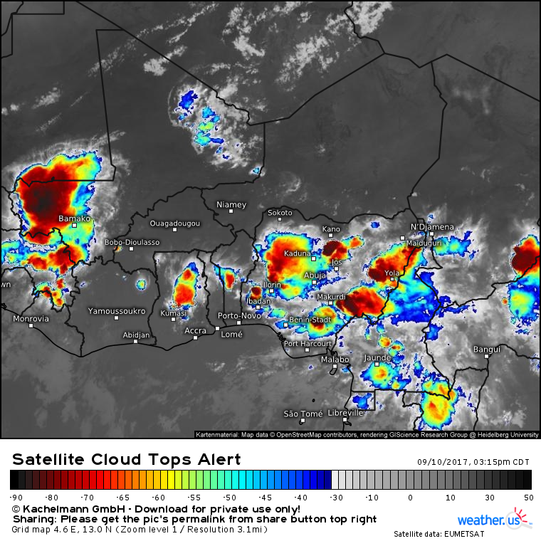
A quick glance at the satellite imagery over Western Africa shows that the active tropical wave train continues and our tropical activity likely isn’t coming to a halt anytime soon.
Much more in the days and weeks to come as Hurricane Season 2017 rolls on! My next update here will be tomorrow morning as Irma plows north.
Jack Sillin is a weather nerd and forecaster who regularly writes for weather.us and 33andrain.com.
