Major Flash Flooding Possible in Parts of the Southeast Today
Hello everyone!
A significant flash flooding event is expected across parts of the Southeast today as several rounds of thunderstorms develop along a nearly-stationary frontal boundary. While rainfall totals aren’t expected to be extremely impressive, the rain will be falling on soils that are already saturated, and rivers that are already overflowing. As a result, today will likely produce flooding that is more typical of events that drop much more rain.
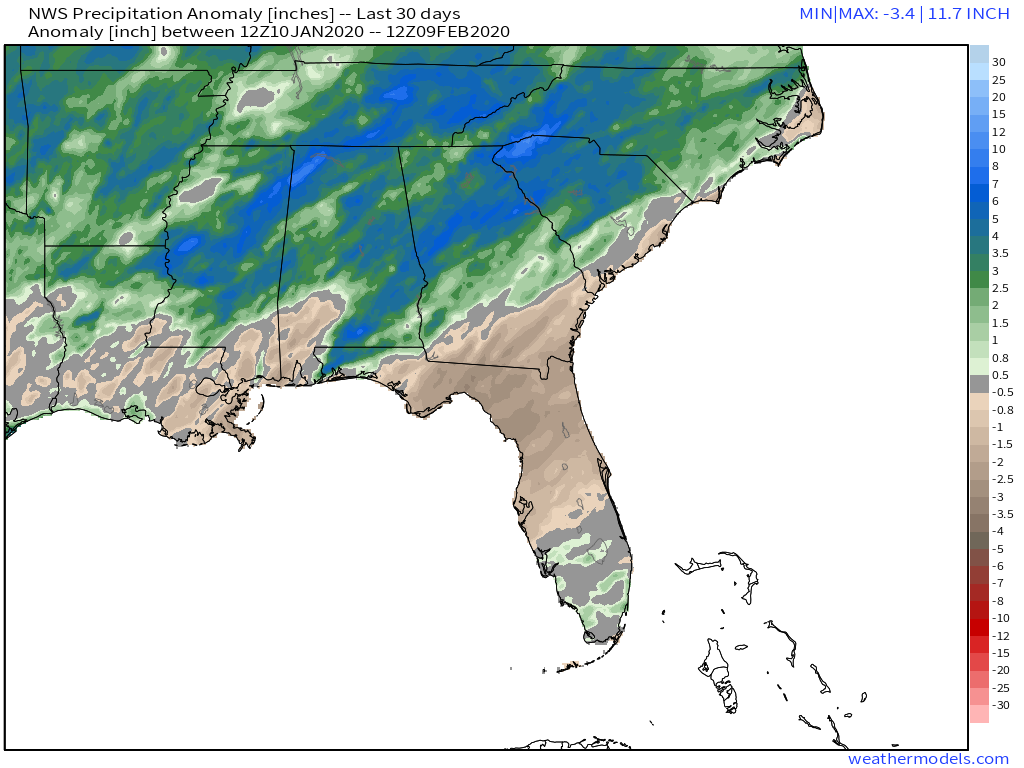
Precipitation anomalies plotted on the map above highlight the wetter-than-normal pattern that has been in place across this part of the country for the past month. Most of MS, AL, GA, and TN have been running 3-5″+ above normal as far as rainfall totals go after a series of storms dropped heavy rain on the region over the past few weeks.
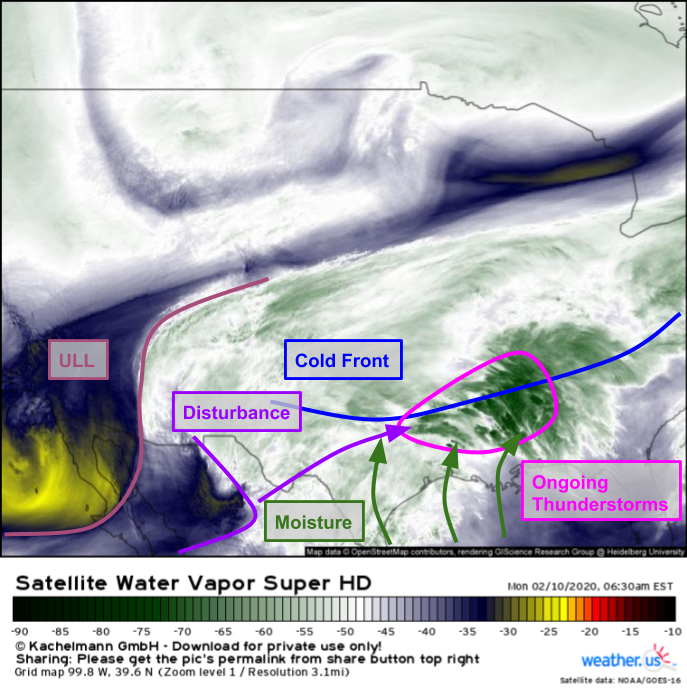
Here’s a look at the setup for today’s storms from GOES-East’s perspective. A cold front (analyzed via surface data) is draped across the southeast and is very slowly drifting south. Thunderstorms are ongoing along this front as a weak disturbance drifts east through the Lower MS Valley. These thunderstorms are producing heavy rain which will continue to set the stage for the main event later today. That main event will come when the much stronger upper level disturbance over northern Mexico moves east and touches off another round of showers and thunderstorms this afternoon/evening.
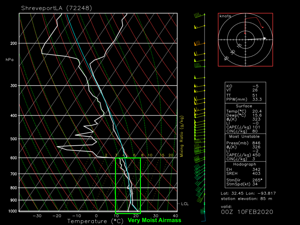
A quick glance at last night’s sounding from Shreveport LA confirms that the airmass over this region is extremely moisture-rich. Note the deep layer where temperatures and dew points are quite close to each other, indicating the presence of moisture. Additional moisture will continue surging north from the Gulf of Mexico as southerly flow strengthens ahead of the second disturbance discussed above.
We’ve now covered all the ingredients necessary for a flash flood event: moisture, lift, and antecedent conditions. It’s clear that these ingredients will come together over the Southeast in such a way that’s supportive of very heavy rain and flash flooding. So how much is expected to fall and which areas are at the greatest risk?
Here’s a look at how the 3km NAM expects rainfall totals to stack up today. I’m a bit skeptical that we actually pick up the 6-8″+ it expects to fall in the region of maximum totals over AL/MS, but I think it generally has a good handle on where the heaviest rain will fall. That axis of heaviest rain will settle where the cold front does. Lighter (but still substantial) totals will be found north of the front, while areas south of the front will receive little to no rain. Generally speaking, 3-6″ of rain is a good bet along the front itself with 2-4″ farther north and east. If thunderstorms ‘train’ (pass over the same areas repeatedly like traincars moving down the track) for a long enough time, some towns could pick up >6″ but I don’t think that should be widespread given the lack of deep instability for extreme rainfall rates.
If you live or are travelling in this area, be sure you’ve taken the relevant precautions to protect yourself from flooding. Remember never to drive through flooded roads and make sure you have a way of receiving flash flood warnings should a local NWS office issue them. Rivers, streams, and dams are already overflowing in this region from previous heavy rain so water may rise rapidly even due to modest amounts of rain.
You can see where the heaviest rain is falling by checking out our HD radar imagery at weather.us.
-Jack


