Major Flash Flooding Expected In Parts Of The Upper Midwest Today
Hello everyone!
While most of our attention has been focused on Tropical Storm Gordon over the past few days, a significant flash flood event is beginning to get going across parts of the Upper Midwest from Northern Iowa through SE Minnesota into Central/Northern Wisconsin. This area has already been soaked by repeated rounds of heavy rain over the past few days, which has piled on to already high totals from earlier this summer. Deep tropical moisture has overspread the area this afternoon, with thunderstorms now developing along a nearby cold front. These thunderstorms are in an environment conducive to both producing very heavy rains, and training over the same areas repeatedly, which is why the flash flood risk is so high.
Speaking of high risks, the Weather Prediction Center, responsible for flash flood and precipitation outlooks, has issued a HIGH risk for flash flooding in this area this evening through tonight. WPC High risk days account for the vast majority (>90%) of flood damage, although they happen on average only four times per year. This setup means business! Why? Let’s take a look “under the hood” to see what the atmosphere is up to.
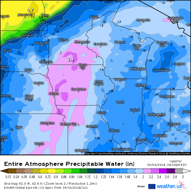
We’ll start with the easiest first ingredient: moisture. There’s just an incredible amount of moisture in the air in the Upper Midwest this evening. Precipitable water values above 2″ indicate tropical air, very unusual for this part of this country at this time of year. Our “sponge” so to speak (the atmosphere) is saturated, all we need is some force to wring it out.
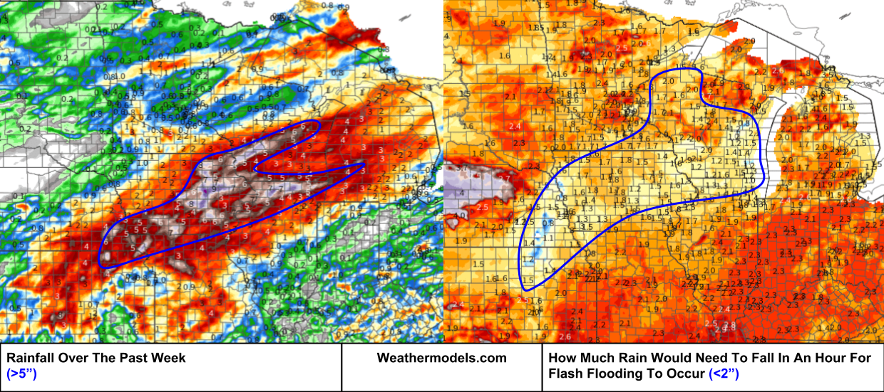
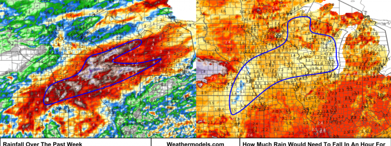
Meanwhile, areas from Nebraska through Iowa and into Wisconsin have already seen tons of rain this week, the latest round in what’s been a very wet summer overall. The result of these rains is saturated soils that can’t absorb much more water. The map on the right is a way of quantifying that impact, as it shows how much rain would need to fall in a one hour period for flash flooding to occur. Notice that it for a large swath of the area we’re looking at, it would take less than 2″ of rain in an hour to result in flash flooding.
Maps via weathermodels.com.
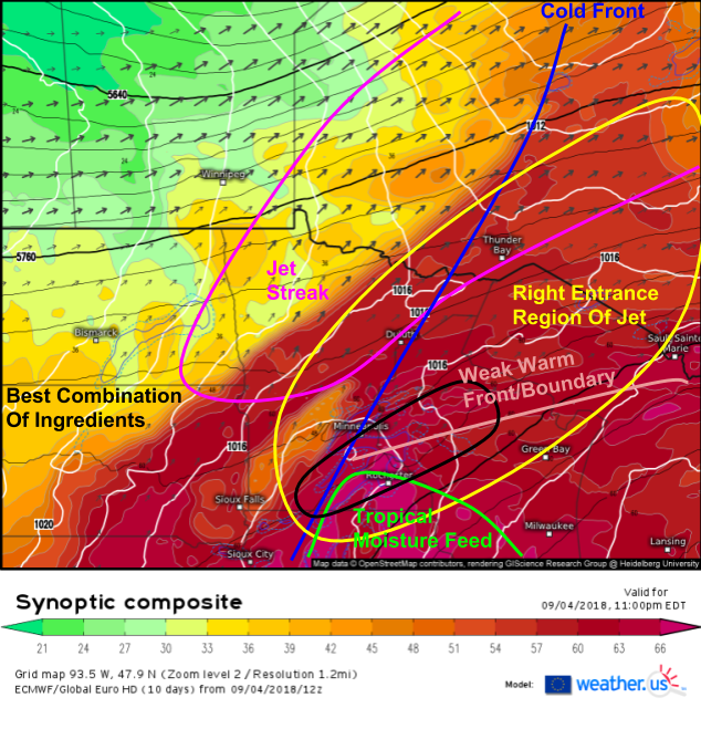
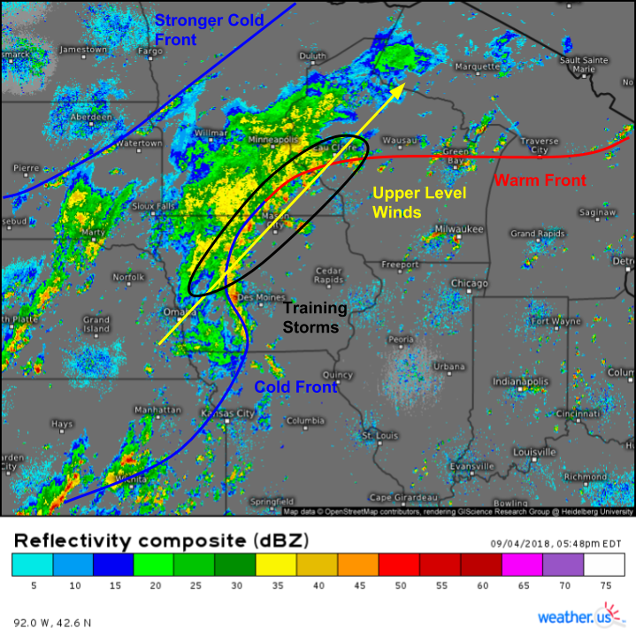
So will be able to wring out that moisture over the saturated soils to result in flash flooding? The ECMWF’s synoptic composite map highlights all the features important for the “wringing out” process this evening. A strong jet streak arcs northeast from N MN through Ontario, placing our area of interest in the right entrance region, an area favorable for upward motion. Two surface features are also noted in this area, a cold front, and a weak warm front/unclassified boundary, likely outflow from ongoing storms.
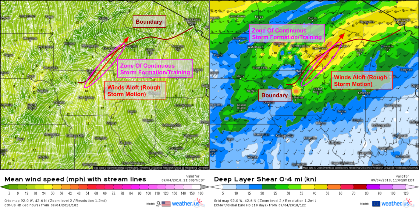
As storms develop along that boundary, they will move NE due to upper level winds from the SW. It just so happens that the boundary is also oriented from NE-SW, so the storms will “ride the boundary” repeatedly, resulting in “training”. The boundary will act as the train tracks, guiding the storms along, while the storms themselves will act as the “train cars”, bringing very heavy rains as they tap into that deep tropical moisture.
This process is already playing out, and can be seen well on composite radar loops. The boundaries, the storms along them, and the upper level winds/storm motion are all visible on the looped imagery, and the rainfall totals are already piling up. While secondary to the flash flood threat, it should be noted that there is a severe weather threat along the leading edge of this line of storms, with damaging winds being the primary threat. A weak tornado also can’t be ruled out.
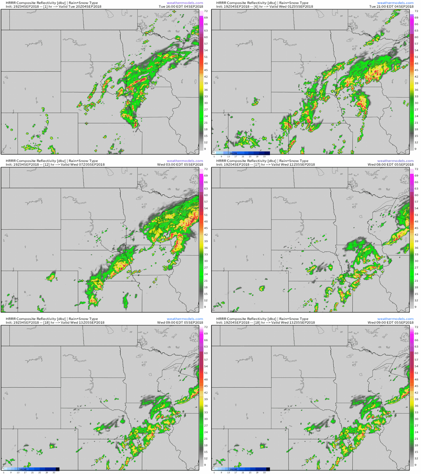
Here’s an approximation of what the next 18 hours will look like as these processes unfold, according to the HRRR model via weathermodels.com. The basic idea is that through the first half of the night, the training processes discussed above will continue to play out, before the stronger cold front currently lurking to the NW over ND/NW MN moves southeast and pushes the moisture out of the area. Don’t treat these simulated radar products as precision forecasts, they won’t be able to pinpoint individual storm cells, but they do provide a good general overview given the large scale setup.
Track the storms with GOES-East and HD radar, and keep tabs on the rain with observed precipitation data (latest data via refresh button at top left of image).
-Jack

