Major East Coast Storm Intensifies Today
Hello everyone!
The major East Coast rain and wind event that I discussed in depth last night is coming together this morning. There have been no major changes to the forecast this morning, so refer to last night’s post for a full forecast breakdown. This post will go over some of the features currently visible on radar and satellite imagery, as well as how to use those tools to watch the storm evolve today and tonight.
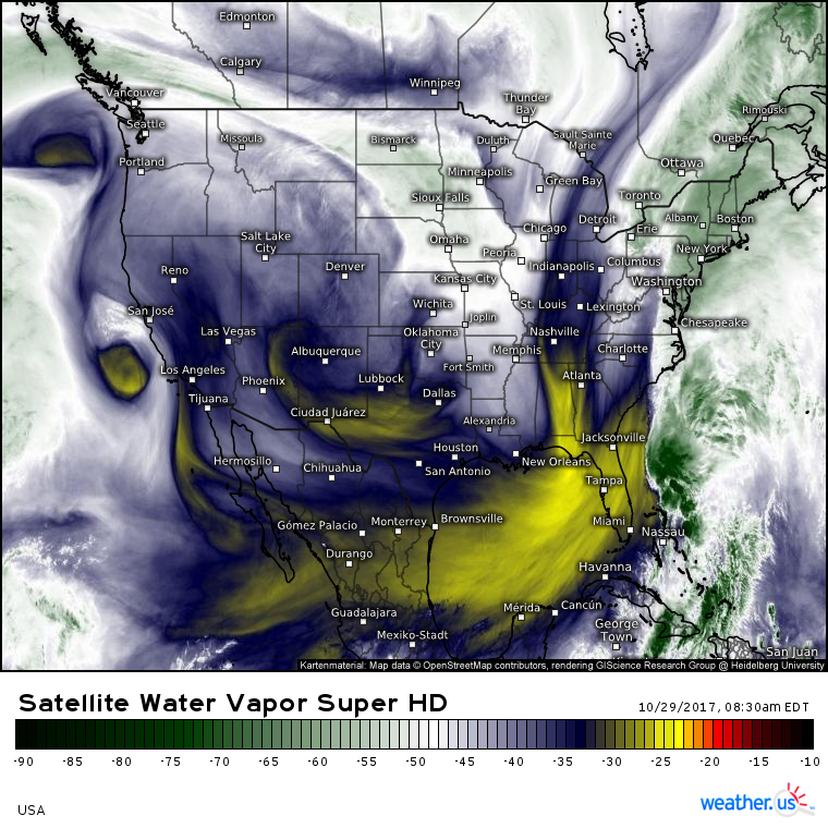
GOES-16 WV imagery shows our storm coming together. Notice the tropical moisture pipeline from the Caribbean up to New England, with the remnants of Philippe/its hybrid spinoff embedded in that moisture feed east of Florida. A strong disturbance is located near Atlanta, and that’s going to be the trigger for our storm development today.
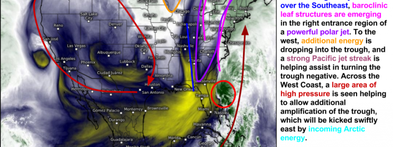
This is an annotated version of the same satellite map where I’ve marked some of the more important features that you can see on the satellite imagery with a quick discussion about how it pertains to the development of our storm. If some of that discussion sounds like gibberish, no worries, I discuss some of the more advanced water vapor analysis techniques you can use in this video.
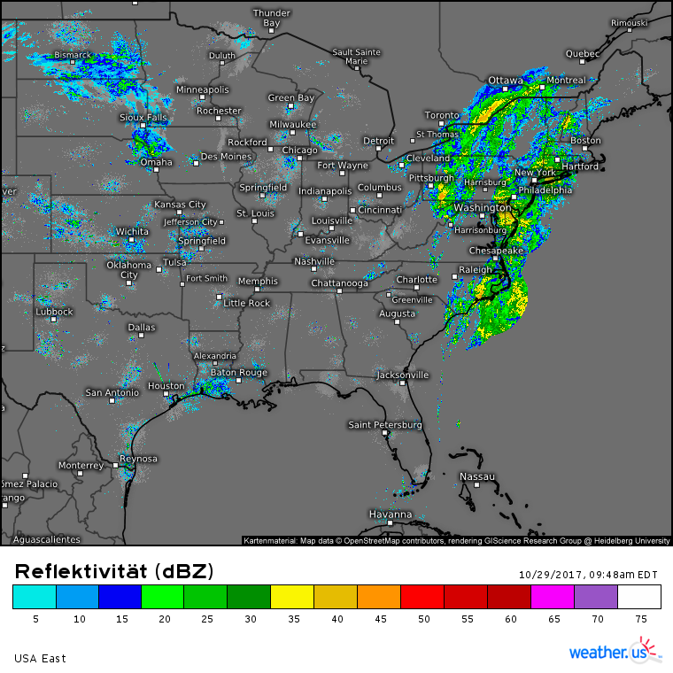
Radar imagery shows rain already in progress across the Mid Atlantic and Northeast this morning. Rain will continue to increase in coverage and intensity through the day today, with torrential downpours developing this evening. You can get high resolution radar imagery at weather.us by going to https://weather.us/radar-us and clicking the map to zoom into your state. You’ll then see HD radar data instead of the SD composite!
You can also stay ahead of the storm with high resolution weather models that provide highly accurate and precise forecasts for the short term. We have HRRR and NAM data as well as the exclusive 1x1km Swiss Super HD model, all at weather.us!
I’ll have updates throughout the day on Twitter @weatherdotus.
Stay safe and enjoy the storm!
-Jack


