Major Early-Season Winter Storm To Impact The Northern Rockies This Weekend
Hello everyone!
A major winter storm will impact the Northern Rockies this weekend, despite the calendar still reading September. A deep upper level trough will combine a very cold airmass from Canada with moisture from the Pacific to produce heavy snow both up in the mountains as well as in lower elevation parts of Montana and Wyoming. This post will outline how this exceptionally unusual event will come together meteorologically, and what can be expected across the Northern Rockies this weekend.
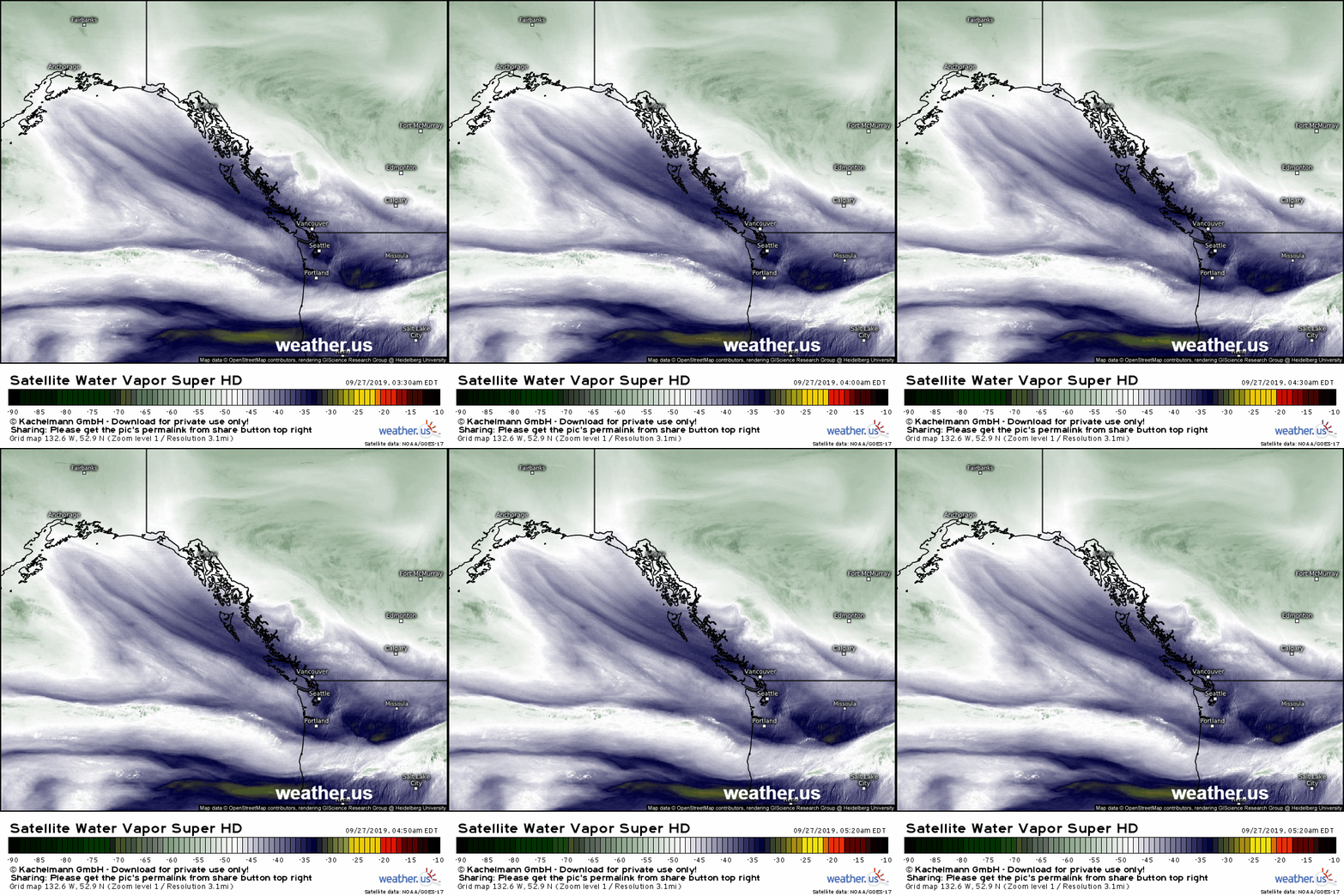
Water vapor satellite imagery shows the seeds of the coming storm being sown along the coast of British Columbia this morning. The disturbance that will end up primarily powering the storm is now digging SE towards Vancouver, and it will keep moving SSE today. As that disturbance joins up with a few others moving in from the Pacific and Arctic tomorrow, a powerful upper level low will develop across the Pacific Northwest. That upper level low will pull moisture in from the Pacific as cold air surges down the eastern side of the Canadian Rockies into Montana, Idaho, and Wyoming. That clash of airmasses will result in heavy snow beginning late tonight and lasting until Sunday night.
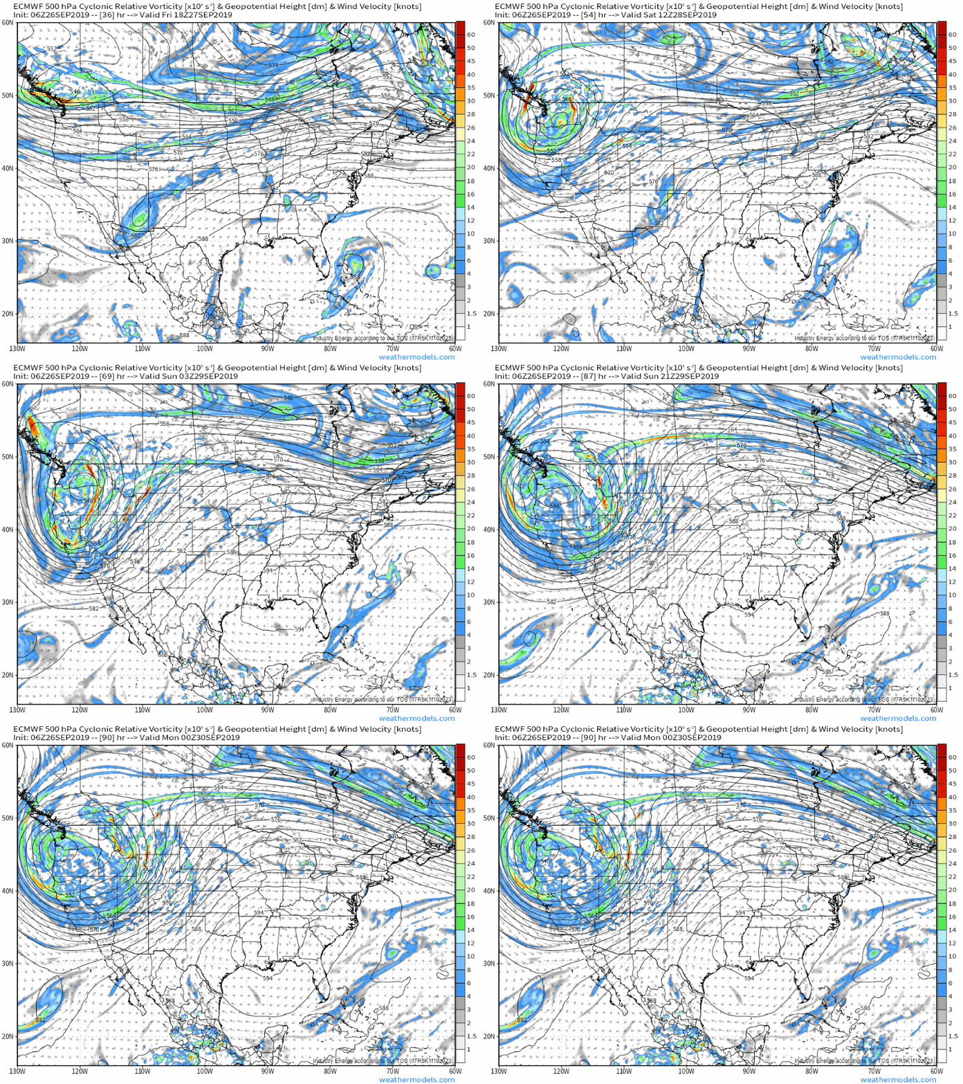
The ECMWF’s 500mb vorticity forecast does an excellent job showing how the disturbance currently near British Columbia will slow down and intensify over the next few days as it’s joined by other disturbances diving SE from Alaska and adjacent parts of the Yukon. The upper level low that will end up spinning over WA/OR tomorrow into Sunday will be extremely impressive for this time of year, and will drive a strong dynamical response in the atmosphere over MT/ID/WY resulting in strong upward motion and bands of heavy precipitation. Additionally, you can see several smaller waves pivoting around the base of the low over the course of the weekend. As each of these moves up the the east side of the low, snow bands over the Northern Rockies will be further enhanced. GIF via weathermodels.com.
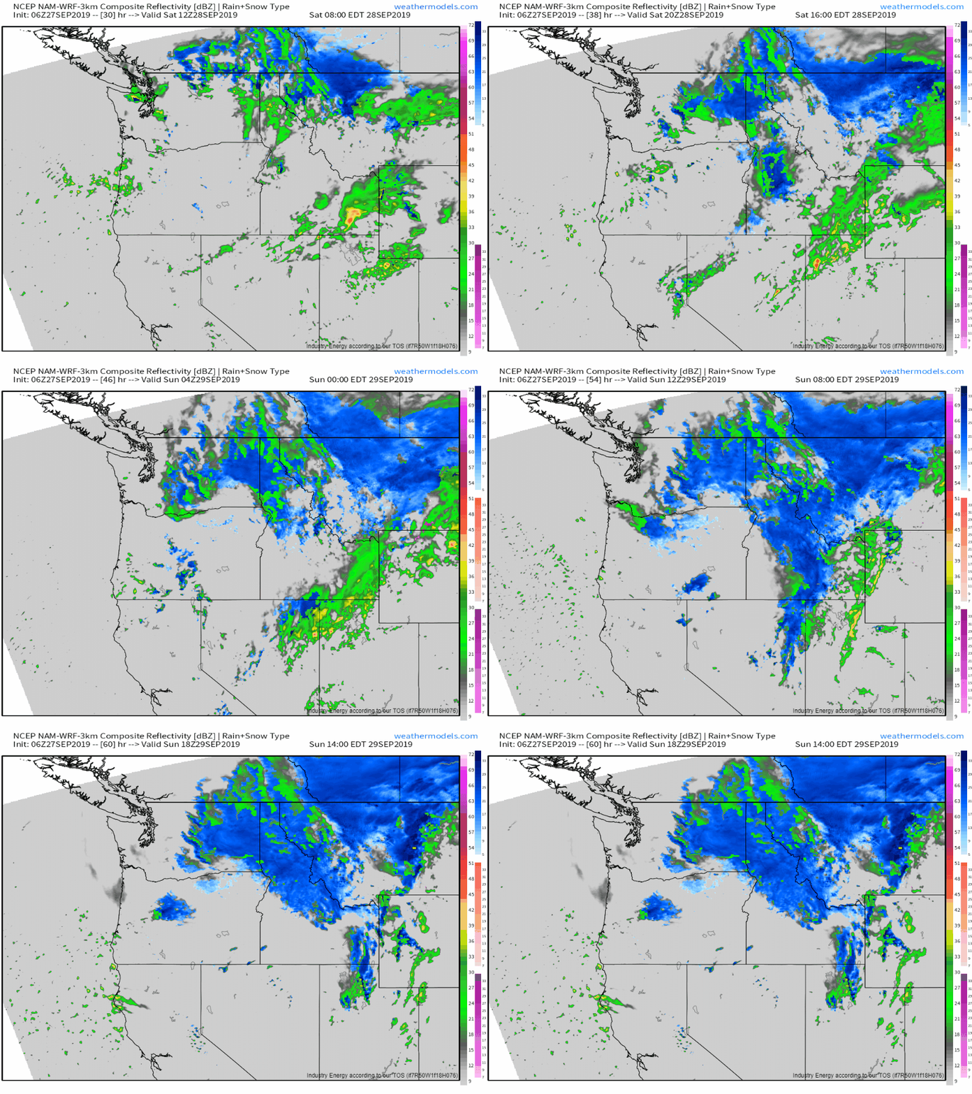 The simulated radar loop above, while by no means a pinpoint forecast of exactly where each snow band will set up, does a decent job highlighting the overall evolution of the system this weekend. Snow will break out over NW MT and N ID tonight ahead of that disturbance, but it won’t be until the upper level low really gets going tomorrow that the heavy snow expands west into Washington and east into lower-elevation parts of MT. Snow could fall at rates of 1-3″ per hour, especially in the higher elevations. GIF via weathermodels.com.
Given that many of the leaves are still on the trees in this area, the threat of power outages is very high. Outages may last an unusually long time given how widespread they’re expected to be.
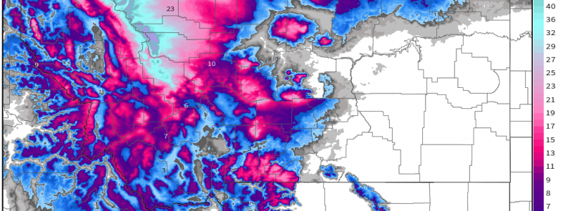
Here’s the snowfall forecast from the NWS showing several feet of snow in the higher elevations and measurable snow all the way down into some of the lower elevation parts of north-central Montana. The mountains of Idaho and Wyoming are also likely to pick up hefty snowfall totals, but the airmass won’t quite be cold enough to bring snow all the way down to the valley floors. Map via weathermodels.com.
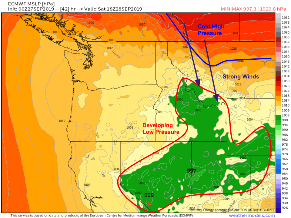
Another dangerous aspect of this storm will be the strong winds. An area of surface low pressure will set up over the Central Rockies while a strong area of high pressure will be pushing south into Montana (providing the cold air needed for the low-elevation snow). The gradient between the high and low pressure areas will drive strong winds that will contribute to blowing/drifting snow, as well as to further increasing the power outage threat. Map via weathermodels.com.
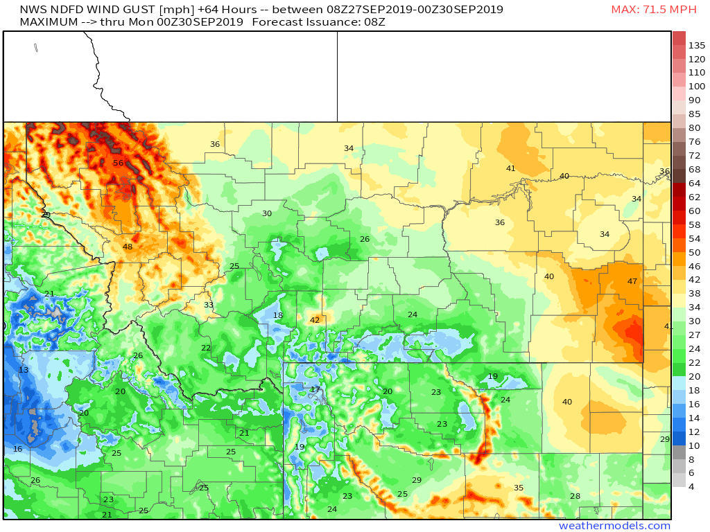
Here’s the official NWS forecast for the maximum wind gusts over the next 72 hours. The highest gusts are of course expected in the higher terrain, but I suspect that some of those values in the valleys may end up a little on the low side given the strong pressure gradient. Either way, if you’re in the valleys expect 20-30 mph winds and if you’re up a little higher, you should be ready for 40-60 mph winds. Map via weathermodels.com.
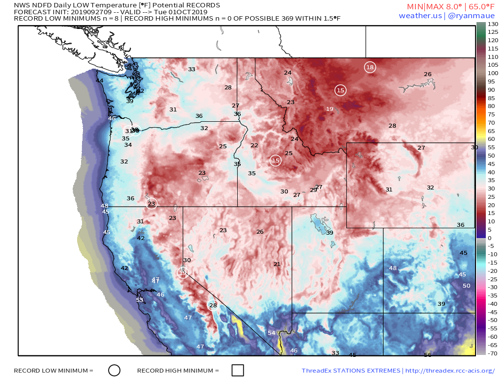
As the storm pulls away, temps will become very cold across the entire Pacific Northwest. Record low temperatures are forecast by the NWS early next week which means that preparing for power outages and the possible loss of heat now is very important. The cold airmass will reach fairly far south into parts of CA as well, with record low temps forecast in parts of the Sierras. Map via weathermodels.com.
The unseasonably cool and active pattern is likely to continue for the Rockies into next week, though another event of this magnitude is unlikely.
-Jack
