Major Diablo Wind Event Expected Sunday
Hello everyone!
We’re now in the thick of fire weather season across California as cold airmasses begin moving out of Canada and into the Rockies. There have already been some significant offshore wind events over the past couple weeks, but Sunday’s is likely to be the most intense we’ve seen so far. This post will outline the setup behind the winds, and will take a look at just how strong they might get.
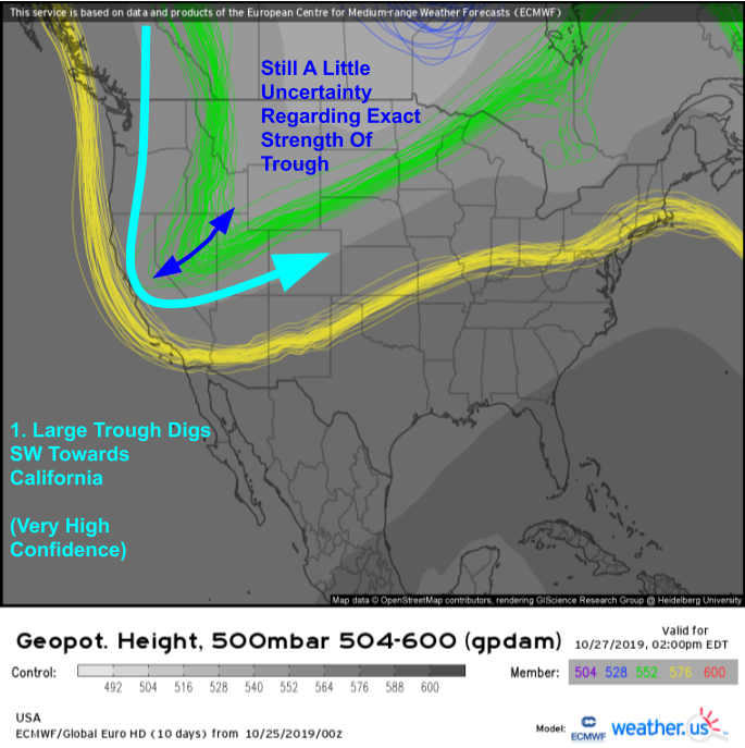
The general mid/upper level pattern, depicted by the EPS 500mb height spaghetti plot above, is expected to become favorable for strong winds in California by Sunday. A sharp trough will be digging south out of Canada, dragging very cold air with it. Confidence in this general pattern (and thus the idea that there will be strong offshore winds on Sunday) is high, though you can see that there’s still some disagreement between ensemble members regarding exactly how strong the trough will be and how far southwest it will dig.
Hourly forecast animations from the ECMWF show the advance and halt of the cold airmass well. Note the rapid south/southwestward advance of the cold airmass through Nevada late on Saturday while little progress is made to the west over California. This is a result of the cold air running into the Sierra Nevada, and being too dense to rise up and over the 12-14,000 foot peaks. As the cold air piles up east of the Sierras, it will begin to spill through the parts of the mountain range that aren’t quite as high in elevation. This forcing of a very dense airmass through very small gaps in the mountain range is what actually causes the strong winds.
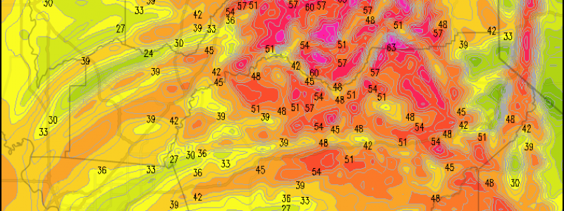
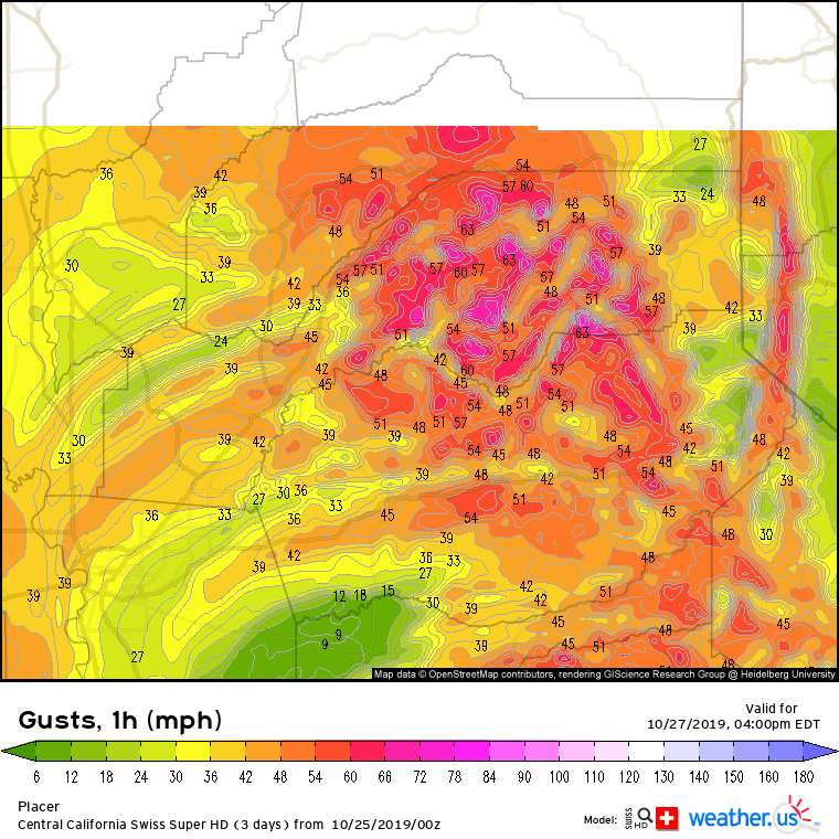
These winds are expected to be quite strong on Sunday because the gradient between the cold continental airmass and the warmer coastal airmass will be extremely sharp. EPS wind gust guidance suggests that winds over 50 mph are likely for a wide swath of North/Central California, even in the lower elevations that typically don’t see strong winds in these events. The typically favored passes are likely to gust over 65 mph.
Of course there will be tremendous local variability in the winds due to the fact that air is rushing through small gaps in the mountains. Near one of those gaps? get ready for the wind. Downstream of a tall peak? you probably won’t get as much wind as your neighbors. Our Swiss Super HD model runs at a 1x1km resolution (9x better than the next best operational model, the 3km NAM) which means it can “see” the gaps through which the cold air will be moving. That means it can give a much better idea of which towns will see the strongest winds, and which won’t.
As the cold air races down the eastern slopes of the mountains, it warms and dries due to a process known as adiabatic compression. This describes the process by which an air parcel (think of some hypothetical chunk of air around the size of a basketball) warms as it descends in the atmosphere, even if no heat is being added to the air. Why does this happen? The detailed answer lies deep in the laws of thermodynamics, but basically if you compress the same amount of air into a smaller space, its temperature will go up even if you don’t add any outside heat to it. As the air warms, its capacity to hold water vapor increases, but no water vapor is added to it, thus its relative humidity decreases. Thus Central California can expect hot temps, bone dry air, and howling winds on Sunday. This is about as dangerous as it gets from a fire weather perspective.
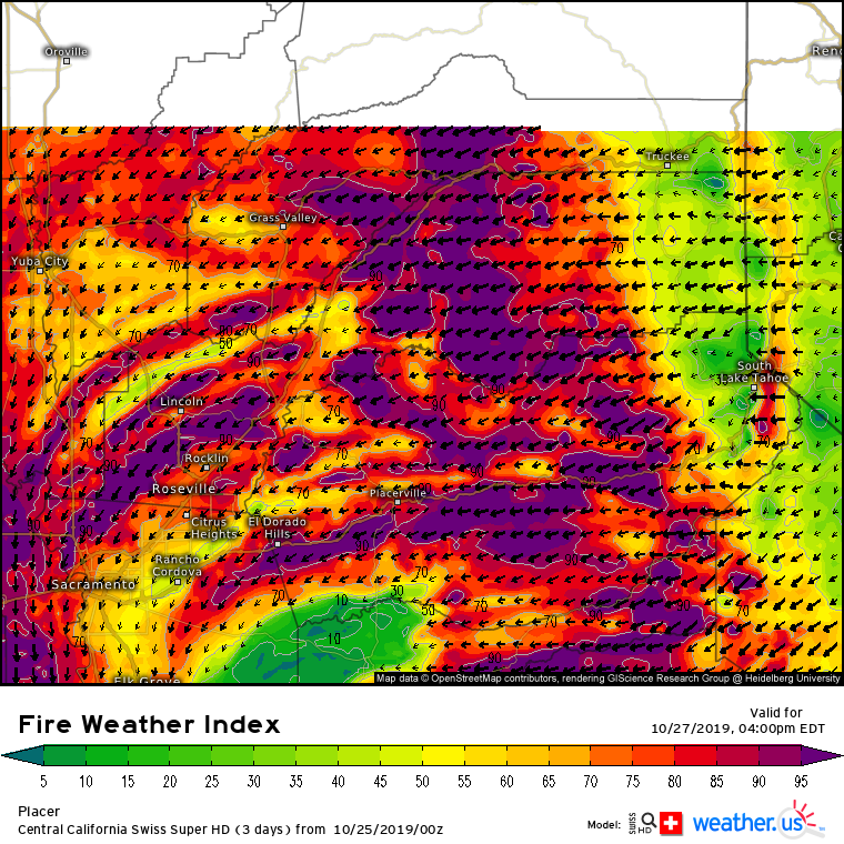
Sure enough, our Swiss Super HD model is forecasting Fire Weather Index values near the top of the scale on Sunday afternoon. Residents in these areas should be ready to evacuate at a moment’s notice should a fire start, as the flames will be able to spread extremely rapidly.
Lighter winds are expected Monday as the cool airmass begins moderating and the temperature gradient across the Sierras lessens.
-Jack


