Low Risk Of Severe Storms In The South Today As Upper Level Low Moves East
Hello everyone!
We’re transitioning into a quieter pattern across the US this weekend as an upper level low slowly traverses the Southern tier of the US. The only impact of note from this system will be the threat of some severe storms, though there are enough mitigating factors that this threat is neither overly significant, nor even guaranteed to play out. I’ll briefly discuss what to expect today from these storms, as well as why this shouldn’t be too rough of a severe weather day.
Here’s a look at GOES-East visible satellite imagery (what’s that?) this morning. There are two main features to note here, the western of which is an ongoing area of showers and thunderstorms. We know that showers and thunderstorms are ongoing here because of the bubbly texture to the clouds indicating strong thunderstorm updrafts that can punch upward above the standard cloud deck. To the east, a thick layer of overcast is present over the panhandle of Florida, as well as all of Alabama and eastern Mississippi. This is important, because without sunshine in these areas, surface temperatures won’t be able to warm up very much, and thus instability will be limited later this afternoon.
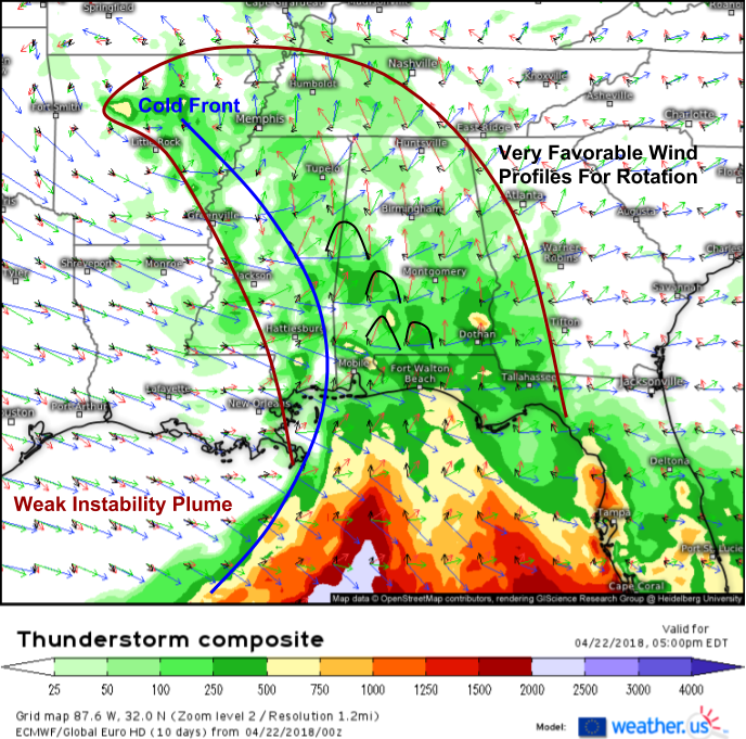
Sure enough, the ECMWF’s thunderstorm composite map (what’s that?) shows a very weak plume of instability across the Southeast this afternoon/evening, with CAPE values generally under 500 J/kg (low). While supportive of some thunderstorm activity, this lack of energy in the atmosphere will likely prohibit any organized severe weather threat. However, notice that wind profiles are extremely favorable for rotation. Weak southeasterlies near the surface become strong southerlies in the mid levels and then strong westerlies in the upper levels. This rotational energy has the capacity to be harnessed by any storms that do develop in the marginal environment, and as a result, a few weak tornadoes are definitely possible across parts of Southern Alabama this evening.
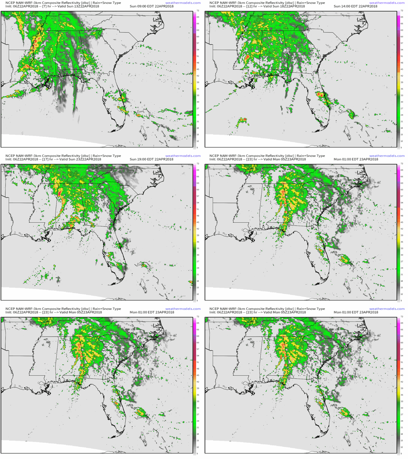
Here’s a simulated radar overview from weathermodels.com showing how storms are generally expected to develop today. Again, this won’t be a widespread severe weather event, but some storms could bring gusty winds, small hail, and maybe even a weak, but still dangerous, tornado or two. Storms will weaken as they move eastward into Georgia tonight.
Elsewhere across the country today, high pressure will be in control with generally dry conditions expected along with no major impactful weather.
For more details on your local forecast: https://weather.us/
For more details on the local forecast for ME/NH: https://forecasterjack.com/2018/04/22/a-beautiful-spring-day-today-2/
-Jack


