Laura May Be Attempting To Relocate Its Center Near Puerto Rico This Morning
Hello everyone!
Tropical Storm Laura is approaching Puerto Rico this morning and remains somewhat disorganized. However, there are signs that the system is attempting to relocate its center under a burst of very impressive thunderstorm activity south of St Croix. This post will focus on explaining how the center relocation process works and what the implications of that process might be for Laura’s longer-term future.
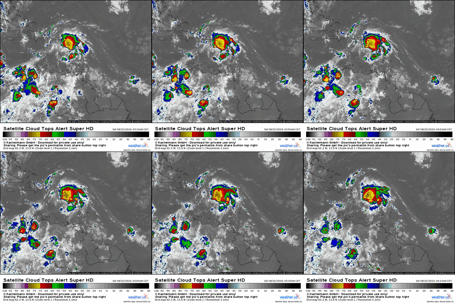 Satellite imagery appears to show a system that is much better-organized than yesterday. There is now a consolidated area of persistent and intense convection instead of sporadic pulses of anemic shower activity. However, a closer look at other observational data suggests that the storm still has some work to do before strengthening significantly.
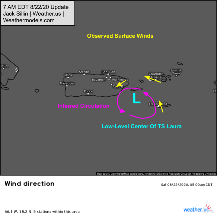
Wind direction observations from 6 AM EDT show the low-level center of the system located just SE of Puerto Rico. This is notably displaced from that burst of intense convection as we can see by layering those wind direction obs over radar imagery:
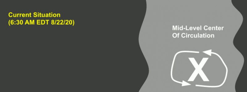
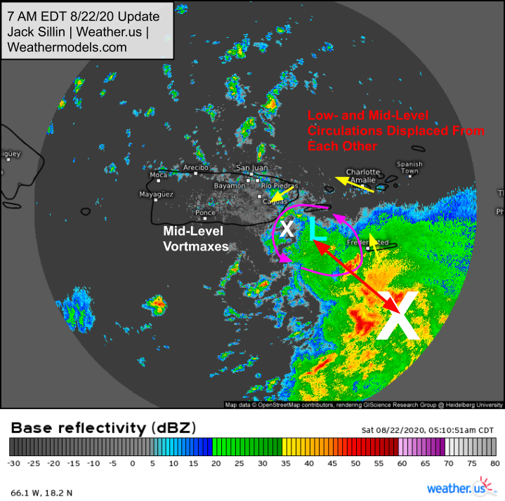 Radar loops show strong rotation in that area of thunderstorms which indicates that the storm’s mid-level circulation is present in this region. This tilting of the storm’s circulation with height is the primary inhibiting factor for strengthening today. The system cannot intensify meaningfully unless it is vertically aligned.
So how might that alignment happen? One way would be for the mid-level center to simply catch up to the low-level center by moving more quickly to the west-northwest. Because the steering flow doesn’t change drastically with height in this situation, I find this to be fairly unlikely, though not impossible if the low-level center slows down upon encountering the island of Puerto Rico. The more likely prospect for center-alignment, if it were to occur (this is no guarantee) is through a center relocation where the current low-level circulation falls apart and a new one takes over underneath the mid-level center.
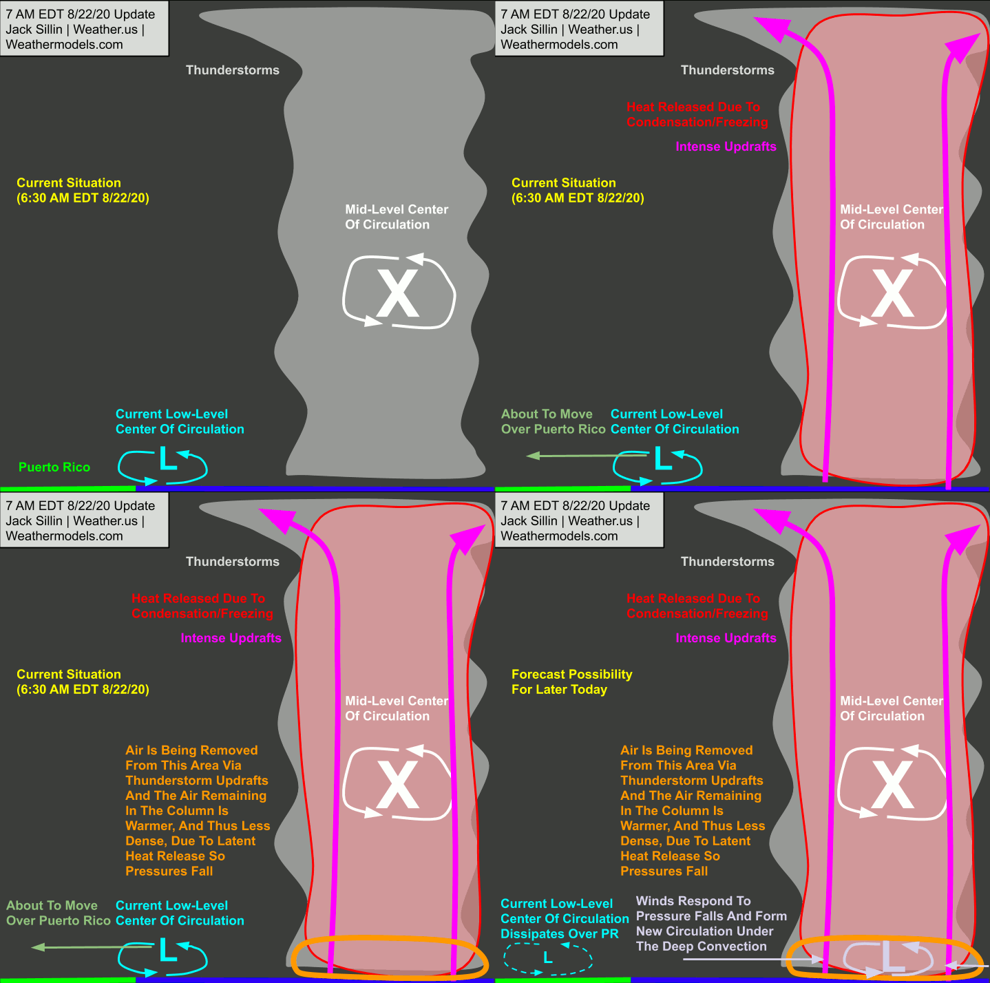
This animation shows how this might happen using an idealized representation of Laura this morning. In the region of intense thunderstorm activity, two processes are trying to push surface pressures down. First, a whole lot of air near the surface is being pulled upward by the intense thunderstorm updrafts then sent away from the system in its upper-level outflow channels. This leaves less air overall in this region, which means the surface pressure in that region will be lower. At the same time, the condensation and eventual freezing of water vapor/droplets in the thunderstorms releases latent heat. This increases the temperature of the air in this area. Warm air is less dense than cold air, so it doesn’t push down on the surface quite as hard. As a result, pressures are generally lower. The net result is that persistent deep convection produces surface pressure falls below the mid-level center. If this goes on for a long enough period of time, the surface wind field will respond and a new circulation will form around the new area of low pressure. Because the existing circulation already has some angular momentum built up from recent days of convective activity, this process is not guaranteed to succeed in generating a new low-level circulation, and even if that process is eventually successful, it may not occur quickly enough to prevent substantial interaction with Hispaniola and/or Puerto Rico. If the center relocation were to have a substantial impact on the system’s track and intensity down the line, it would need to occur relatively quickly today and it would need to complete a delicate steering maneuver.
 That steering maneuver would include the new center pinwheeling around the northeastern flank of the broader circulation and ending up north of Puerto Rico by this afternoon/evening. This is possible because Laura is still structured a bit more like a tropical wave with multiple vortmaxes than a well-defined tropical cyclone (though yes, it does technically meet the criteria). Each vortmax is steered by a combination of the broader “wave” circulation and the environmental steering flow. In this case, the environment is pushing the system and all of its component vortmaxes towards the west-northwest. The “wave” circulation would be pushing the new center (if it were to form) to the north. The net result would be a movement towards the NW, at least for a period of time today. That could be all the system needs to end up going a little north of the islands rather than right over. The difference wouldn’t be much in terms of track, perhaps 30-50 miles at best, but if that means the difference between three days over land and three days over warm water, it could produce a significant difference in the intensity forecast.
Overall, the prevailing thinking on Laura’s track forecast hasn’t changed much. Ensemble members are still split about 50/50 on a track right over Puerto Rico – Hispaniola – Cuba vs a track maybe 50 miles north of the islands. Nearly all guidance keeps the storm relatively weak until it emerges into the Gulf of Mexico on Monday, at which point it will enjoy a favorable environment for intensification. The biggest question is in what state the system enters that environment. If it tracks just north of the Greater Antilles and has a well-organized circulation, intensification in the Gulf could be dramatic. If it doesn’t have a coherent center of circulation, it would struggle in the Gulf despite the favorable environment. We’ll be watching satellite imagery closely over the next few days to see where exactly the storm ends up going. Unfortunately, model guidance probably won’t be much of a help when it comes down to figuring out track errors less than 30-50 miles. If model guidance can get us to within 50 or 100 miles over the next four days, that’s pretty good. Unfortunately by nature of where exactly Laura is tracking, even that level of precision is insufficient to resolve questions of intensity.
Regardless of which way Laura wobbles in the next couple days, residents along the Gulf Coast should be tuned into the latest forecast information and should be ready to take preparedness actions should the need arise.
-Jack
