Late-Season Severe Weather Expected To Impact Parts Of The Mid Atlantic Today
Hello everyone!
A large storm system will be developing across the Ohio Valley today, and will bring heavy rain and gusty winds to a large part of the Eastern US today and tonight. The system’s most impactful weather will be focused in the Mid Atlantic states where severe storms are expected this evening. This post will outline the setup that will drive these storms, and will discuss the expected timeline for when these storms will develop and move east. As always, if you’re looking for information specific to your town, your best bet is to head on over to weather.us and type your town’s name into the search box.
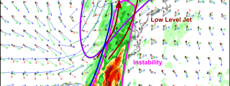
The ECMWF’s thunderstorm composite map does a good job highlighting the features that will come together to support the strong thunderstorms over the Mid Atlantic. Aloft, a very strong jet streak will help “vent” the storms by whisking the air that has risen through the storms’ updrafts far off to the northeast, making room for more air to rise, thus supporting the storm’s continued existence. Closer to the ground, a strong low level jet is noted at the 850mb level (red vectors) which will help carry unstable air northeastward from the Gulf of Mexico. The turbulent downdrafts produced by the thunderstorms will also help to “mix” some of these strong lower level winds to the surface, where they may cause damage to trees and power lines. Finally, at the surface, a strong cold front extends from the Great Lakes to the Gulf of Mexico and will provide the focused rising motion needed to get storms started in the first place.
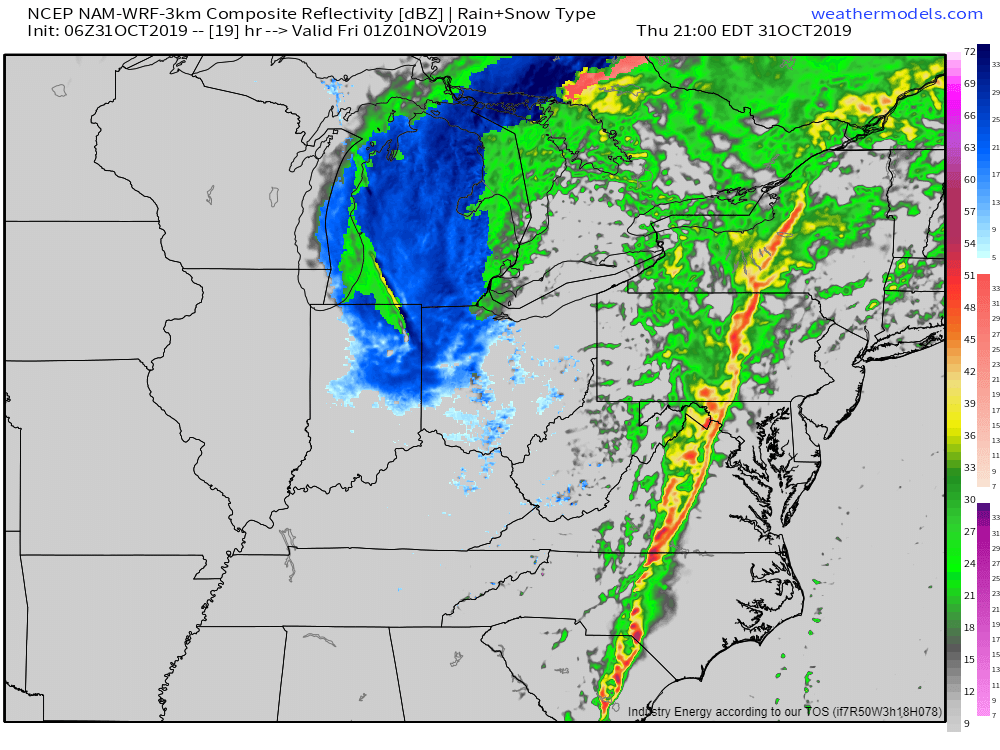
HRRR simulated radar imagery shows a strong line of thunderstorms moving east through the Mid Atlantic this evening (9PM EDT) in response to the atmospheric dynamics discussed above. Due to the strong forcing and fast movement of the cold front, storms will rapidly coalesce into a line, and supercells are not expected. As a result, damaging straight-line winds will be the primary threat associated with today’s storms. That being said, the strong low level jet discussed above will also support some tornadoes that will be embedded within the larger squall line. These tornadoes will be very fast-moving, and can develop quickly, so if a warning is issued for your town, you may not have as much time to move to a safe place. Be sure you have a way of accessing warnings if they are issued for your location! Map via weathermodels.com.
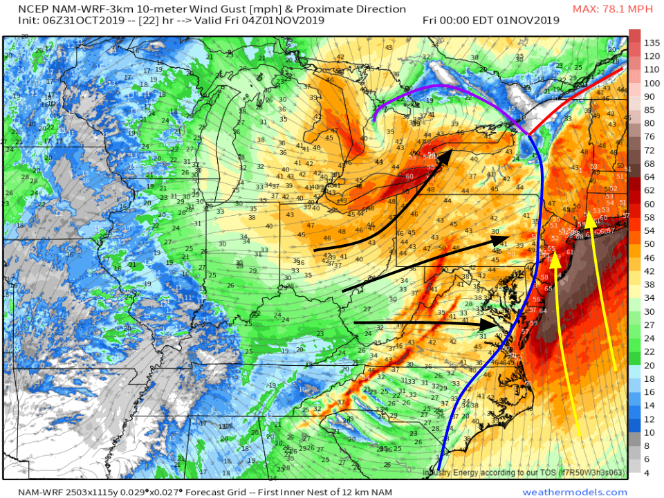
In addition to the strong winds associated with the thunderstorms, the winds associated with the storm’s larger scale circulation will be strong enough to cause some power outage issues as well. Wind gust forecasts by the NAM model suggest that winds will be gusting over 50 mph ahead of the front (note that the model values are likely overdone near the coastline) and over 40 mph behind the front. Even if you miss the strongest severe thunderstorm winds, you still may see tree/powerline damage from strong winds either before or after the front passes through. Map via weathermodels.com.
Winds will settle down Friday as high pressure moves in from the west.
-Jack


