June 8th, 2020 Tropical Weather Video Discussion
06/08/2020 /
2 Comments
In this video, forecaster Jack Sillin discusses the forecast for tropical cyclone activity in the North Atlantic as of June 8th, 2020. Topics of discussion include the forecast for Tropical Storm Cristobal as it continues inland, a possible brief subtropical cyclone northeast of Bermuda during the middle of the week, and a glimpse at the pattern farther down the road towards mid/late June.
Graphics used in today’s discussion can be found at weathermodels.com or using the following weather.us links.
Cristobal satellite imagery
ECMWF 500mb height forecasts
ECMWF precipitable water forecasts
ECMWF US precipitation forecasts


Hi Jack,
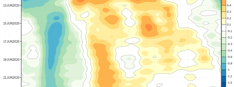
In that long-range chart you cover at the end of the video, were those blue areas in the Atlantic? What of the longitude scale at the bottom? As a surfer/sailor in northern New England, my eyes are on the tropics for the next several months.
Thanks,
Luke
Hi Luke,
The blues in the Atlantic towards the end of that long range chart indicate generally favorable conditions for thunderstorm (and tropical cyclone) development. The longitude scale at the bottom tells you which part of the tropics is anticipated to see those favorable conditions at any given time. Remember that the graph itself has longitude on the x-axis and time increasing down the y-axis (an odd convention admittedly, but I didn’t decide that’s how it should work!). The longitude scale at the bottom with the little map is just to give you a point of reference in case you forgot exactly where each basin begins and ends.
Hope this helps!
Jack