Invest 95L Becomes TD 11, Poses No Threat To The US
Hello everyone!
A tropical disturbance way out in the deep tropical Atlantic (about half way between Barbados and Africa) has become the eleventh tropical depression of the Atlantic season after the NHC has determined that the system acquired a low-level center of circulation and sufficient convective organization.
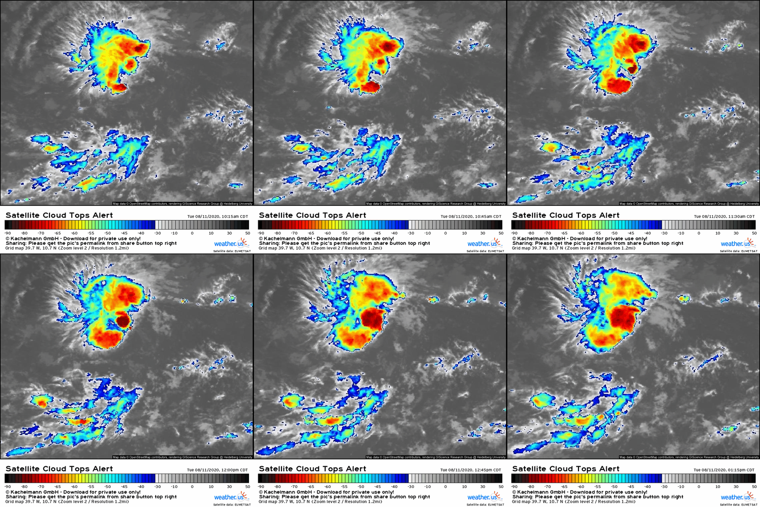
TD 11 looks a bit anemic on satellite imagery this afternoon, but that’s probably more a function of the diurnal convective minimum taking a toll on the system’s cloud top temperature numbers than an indication of actual disorganization. Thunderstorms have been firing near the system’s incipient center for most of the day today, and decent cirrus outflow is noted especially to the north and east of the system. There is a bit of easterly wind shear impacting the storm this afternoon, as seen by the lack of easterly outflow and the westward movement of cirrus to the southwest of the storm’s center. This shear is probably why we didn’t have TD 11 designated until this evening rather than this morning, not that it makes a huge difference.
 While this easterly shear is likely slowing down the organizational process for TD 11, it’s not ripping the storm to shreds mostly because the air upshear (east) of the storm is relatively moist in the mid-levels of the atmosphere. This makes it a bit harder for the shear to kill off developing thunderstorms. Most of the dry air near the storm is located to its north and west. The extent to which this dry air will get swept into the storm’s circulation will play a large role in determining how strong 95L is likely to get over the next couple days.
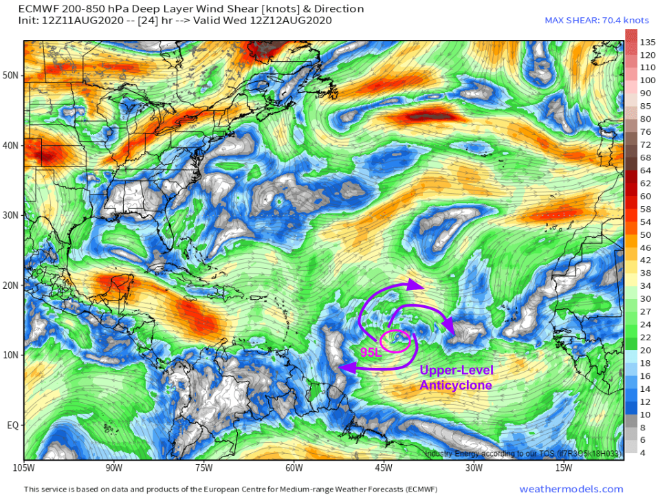
Over the next 24-48 hours, TD 11 will sit at the southern edge of an upper-level anticyclone. This is the feature responsible for the little bit of easterly shear we’re seeing this afternoon. As TD 11 tracks WNW, it will briefly become better-aligned with this anticyclone, and it should have a window of relatively favorable shear conditions as a result. As we saw with Gonzalo last month, small storms like this can fluctuate in intensity fairly rapidly, both upward and downward. I wouldn’t be totally shocked to see TD 11 intensify into a moderate or strong tropical storm tonight or tomorrow given the relatively favorable conditions both in terms of dry air and wind shear.
So do we need to worry about TD 11 in the NE Caribbean or in the US?
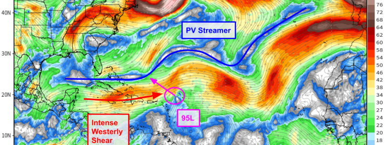
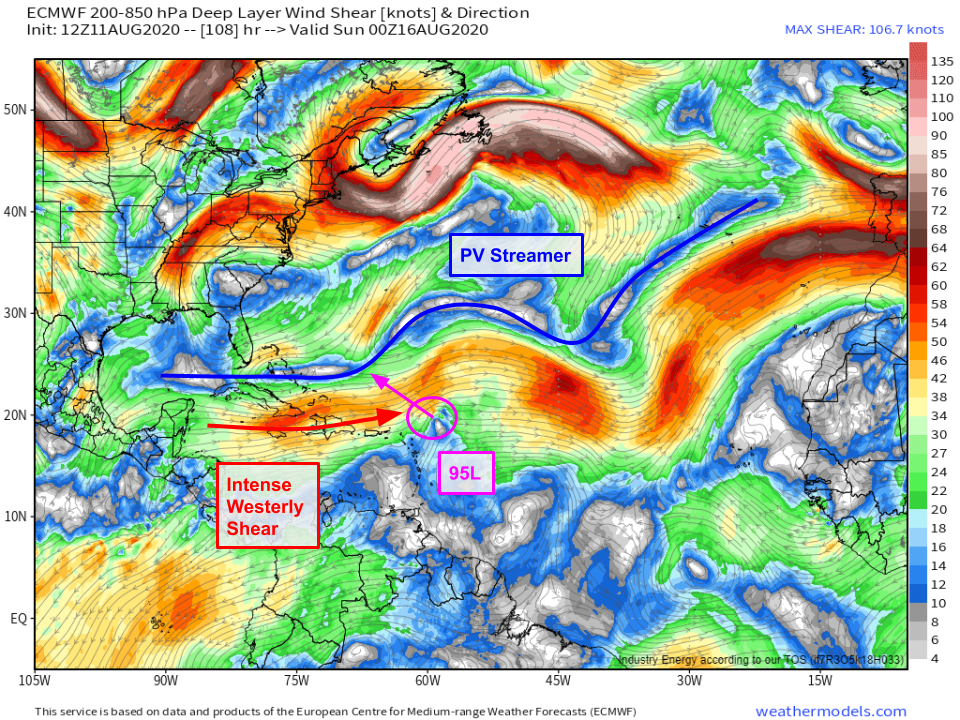 Thankfully, by this weekend, the system will almost certainly become a non-issue for any landmass in the Atlantic basin. As it slides northeast of Puerto Rico, it will run headlong into a Potential Vorticity Streamer (PVS) which will rip it to shreds with westerly wind shear and dry air. Recall from a few weeks ago that a similar was responsible for Isaias’ struggles in the Bahamas. This PVS is quite a bit stronger than that which impacted Isaias, and the tropical cyclone in question (small TS rather than large hurricane) will be even more poorly-equipped to fight back against the hostile environment. The net result is a high-confidence forecast in a low-impact scenario for TD 11 or future-TS Josephine.
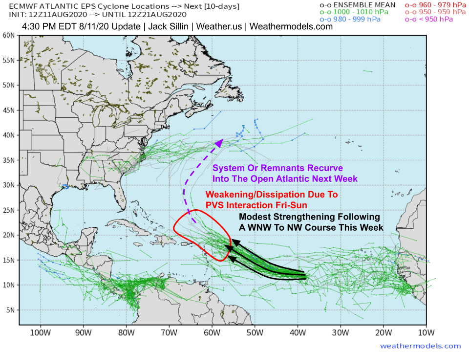 Indeed, this scenario is shown by all 51 EPS members. If you’re still concerned that TD 11 might be able to bust through the PVS intact, the steering pattern by the time the system would be north of the Bahamas early next week appears to favor a recurving track into the open Atlantic (possibly with a few showers in Bermuda). Either way, this system really isn’t anything to worry about in the US at the moment, and that’s likely to remain the case throughout its lifetime.
Unless another system develops or TD 11 really takes off unexpectedly, I think my next blog update will probably be on Friday, or if there’s really nothing new to report, Monday’s tropical weather discussion video.
-Jack
