Intense Heat Wave To Continue Across The Midwest Today Before Spreading Into The Northeast Tomorrow
Hello everyone!
Heat will continue to be the big weather story this weekend as hot temperatures that have been baking the Midwest over the past few days move east and begin impacting the Northeast this weekend. High temperatures in excess of 90 degrees will be common, with some areas breaking the 100 degree mark. The heat will be combined with oppressive humidity that will drive heat index readings well above 100. This type of heat can be dangerous, so be sure you take proper precautions. Stay hydrated with plenty of water, and limit strenuous physical activity outside during the heat of the day.
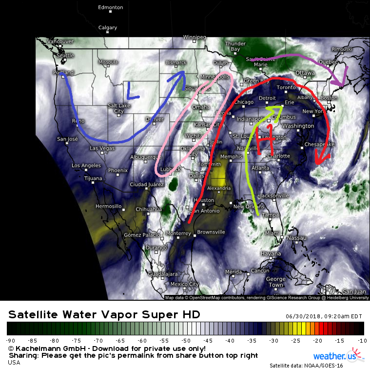
Here’s a quick look at GOES-East Water Vapor satellite imagery this morning, which shows the large scale pattern responsible for the heat. A very large ridge of high pressure is located in Eastern Kentucky this morning, and is slowly drifting east. This ridge has bumped the jet stream well north into Canada, where thunderstorm activity is confined this morning. Some of that activity could sneak into Northeastern New England this afternoon, but most of the activity will remain north of the major population centers of the I-95 corridor. Tropical moisture is streaming north on the back side of the high pressure area, with a tap open from the Gulf of Mexico up through the Mississippi and Ohio valleys. This moisture will provide the humidity that makes the heat feel even worse than it already is. Meanwhile to the west, a trough of low pressure will bring cooler weather to the Northern Rockies, while severe thunderstorms develop in the Plains under an area of strong upper level winds between the trough and the ridge.
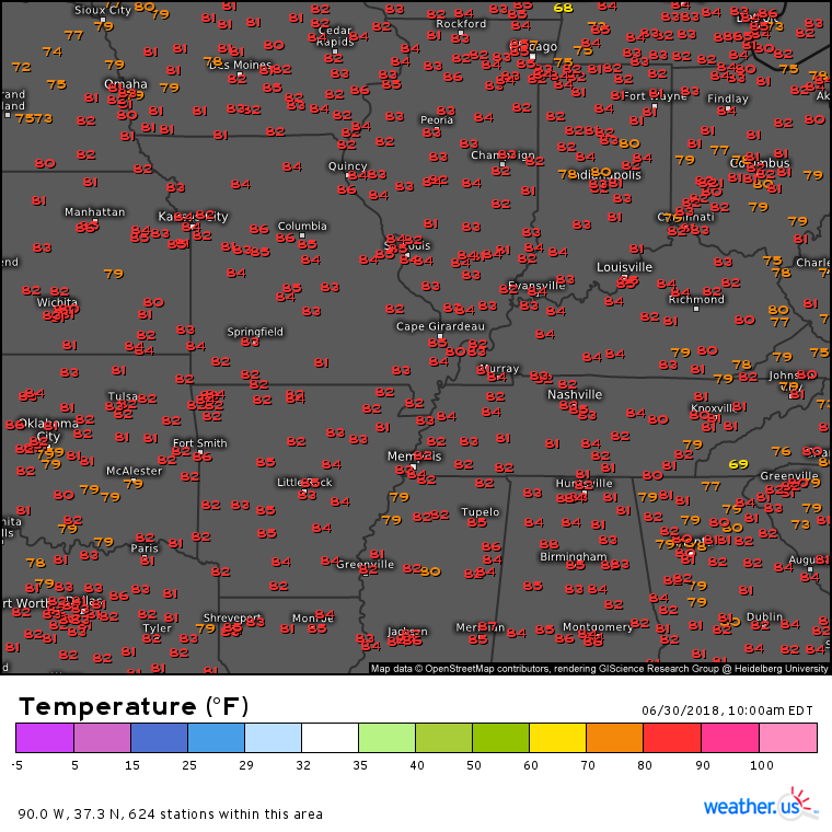
Temperatures are already rapidly rising this morning across the Midwest where highs today will climb well into the 90’s. You can track the temperatures hour by hour with our observational data, which also includes cloud cover, dew points, and much more. Use the menus to the left of the image to explore the full range of the data we have available.
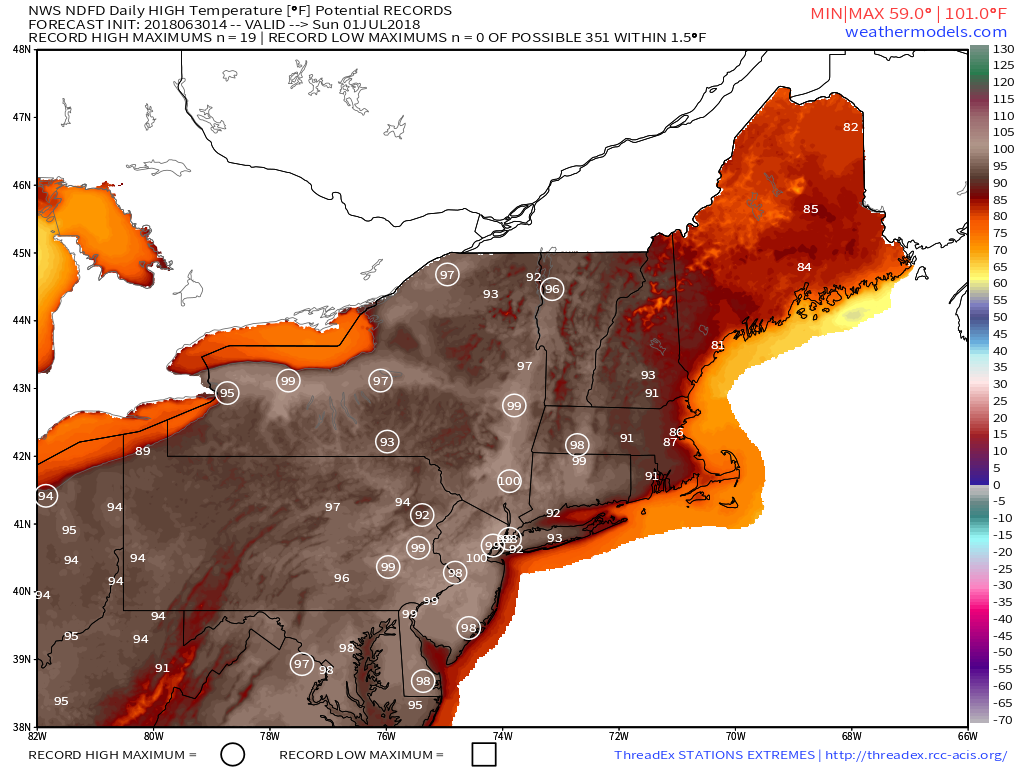
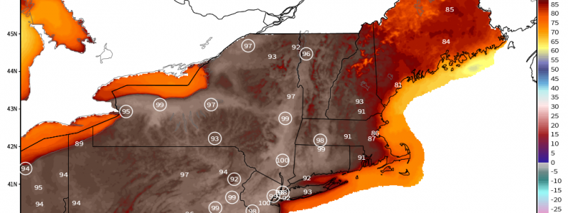
Heat will kick into full gear across the Northeast tomorrow. This map via weathermodels.com shows the National Weather Service’s forecast for the high temperature tomorrow, with potential record highs circled. As you can see, plenty of locations will be making a run at record territory in the upper 90’s, with some spots even poking up above 100. Looking for relief from the heat? Maine and Cape Cod will be your best bets as the cooling influence of the Gulf of Maine remains strong even this time of year.
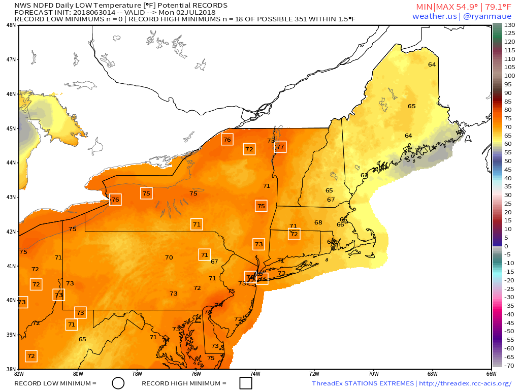
Little relief will be found overnight, as temps will have trouble falling below 70 west of the Connecticut River. Locations with boxes around their low temperature forecasts are areas that are likely to set records for the highest low temperature on Monday morning. Keep in mind that these are temperatures forecast for the morning lows, it will be even warmer as you head to sleep in the evening. Time to crank up the fans and air conditioning units! Map via weathermodels.com.
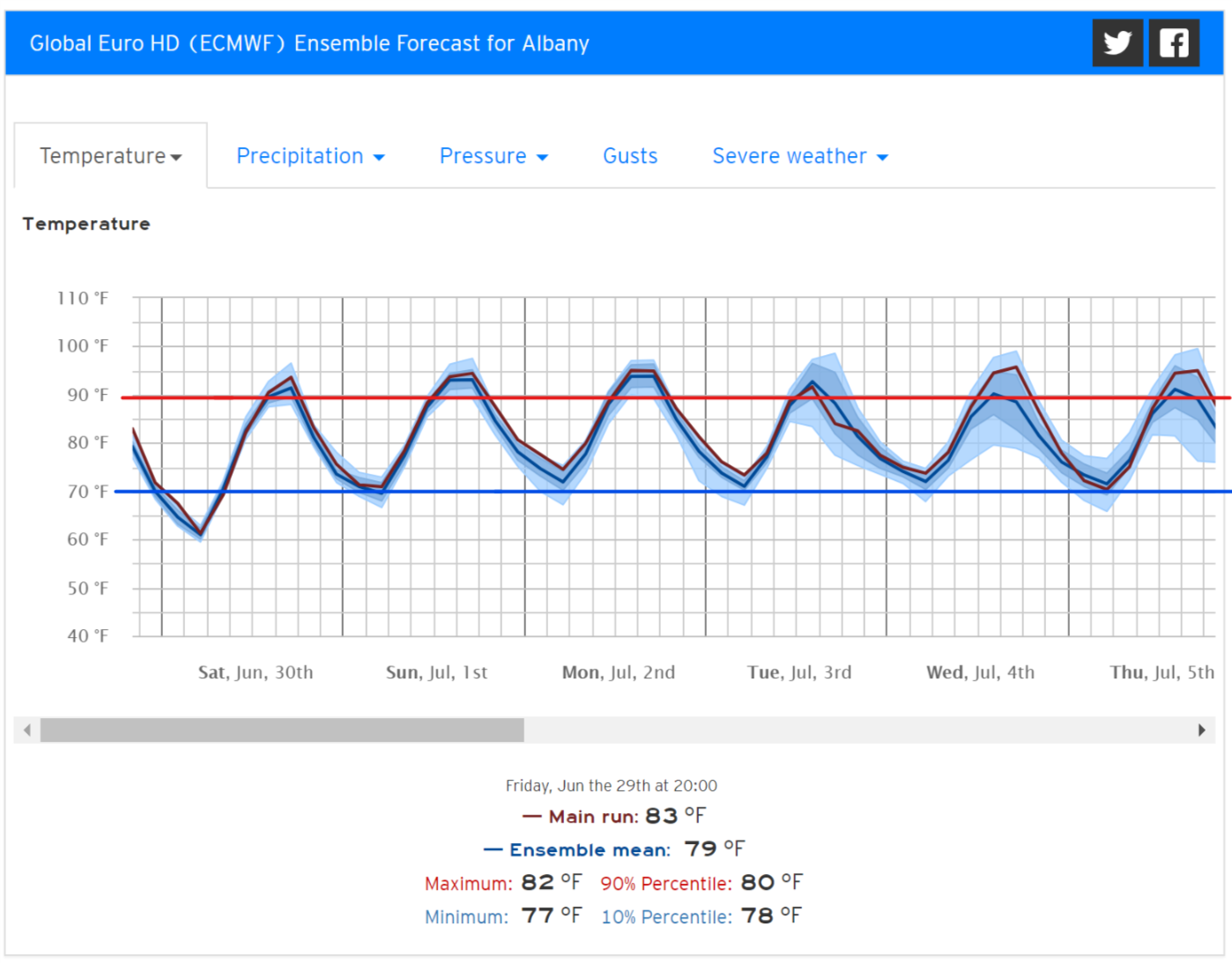
If you’re looking for the heat to end, you’re likely to have to wait quite a while in interior parts of the Northeast. This plot from the ECMWF’s ensembles shows high temperatures above 90 and low temperatures around or above 70 in Albany NY through Independence Day and beyond as the ridge of high pressure responsible for the hot weather remains steadfastly in place across the Eastern US. You can find this type of forecast information for your town by selecting “Forecast Ensemble” from our “Forecasts” menu on weather.us and typing your town into the search box.
-Jack
