Hurricane Nate Racing North Towards New Orleans
Hello everyone!
All eyes are on now-hurricane Nate today as it races NNW towards New Orleans.
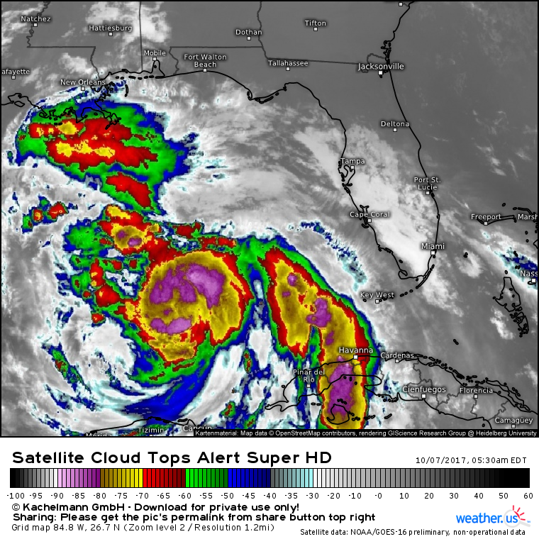
Nate continues to improve its satellite presentation as it cruises NNW this morning. (What does this map show?) Intense thunderstorms have wrapped all the way around the center, and distinct spiral bands have developed both NW and SE of the center. Strong outflow is noted in all directions which indicates low wind shear. It will be a race against time to see how much Nate can intensify before it moves onshore and weakens.
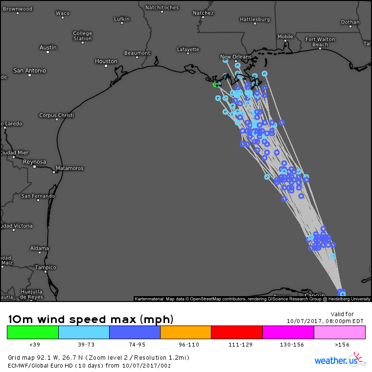
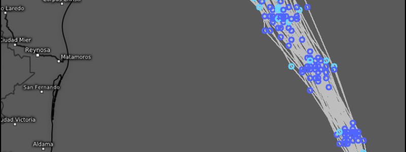
ECMWF ensemble data show high confidence in landfall tonight over SE Louisiana. (What does this map show?) How much strengthening can happen in the next 12-15 hours remains a bit uncertain, but based on current trends, this storm will definitely be a hurricane when it comes ashore.
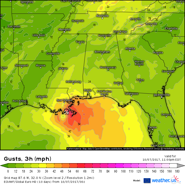
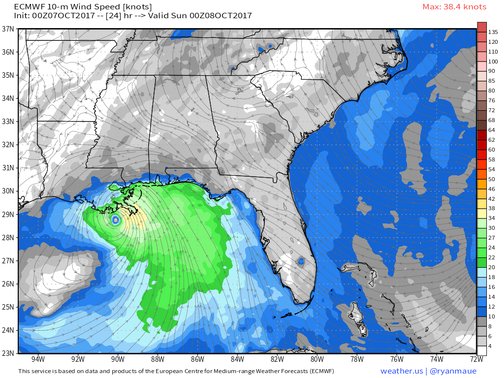
Wind forecasts from the ECMWF show a lopsided system wind wise this evening. There will be a small core of hurricane force winds to the NE of the center. There will be little in the way of winds to the west of the storm, but TS force winds will extend well east into Alabama and Mississippi, and possibly the Florida panhandle as well.
This map shows not just wind speed, but also wind direction. Notice the onshore winds across a wide swath of the Northern Gulf Coast from SE LA to the Panhandle of FL. These onshore winds will pile water up against the coastline, resulting in storm surge flooding. The slope of the Gulf Coast is quite flat, meaning that it doesn’t take much storm surge to cause issues. Thankfully, this storm is an extremely fast moving system meaning that there won’t be a prolonged assault on the coast.
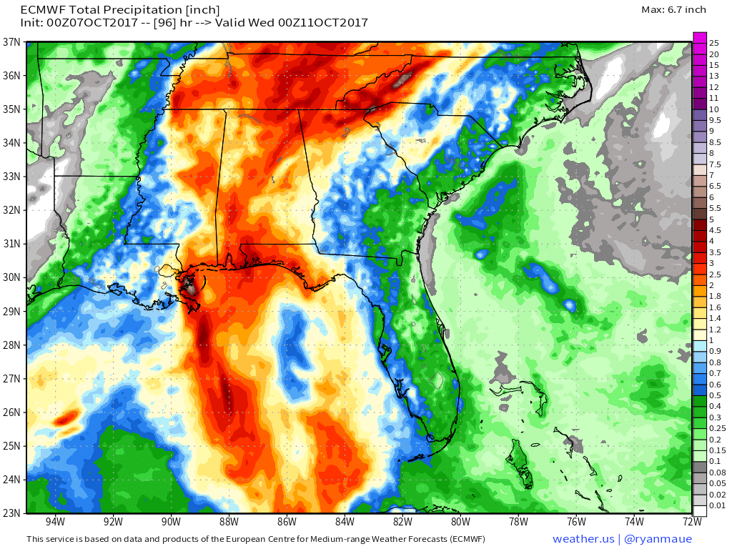
Rainfall will be heavy as this system moves onshore, especially near the center. Heavy rains will extend well east of the center, all the way to the Florida peninsula. As with the surge, the fast motion of the storm is precluding any extreme impacts from rainfall, but flooding can be expected any time you’re looking at 3-8″ of rain. Also notice that the heavy rain continues north into the Appalachians. I’ll go over this rainfall in this evening’s update.
Strong wind shear created by Nate’s circulation (not the kind of wind shear that will hurt Nate) is forecast to develop over SE LA tonight before moving into southern MS and AL early tomorrow morning. This wind shear, combined with the instability associated with a landfalling tropical system, will create a severe weather threat. As with all landfalling hurricanes, weak tornadoes are the primary threat with damaging winds being a close second. Due to the incredibly warm, moist nature of hurricanes, hail is not expected to be an issue. Severe storms will move NE tomorrow as Nate races off towards its death.
I’ll have another update this evening!
-Jack
