Hurricane Isaias Struggling With Shear And Dry Air In The Bahamas This Morning
Hello everyone!
Yesterday, I took a deep dive into the forecast for Hurricane Isaias, now moving through the southern Bahamas. This post will serve to refine those thoughts and present a few new ideas that have popped up since yesterday. This post, like yesterday’s, will be focused mostly on the meteorological nuances of the forecast. I will have another post this afternoon that’s geared more towards exploring expected impacts.
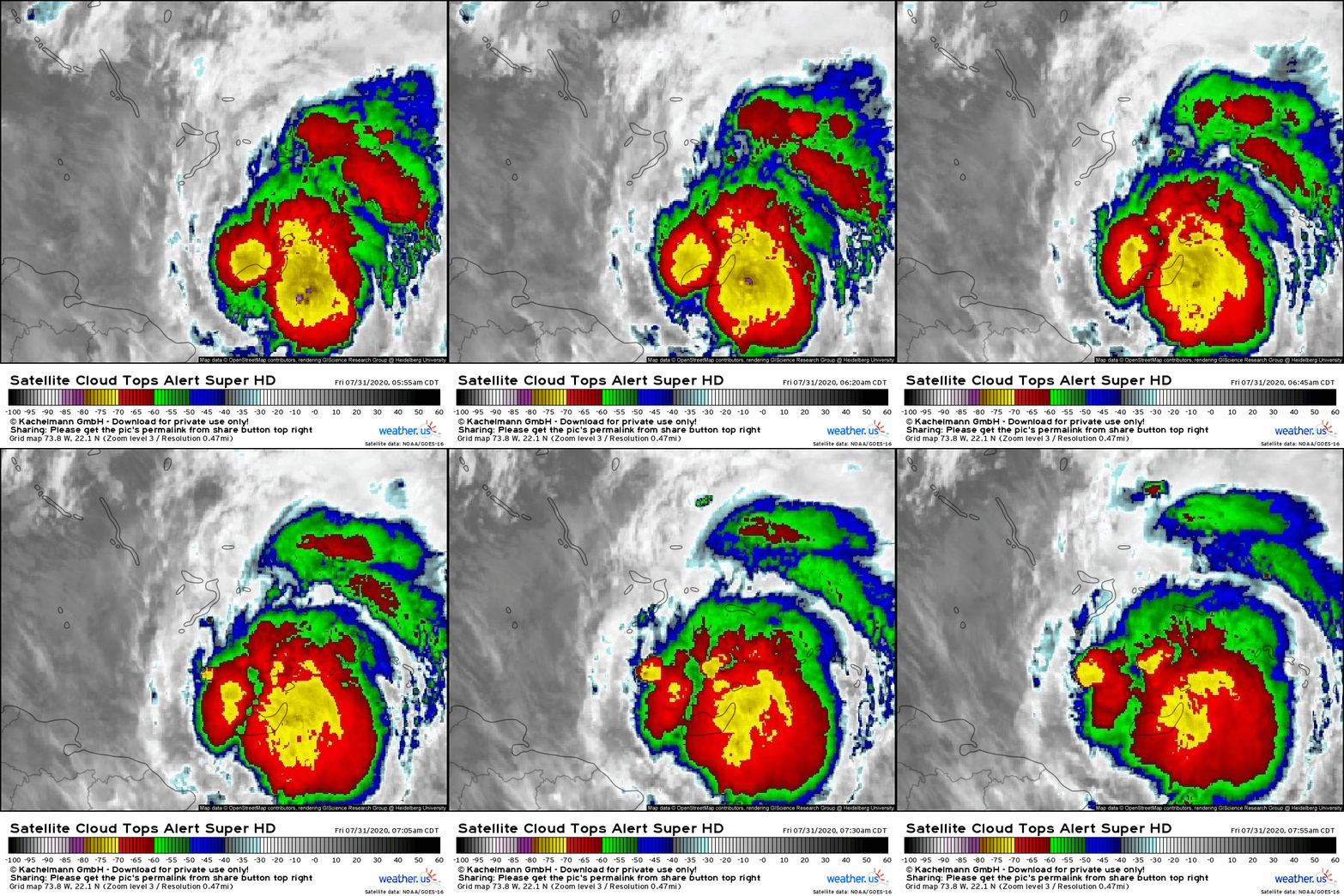 No matter how you choose to look at Isaias, its presentation has degraded significantly since last night. Hurricane hunter data suggests that the storm’s center is on the far western edge of the region of cool cloud tops (below -60C, in red). The most persistent area of intense thunderstorm activity is well east of the center, and just a few cells are struggling to survive near the center. Conditions in the storm’s western semicircle are currently mostly sunny. This is due to the southwesterly wind shear discussed in detail since back on Sunday associated with a PV streamer located northwest of the storm’s center.
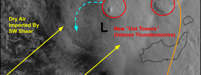
Here’s an annotated look at satellite imagery from a little earlier this morning (8:30 AM EDT). The center is located just south of the new thunderstorm cell visible between Inagua Island and Crooked Island. Over the next few hours, I’ll be watching very closely to see if that thunderstorm (and others like it that will be popping up north and northeast of the center) can rotate around the storm’s western flank. If this were to happen, Isaias could build a fairly robust defense against the shear and dry air. This would allow for some modest intensification today, or at least the maintenance of its hurricane-force winds. If the thunderstorm activity remains confined northeast of the center, Isaias will likely weaken back into a tropical storm by this afternoon.
As per usual, the uncertainty related to Isaias’ short-term intensity has significant ramifications for its longer-term track (and in turn, intensity). Recall that a stronger tropical cyclone is steered more strongly by upper-level features than lower-level features.
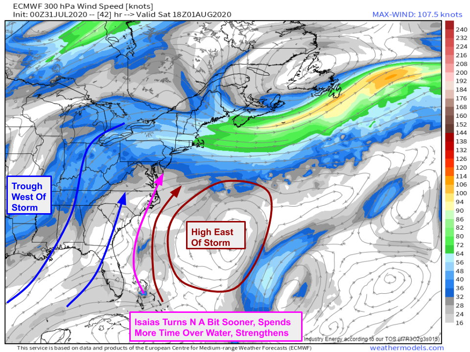
Here’s a look at the upper-level wind forecast for tomorrow afternoon which is more or less a roadmap to the steering of a stronger (hurricane-strength) Isaias. In the upper levels, the Bermuda high is located northeast of the storm while a deep trough is located off to its west/northwest. As a result, winds near the storm are basically out of the south or south-southwest. This would steer the storm north, maintaining some distance from the Florida coastline. If the storm were to follow this path, it would have ample time over very warm (29-30C!) water before it arrived in North Carolina. This would favor much more significant impacts to NC and points farther north, while minimizing impacts in Florida and Georgia.
The lower-level wind forecast for tomorrow afternoon looks much different. In this layer, the Bermuda high extends north of Isaias into the Gulf of Mexico. Easterly flow around that high would steer the storm west into Florida before recurving north much later. This would increase the potential for gusty winds and heavy rain in Florida, but because the storm would ride right along the Southeast US coastline, it wouldn’t have much opportunity to strengthen. As a result, we’d probably be looking at a tropical storm scraping along the coast with rain/wind that is not nearly as intense as the scenario farther east, but ends up impacting more people.
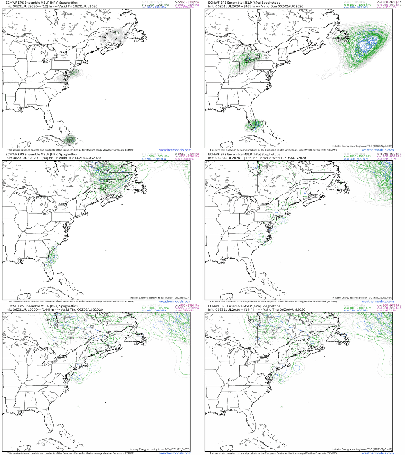 For what it’s worth, the 06z suite of the EPS (ECMWF ensembles) is unanimous in showing this weaker/farther west scenario. Of course there would still be a range of possible outcomes regarding the exact track/intensity/etc. but we’d be talking about 30 mph winds vs 60 mph winds instead of 60 mph winds vs 100 mph winds in places like the Outer Banks and Cape Cod. Storm surge discussions would follow along similar lines (1-3 ft vs 3-5+ft etc.). The one constant I think is the heavy rain threat. I discussed in detail yesterday how the positioning of a jet streak over southeastern Canada would support widespread heavy rain regardless of the exact track/intensity of Isaias.
 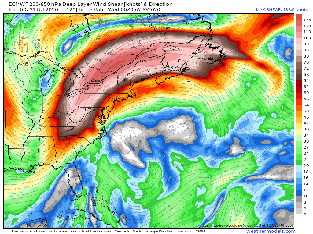 Last night’s ECMWF run, despite representing the weaker/farther west track, retains the exact same jet structure discussed yesterday along with the associated heavy rainfall risks. So even if this ends up being a weak TS or TD as it moves up the East Coast, a wide swath of the I-95 corridor could be looking at 3-6″ of rain in a relatively short time.
More detailed discussion of expected impacts will come later this afternoon. Until then, follow my latest musings on twitter @WeatherdotUS and @JackSillin.
-Jack

