Hurricane Hanna Continues To Intensify As It Approaches The Southern Texas Coastline
Hello everyone!
This morning’s update will be focused on Hurricane Hanna which continues to intensify as it grinds closer to the south Texas coastline this morning. The storm has about six hours left over water to intensify, but it appears to be poised to take advantage of every minute of that time. Preparations for hurricane conditions should be complete along the coastline south of Corpus Christi and north of Port Mansfield. Parts of this area could see serious storm surge flooding (3-6 feet above normal high tide) in addition to winds over 80 mph and nearly a foot of rain. Given that this area is currently experiencing >40 mph winds and heavy rain, there’s not much more you’ll be able to safely do to prepare at this point. Farther inland, the biggest threat from Hanna will be flooding rains. I discussed Hanna’s expected impacts in some detail yesterday evening. This post will mostly focus on the storm’s intensity forecast over the next six hours or so before landfall. The remaining uncertainty (just how strong Hanna’s maximum winds will get) is entirely irrelevant to the vast majority of those in the path of the storm who will not experience such winds. However, for a select few just north of where the eye ends up moving onshore, these details are important. Not to mention that the meteorology here is really interesting.
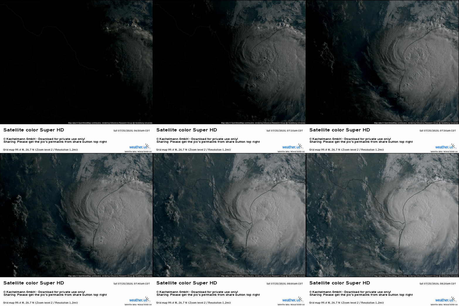
Satellite imagery shows a healthy Hanna once again this morning. We’re still observing the same pattern as we have for the past several days: intense thunderstorm activity near the center and unimpeded upper-level outflow spiraling clockwise away from the center. You can even see the storm’s eye beginning to clear out east-southeast of Corpus Christi.
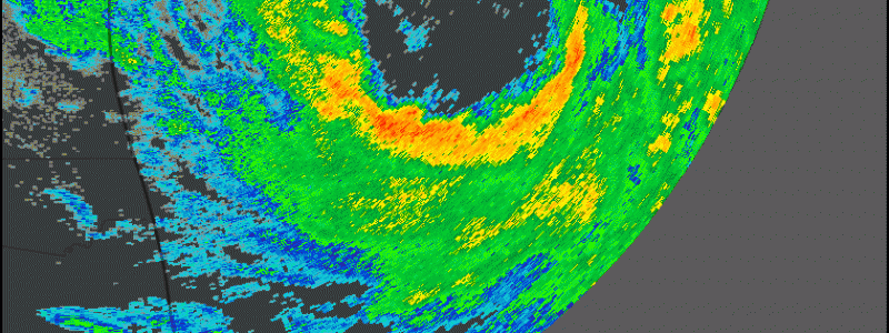
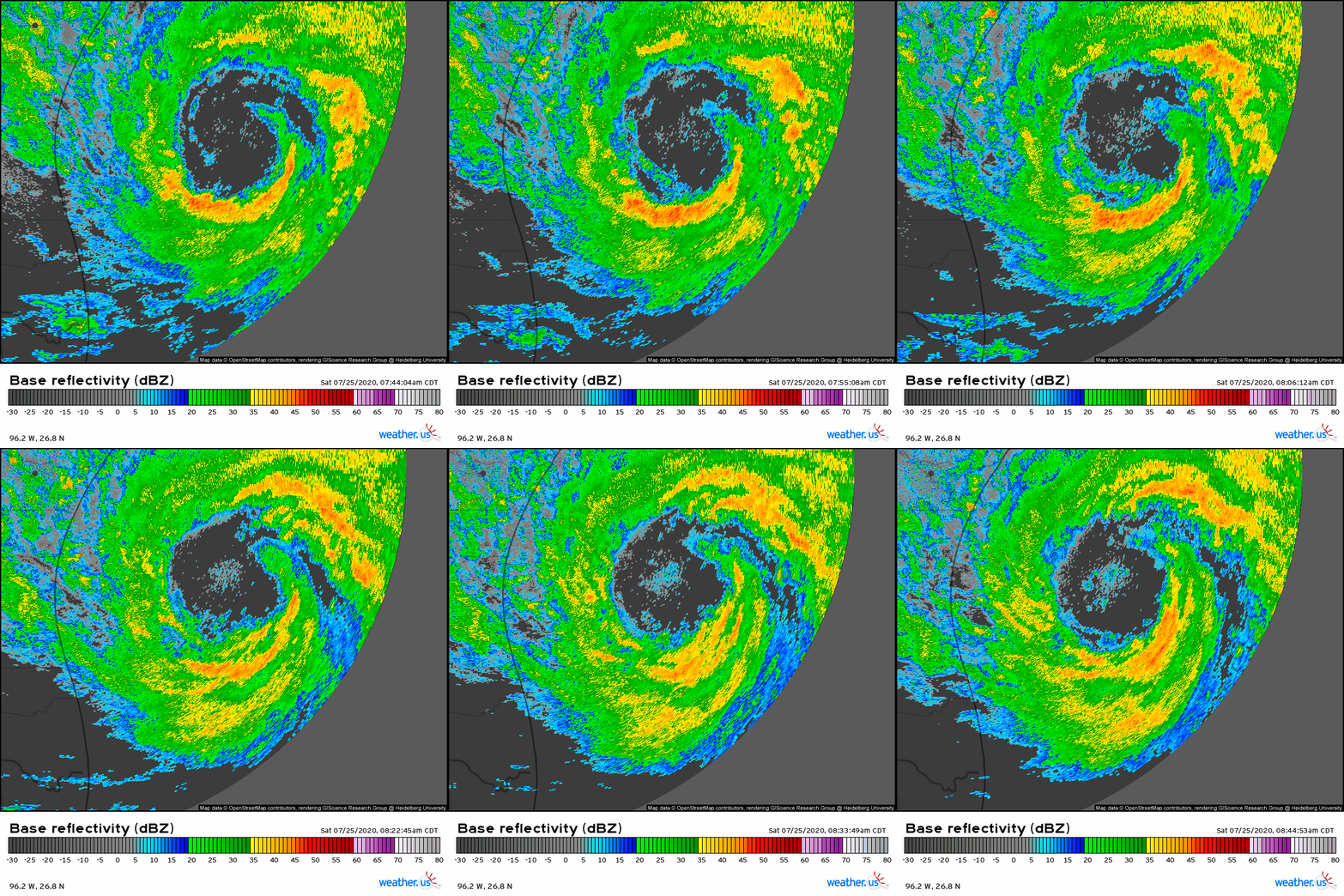 Radar imagery from Corpus Christi shows Hanna’s eye much better than satellite imagery. Even in the one-hour timeframe of this loop, you can see the eyewall strengthening and the eye becoming clearer and more symmetric. These are both signs that Hanna is continuing to intensify.
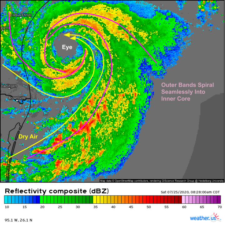
Zooming out a bit with SD composite radar imagery, we get a clearer view of the only thing preventing Hanna from taking off towards major hurricane status: a plume of dry air moving off the Mexican mountains and wrapping into the southern/eastern side of Hanna’s circulation. Because that dry air is still wrapping all the way into Hanna’s eye, I would expect intensification to be steady rather than extremely rapid over the next few hours. We’ll see if the storm can close off its northeastern eyewall, but even if it does in the next couple hours, it’s nearly out of time over water.
Given this dry air infiltration, I bet Hanna tops out just shy of 100 mph this afternoon. If that dry air weren’t present, I could easily have seen Hanna making a run at major hurricane status (category three, winds at or above 115 mph).
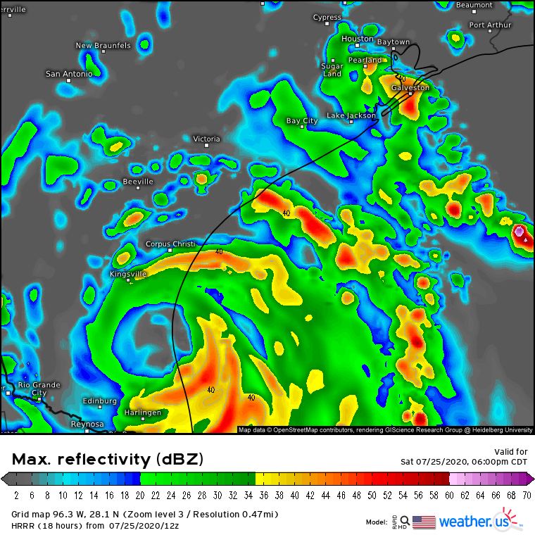
HRRR guidance suggests that Hanna will make landfall shortly before 6 PM CDT. Any wobble or brief pause that nudges that time back, even just by an hour, could tack another 5-10 mph onto Hanna’s maximum wind speed. Fortunately, the area most likely to be impacted by Hanna’s most intense winds is sparsely populated. The much greater concern is for flooding which will occur over a much broader area.
You can join me in tracking Hanna using the tools at weather.us using the following links:
GOES-East satellite imagery
HD radar imagery
Wind gust observations
-Jack
