Dorian Now A Dangerous Category Four Hurricane, Eventual Track Becoming A Little Clearer
Hello everyone!
Hurricane Dorian completed a remarkable rapid intensification cycle yesterday evening with its maximum winds increasing from 110 mph to 140 mph in just 12 hours. The storm has completed its turn towards the west-northwest and so far is sticking fairly closely to its forecast track. The storm’s future, while still somewhat uncertain, has become more clear over the past 24 hours. This post will outline changes to the forecast and present what I think is the most likely end solution for Dorian while keeping in mind that there’s still plenty we don’t know.
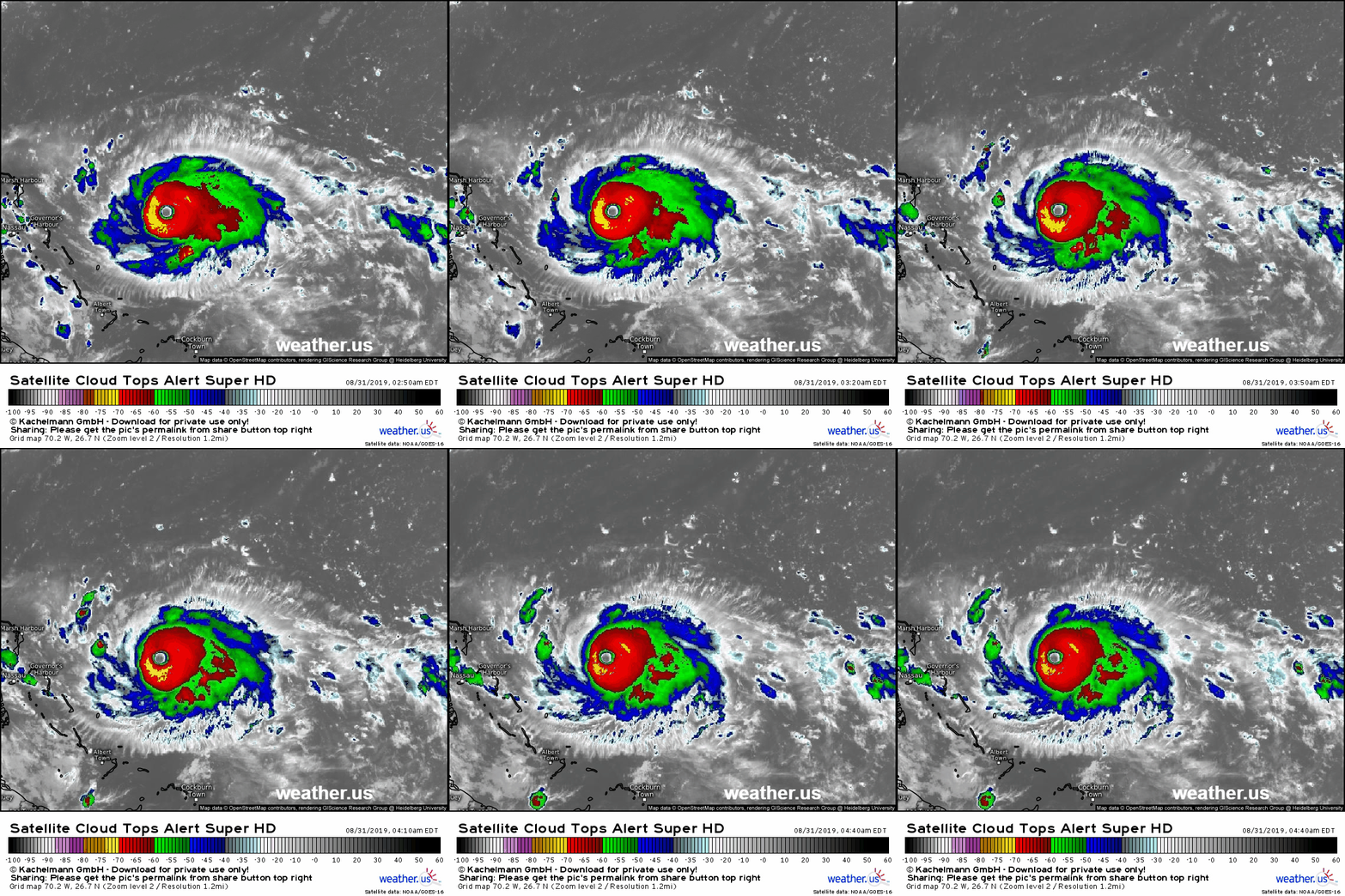
Satellite imagery this morning shows Dorian in tip-top shape by pretty much any measure. The storm has a warm, well defined eye surrounded by a symmetrical ring of very intense thunderstorms with cold cloud tops. Upper level outflow is fanning away from the storm in all directions, but particularly to the SE and W. The storm has shed many of its outer bands as its energy is focused on maintaining the intense core. This structure (core-heavy, banding-light) is well-documented to assist a strong hurricane in maintaining its intensity despite (moderately) negative environmental influences.
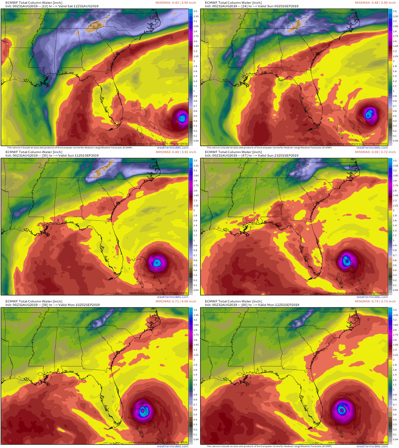
The next leg of Dorian’s forecast has been fairly well forecast over the past few days. The storm will be slowing down as it moves into the Bahamas, and it is likely to stall out somewhere between SE Florida and Great Abaco Island. While we still don’t know exactly where the storm will stall, it is likely to do so east of Florida. What happens after that is of great importance to the Florida Peninsula, and while it remains somewhat uncertain, we have a much better idea today than we did yesterday. GIF via weathermodels.com.
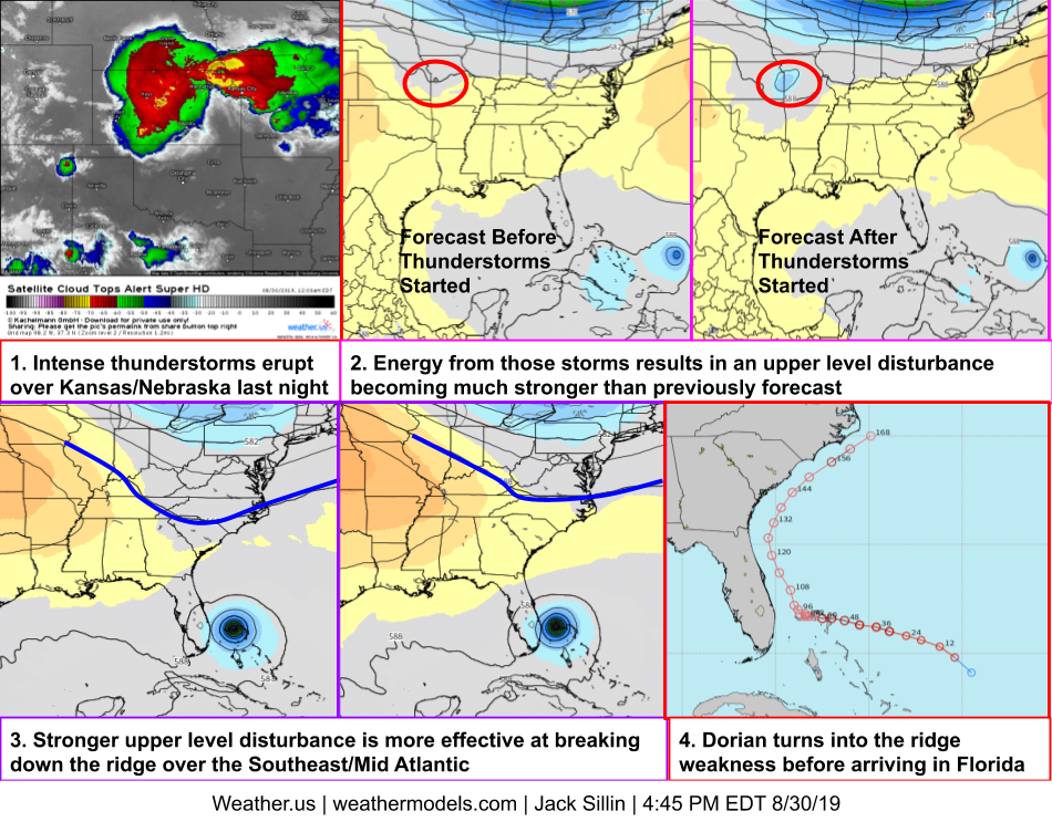
Which of the possible outcomes presented yesterday is most likely, and what’s responsible for the change? The answer lies in a cluster of very intense thunderstorms that erupted over Nebraska and Kansas on Thursday night.
This graphic is an attempt to show how those thunderstorms influenced Dorian’s forecast track in yesterday’s run of the ECMWF model. The energy released by the thunderstorms gave a little boost to an upper level disturbance moving through the Plains. That disturbance will be responsible for chipping away at the upper level ridge currently pushing Dorian west. The stronger the disturbance is, the weaker the ridge gets. We now have good reason (observations of the thunderstorms in Kansas) to believe that the strength of the ridge will fall closer to the weaker side of the range of possible outcomes than the stronger side. As a result, we can expect Dorian to more easily move north towards the weakness in the ridge by the time it stalls out in the Bahamas. Maps via weathermodels.com.
What does that mean for Florida? There is a fairly decent chance that the eye of Dorian never makes it fully ashore. A couple important caveats to that: a Florida landfall is still well within the range of possible outcomes and extremely dangerous conditions exist well outside the storm’s center. Even if there’s no official landfall, parts of Florida may still experience destructive winds, storm surge, and torrential rain. With that in mind, the slight shift in forecast (scientifically speaking, a 50 mile shift in the 4-5 day track is basically nothing) could allow the storm’s peak 130-140 mph winds to stay just offshore.
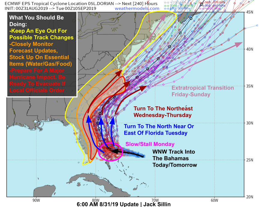
Here’s an updated look at the range of possible outcomes regarding Dorian in light of the new information.
The storm’s WNW track will continue today and tomorrow until the storm is somewhere in the Northwestern Bahamas, where it will slow to a crawl or stall on Monday. A turn to the north is expected beginning Monday night, and will take the storm parallel to the Florida coast. Exactly how close the eye makes it to the coast is still something we don’t know, and likely won’t until Monday/Tuesday. By Wednesday, the storm will be approaching Jacksonville FL’s latitude and will begin turning to the northeast in response to an approaching mid latitude trough. This will bring the storm either over or very close to GA/SC/NC. Again, the exact track is still uncertain but the general idea is becoming much clearer. On Thursday, the storm will be departing NC and heading off to the northeast while transitioning into a powerful extratropical cyclone. The storm may pass close enough to Cape Cod to bring rain and wind to parts of New England, but it’s far too early to tell what the extent of those impacts might be. Map via weathermodels.com.
What impacts are we confident about? Regardless of Dorian’s track, either just onshore or just offshore, beaches up and down the East Coast will see very high surf.
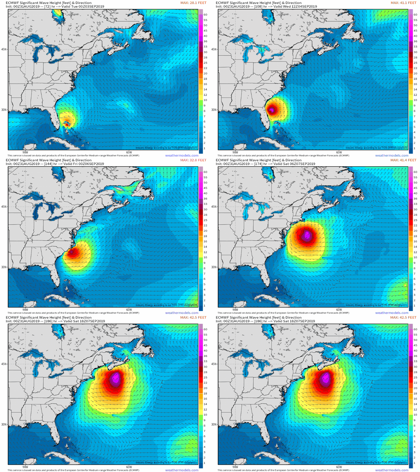
The ECMWF significant wave height forecast for the next week shows Dorian producing intense swells in excess of 30 feet as it moves north and then northeast. These waves will produce dangerous surf along ocean-facing beaches, beach erosion, and potential coastal flooding given the astronomically high tides this weekend. If you’re headed out to watch the waves, make sure you do so from a safe distance and always keep an eye on the ocean. GIF via weathermodels.com.
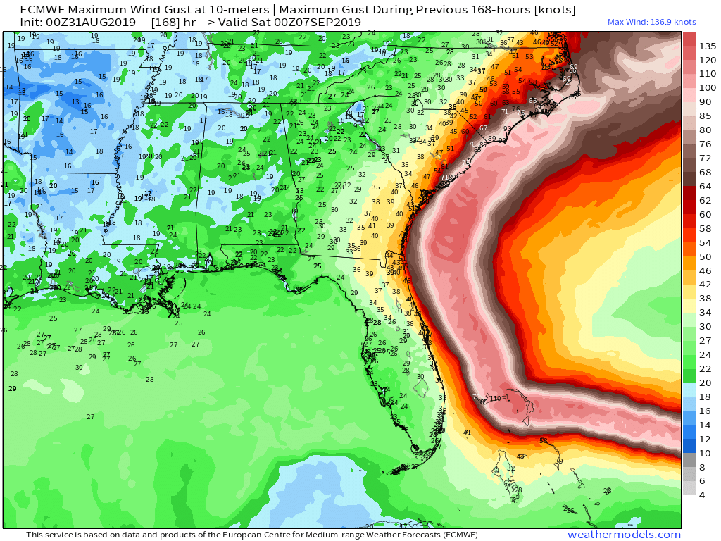
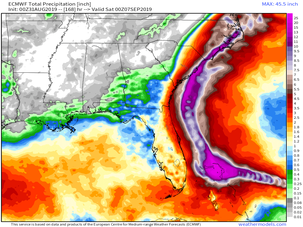
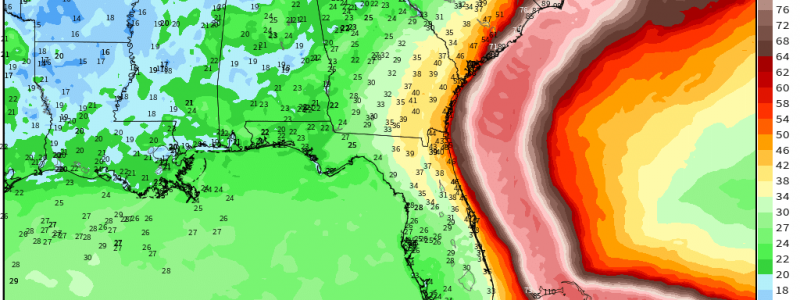
As far as wind and rain goes, of course both are much more track-sensitive than the waves. The ECMWF max wind gust and total rain products show the swath of intense conditions associated with Dorian’s core. If the storm wobbles even 30-40 miles west, Coastal Florida will see destructive winds and flooding rain. A 30-40 mile wobble to the east and the coastline would escape with just a few breezy showers. As frustrating as it is, both options are still on the table. If you’ve been reading my forecast discussions over the past few days, hopefully you’ve come away with a sense of just how hard it is to forecast tropical cyclone tracks even to within a couple hundred miles, let alone a couple dozen. If you live on the Florida coast, you still need to be preparing for the worst, even while hoping for the best. Maps via weathermodels.com.
Farther north, we’ll be dealing with the same dynamic. Dorian will be taking a track roughly (but not exactly) parallel to the coastline. If the storm track shifts slightly to the west, parts of coastal GA, SC, and NC will be at risk for intense winds along with heavy rain. By the time the storm arrives in the Carolinas, it will be interacting with the mid-latitude jet stream in such a way that’s favorable for heavy rainfall even if the core doesn’t come onshore, so residents of Eastern NC and adjacent parts of SE VA prone to freshwater flooding should be preparing for high water regardless of Dorian’s exact track. I’ll cover this aspect of the storm in more detail a few days from now.
I will have more updates on twitter through the rest of the day today. You can follow us at @WeatherdotUS and @JackSillin. My next blog update will likely be this time tomorrow.
You can keep track of Dorian on your own timetable by using the tools we have at weathermodels.com (all the model maps you see in this post plus many more) and weather.us (GOES-East satellite imagery, free model data, tools to see the range of possible rain/wind outcomes in your town).
-Jack
