How Thunderstorms Near The Bahamas Can Impact Snow In New York
Hello everyone!
Today’s snowfall event provides a great opportunity to examine the influences of thunderstorms near the Bahamas on snow that falls in the Northeast. Weather is so interconnected, that the forecast for any given location is often impacted by phenomenon going on hundreds or even thousands of miles away.
Lightning analysis shows a large area of thunderstorm activity stretching from the Miami area through the Northern Bahamas and out into the western Atlantic. GOES satellite imagery confirms this, with cloud top maps showing cold cloud tops indicating strong thunderstorms in this area. Even though the majority of these storms are offshore, they’re still impacting the weather along the East Coast by changing the behavior of a larger storm system.
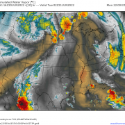
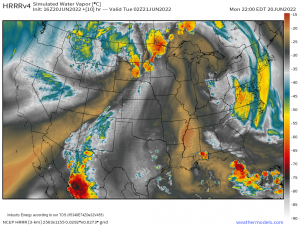
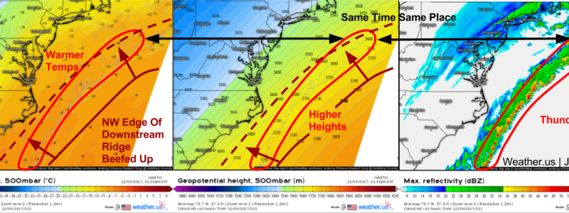
A series of model maps from a model that can “see” thunderstorms highlights the mechanism behind this effect. Thunderstorms carry immense amounts of warm air upward through the atmosphere. This warm air gets deposited in the middle and upper levels, where it has the effect of boosting geopotential heights. You can see this effect on the model maps above, where 500mb (~20,000ft) temperatures are relatively warm in the area with thunderstorms. Remember from our discussion about ridging that low-density warm air expands and pushes geopotential heights upward. You can also see higher heights in the area with thunderstorms. So why is that important to the East Coast and its snow?
This synoptic composite map highlights the impact of the downstream ridge. The ridge acts like a rock in a stream, which is one way to think of the atmosphere (water and air are both fluids, and behave very similarly). When you place a rock in a stream, the water must bend around it. Sure enough, by placing a ridge over the West Atlantic, the incoming storm was forced to bend around it to the north, result in a track closer to the coast than what would’ve been expected if that ridge was weaker. The strengthening effect of the thunderstorms on the downstream ridge played an important part in directing this storm up the coast instead of out to sea!
This effect is an important one to be aware of when evaluating forecast model guidance ahead of coastal storms. Some models such as the GFS have a resolution too coarse to resolve thunderstorms. This results in an underestimation of the downstream ridge, and a tendency to track storms too far southeast. The opposite is true for models that are overly aggressive with convection such as the NAM. Their bias will be towards the northwest due to an overestimation of the downstream ridge. You can also evaluate model biases by watching satellite imagery. If models forecast little in the way of convection off the Southeast coast, and satellite imagery reveals robust activity, perhaps a shift NW of the storm track is in order. The opposite is also true.
Next time we have a coastal storm in the forecast, be sure to watch for potential thunderstorm development on the southeastern edge of the system! Remember how different models handle thunderstorms, and the potential influences those differences may have on the forecast for the storm’s track.
-Jack


