How Do Thunderstorms Produce Damaging Winds?
In addition to lightning, flooding rains, and hail, strong thunderstorms often produce gusty winds. Sometimes, these winds are even strong enough to cause substantial damage. What causes gusty winds in thunderstorms? How do the normal air currents inside a thunderstorm turn into walls of wind that can reach hurricane strength?

Downward moving cold air spreads out when it hits the ground, often resulting in gusty winds. Notice how the rain shaft of this storm is bent at the base indicating the spreading out of the downdraft.
Thunderstorms themselves are just reflections of currents of wind that move up, down, and around through our atmosphere. An upward moving air current that cools and condenses as it rises is what results in the thunderstorm forming. A downward moving air current develops as the storm matures and precipitation begins to fall. Eventually, a downward moving air current will intercept the ground. When it does, it spreads out, just like how the updraft spreads out when it encounters the stratosphere. The spreading out of the downdraft when it reaches the surface is one reason that gusty winds often accompany thunderstorms.
The second reason gusty winds often accompany thunderstorms is closely connected with the first. As precipitation (moisture) falls through previously unsaturated (dry) air, it cools through evaporational cooling. The now cold air becomes heavier and denser than its surrounding environment and negative buoyancy kicks in. The cold air parcels accelerate towards the ground just like the buoyant air parcels accelerated away from the ground in the updraft. This pocket of cold air will eventually hit the ground and spread out rapidly. This phenomenon can help to intensify bursts of wind associated with downdrafts and, in extreme cases, can result in microbursts- very localized areas of extreme winds that can cause extensive damage.
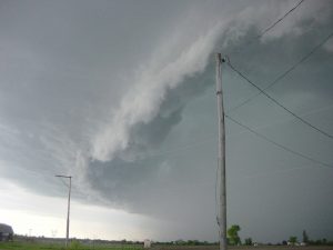
Shelf clouds often form along the leading edge of a storm’s cold pool marking the beginning of the gusty winds.
Between the downdraft and the effects of low level dry air, you end up getting a pool of rain-cooled air in the low levels as a storm matures. This cold pool is constantly spreading out away from the storm and a mini cold front of sorts forms along the leading edge of the cold pool as the rain cooled air pushes the warm air away. As the warm air is forced to rise up and over the new boundary, it cools and condenses into clouds. This is how shelf clouds form, the often ominous looking walls of dark grey that form in advance of strong thunderstorms. If a shelf cloud is moving in your direction, it’s pretty safe to assume some gusty winds are as well!
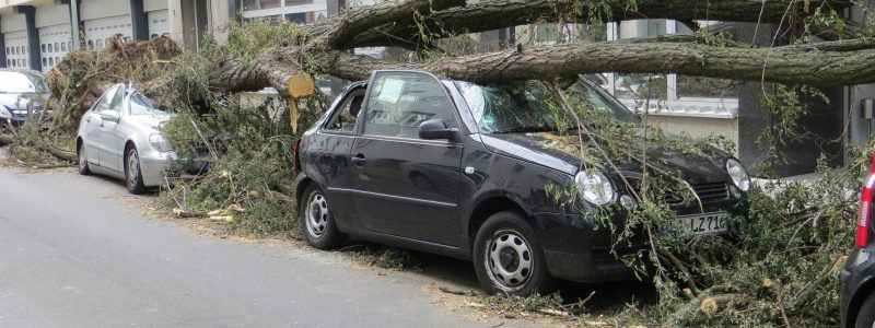
In extreme cases, a combination of the factors mentioned above results in gusty winds that can become damaging.Winds well over 100mph have been recorded in thunderstorms that never produced any tornadoes. Straight line winds (termed because they lack tornadic rotation) can produce just as much damage as low-moderate strength tornadoes so watch out if you’re under a severe thunderstorm warning for damaging winds, they can really do some damage!
Now that you know how thunderstorm wind gusts form and how dangerous they can be, check out the data over at weather.us to see if there are any gusty thunderstorms headed in your direction!
Feel free to send me an email if you have any questions about the weather you’d like me to explain! jack@weather.us
-Jack Sillin
