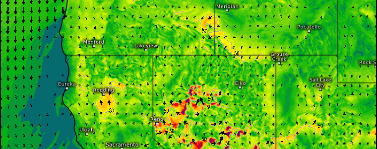
Hot and Dry: Western Wildfire Risk
We’ve been talking a lot about heat lately, especially with reference to the southern tier of the country. They’re not the only region left in the oven a bit too long, though.
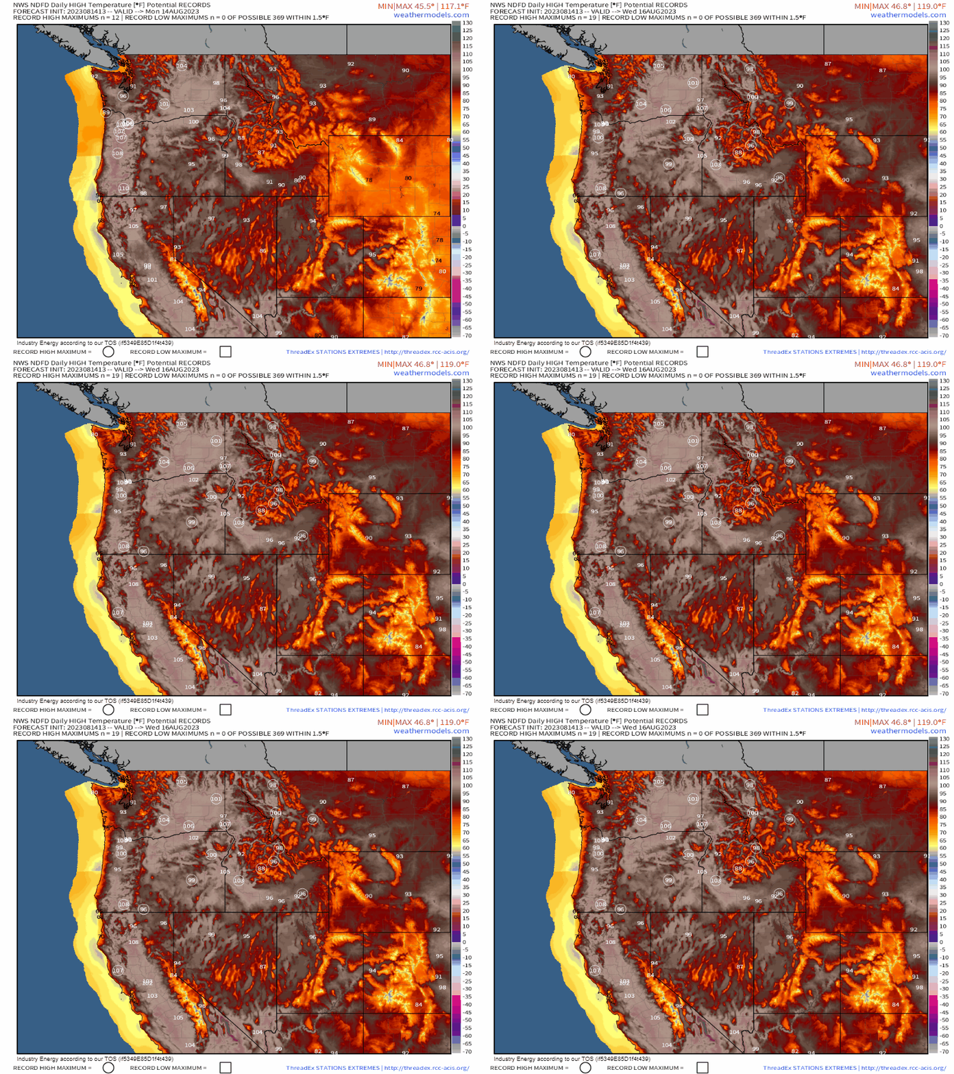
The first half of this week will feature a waning heatwave over the Northwest. However, the current synoptic set-up and transition to a new pattern brings concerns other than just how hot it is.
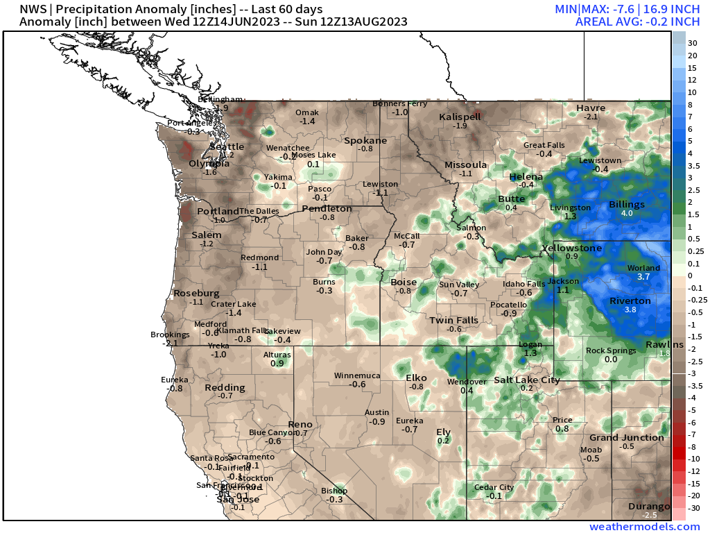
Before we dive into the set-up, we need to take a look at the precipitation anomaly over the region.
Despite a rather wet winter/spring that did wonders for reducing the drought across some of the Pacific Northwest, drought conditions have been slowly creeping back in as little rainfall has been seen over the summer.
As we are well aware, this region is prone to wildfires. There are already a few active fires and, with a set-up that is both hot AND dry, it spells the potential for trouble ahead.
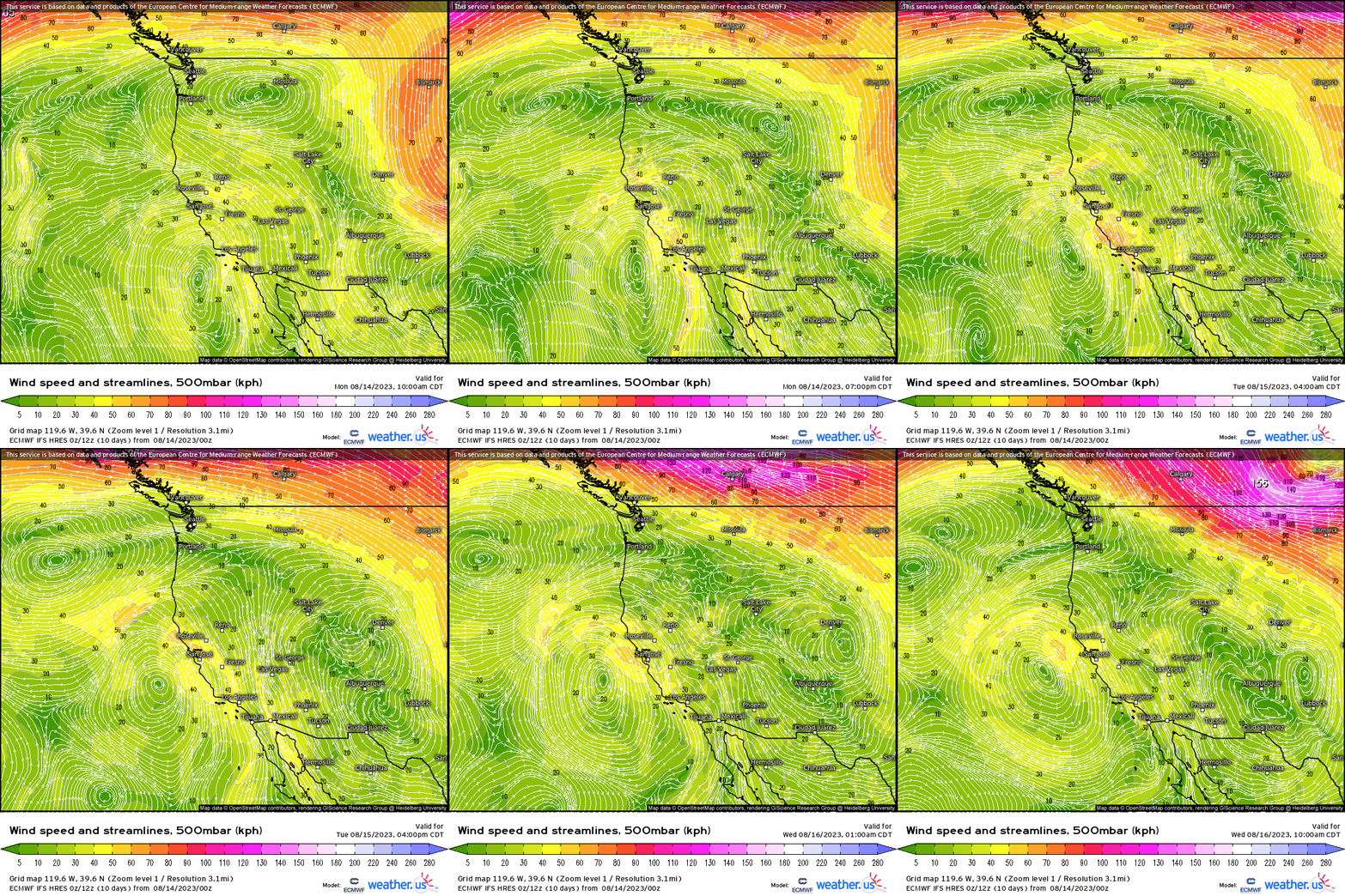
Currently, we have an area of high pressure, indicated by the clockwise swirl, dominating just offshore. This will drive today’s fire threat.
The clockwise flow around the high will allow for a fair amount of downsloping to occur on the western slopes of the Cascades, specifically in Oregon.
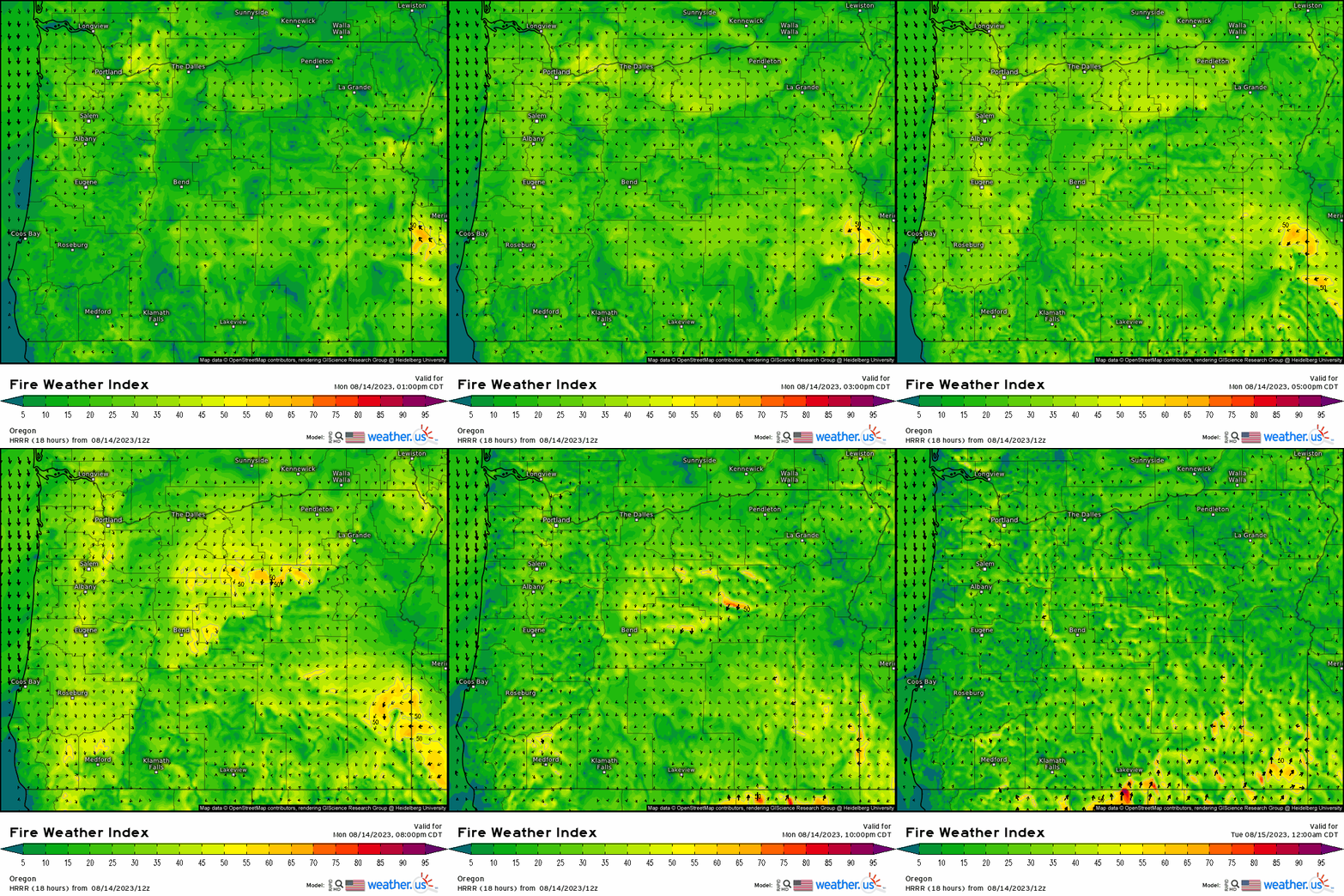
While not a particularly potent threat due to winds only expected to reach 15 to 20 mph, very dry air and dry fuels (brush, grass, trees) means that any fire that starts may have the potential to spread somewhat quickly.
The pattern changes a bit tomorrow as a weak low approaches. If you’ll refer back to the 500 mb wind speed and streamlines map, you’ll notice a counter-clockwise swirl sliding up the coast. This will bring some mid-level moisture into the region.
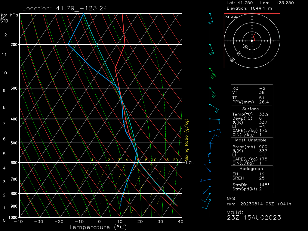
With the addition of a bit of lift from the offshore low, some instability may be present to produce a few thunderstorms.
Though there will be moisture in the mid-levels as mentioned, the lower levels will remain extremely warm and dry. So, as any rain falls from these storms, it will evaporate into the dry layer below (the inverted V on the sounding above) before it ever reaches the ground. Cloud-to-ground lightning will remain possible, however, bringing the risk of “dry lightning” into play.
With no beneficial rain falling to temper the risk, these lightning strikes could potentially spark new fires that could begin spreading quickly, given antecedent dry conditions.
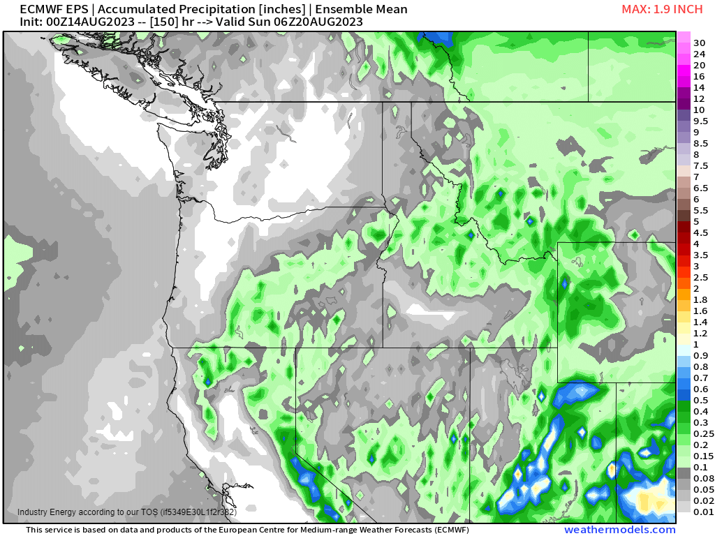
Unfortunately for the region, meaningful rainfall looks to remain scarce through the week. Additionally, there will likely be more chances for conditions to be conducive to wildfire spread during this period.
Use caution in your outdoor activities and, if you live near an active fire, have a plan of evacuation ready to go should you end up needing it.


