Heavy Snow Falls In The Northern Rockies, Jose Could Make A Close Pass To The East Coast
Hello everyone!
After a couple days with high pressure dominating the US, we’re wasted no time in returning to an active weather pattern today. This post will discuss severe weather in the northern plains, heavy snow in the Rockies, and Jose which looks to make a close pass to the east coast next week.
Click on any link for more information about a particular topic. For each link, you can click the map to zoom in, you can click near the edge of the map to pan, and you can use the (-) button to zoom out. You can also explore other parameters/satellite views and time steps via the menus to the left of each image.
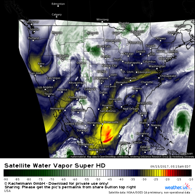
Satellite imagery gives us a full picture of the players involved in today’s weather.
Notice strong upper level energy just NW of Denver this morning with additional energy dropping south through Nevada. The first disturbance is the moisture laden pacific low that brought storms to California in the past few days, while the second disturbance holds some very cold air from the polar regions. The combination is resulting in snow across the northern Rockies. Meanwhile out ahead of this system, severe weather is forecast to develop along the warm front associated with the surface low this disturbance has formed. Generally quiet weather is dominating the eastern third of the country while Jose lurks offshore.
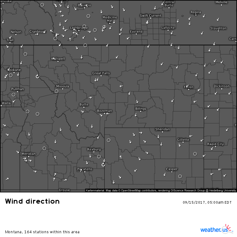
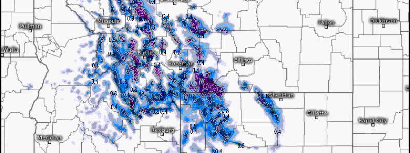
In Montana, northeasterly winds are bringing in cold air from Canada. The water vapor satellite image above showed the deep Pacific moisture in the region. It’s no surprise then that snow is falling now, and is forecast to continue falling today.
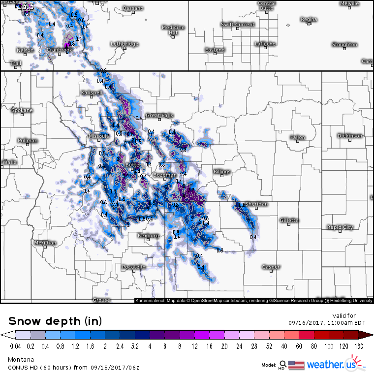
While temperatures are still too warm for snow in the valleys, there’s plenty of high terrain across the state that’s seeing snowfall. Some of the highest peaks could see over a foot of snow!
Snow will continue through the day today and into tonight before tapering off tomorrow.
Now that we’ve covered the cold side of this system, it’s time to talk about the warm side, where severe weather is forecast to develop this afternoon.
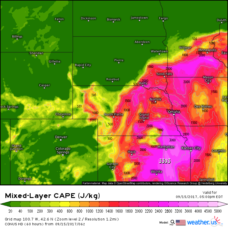
Southwesterly flow aloft ahead of the disturbance over Wyoming will bring ample wind shear to the Northern Plains this afternoon/evening. Remember that shear is one of the three ingredients needed for severe storm development. What about the other two ingredients, instability and a trigger?
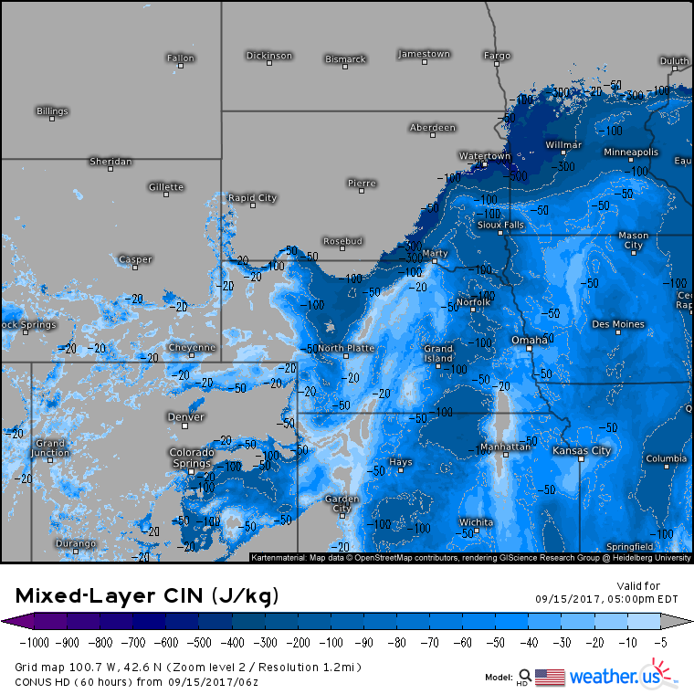
There will be plenty of instability present across NE Nebraska, Eastern South Dakota, and SW parts of Minnesota as strong daytime heating combined with moisture flowing north from the Gulf of Mexico creates an unstable atmosphere. However, there will be a strong “cap” in place that will prevent storm development from getting going until later in the evening. This cap is evident in Convective Inhibition fields.
High CIN values indicate a strong cap, which is clearly present along the boundary expected to trigger thunderstorm development. If this cap is stronger than modeled, it may prevent storms from getting going altogether. While this currently isn’t the forecast, it is a possibility worth mentioning.
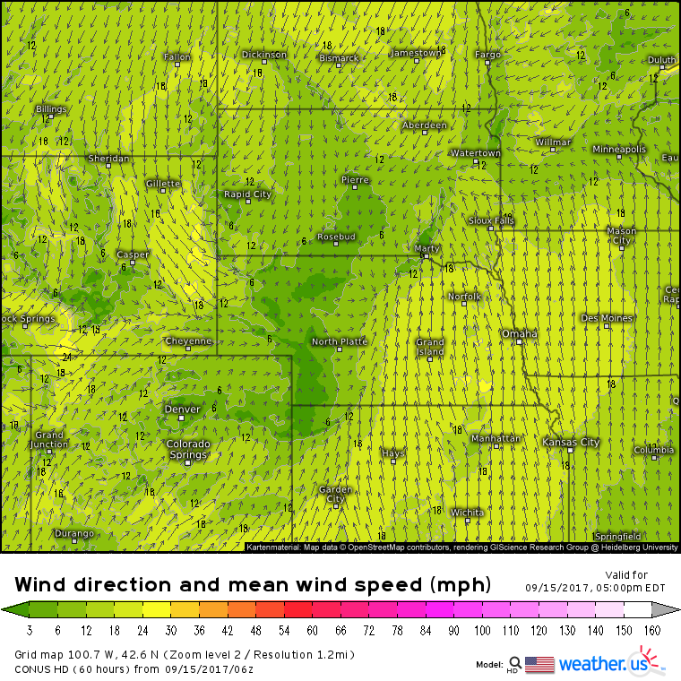
Speaking of boundaries, any severe weather threat needs its trigger, and today we’ll have a warm front draped across the northern plains from Nebraska up through SD and into MN. This boundary will be the focus for thunderstorm development this evening. Notice those easterly winds modeled in the far SW corner of MN. That so-called “backed flow” will promote some turning in the atmosphere with southerly winds aloft. This turning could support enough rotation in thunderstorm updrafts for a brief spinup tornado in the far NE part of SD and the far SW part of MN. Any supercell storms capable of tornadoes in this area will also be capable of some large hail. Otherwise, strong winds will be the primary threat along with lightning and heavy rain. Thunderstorms will lose steam as they drift east tonight.
We’ve covered wintry conditions in Montana and summery severe weather in the Northern Plains, now it’s time for a trip to the tropics.
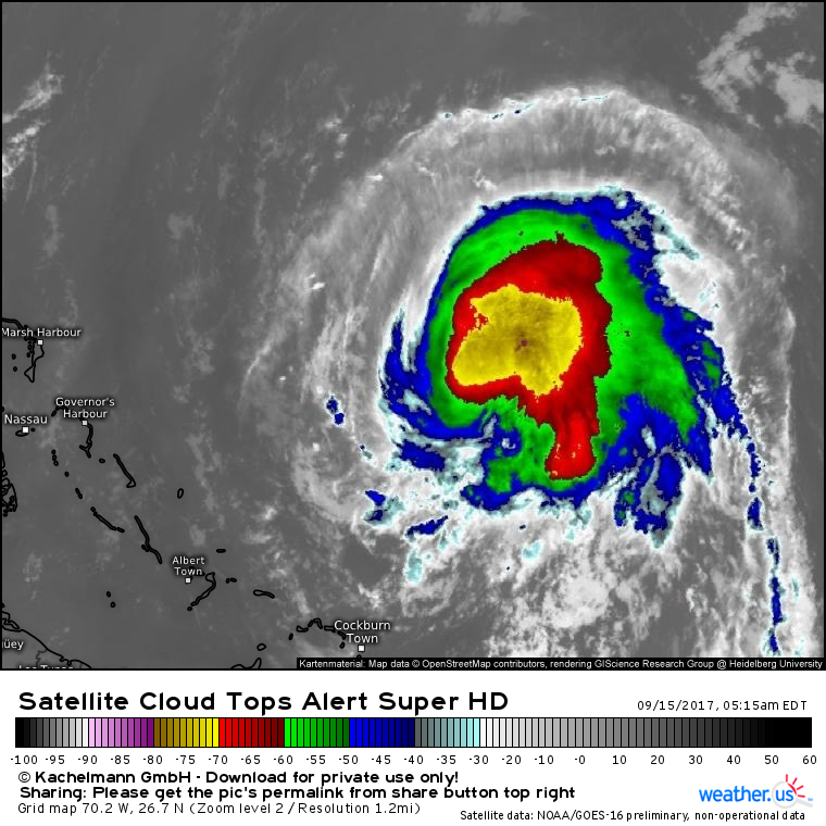
Jose has weakened to a tropical storm in the past couple days while wandering aimlessly through the SW Atlantic. Satellite imagery shows a much healthier system this morning than in recent days with outflow improving to the north and a much more symmetric appearance to the cloud pattern. This is all the result of northerly wind shear caused by Irma fading as Irma dissipated over the US.
The last time we talked about Jose it was likely to spin harmlessly out to sea with no direct impacts to the US. However, developments half way across the world have made this forecast considerably more challenging.
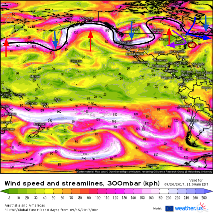
Upper level energy over China was slightly stronger than modeled a couple of days ago, and as a result, Typhoon Talim did not make landfall in the Shanghai region. Instead, it’s turning northeastward and will make landfall in Japan. Why is this important to Jose? Recurving tropical cyclones carry enough heat energy with them into the mid latitudes that they can disrupt the pattern across an entire hemisphere. Talim will be doing just that, by triggering what’s called a Rossby Wave Train event.
This upcoming RWT event is clearly evident on the 300mb wind forecast from the ECMWF. This shows the jet stream (black line). An RWT is a series (train) of waves in the jet stream. You can see that the black line I’ve drawn showing the jet stream resembles the shape of waves you might see breaking on the beach. How does Talim cause an RWT? Talim transports tons of heat energy northward when it recurves (leftmost red arrow). This displaces cold polar air that is forced to plunge southward (blue arrow over the N Pacific). This digging trough forms a strong storm that pumps heat energy northward on its eastern side, causing a ridge south of Alaska (red arrow in the E Pacific). This then displaces cold air which dives south over the West Coast, which of course causes a ridge to form downstream over the Great Lakes. This alternating pattern of ridge/trough/ridge/trough/ridge is the direct effect of Talim recurving as a strong typhoon as opposed to dissipating over China. Now instead of a fast, flat jet stream to push Jose right out to sea, the storm will be left with competing steering influences.
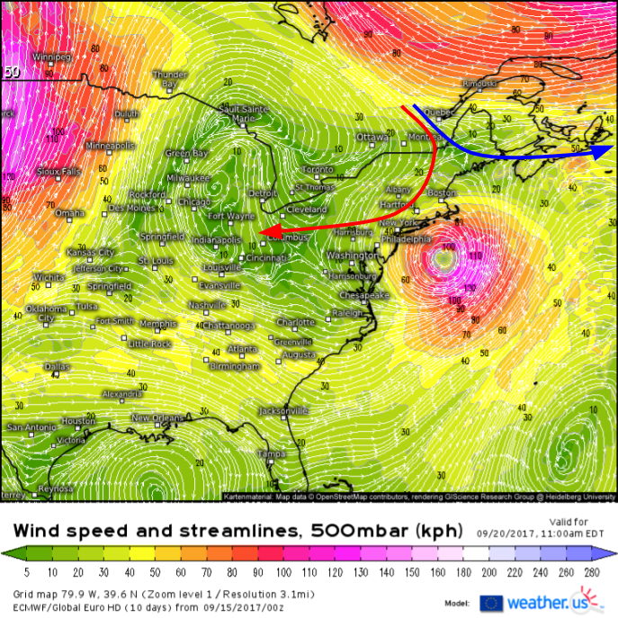
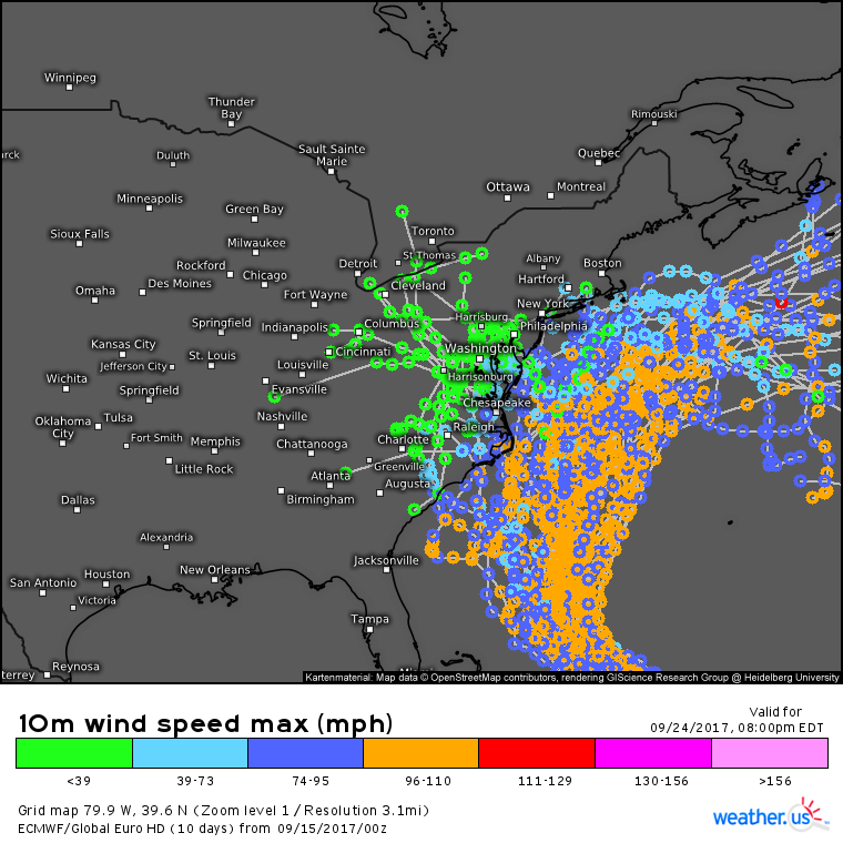
By Wednesday, Jose will be making a close swipe of the East Coast. Two of our RWT forces will be playing tug-of-war with the system. The large ridge over the Great Lakes will want to pull Jose westward into the coast. The large trough developing over Quebec will want to sling Jose eastward into the Canadian maritimes and then out to sea. Small changes in either feature will determine where Jose goes. If that trough is a little stronger or a little farther west, Jose goes out to sea. If that ridge is a little stronger or a little farther NE, Jose makes landfall somewhere between the Outer Banks and Nova Scotia. It’s too soon to tell exactly which path Jose will take, but for residents of the northeast, it’s certainly a system to watch closely.
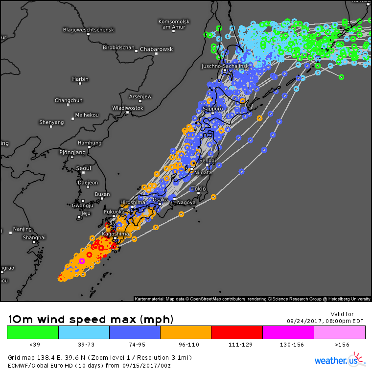
EPS ensemble data shows a pretty even split between members forecasting an out to sea track and members forecasting a US landfall. We’ll refine the forecast in the coming days to see which is more likely.
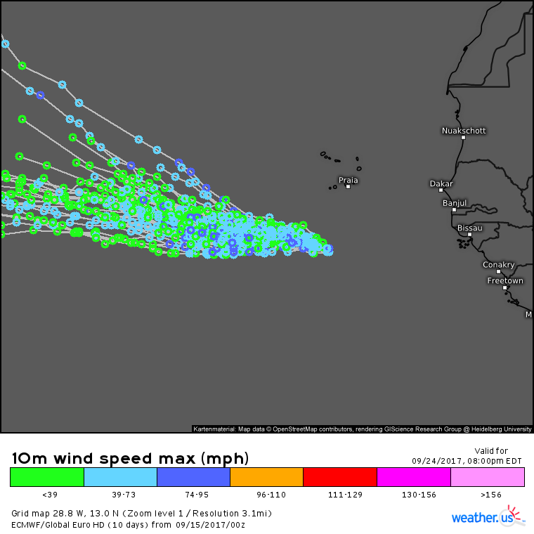
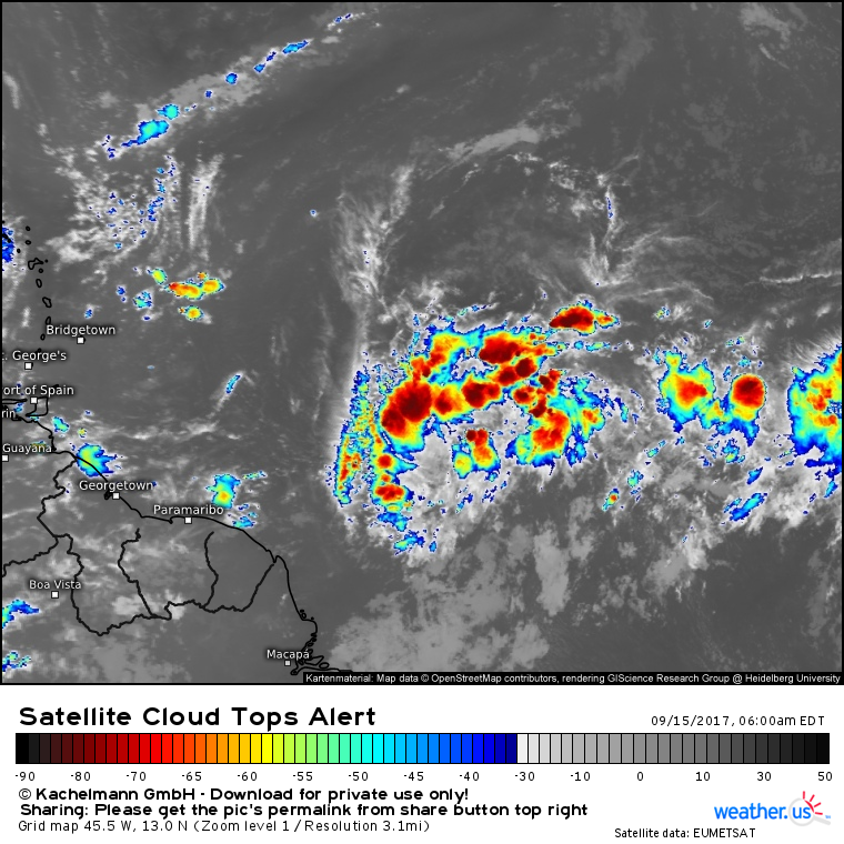
Are you as tired of the tropics as I am? Hopefully not, because TD-14 has just been named by the NHC and it’s forecast to gradually strengthen as it moves WNW away from Africa.
There remains considerable uncertainty as to where this system is headed and how strong it could get. Yet another tropical wave to the west of TD-14 could develop into a tropical storm or hurricane as it approaches the Caribbean next week. We’ll keep an eye on both in case they drift in the direction of the US as some models forecast.
For more information on your local forecast, head on over to weather.us.
For more information on the local forecast for Maine and New Hampshire, check out my local blog post from this morning.
My next update will be tomorrow.
-Jack
