Heavy Snow Event Expected In North Carolina Today
Hello everyone!
Today’s the day that snow is expected to fall across much of North Carolina as a wave of low pressure races east along a frontal boundary draped over the Gulf Coast. I discussed the overall setup for this system on the blog yesterday, but the forecast has changed meaningfully since then. With that in mind, this post will outline what has changed since yesterday morning and why.
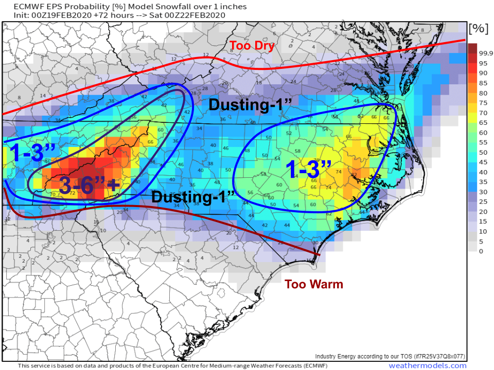
First of all, a quick refresher of yesterday morning’s expectations:
This was the snow map I posted yesterday morning based on my analysis of available model guidance and observations. I notably discounted the NAM suite of guidance which was expecting a much larger storm. My reasoning for this was that the NAM often ends up overamplifying the upper level waves responsible for producing storms like this. Furthermore, the zonal nature of flow aloft favored a weaker (less amplified) system.
What changed? Yesterday a bit later in the morning, I posted this GIF to twitter, wondering if my low-ball forecast was in trouble. 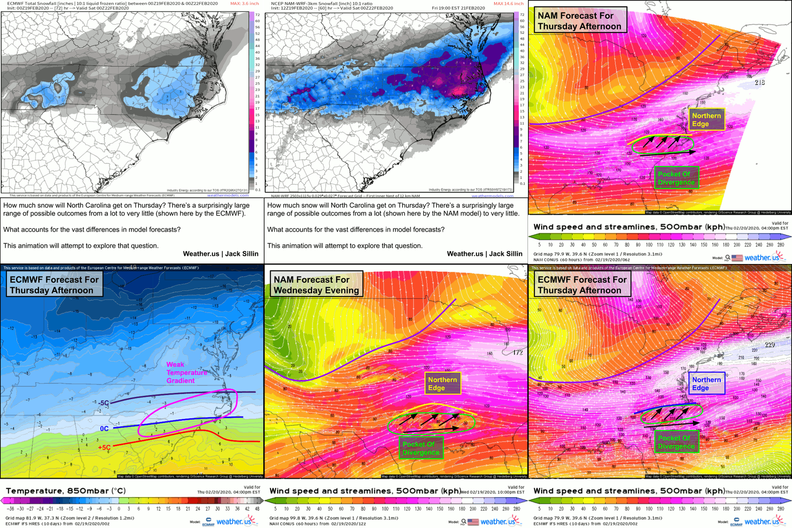
Basically, it seemed as though the NAM was producing an amplified solution in response to latent heat release over Texas and Louisiana yesterday evening in showers/thunderstorms. More thunderstorms = more heat added to the upper levels = “breathing room” for the storm. Because the ECMWF can’t explicitly “see” thunderstorms, it needs to guess when and where they’ll show up, and for whatever reason the model didn’t expect much in the way of thunderstorms last night.
So what actually did happen with those thunderstorms?
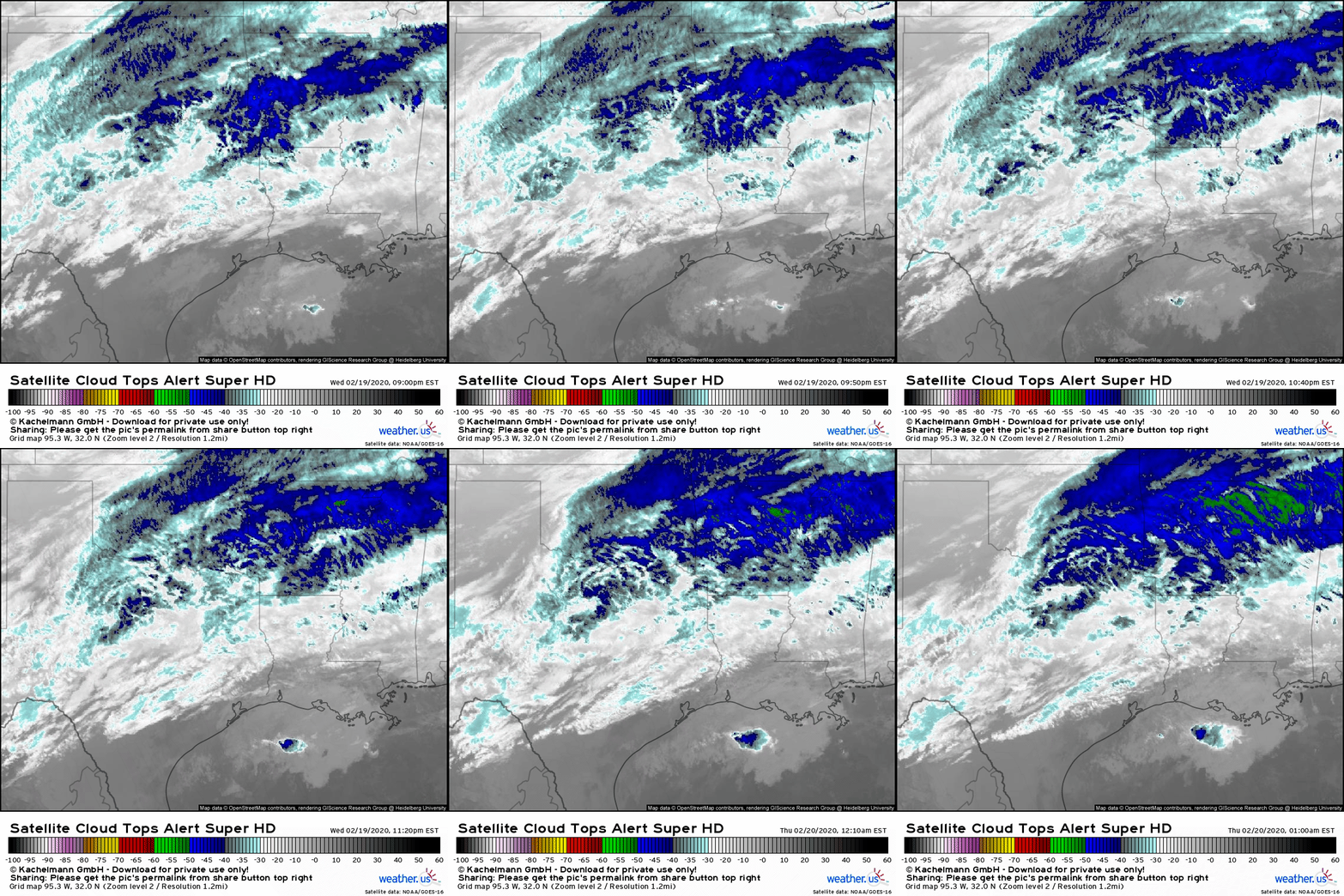
Here’s a loop of satellite imagery from last night over the area in question. It’s not totally obvious, but the blue speckled areas that develop near Austin TX before moving NE towards the Red River Valley are convective cells (showers/thunderstorms). If you look farther northeast, you’ll see a thicker area of dark blue emerge over the course of the loop. That’s a deck of cirrus clouds that’s somewhat reflective of upper level winds. If you look closely enough, you can see these cirrus clouds expand a bit northward into MO (very top of the image) towards the end of the loop. That northward expansion despite zonal westerly flow is a hint that this system might be amplifying a bit more than we thought.
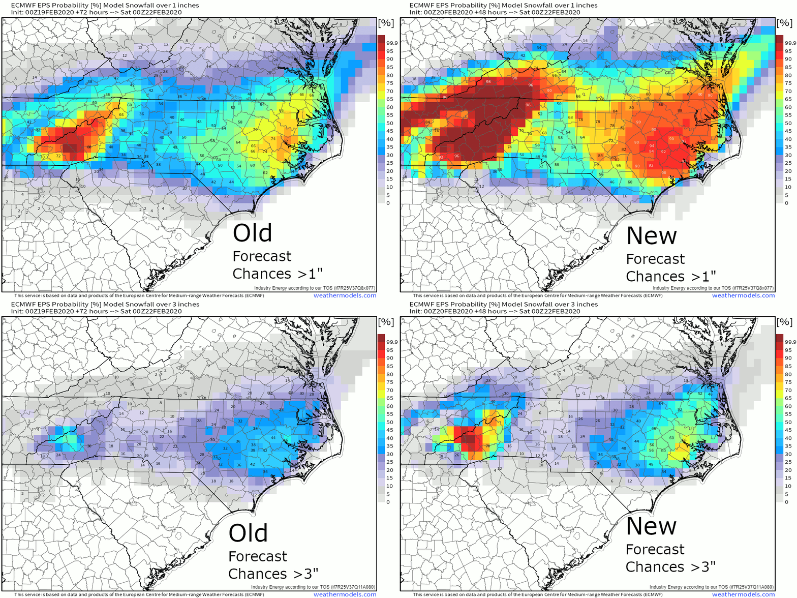
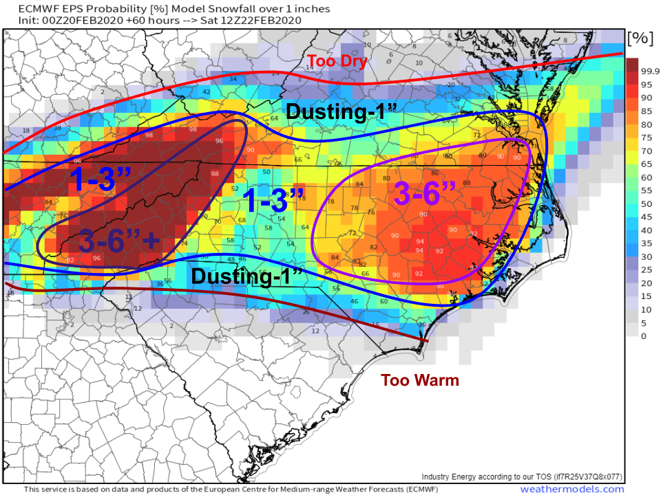
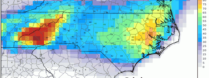
Here’s a look at how EPS guidance shifted since yesterday morning. Yesterday, it seemed like totals >3″ would be confined to the mountains and possibly a few lucky spots along the coastal plain. Today, it’s evident that much of eastern NC will pick up at least 3″ and possibly quite a bit more. A similar trend is noted with the forecasts for chances of accumulation >1″. Of course changes in the forecast this close to an event happen, but usually not this drastically.
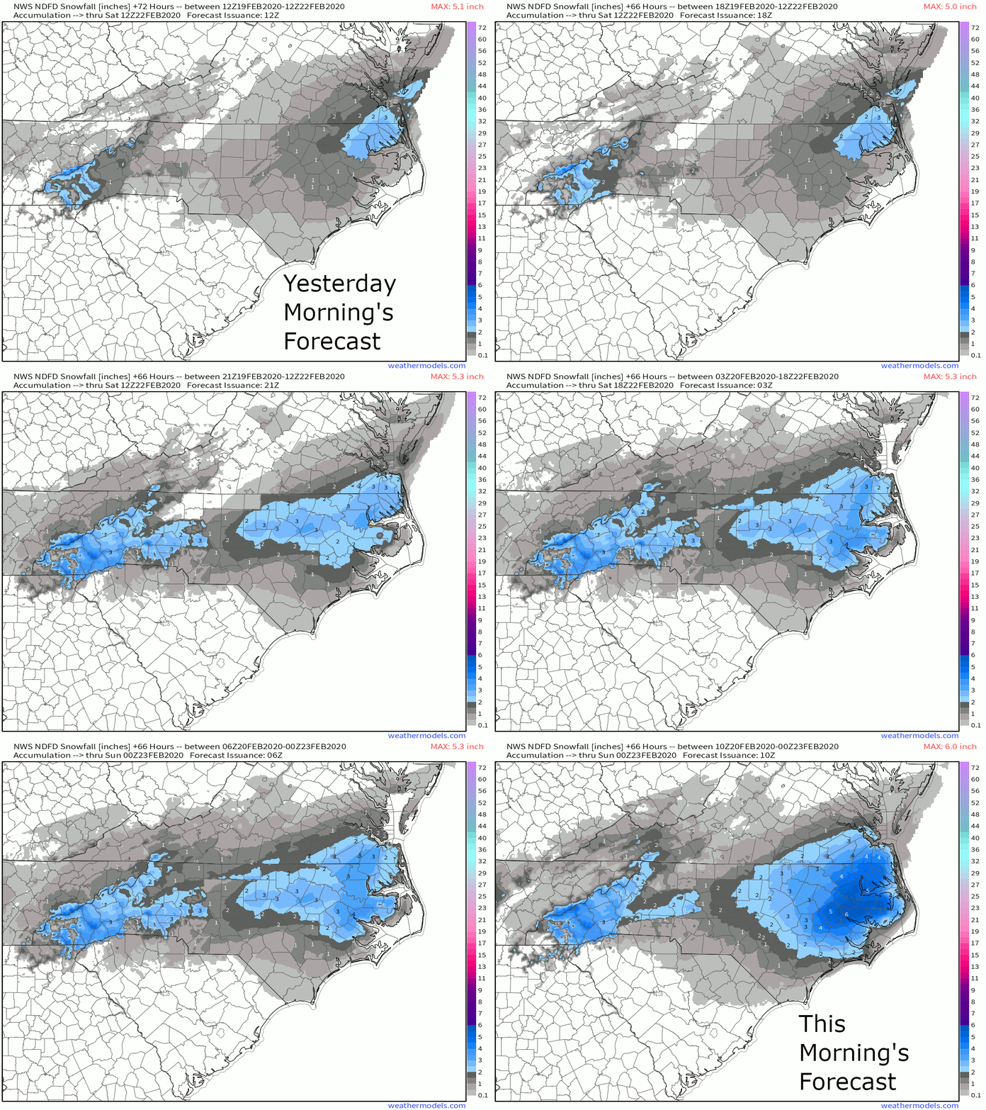
A similar story can be found in NWS forecasts for snowfall totals, shown in the loop above (from yesterday morning’s forecast to this morning’s forecast). It’s clear that forecasters and forecast models had the jackpot regions pretty well nailed down yesterday, but neither (except the NAM) were bullish enough on the totals in those jackpot areas until it became evident what was transpiring over TX/LA.
Now that we’ve explored why forecasts for snow in NC have been increasing, let’s take another shot at a snowfall accumulation map.
You’ll notice that this one looks similar to the last one, except that the totals have been bumped up a bit pretty much everywhere, but especially over eastern NC. I suspect a few spots might be able to break the 6″ mark in this area, but I think overall 3-6″ is a good bet. The highest totals, as always, will be found in the higher terrain of NC closer to the TN border.
Snow quickly departs early tomorrow morning, leaving cooler and drier conditions for the weekend.
-Jack
