Heat To Build Across The Eastern Two Thirds Of The Country To End June
Hello everyone!
Daily showers and thunderstorms will continue to pop up across parts of the Plains, Midwest, and Southeast over the next week or so as a typical summertime weather pattern rolls on. Some of these storms will become severe each evening, but no major severe weather outbreaks are expected. Look for severe weather coverage in tweet form each morning, then a few realtime tracking tweets each evening. I’ll leave the blog for looks at the larger weather pattern, and any large scale systems that might be regionally impactful (i.e. more than severe thunderstorms in a single state). This post will start off that trend, and will take a look at building heat over the Plains, Midwest, and East Coast to end the month of June and kick off July.
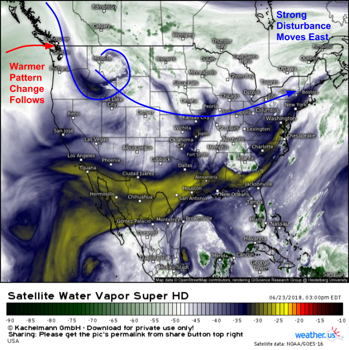
GOES-East water vapor satellite imagery shows a pattern change in the works this afternoon. A strong disturbance is diving southeast out of the Rockies. This disturbance will be strong enough to shake up the pattern across the US, which will usher in much warmer temperatures for the eastern two thirds of the country. This transition will take a little time, but by next week, the Midwest will be seeing heat index values over 100 degrees, with heat reaching the East Coast by next weekend.
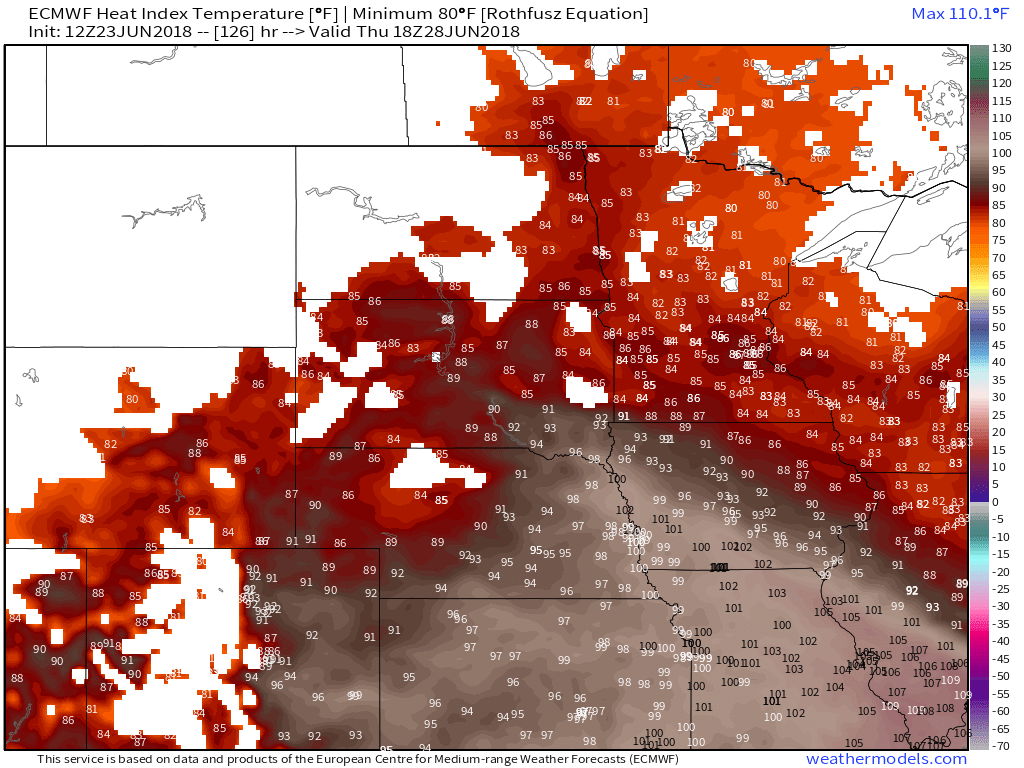
This map shows the forecast heat index on Thursday afternoon. Note the wide swath of values over 100 degrees from Iowa southeast into Missouri and southern Illinois. High temps in the 90’s and oppressive dew points in the 70’s will combine to create these dangerous heat index values. To stay safe from heat related dangers, try to limit outdoor strenuous activity during the heat of the day in these areas, and make sure you drink plenty of water.
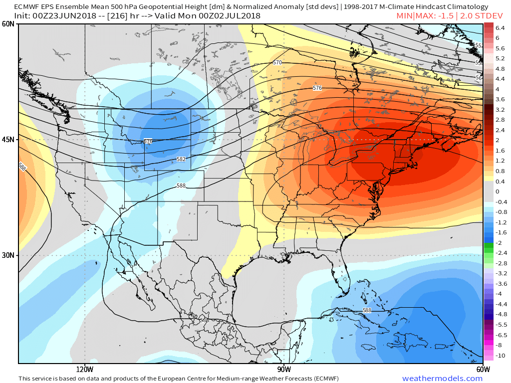
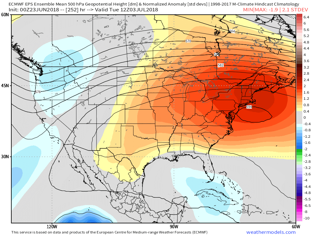
By next weekend, the upper level ridge responsible for the Midwestern heat will expand towards the East Coast. 500mb height forecasts in excess of 594dm (5400m) indicate the potential for intense heat from the Mid Atlantic north into parts of the Northeast. Curious why upper level ridges are signs of possible heatwaves? This article from last fall explains the science behind that phenomenon.
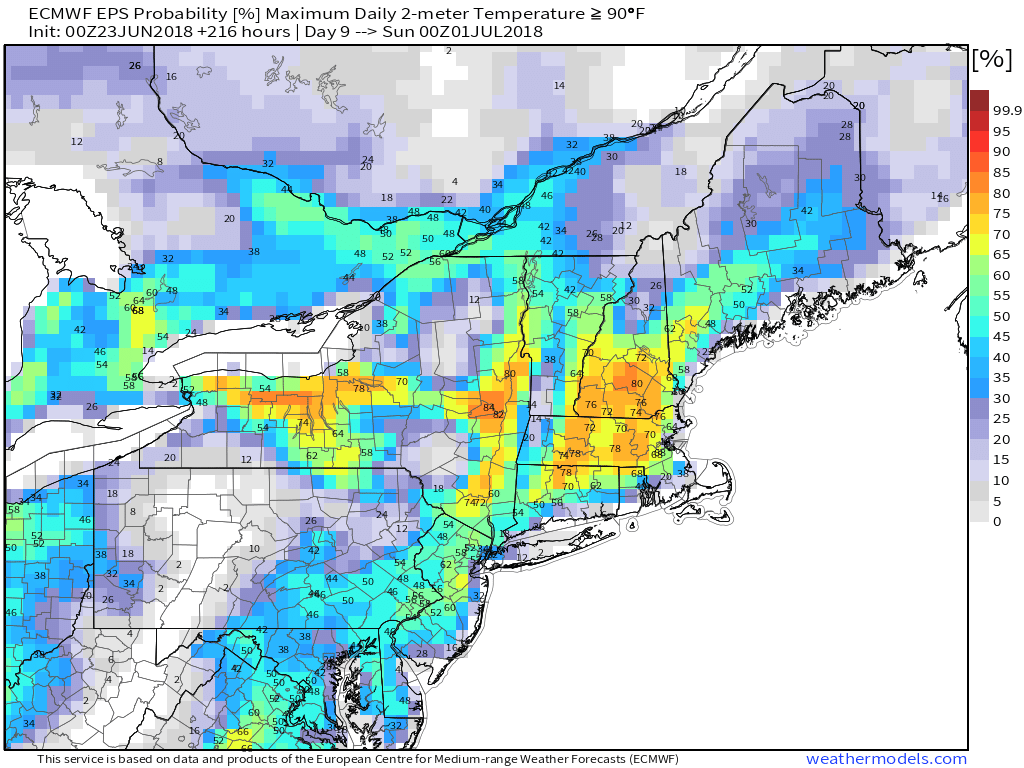
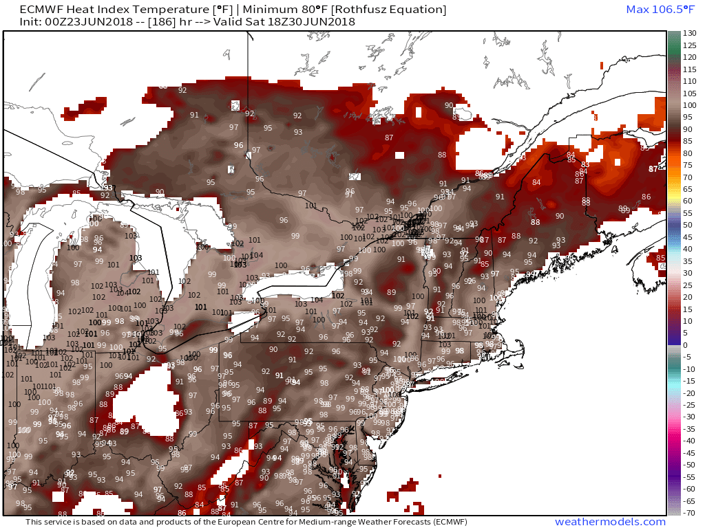
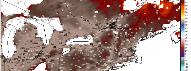
EPS ensemble forecasts for next weekend (Saturday pictured) show high potential for hot weather (temps above 90) for much of the Northeast outside of coastal and high elevation areas. The hottest locations are likely to be those that downslope on southwesterly winds. Downsloping, the process that occurs as air travels down the slope of a mountain, results in warming which can significantly enhance temperatures for places like Albany (downslope of the Catskills), and Southern New Hampshire (downslope of the Berkshires). The locations with optimal downsloping will vary depending on the exact wind direction. If winds end up being more westerly, interior Massachusetts and the Hudson river valley will become the favored downsloping locations. Depending on the exact wind and cloud cover situation, there’s even a chance that some places hit the 100 degree mark.
Regardless of exact high temperatures, the heat combined with humidity will make for uncomfortably high heat index values across the Northeast on Saturday afternoon. Heat indexes in excess of 90 degrees will be very common, with some areas seeing heat indexes over 100 degrees despite highs only in the 90’s.
ECMWF ensemble forecasts for early next week show that ridge continuing to stick around in the Northeast, while also expanding back towards the Midwest. As of now, it looks like warmer than normal weather is likely to stick around into July, though it’s important to note that the presence of upper level ridges don’t guarantee hot weather. Temps at any given location on any given day will depend on the influences of cloud cover, terrain, and any nearby bodies of water that might have a cooling sea or lake breeze effect.
As I mentioned before, showers and thunderstorms will continue to pop up, especially on the northern side of the ridge. More widespread and substantial severe thunderstorm activity is possible across the Midwest and Northeast once the ridge begins to retrograde sometime during the first half of July. I’ll have much more on that as we get closer.
All graphics in this post with the exception of the satellite image are from weathermodels.com, though you can find much of the same information on our free weather.us model site.
-Jack
