Harvey’s Catastrophic Flooding Continues, Storm May Restrengthen In Gulf Of Mexico This Week
Hello everyone!
I’ve run out of words to convey just how bad the flooding is in the Houston area. If you’ve been paying any attention to social media, you’ll know just how bad of a situation this is. It’s a pretty darn bad situation. Unfortunately, the end of this event is still a long ways off for the Houston area. In fact, it could get much worse if some of the latest model projections verify. Those projections call for Harvey to make a second landfall as a strong tropical storm directly over the Houston area after restrengthening in the Gulf of Mexico. Let’s dig into this possibility using some of the ECMWF data that you’ll find for free exclusively on weather.us.
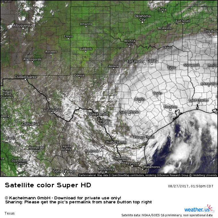
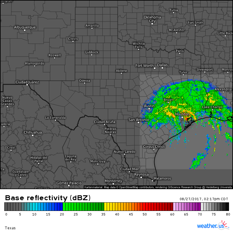
Harvey is drifting slowly southeast this afternoon as seen by HD radar and GOES-16 satellite data. This SE movement is extremely slow, but it is there, and it will continue through the night tonight. Harvey remains very close to the Gulf of Mexico as it never was able to travel all that far inland after landfall.
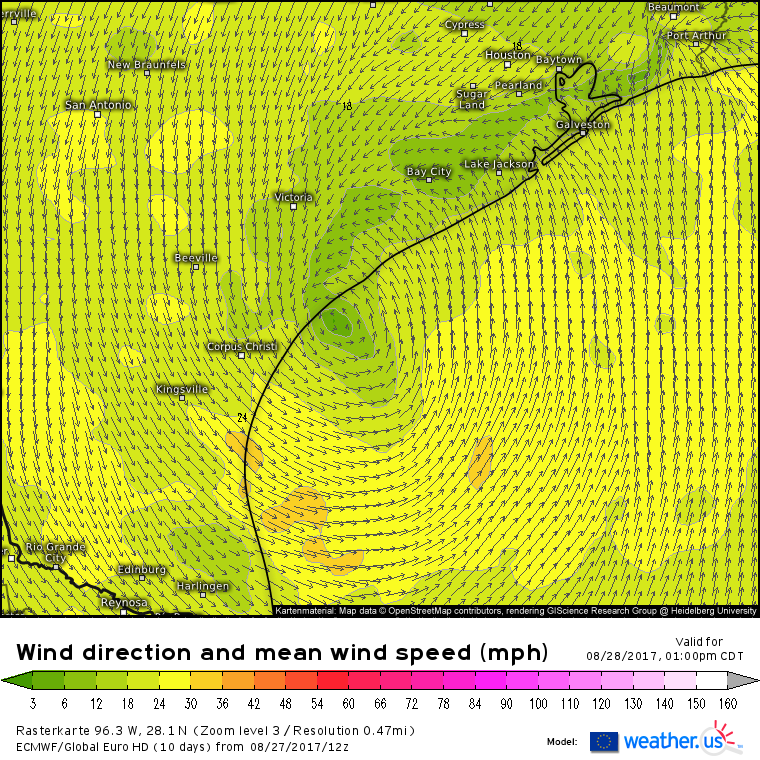
The storm is expected to re-emerge back out over the Gulf of Mexico tomorrow afternoon.
While water temperatures over the Gulf have cooled slightly since Harvey’s first landfall, they remain quite favorable for Harvey to reintensify as it moves overhead tomorrow. Other parameters we look for when forecasting intensifying tropical systems are favorable as well. ECMWF forecasts show high mid level moisture and low wind shear continuing to characterize the storm’s environment over the next few days. While these parameters, especially the shear, won’t be as intensely favorable as they were back on Thursday, some restrengthening of Harvey is expected before the system makes a second landfall near Houston.
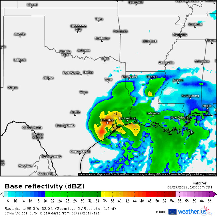
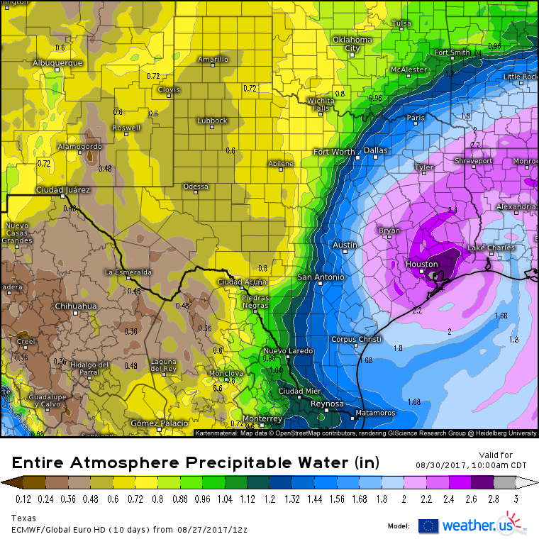
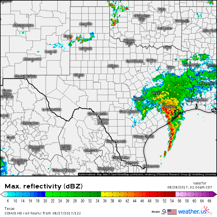
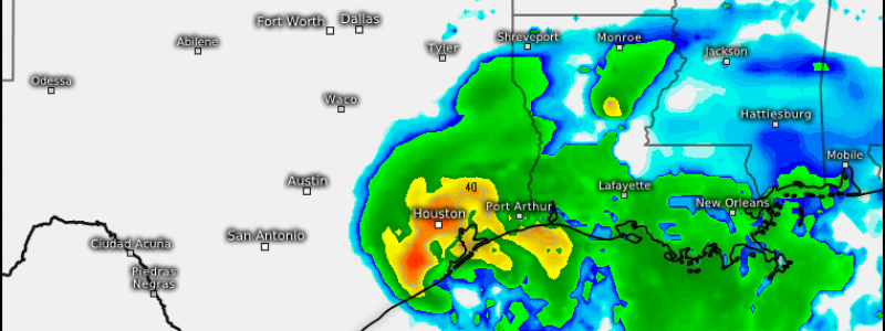
Here’s the ECMWF’s simulated radar product depicting that second landfall as a strengthening tropical storm on Tuesday night. While Houston could see gusts near hurricane force in the developing eyewall should this play out, I’d argue it’s far better than the solution depicted by last night’s ECMWF run which showed a landfall just west of the city. The sooner winds can turn northerly/northwesterly in the Houston area, the better as drier air is located to the north/northwest of the city as shown on the ECMWF’s precipitable water product.
Recent trends in guidance, especially with the ECMWF, have been towards a faster exit of the system northeast as it begins to feel the influence of a trough to the northeast. This would be great news for parts of SE TX that would get to dry out potentially as soon as the upcoming weekend (6 days from now). Compare that with some of yesterday’s guidance that indicated rains could go on for over a week. We’ll see if that trend continues and what impacts if any there could be for places like New Orleans if this system tracks farther off to the east. Right now, there’s only one run of model guidance to support this idea so I’ll wait until more data arrives tomorrow to talk about it in more detail.
The bottom line for Harvey is that the flooding threat will continue for days to come. Two additional feet of rain are expected to fall across places that have already gotten in excess of 2 feet of rain last night. Follow each band of rain as it develops with our HD radar products.
Speaking of HD radar, here’s a look at the Houston area as of 2:15 CDT. Notice how some parts of Houston especially southern and western areas are seeing a break from the rain at the moment. It appears as though there’s more dry air in the pipeline over the Gulf of Mexico. Will there be an extended break in the rain tonight?
Almost certainly not. High resolution model guidance shows this afternoon’s break in the rain coming to a dramatic end, just like yesterday afternoon’s dry weather quickly gave way to extreme flooding.
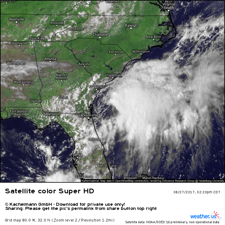
While Harvey is far and away the biggest tropical threat, it’s not the only one. An area of low pressure east of Florida has organized somewhat this afternoon, and it could become Tropical Storm Irma at some point tonight.
GOES-16 satellite imagery shows an interestingly organized system in close proximity to a cold front located over the area. Nearly tropical storm force winds are already being reported along the South Carolina coast and an area of fairly strong thunderstorm activity is located near, but not over, the approximate center of the system. As soon as that circulation can close itself off, it will likely be designated TS Irma. It will be moving northeast as it intensifies in the coming days.
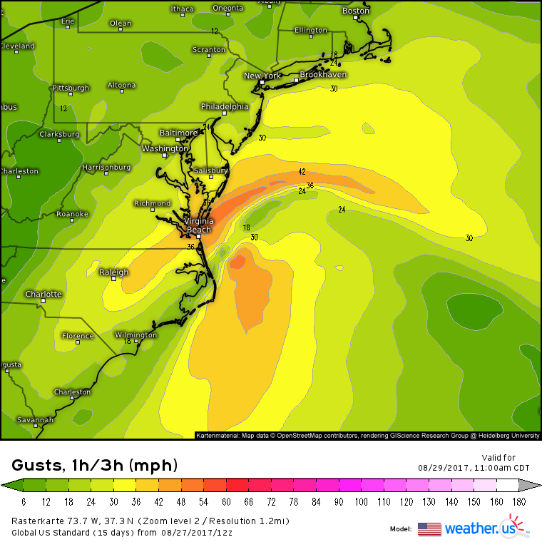
By the time the system begins to transition into an extratropical storm on Tuesday, it will be bringing 40-50mph wind gusts to portions of SE VA, E NC, and S MD. These NE winds will push water into the inlets and sounds in the Virginia Beach area. A storm surge of 2-4 feet is expected which could cause minor coastal flooding issues in typically susceptible areas. There will be some rainfall associated with this system though it will likely remain in the 1-3″ range as it quickly moves ENE. The fast motion will preclude any serious flooding issues. All in all, this will be a “nuisance” storm that is unlikely to cause any serious damage. That being said, it will bring some noticeable impacts to the coastal Mid Atlantic region on Tuesday.
Many more updates are forthcoming with regards to both Harvey and the Mid Atlantic system in the coming days! The next one will be posted here tomorrow morning.
-Jack.
