Great Lakes Cutter Ends A Long Stretch Of Quiet Weather This Week
Hello everyone!
After nearly a month of tranquil weather, big changes are coming to the atmosphere this week. A system currently entering the Pacific Northwest will result in the development of a system in the Plains that will move northeast through the Great Lakes early this coming week. This system will bring rain, snow, and cooler temperatures to a wide swath of the eastern 2/3 of the country, ending the long stretch of warm and dry weather we’ve seen dominate since late October.
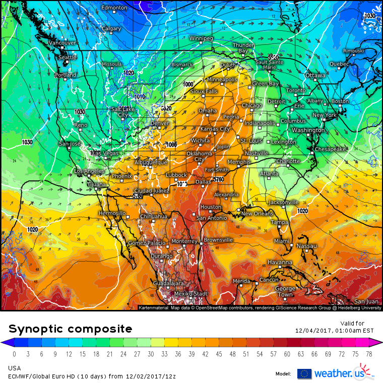
The ECMWF’s synoptic composite map (what’s that?) shows cyclogenesis occurring tomorrow night across the Plains. All the ingredients for storm formation are present and visible on the map above. The vectors indicate jet stream winds. There are two jet streaks (pockets of unusually strong jet stream winds) located in the vicinity of the Plains. One is cyclonically curved from San Francisco to Las Vegas to Denver, while the other is anticyclonically curved from Bismarck to Thunder Bay to Ottawa. The area between these two streaks, the Great Plains from South Dakota to Kansas, is a favored location for lifting based on the jet stream. The black lines indicate 500mb heights. A sharp dip in the 500mb height field is noted over the Rockies where the black lines bunch together. This indicates the presence of a shortwave trough, to the east of which (over the Great Plains) air rises. Finally, the shading indicates the presence of a tightening thermal gradient between cool air associated with the trough, and warm air flowing north from the Gulf of Mexico.
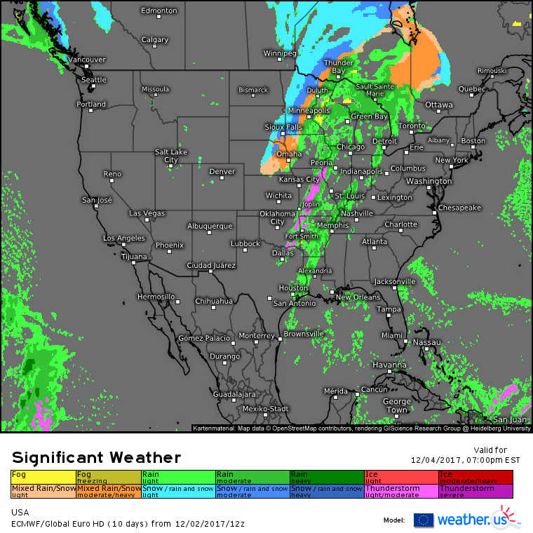
As it develops, this system will bring a range of impacts early this week. To the south, ECMWF significant weather maps show thunderstorm potential along the cold front. Due to a lack of strong instability, the severe weather threat from these storms will be minimal. To the northeast of the storm, steady rains are expected as parts of the Great Lakes will be too warm for snow and too cool for thunderstorms. Snow will fall to the west of this system, across parts of Nebraska, South Dakota, and Minnesota, but accumulations should remain in the 2-4″ range. Higher totals will be found in Canada as the storm wraps up on Tuesday.
The storm will intensify further as it moves into Canada, eventually becoming a fairly powerful storm. Its most intense impacts will remain north of the border, but the system will push a cold front all the way down to the Gulf Coast by Tuesday. Showers and non-severe storms are expected along this front, and behind it you’ll notice much cooler temperatures.
Those cooler temperatures will be moving in on gusty WNW winds on Tuesday. Behind the cold front, winds could gust over 50 mph in parts of the Great Lakes. Gusts in the 30-40 mph range will be much more widespread as far south as Texas. While these winds won’t be strong enough to cause widespread issues, scattered power outages are likely. These WNW winds and their cold air passing over the warm waters of the Great Lakes will bring another impact along with this system: lake effect snow.
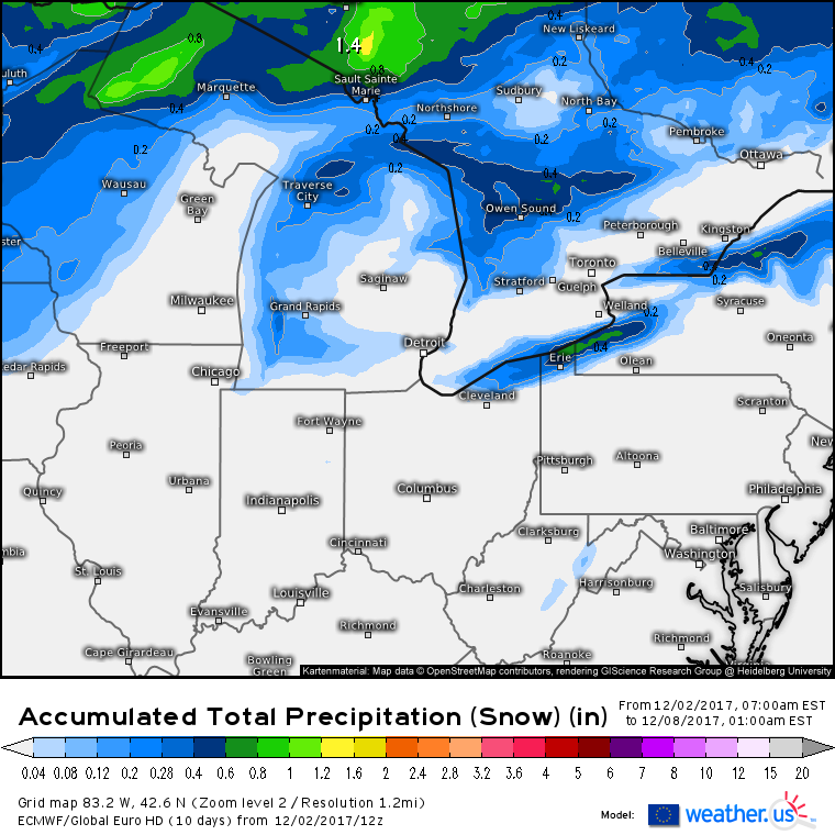
ECMWF forecasts show lake effect snow bands lingering well past the cold front. By Wednesday night, snow will still be falling downwind of the lakes as cold air continues to pour south. However, because this airmass is polar and not arctic (think cold instead of COLD), snow won’t be overly heavy. 
Over the course of several days of lake effect snow, accumulations are likely to total 3-6″ downwind of Erie, Huron, and Ontario while 1-3″ will fall downwind of Michigan. Lake Superior will see snow from the system itself, in addition to lake effect snow, so accumulations will be much higher in parts of northern Wisconsin and Minnesota.
The system’s direct impacts will be all wrapped up by midweek, but its indirect impacts will linger through the rest of the month as it will be a significant contributor to a large scale pattern change. For more information on that pattern change, its timing, and its impacts, click here.
-Jack


