Fast Moving Storm To Bring More Heavy Rain And Snow To Much Of The East
Hello everyone!
This morning’s blog will look at the next storm system set to bring heavy rain and snow from the Southern Plains through the Eastern states. The system appears to be a fast-mover, which will keep total accumulations to manageable levels. That being said, it won’t take much heavy rain falling on saturated soils in Mississippi, Tennessee, and Kentucky to pose flooding concerns. On the wintry side, strong high pressure sinking south out of Canada should let snow fall farther down the I-95 corridor compared to most of this winter’s other storms. This post will outline what to expect from both parts of the system, highlighting some of the meteorological processes behind the forecast.
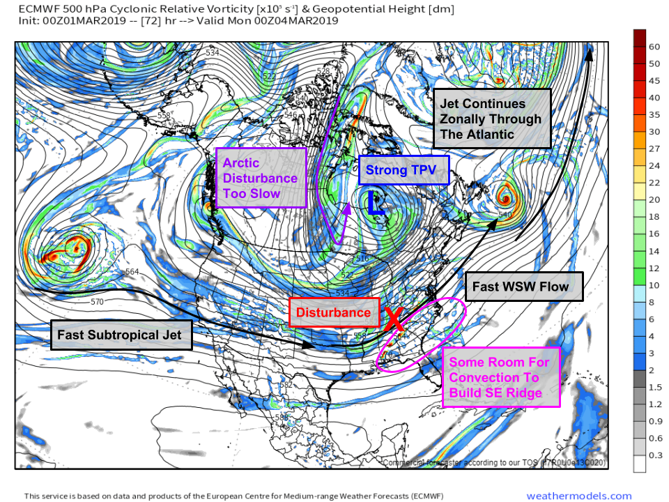
Here’s a look at the general pattern Sunday night as the storm is cruising through the Ohio Valley. The 500mb vorticity map above is a little complicated at first glance, but a few features are quite notable. First is the strong tropospheric polar vortex lobe over Hudson Bay. This is basically a strong area of upper level low pressure associated with cold air. Westerly flow on the south side of that system, along with fast westerly flow associated with the Subtropical Jet coming in from the Pacific, and fast westerly flow over in the Atlantic, will keep this disturbance cruising along at a fast pace. There is some room for strong thunderstorms in the Southeast to release heat into the upper atmosphere such that the southeast ridge builds up a bit, but this would only affect the track of the system slightly. The Arctic disturbance that would have turned this into a bigger storm will be too late and unable to catch up with the southern system, so this is not going to turn into a blizzard. Map via weathermodels.com.
The storm will first emerge onto the Southern Plains early Sunday morning. The low will be developing over NE Texas, while strong Arctic high pressure sinks down the eastern side of the Rockies. The pressure gradient between the strong high and the developing low will help support strong winds over parts of Kansas, Oklahoma, and Missouri on Sunday morning as moderate snow is falling. The combination of falling and blowing snow will make travel quite difficult in these areas. Several inches of snow are likely to fall in these areas before the storm moves east on Sunday afternoon. Map via weathermodels.com.
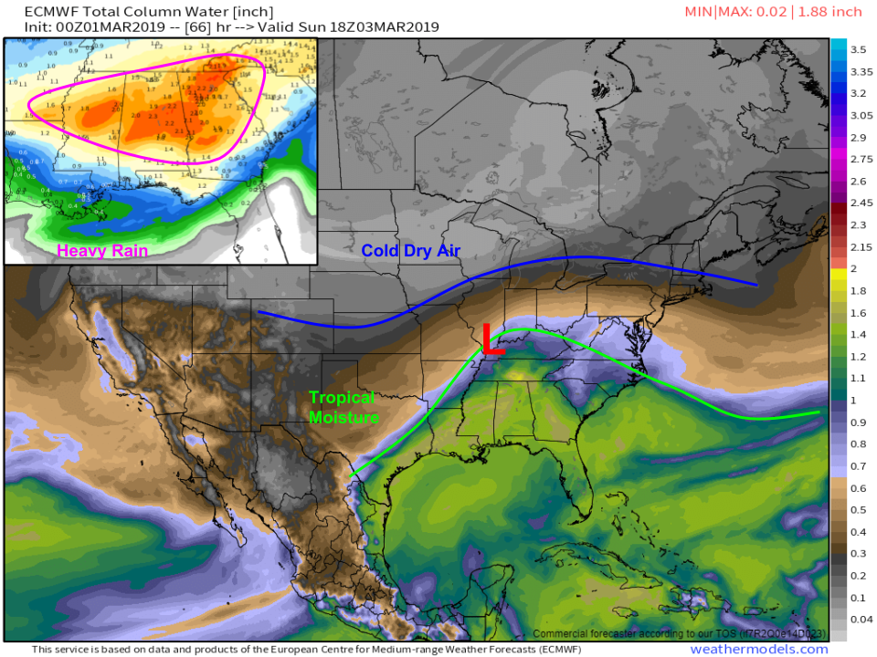
Here’s a look at the setup for Sunday afternoon. Note the storm has already moved several hundred miles from NE Texas into the Ohio Valley. As I discussed before, this will be a very fast moving system so no one area will see more than 8-12 hours of precipitation. The storm will be pulling Gulf moisture as it starts to move farther east, which will result in another round of heavy rain for already-waterlogged parts of Mississippi, Alabama, Tennessee, and Georgia. A general 1-3″ of rain is expected in these areas, but small scale thunderstorm dynamics will result in locally higher/lower totals. To the north, our precipitable water map shows plenty of cold dry air that can be fed south to support snow on the storm’s northern edge. Map via weathermodels.com.
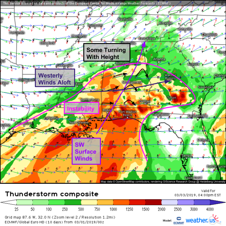
Any time you see a storm cutting through the Ohio Valley this time of year, you have to worry about severe weather in the Deep South. A look at our Thunderstorm Composite product from the ECMWF shows enough instability over Southern Mississippi, Southern Alabama, and Southern Georgia to support thunderstorm activity, while strong winds aloft will help turn those storms into potential severe weather threats. Given that surface winds are out of the southwest, we won’t have enough turning with height to support widespread tornadoes (though a few can never be ruled out). That said, winds do get much stronger with height so enough speed shear will be present to support strong damaging winds, especially in any linear storm structures. Storms will weaken as they move into Eastern Georgia later Sunday night.
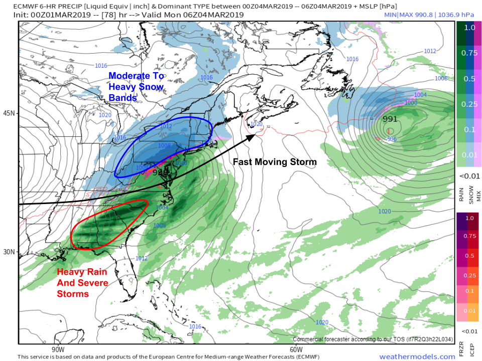
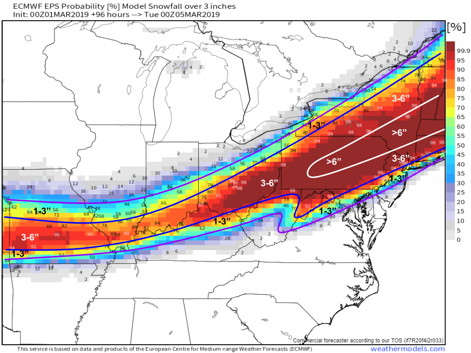
By Sunday night, the storm will be rapidly racing through the Mid Atlantic. Heavy rain and severe storms will be moving offshore in the Southeast, while a band or two of heavy snow impacts the Northeast. While the snow bands are likely to be heavy, they won’t linger in any one place for too long, which will minimize their overall ability to drop more than 8-10″ of snow even along the axis of heaviest snow. Map via weathermodels.com.
Here’s a look at approximately how much snow to expect from this system as it zooms east on Sunday night. The best banding and thus highest totals will stretch from Central PA through SE NY into New England. This is where 6-12″ are possible. Because of the fast storm motion, I don’t see more than 12″ outside of perhaps one or two mountain towns in the Catskills/Berkshires where upsloping gives an added boost. Most areas can expect a solid 4-8″, with lighter amounts to the southeast due to mixing, as well as to the northwest due to a lack of dynamics and moisture availability. More precise snow forecasts can be found at weather.us by typing your town into the search box, as well as at weathermodels.com by selecting the NWS NDFD snowfall parameter in either the animator or comparator. Map via weathermodels.com.
-Jack
