Fall Cold Front To Bring Severe Storms To Part Of The Northeast Today
Hello everyone!
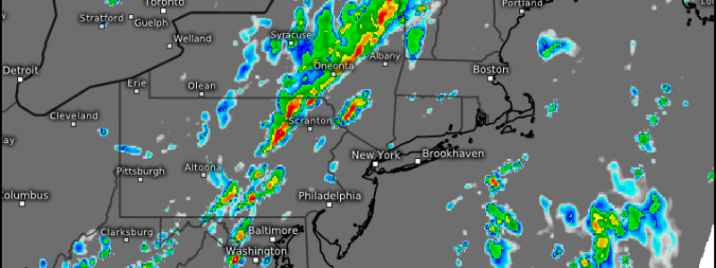
Today’s primary area of interest weather-wise will be severe thunderstorms along a cold front in the Northeast. The front is currently draped from Ohio through Kentucky, extending all the way down into Texas. By tonight, it will have cleared the New England coast, settling down into the Mid Atlantic. A squall line is likely to form along this front, with gusty winds being the primary severe weather threat.
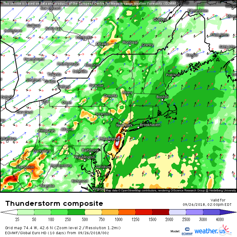
Here’s the ECMWF’s thunderstorm composite map showing wind profiles and instability today. Notice how instability is limited. There’s plenty of cloud cover over the Northeast this morning, and this combined with the lower sun angle at the end of September will limit how hot temps can get, which in turn will limit instability. However, mid/upper level winds will be strong enough to fuel severe weather even in the absence of very strong instability. Notice the length of the vectors on the map above, indicating the magnitude of the wind. There are some strong winds aloft today!
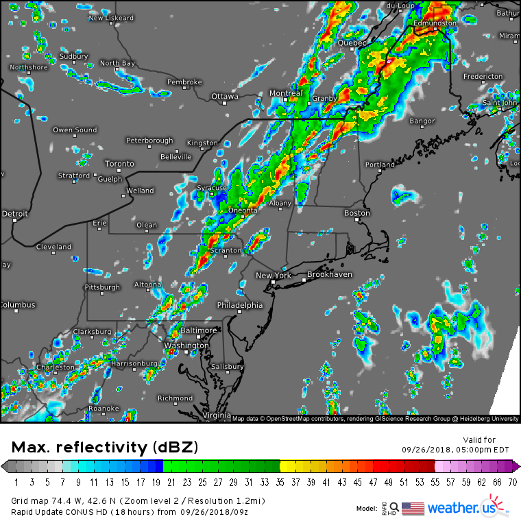
Because of the forcing mechanism for today being a strong front, a line of storms is the preferred storm mode. This simulated radar map valid at 5 PM this evening highlights that. The farther south you go, from the Catskills down towards DC, the weaker the front’s forcing will be. Therefore, the storms will be more of the “classic” cellular mode. The primary threat with linear storm modes is always gusty winds, though tornadoes are possible if the wind field is set up right. What does it look like today? A careful analysis of the thunderstorm composite map above will show some turning with height, but that can easily be quantified with the map below.
This map depicts Storm Relative Helicity in the low levels of the atmosphere. What is SRH? It’s basically a measure of rotation. The more SRH, the more rotational energy there is in the atmosphere. Notice the SRH maxima in Vermont, with lower SRH values as you head farther southwest towards NE PA. A phenomenon known as “terrain channeling” where southwest winds turn southerly as they encounter the terrain of the Adirondacks/Champlain Valley/Green Mountains will help contribute to that high rotational energy. The more winds change direction with height, the more rotational energy is available for thunderstorms. With winds out of the southwest aloft, there isn’t much change with height if low level winds are also southwesterly (which will be the case in most areas today). But if you change those winds to southerly, now you have some change, and some rotation. All that to say, watch out for embedded rotation in the line as it moves through Northern New England. The CT valley and mountains of NH/ME will put on a similar effect, with locally high SRH expected in those areas as well.
Storms will weaken as they move east later in the evening. Cooler and drier air will filter in behind the front tonight.
Track the storms with all the tools we have at weather.us, including HD radar, GOES-East, and lightning analysis!
-Jack


