Extreme Fire Weather In Southern California While Rain Continues In The South
Hello everyone!
Today’s weather stories will sound familiar if you’ve been watching the weather over the past few days. Strong Santa Ana winds will result in extreme fire weather across parts of Southern California, a stalled front will bring rain to parts of the Gulf Coast and Southeast, and Lake Effect snows will continue downwind of the Great Lakes.
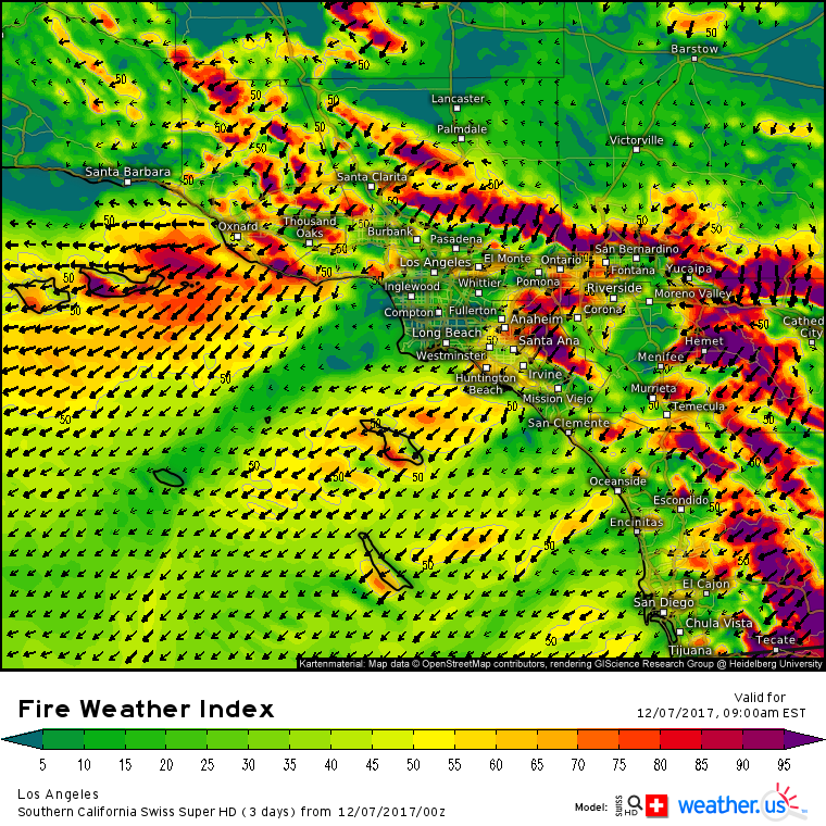
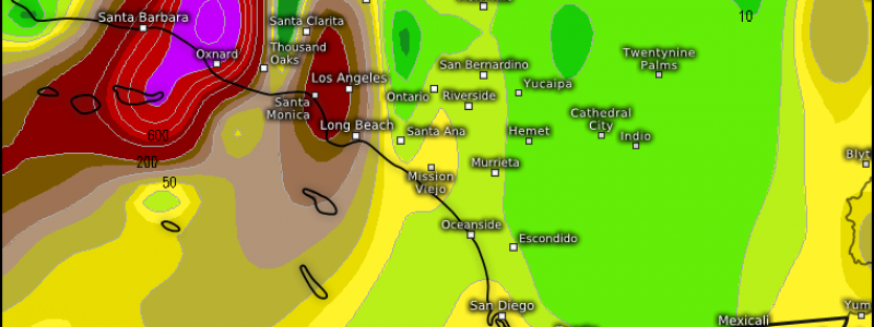
Santa Ana winds will ramp up again today, perhaps to a level not yet seen with this event. County level 1x1km Swiss Super HD model forecasts show wind gusts on the ridges pushing hurricane force, a brutally hard challenge for firefighters trying to contain the blazes. Expect fires to continue to expand rapidly today, and any new fires will become serious situations very quickly.
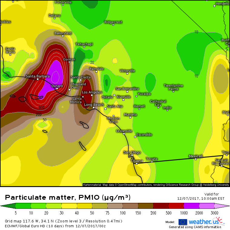
Flames won’t be the only fire-related issue in Southern California today. Where there’s fire, there’s smoke, and smoke is extremely harmful in high concentrations. ECMWF aerosol forecasts show very high levels of particulate matter, a type of pollutant associated with smoke that can find its way into your lungs and cause problems. Be aware of the poor air quality today near Los Angeles, even if you’re lucky enough not to be in danger from the fires themselves.
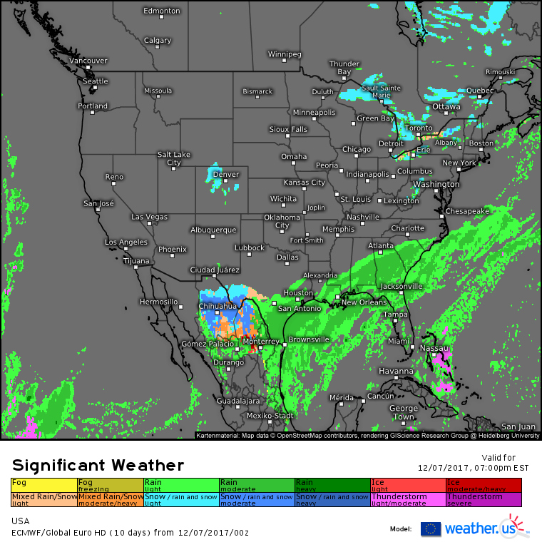
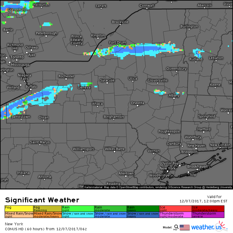
The ECMWF’s overview map highlights the other two areas of active weather today. Rain will be widespread along a stalled frontal boundary extending from the coastal Carolinas back to Texas. At the tail end of this front, rain will mix with and change to snow near the Texas-Mexico border west of San Antonio. Rain will be light enough that no major issues are expected flooding wise. Farther north, lake effect bands will continue across the Great Lakes, though as the day progresses, the focus for heavy snow will be shifting east away from Superior and towards Erie and Ontario as the bone-dry Canadian airmass moving in will be too much for the lakes to overcome.
The bands downwind of Erie and Ontario will continue to be fairly robust. Snow will continue to fall at rates of 1″ per hour or more, with storm total accumulations still looking to fall between 1 and 2 feet for those located under the heaviest parts of the band. Snow will continue into this evening, and may expand in coverage as an upper level disturbance approaches from the west.
Elsewhere across the country, high pressure will bring quiet weather to the Pacific Northwest, and cool northerly flow over the Plains will ensure a dry but chilly Thursday.
For more information about your local forecast: https://weather.us/
For more information about the local forecast for ME/NH: https://forecasterjack.com/2017/12/07/cool-and-quiet-weather-returns-today/
-Jack
