Early Season Snow Storm Across The Rockies Today
Hello everyone!
There’s one weather story that takes precedence this morning over some scattered thunderstorms in the plains and day 3 of a tropical low near Florida. That story is the early season snow storm cranking up in the Northern Rockies. I’ll briefly go over the timing and impacts of this system as it will be impactful for areas even outside the typical higher elevations.
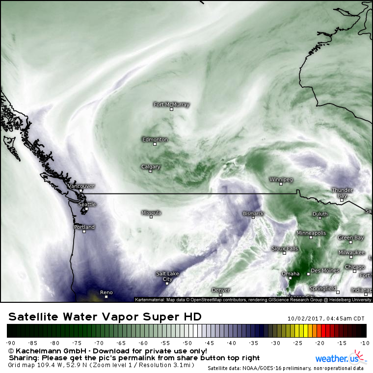
Water vapor satellite imagery (what’s this?) shows Pacific moisture streaming around the base of a deep trough this morning. This moisture is feeding into a developing storm between Calgary and Winnipeg. Northerly winds on the west side of this storm are bringing in cold air from the Canadian Arctic. The cold air and the Pacific moisture will collide over Montana where heavy snowfall will develop this morning.
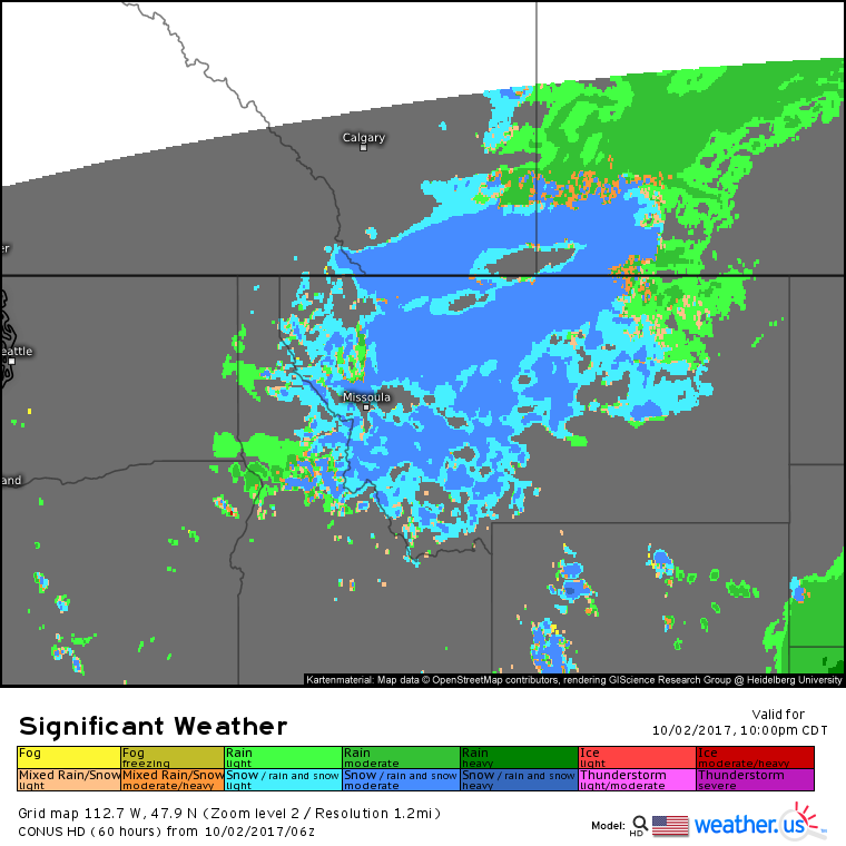
By tonight, snow will be falling across most of the northern and western parts of Montana, even in the lower elevations. Roads will become snow covered and visibility will drop, leading to slow travel conditions. How much snow can be expected?
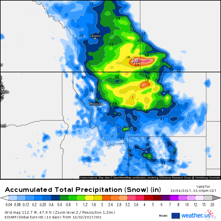
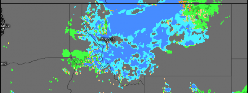
This map from the ECMWF shows how much liquid equivalent precipitation is expected to fall as snow between now and Wednesday (snow will wrap up tomorrow). To get the amount of snowfall forecast, multiply these values by a snow-to-liquid ratio. This ratio changes depending on the storm, but can range from 4:1 to 35:1. For most of Montana, snow to liquid ratios around 10:1 will be a good approximation for this event. Higher ratios will be found in the higher elevations. Assuming a 10:1 ratio, any areas inside the green color (>.6″ liquid) can expect 6″ or more of snow. Yellow areas (>1.2″ liquid) could see over a foot of snow!
By tomorrow night, the storm will drift SE towards the Dakotas and dry air will stream into Montana. This dry air will shut off snowfall and lead to improving conditions across the state.
Montana won’t be the only area getting snow early this week, another disturbance rotating around the base of the trough will have enough cold air to bring snow to the high elevations of Colorado.
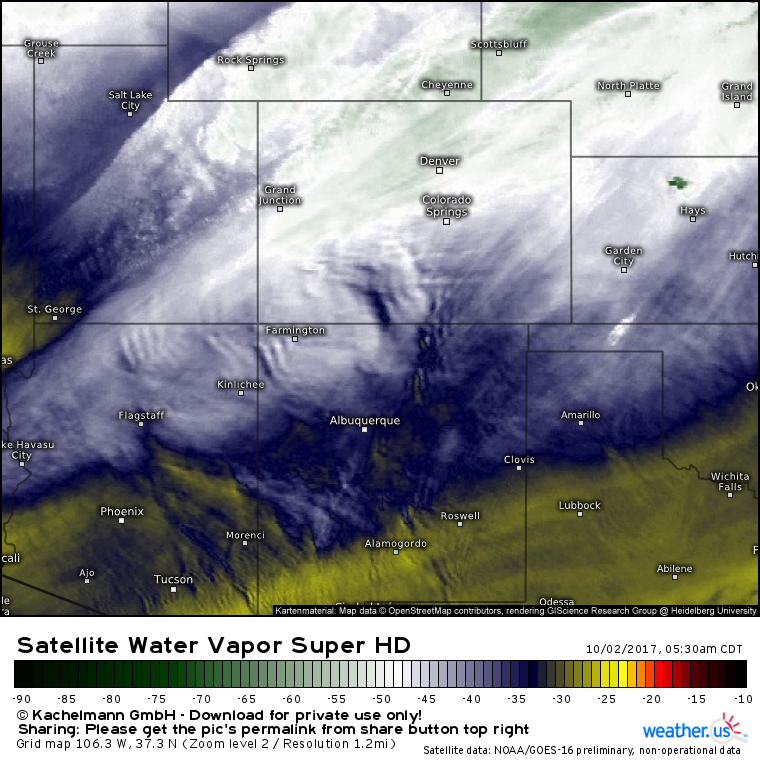
This water vapor image shows the very fast jet stream winds pushing Pacific air into Colorado. Notice the striations in the lighter shading, as well as the ripples showing interaction with mountains. Both of these signals indicate strong winds aloft. While Canadian air won’t be as readily accessible in Colorado as it will be in Montana, higher elevations don’t need a fresh tap of low level cold air to get snowfall.
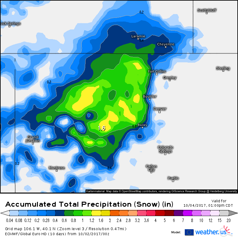
This is the same product I showed above in Montana, the liquid equivalent snowfall forecast. Note the widespread forecast for 6″+ in the high elevations west of Denver, with isolated amounts to 12″.
As with Montana, Colorado snowfall will wind down tomorrow as drier air moves down the Rockies.
I’ll have another update this time tomorrow!
For more information on your local forecast: https://weather.us/
For more information on the local forecast for ME/NH: https://forecasterjack.com/2017/10/02/another-fall-beauty/
-Jack
