Devastating, Catastrophic Flooding Disaster In Progress Today Across SE TX
Hello everyone!
Harvey continues it’s destructive drift near SE TX. While its winds have now calmed to tropical storm force, but Harvey’s real threat is the flooding. We’ve been talking about this threat for days here on the weather.us blog. Unfortunately, all of the worst case scenarios for this storm are coming true so far. In the past few days, I’ve used words such as “Devastating” and “Catastrophic” to describe the flood threat posed to the nation’s fourth largest city. Those words don’t even begin to touch just how bad this is going to get over the next few days. I’m not going to get bogged down in the nitty gritty details of exactly how these bands of rain are coming together, though that is fascinating. I want to use this space to point you to the resources you can use to track the storm. I’ll go over what the forecast is for Harvey over the next few days (Hint: more rain). I’ll also mention the potential for more tropical activity near the East Coast.
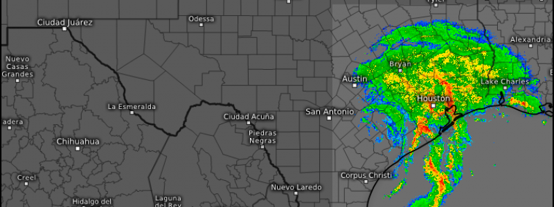
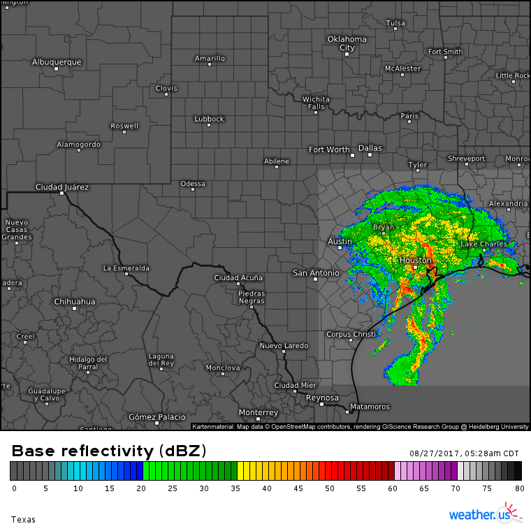
Here’s our HD radar product for the Houston area showing a worst-case scenario for flooding. The center of Harvey is that smallest curved band near San Antonio. On the east side of the center, incredible amounts of moisture are streaming inland from the Gulf of Mexico resulting in those torrential rains. You can get the latest HD radar loops here. Once you click on the link, use the small blue buttons to navigate between different data such as storm tracking and lightning.
One of the tips I want to pass along from local authorities in Houston is that you should not move into your attic unless you have an axe or a chainsaw or some other method to escape onto your roof. Hundreds of people died in Katrina because they were trapped in their attics. This is a very similar situation. Please stay tuned to information from local authorities as they have specific instructions for how to keep you safe if you’re in these areas.
Over two feet of rain has fallen in the Houston area with two to three MORE feet of rain to come.
I said in last night’s update that I wouldn’t show ECMWF storm total precip maps because they would include rain that has already fallen. However, based on latest trends in radar in observational data, I unfortunately think that the above map shows a reasonable forecast for rain yet to come through the next week.
Some model guidance indicates that Harvey’s rains won’t let up for a week or maybe even more as the storm sits in an atmospheric version of “no man’s land”. If you’re interested in checking out some of that model data from the ECMWF, you can use the menus to the left of the image to select different parameters and time frames. For now, I want to talk about Harvey’s immediate future and impacts, which could include re organizing over the Gulf of Mexico and making a second landfall near Houston.
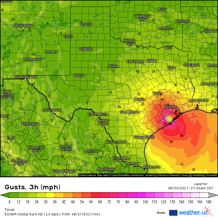
Radar loops from San Antonio show Harvey’s center is beginning to drift ever so slowly to the southeast. If the storm drifts far enough southeast, it could move back into the Gulf of Mexico. If it moves back into the Gulf of Mexico, it would be able to re organize and re strengthen as it taps into incredibly warm waters. The ECMWF shows this scenario panning out with the storm making a second landfall in Houston as a strong tropical storm with hurricane force wind gusts.
While some models like the ECMWF depict this nightmare scenario, others keep the storm over land with minimal or no strengthening. Either way, the flooding threat will continue for the next week. Keep an eye on our HD radar products, keep an ear out for instructions from local authorities, and stay safe.
Farther east, tropical or subtropical development is expected to occur off the Southeast US coast this week.
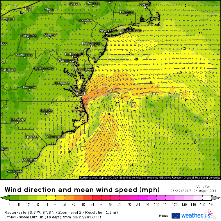
Models are in general agreement that an area of weak low pressure currently over Florida will move north and strengthen into a tropical or subtropical storm as it moves towards the Outer Banks of North Carolina. Most guidance is depicting 40-50mph NE winds developing on the backside of this low which would force water into the inlets and bays of the Virginia Beach area. While this storm will be nowhere near as strong as Harvey, it will still bring impacts such as high winds, storm surge, and heavy rains. The timing for this would be Monday and Tuesday for coastal North Carolina, the Delmarva, and the Virginia Beach area.
I’ll have more information on this storm in the coming days as it becomes a little clearer exactly what form it will take. It’s not yet known if the system will be tropical, subtropical, or extratropical in nature.
More updates on Harvey and the NC storm this afternoon/evening!
-Jack


