Dangerous Major Hurricane Irma Approaches Southern Florida
Hello everyone!
With Major Hurricane Irma beginning to approach Southern Florida, that’s the story we’ll focus on for the next several days until the storm is no longer a direct threat. If you’re just curious about today’s weather in your town, head on over to weather.us for all the forecast information you need.
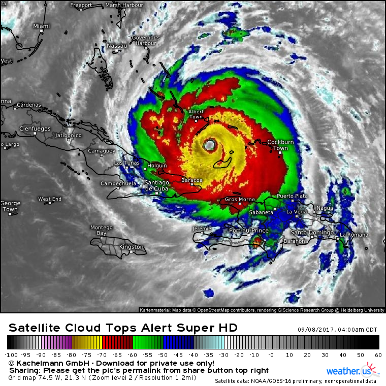
After a bit of a disheveled look overnight, Irma has regained a powerful appearance on satellite this morning.
Cloud tops have been cooling and are now approaching -80C in the eyewall. The system has continued to become more symmetric and it has filled in some of the gaps that developed in its inner core last night. Overall, the satellite presentation and trends in Irma indicate that the system reshuffled its inner core last night, and is ready to get back on track today.
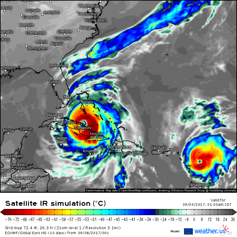
The ECMWF simulated satellite product shows Irma moving towards the northern coast of the island of Cuba tonight. Whether the storm actually makes landfall is still unknown, but landfall or not, northern Cuba will see the full force of Irma’s inner core tonight. After moving west into/near Cuba, the system will make a turn to the north.
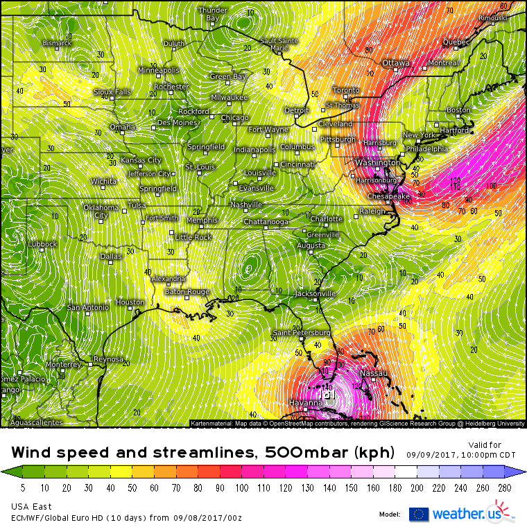
This turn to the north is likely to occur tomorrow afternoon/evening. There is one system primarily responsible for this turn and that is the upper level disturbance over Alabama. This small disturbance will be enough to pull Irma north and it will determine Irma’s track from now until it dissipates over the interior Southeast in the middle of next week. This turn to the north is what’s going to make this storm so especially dangerous for Florida, because as it moves north, it’s going to bring severe impacts to the entire state, not just a few counties.
One other thing to note with regards to Irma is its size. The wind field is extremely large, and constantly expanding. The ECMWF shows what this means for Irma’s impacts post landfall.
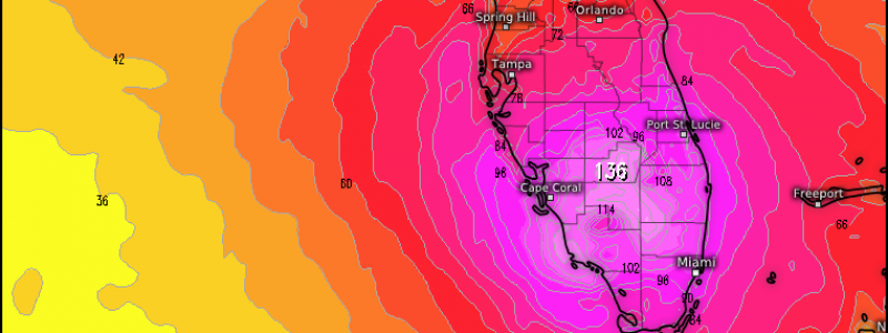
This is the ECMWF’s wind gust forecast for Sunday evening, several hours after landfall. Notice the radius of hurricane force (74 mph+) wind gusts. They extend from the keys all the way up the East Coast to Cape Canaveral over to Tampa and all the way down the west coast including all the inland areas in between. I think it’s extremely safe to say at this point that everyone who lives in Florida outside of the Panhandle will see hurricane force wind gusts from Irma, and some folks right near the center will see gusts much higher.
Impacts from Irma will continue well inland through the southeastern states as the storm moves north early next week. I’ll have a full update this evening on all things Irma that will include my thoughts on that as well as why I think the system is not yet done strengthening.
If you’re interested in more information about your local forecast, head on over to weather.us.
If you’re interested in more information about the local forecast form Maine and New Hampshire, check out my local blog post from this morning.
Jack Sillin is a weather nerd and forecaster who regularly writes for weather.us and 33andrain.com.


Thank you for this information. Very helpful. Regards from Miami-Dade County