Dangerous Hurricane Harvey Bearing Down On The Texas Coast
Hello everyone!
Harvey is now making its final approach to parts of the Texas coastline. Any preparations should be finished at this point as the storm’s outer rain bands are already moving ashore in Corpus Christi. If you’re in the Houston area, you have just a few hours this morning to rush to completion any preparations. If I were in the Houston area, I’d either be evacuating, or making sure I had enough supplies to last well over a week as Harvey is expected to stall out over the area this weekend. Now that the storm is basically ashore, we’ll turn much more to using observations and radar data, and will focus less on model data. However, at the end of this blog post I will mention a trend in the latest model data that is very worrisome. Stay tuned for more on that.
Our first stop this morning, as always will be GOES-16 satellite imagery.
For a storm this strong and strengthening this fast, Harvey has a less than stellar look on satellite. A central dense overcast of very strong thunderstorms is noted over the center (blue circle) while the most intense convection is in the eyewall (pink center). There isn’t a totally cleared out eye on satellite data though. This indicates that the storm hasn’t reached its peak intensity. It’s still working on it. Likely the only thing keeping it from getting there is a little bit of mid level dry air wrapping into the storm from the south/southeast (orange arrow). However, even with that dry air, this storm still has about 18 hours left over water, and it will be intensifying every minute.
I’ll be watching GOES-16 satellite trends all day, and you can too! Click the link and you’ll see a loop of the IR satellite product which shows the temperatures of the cloud tops. The colder the cloud top, the higher the storm, and the stronger the storm. Click the map to zoom in/around, and use the menus to select other satellite views such as Water Vapor, or, when the sun comes up, visible.
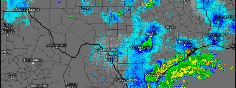
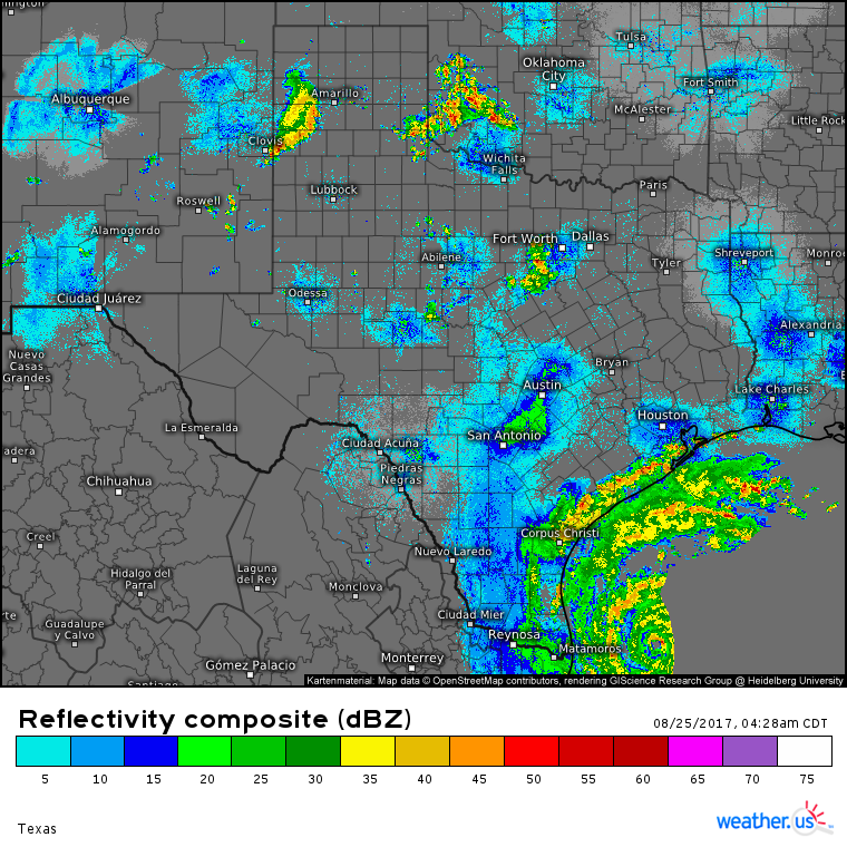
The storm is now close enough to the coast so that we are able to see it on radar.
The eye of the storm is still offshore, but the outer spiral bands are already moving into the Texas coast. The above image is a radar composite, meaning it stitches together all the images from all the radars. You’ll notice it’s pretty low resolution though. You can change that! Click this link to see high resolution imagery from the Brownsville radar which shows the eye moving closer to the coast. You can zoom in by clicking the map, and you can select different radar sites (for example Corpus Christi) by clicking on the small yellow circles you see on the image. Alternatively, you can use the menus to the left of the image to navigate.
So what’s ahead for today? Conditions will rapidly deteriorate in SE Texas as the center of the storm nears landfall. Winds will pick up to hurricane force, the Gulf of Mexico will rise 6-12 feet above its normal levels in some areas, and rain will be coming down as hard as one can imagine. This evening and into tonight will not be the time to do anything but hunker down if you have not evacuated. Driving, even for a minute will be an extremely dangerous proposition as roads flood and debris is blown around by the winds. Conditions won’t subside much tomorrow except for areas right along the coast, which likely will “only” see category 1 winds as opposed to category 3 winds.
 This is the HRRR model showing what the radar could look like this evening. Nearly the entire Texas coastline will be seeing heavy rains, high winds, and storm surge. Areas well to the northeast of the center could see tornadoes in the outer spiral bands as well. Even if you’re hundreds of miles from the point of landfall, you’ll still feel impacts that could be quite severe.
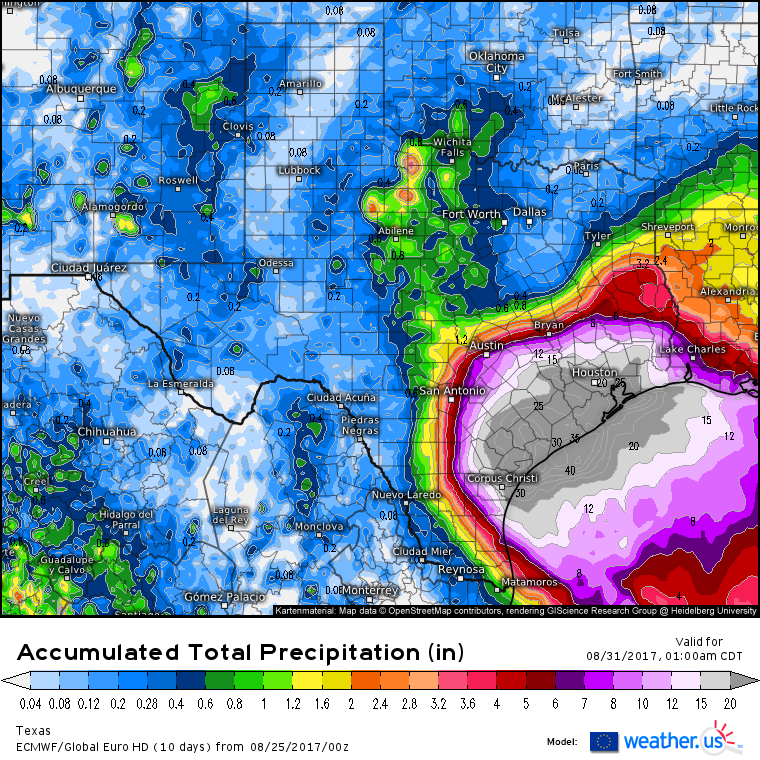
What about the rainfall forecast? It’s as dire as ever for parts of SE Texas.
Last night’s ECMWF data suggested rainfall amounts in excess of 40″ are possible between Corpus Christi and Houston. The worst of the rain appears to have shifted southeast of places like San Antonio and Austin though they will still see hefty rainfall totals near 6″. How much rain will fall in your town? Click this link then type in your town and select “accumulated precipitation” to compare all the model forecasts. If they all agree on a pretty similar number, you can have high confidence that you’ll see that much rain, while if they disagree, there remains some uncertainty. Always prepare for the worst and hope for the best.
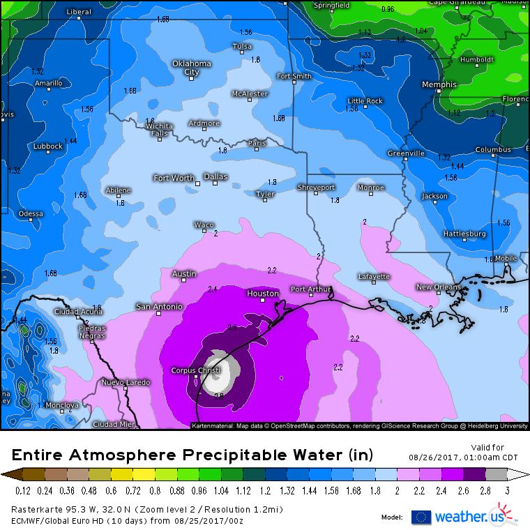
Speaking of ECMWF data, there’s lots of cool new stuff up on weather.us! A few of the new parameters that will be helpful for Harvey include precipitable water (that’s how much moisture is in the atmosphere), significant wave height and direction (how tall the waves are and where they’re moving), and 700mb geopotential height (this will show the features steering Harvey). You can click the map to zoom in/around, or you can use the menus to navigate. Also use the menus to choose your parameter and select your desired forecast time.
This is one of the new products, known as Precipitable Water, that indicates how much moisture is in the atmosphere. Notice how values are literally off the charts in the center of Harvey!
After Harvey comes ashore tonight with a large storm surge, ferocious winds, and a deluge of rainfall, what’s next for the system? The latest ECMWF data gives us several clues. The first step is that it will stall out over SE Texas. This is why rainfall amounts of 40″ are possible. The storm will sit and dump for days. Why is that? The storm will be stuck between two high pressure systems that are pulling the storms in opposite directions. These forces will cancel each other out leading to a net motion of zero, hence the stall.
After the stall, the high pressure system over Arizona will strengthen and force Harvey back east over the Gulf of Mexico. Model guidance suggests that it will restrengthen, potentially into a strong hurricane, before it moves NE back onto land either in far eastern Texas or over Louisiana.
Note that this is for Wednesday of next week. The track hasn’t shifted a couple hundred miles north, the storm is expected to re emerge over the Gulf of Mexico and restrengthen! This idea doesn’t have a lot of other model support, because it would be fairly tricky to pull off. The ridge would have to strengthen just enough to push it just far enough east for a trough coming south over the Great Lakes to pull it farther east. If the western ridge is too strong, the storm will turn southwest and dissipate over Mexico. If the western ridge is too weak, the storm will just continue northwest and dissipate over Central Texas. I’ll have much more on this aspect of the storm in the coming days. For today, the main focus will be on the impacts from the first landfall, near Corpus Christi.
I’ll have another update here this afternoon, but will be posting all day on Twitter and Facebook. Stay safe if you’re in the path of this storm, it means business!
-Jack


