Cold Rains In New England, Snow In The Rockies, And A Tropical Disturbance Near Florida
09/30/2017 /
No Comments
Hello everyone!
Here are the three things you need to know about today’s weather:
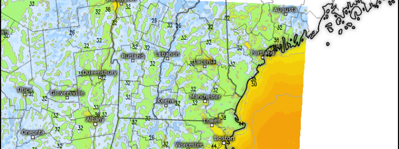
- A strong upper level disturbance continues to bring a variety of weather conditions to New England. Snow fell on Mount Washington last night as showers moved through with subfreezing temperatures at the summit. Farther south, a strong thunderstorm brought flash flooding to areas Northeast of Boston. Showers will continue to meander around the region this morning before departing off to the southeast this evening. By tonight, skies will clear, winds will calm, and temps will drop. Frost is expected across much of interior New England and upstate New York away from the Hudson Valley and the Great Lakes. Click the map in the link for county level forecasts. Be sure to move any sensitive plants inside before temps drop tonight!
- A different upper level disturbance will begin moving towards the Rockies today. Rain and snow will develop in the higher terrain of Montana, Idaho, and Wyoming this evening before expanding in coverage and intensity tomorrow. I’ll have more about the incoming snowstorm this evening.
- A tropical disturbance will continue to move up the Florida coast today. While no development into a tropical storm is expected, heavy rain and gusty winds will impact parts of Northeast Florida throughout the day today. Beyond some localized flooding in the heavier showers, no major impacts are expected.
I’ll have another update this evening that will discuss the incoming early season snowstorm for parts of the Northern Rockies.
For more information on your local forecast: https://weather.us/
For more information on the local forecast for Maine and New Hampshire: https://forecasterjack.com/2017/09/30/morning-rain-gradually-clearing-to-evening-sunshine-today/
-Jack


