Cold Front To Bring Showers To The Midwest Today While Pacific Storms Continue To Impact The West Coast
Hello everyone!
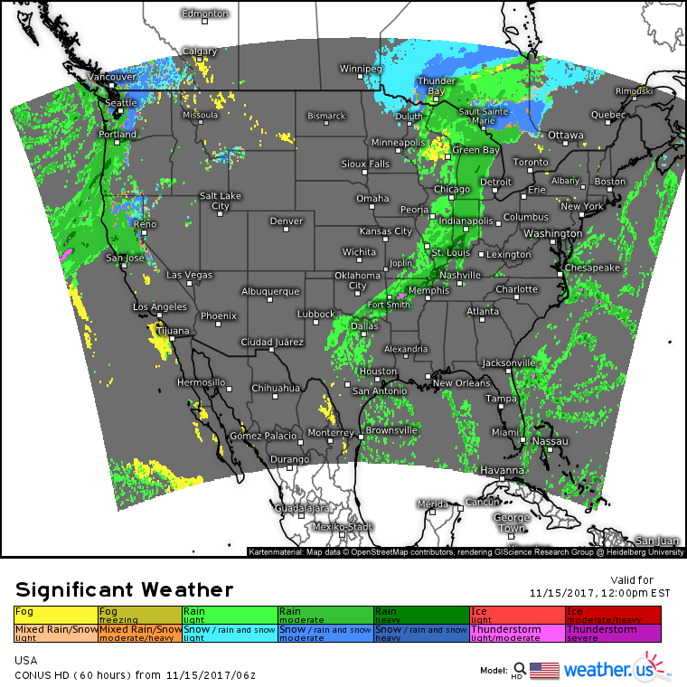
Today will feature two areas of active weather, one in the center of the country as a cold front moves east, and another along the West Coast where a Pacific storm will move onshore today, bringing rain and mountain snow.
Here’s a look at the nationwide weather map for the middle of today, showing our two systems. The Pacific storms will be much more impactful, as heavy rains falling on the burn scars left from last month’s wildfires will cause flooding and mudslide concerns.
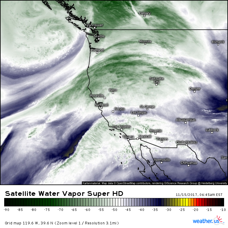
GOES-16 water vapor satellite imagery (what’s that?) shows the plume of moisture responsible for today’s heavy rains. Southwesterly winds on the southern side of a strong storm west of Vancouver are transporting tropical moisture northeastward towards the coast. The best moisture and dynamics will be focused north of San Francisco, though a smaller disturbance visible near Los Angeles could bring a few showers to Southern California.
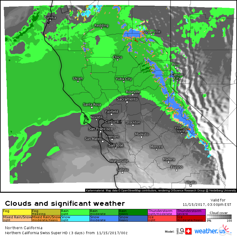
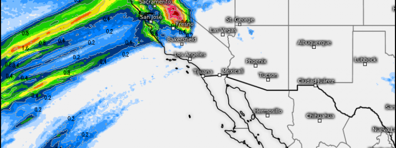
The Swiss Super HD model’s forecast for Northern California shows who is most likely to get rain and snow today. Rain will fall across the width of the state north of San Francisco, while the only areas south of San Francisco that could see precipitation will be the Sierras. Due to the tropical airmass moving into the region, snow levels will be fairly high, and accumulations will be limited to the summits and high passes. That being said, expect some serious winter driving conditions if you’re headed up and over the mountains today. County level Swiss Super HD forecasts show heavy snow along I-80 near Truckee this afternoon.
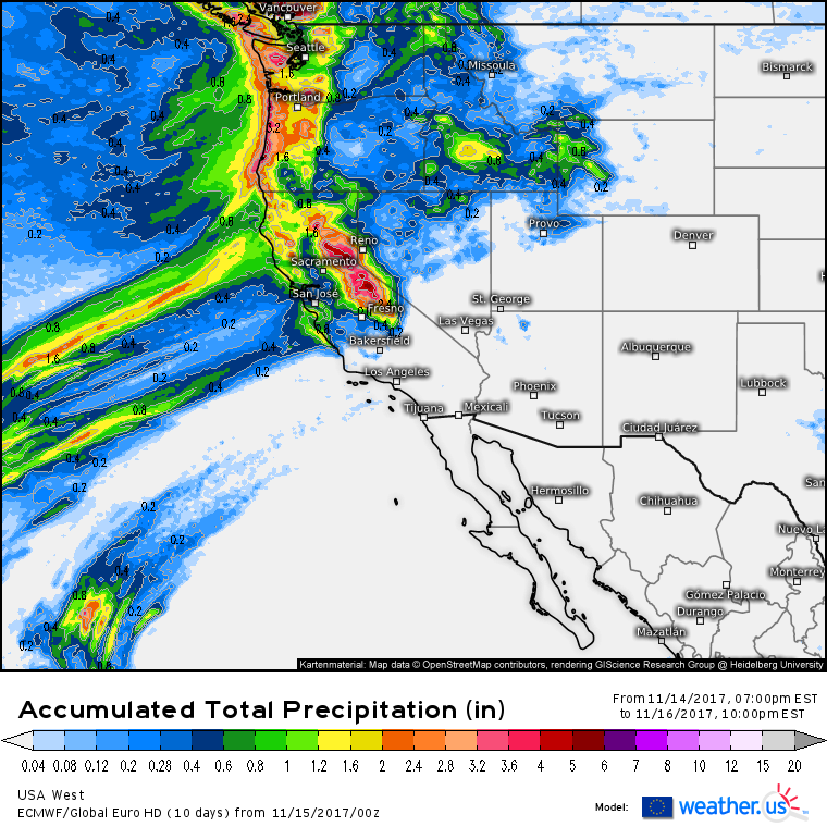
ECMWF forecasts show precipitation expanding both south and east tomorrow as additional moisture and upper level energy moves onshore.
Precipitation totals through tomorrow evening show a decent soaking for the western parts of Washington, Oregon, and Northern California. The highest totals will be found in the coastal mountains of WA/OR and in the Northern Sierras of California. Even though lighter amounts are forecast in the San Francisco area, it won’t take much rain falling on the burn scars from last month’s wildfires to cause issues. Watch for flash flooding and mudslides in these areas!
Farther east today, a cold front will bring showers and a few thunderstorms to parts of the Mississippi and Ohio valleys, but no significant flooding or severe weather impacts are expected. This cold front will reach the New England coast tomorrow and as it does so, a coastal storm will develop, bringing rain and snow to parts of Maine and New Hampshire. For more details on this storm, check out last evening’s blog post.
For more information on your local forecast: https://weather.us/
For more information on the local forecast for Maine and New Hampshire: https://forecasterjack.com/2017/11/15/a-lovely-late-fall-day-today/
-Jack
