Clipper System Brings Another Round Of Light Snow To The Midwest Today
Hello everyone!
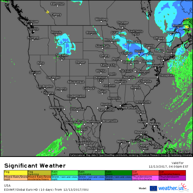
Today’s weather will be familiar for many across the country as we remain more or less locked into the pattern we’ve seen for about a week now. High pressure will control the weather in the West, with just a few light snow showers associated with a disturbance in the Rockies. In the middle of the country, quiet weather will stretch up and down the plains today as moisture will be limited for any precipitation. Farther east, the Great Lakes will see another day of snowfall as another clipper system cruises towards the Atlantic.
Here’s the national weather map for today showing the chances for snow across the Midwest and northern Rockies. The lingering effects of the last clipper system to move towards the coastline will be felt across New England where snow showers in the mountains could add up to an additional 6″ of accumulation.
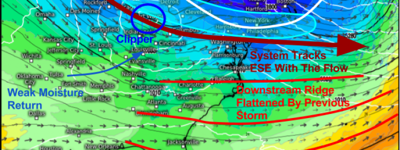
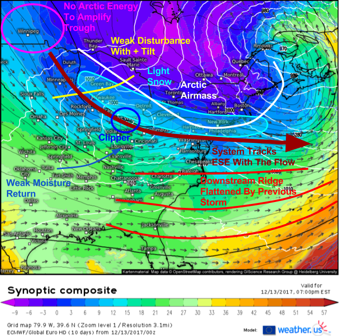
Last time we had a clipper approach the Atlantic coast, it turned into a major storm for New England. Is something similar to be expected tonight? Not at all, and the ECMWF’s synoptic composite (what’s that and how do I use it?) shows us why.
All the features we looked for to get the large storm yesterday are gone today. There’s no downstream ridging to force the storm to turn north, there’s no Arctic energy to drop into the back side of the trough and amplify it, there’s very little in the way of moisture return, and the system itself is fairly weak. As a result, it will just be a little blip embedded within prevailing WNW flow, and a track SE then ESE is expected before it eventually develops into a more respectable system out over the open Atlantic. A stripe of light snow associated with this system will extend from its current location in Wisconsin down through the LP of Michigan and across parts of the Northern Mid Atlantic. A general coating to 2″ is expected, but parts of the Midwest that see Lake Effect kick in behind the system will see much higher totals.
Farther north, this system will help continue to draw a very cold and dry airmass south from Canada. Bitter cold temperatures are expected tonight in New England with wind chills falling below zero for many in Maine, New Hampshire, and Vermont tonight.
For more information about your local forecast: https://weather.us/
For more information about the local forecast for ME/NH: https://forecasterjack.com/2017/12/13/gusty-winds-bring-much-cooler-air-today/
-Jack


