Calm Weather Briefly Returns To The East Today While Storminess Continues In The West
Hello everyone!
Today will feature improving weather in the Northeast as the behemoth Nor’easter that brought hurricane force winds, three feet of snow, torrential downpours, and major storm surge inundation yesterday is slowly moving away to the south and east. Winds will continue to whip today especially on Cape Cod, and the midday high tide will once again flood low lying coastal areas, but overall the storm is winding down. Out West, however, stormy weather will continue in full force today as another disturbance pinwheels around a strong upper low just off the Oregon Coast.
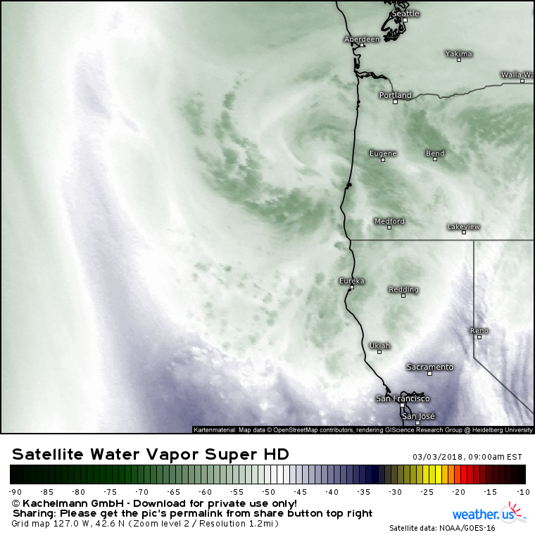
Here’s a look at the storm through the lens of GOES-East Water Vapor satellite imagery (what’s that?). As that swirl west of Eugene Oregon drops southeast today, precipitation will once again increase in coverage and intensity across the Northern California area.
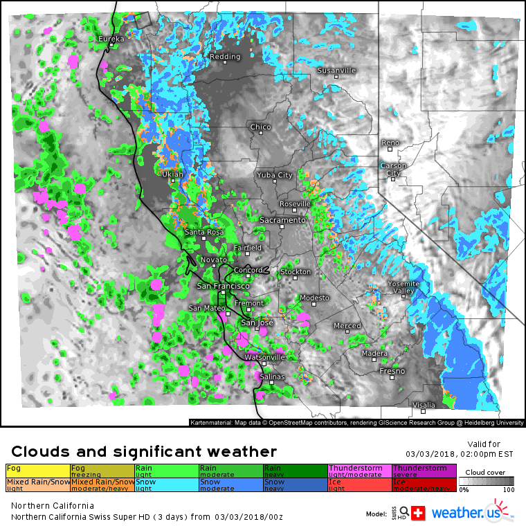
Here’s a look at our Swiss Super HD model’s forecast for midday today in Northern California. Notice the areas of heavy snow continuing in the mountains north of San Francisco and also in the Sierras. Additional snow accumulations of 3-6″ north of San Francisco and 6-12″ in the Sierras are expected through tomorrow before the storm moves east. Also notice the thunderstorm activity around and just south of San Francisco. These storms will form as patchy sunshine heats up the ground underneath very cold air aloft. The vertical temperature gradient will generate instability, with lift provided by the disturbance pinwheeling in. Due to the very cold air aloft, it won’t take very strong (tall) a storm to lift water droplets to the freezing level where they can form into hail. As a result, small hail is expected with some of the stronger showers near San Jose.
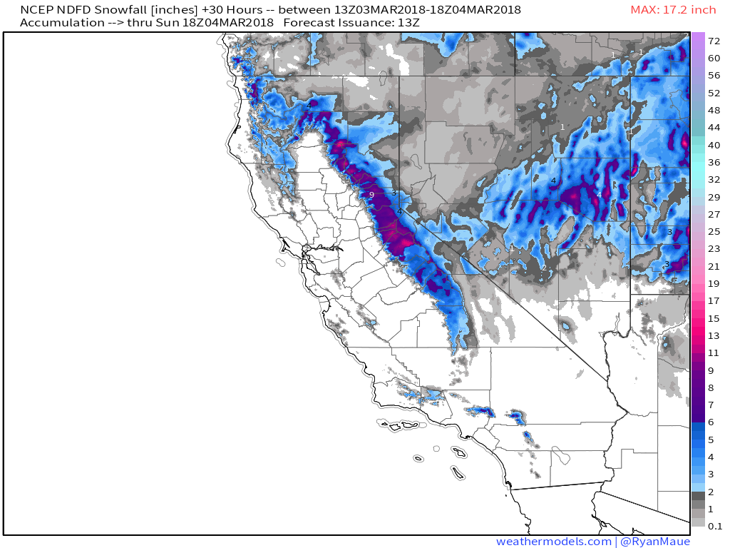
Here’s a look at how much additional snow to expect through tomorrow afternoon. Forecast is provided by local NWS offices, and is displayed via weathermodels.com. Snow will also continue today in areas farther east across Nevada and Utah.
Here’s the ECMWF’s overview map for this afternoon showing quiet weather across the rest of the country as the massive East Coast storm drifts slowly southeast. Showers and perhaps a localized storm won’t cause any major problems in Texas, though they will cause some wet roads and locally reduced visibilities.
For more information on your local forecast: https://weather.us/
For more information on the local forecast for ME/NH: https://forecasterjack.com/2018/03/03/breezy-and-cool-today-3/
-Jack


