Barry Making Landfall In Louisiana This Morning, Flooding Remains The Primary Threat
Hello everyone!
Tropical Storm Barry is moving closer to landfall on the Louisiana coastline this morning. Currently the National Hurricane Center has the storm’s maximum sustained winds pegged at 65 mph, and while that number may go up slightly in the next few hours before the center moves ashore, the wind is not the big story with this system. The biggest threat, as I’ve hopefully tried to communicate in my posts over the past few days, will be the potential for major flooding as a result of persistent torrential downpours. This post will be a shorter look at how the system is doing currently, and how to follow along with the rain as it falls today and tomorrow. If you’re interested in a deeper look at the dynamics behind the heavy rainfall threat, I’d suggest reading yesterday’s update. The information there remains valid today.
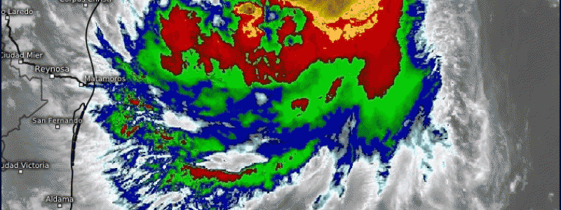
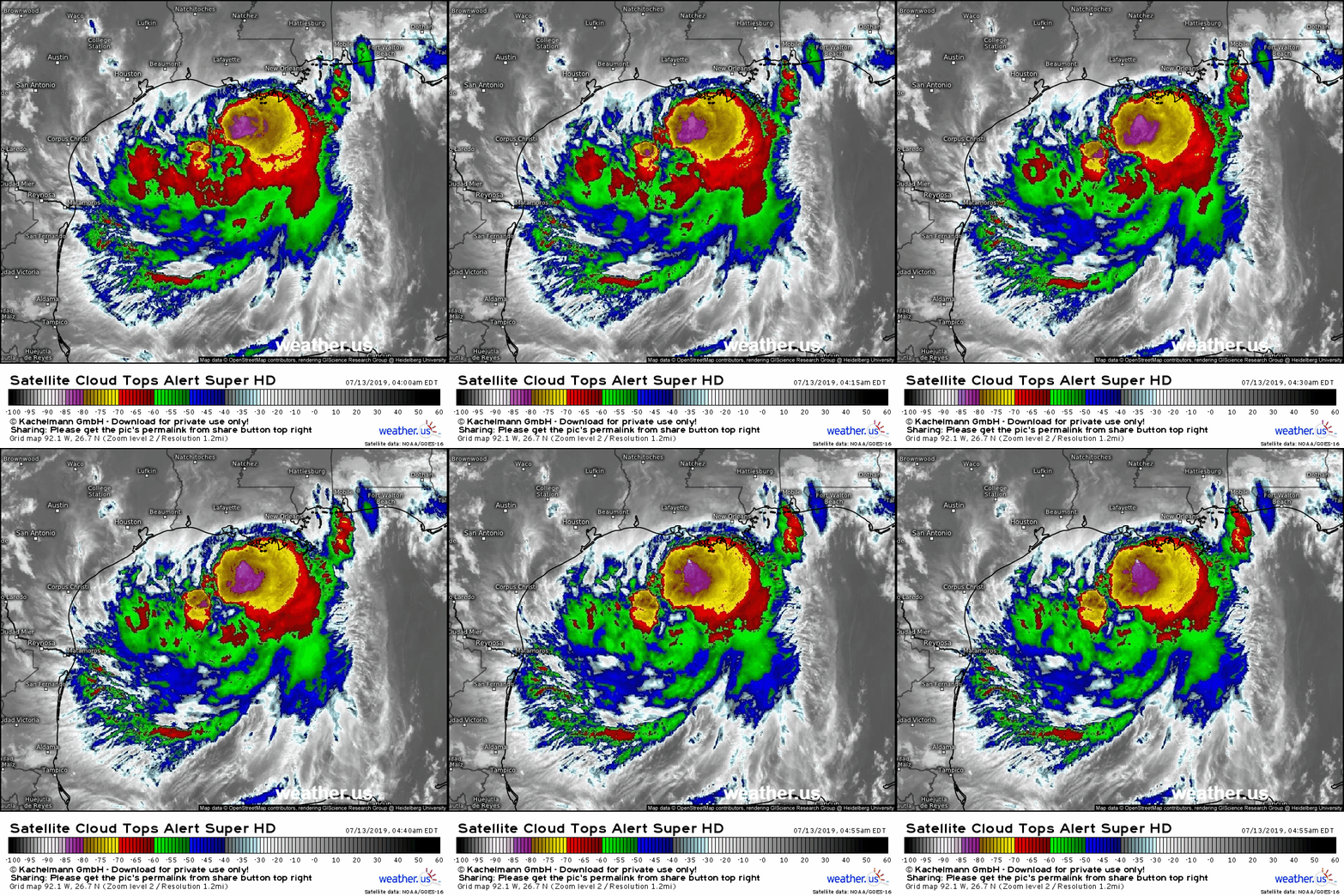
The system’s satellite presentation has improved drastically over the past 24 hours. In addition to more robust spiral bands, Barry now has its center underneath thunderstorm activity that is both persistent and intense. This has led to the storm’s intensification over the past 12 or so hours. Thankfully for those in the path of the storm, the window for further development is rapidly closing as the center moves onshore. Once the center is over land, the storm’s source of energy becomes cut off, and steady weakening will ensue. You can follow along with the latest satellite imagery here.
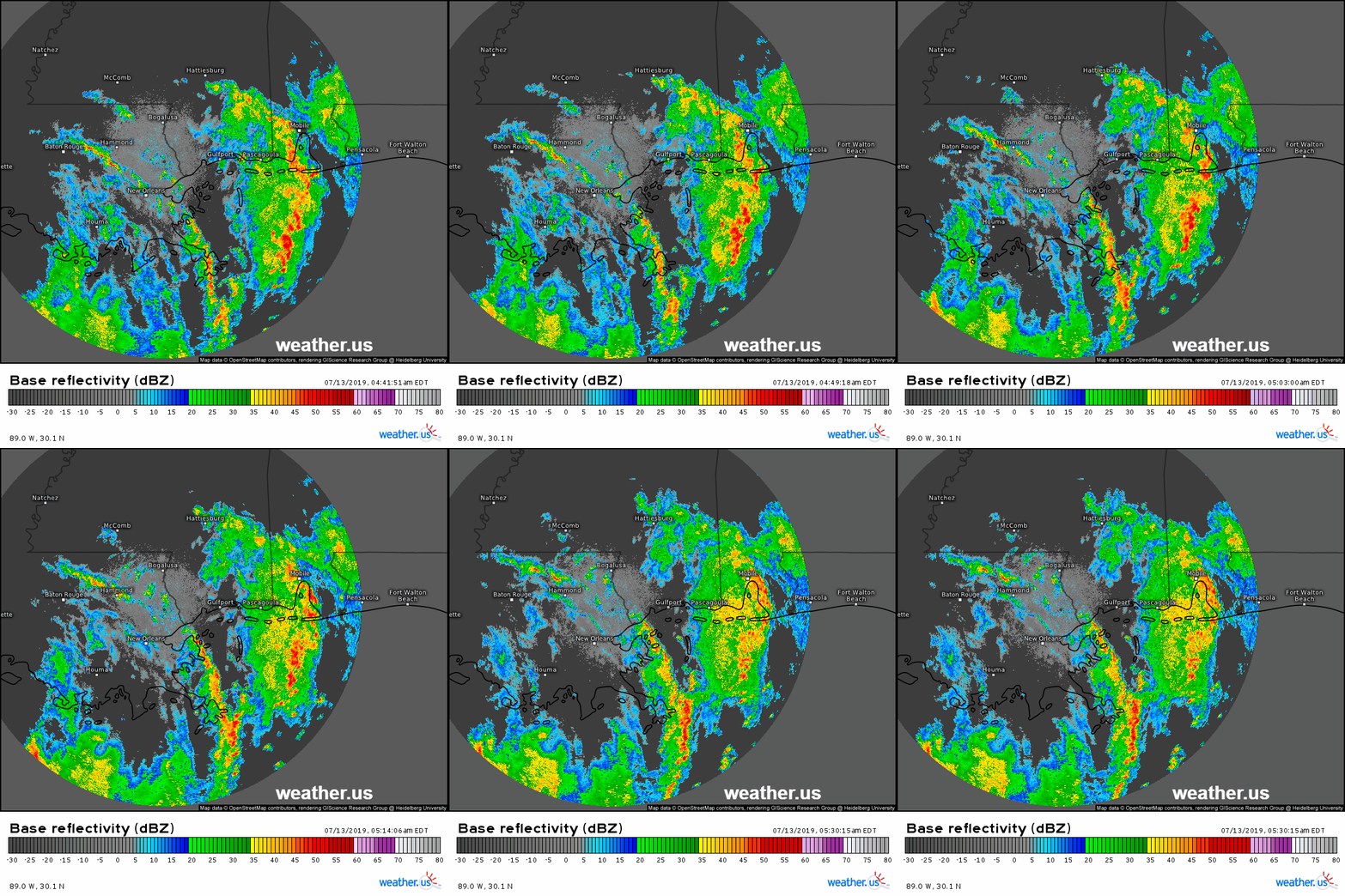
Radar imagery out of the New Orleans area shows the slow development of training bands of thunderstorms which will continue to move onshore as the center makes its way north, and the moisture-laden southern half of the storm comes in contact with the shore. You can see the ‘training’ phenomenon occurring near Mobile Alabama where storms are moving north along a north-south oriented axis that is more or less stationary. As a result, the same areas are experiencing torrential downpours for a prolonged time. These bands are expected to shift into Louisiana as the day goes on. You can follow along with the latest radar imagery here.
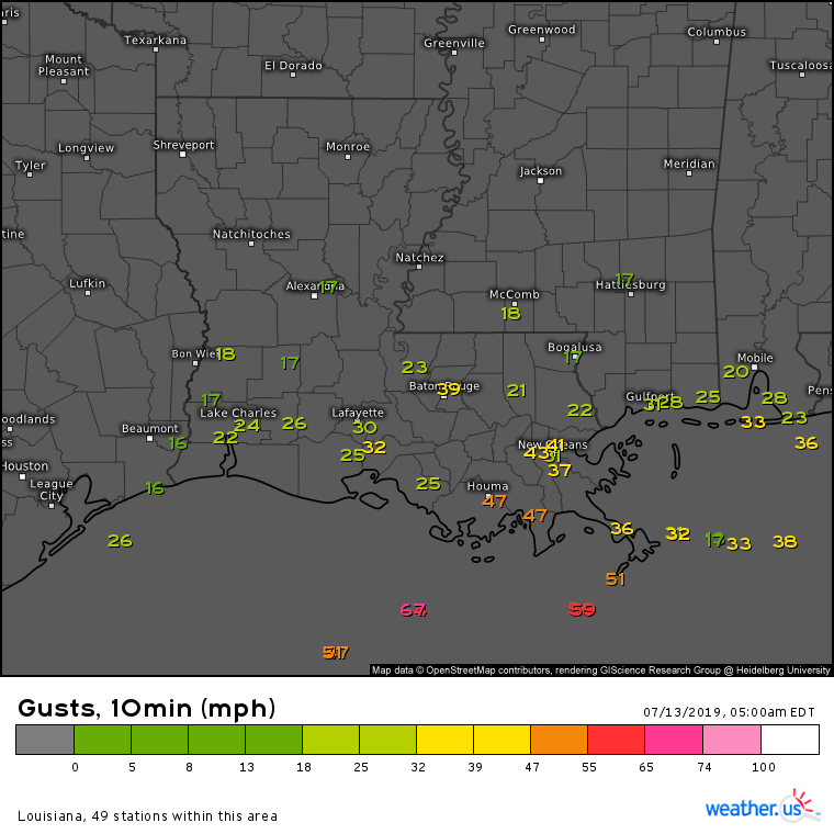
Wind gusts this hour aren’t all that impressive, ranging from 30 mph inland to 45 mph along the coastline to 55 mph offshore. Those gusts will be enough to bring down some trees and power lines, but are unlikely to cause widespread damage. You can follow along with the latest observations here.
I’ll add another link to yesterday’s blog post here in case you’re looking for more forecast-oriented discussion and resources.
-Jack


